Crockett (formerly Crockettville) is a census-designated place (CDP) in Contra Costa County, in the East Bay sub-region of the San Francisco Bay Area, California. The population was 3,094 at the 2010 census. It is located 28 miles northeast of San Francisco. Other nearby communities include Port Costa, Martinez, Vallejo, Benicia, Rodeo, Hercules, Pinole and Richmond.
| Name: | Crockett CDP |
|---|---|
| LSAD Code: | 57 |
| LSAD Description: | CDP (suffix) |
| State: | California |
| County: | Contra Costa County |
| Elevation: | 128 ft (39 m) |
| Total Area: | 1.06 sq mi (2.75 km²) |
| Land Area: | 1.06 sq mi (2.75 km²) |
| Water Area: | 0.00 sq mi (0.00 km²) 0% |
| Total Population: | 3,242 |
| Population Density: | 3,052.73/sq mi (1,178.38/km²) |
| ZIP code: | 94525 |
| Area code: | 510, 341 |
| FIPS code: | 0617274 |
Online Interactive Map
Click on ![]() to view map in "full screen" mode.
to view map in "full screen" mode.
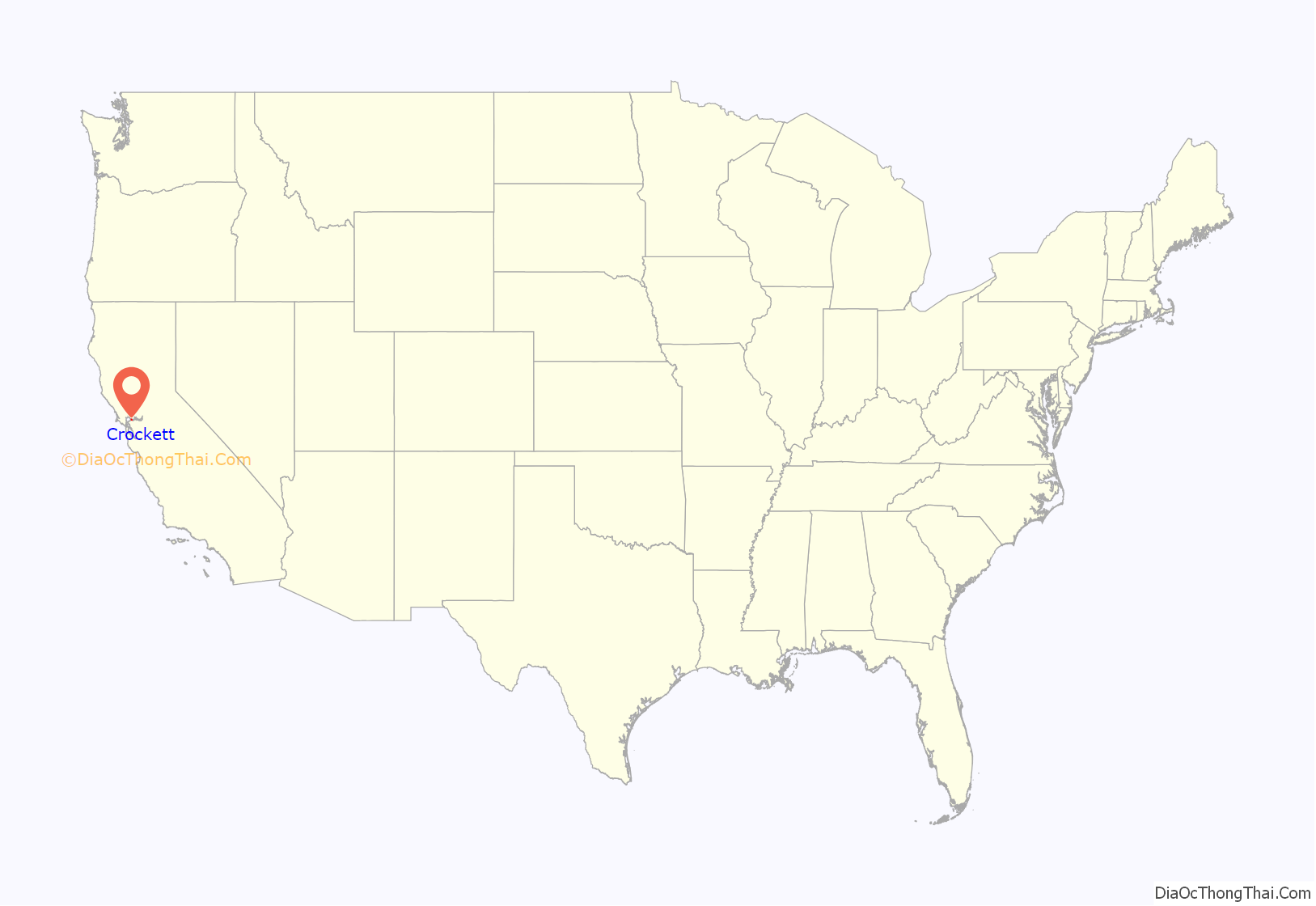
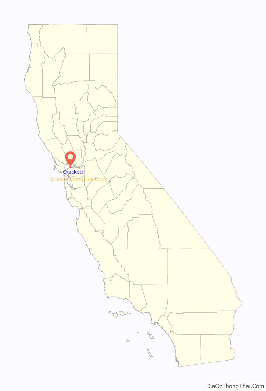
Crockett location map. Where is Crockett CDP?
History
Crockett is located on the Mexican land grant Rancho El Pinole made to Ygnacio Martinez, and is named after Joseph B. Crockett, a judge on the California Supreme Court. The town started when Thomas Edwards Sr. bought 1,800 acres (730 ha) of land from Judge Crockett in 1866. Edwards built his home in 1867 and when other settlers arrived, he started the first general store in Crockett. Edwards’ home still stands and is known as “The Old Homestead”, a California Historical Landmark. Crocketville post office was established in 1883, and the name was changed to Crockett later that year.
“Sugar Town”
In 1906, an agricultural cooperative of Hawaiian sugar cane growers bought an existing Wheat Factory that never opened, refitted the facility, built additional structures for their refining needs, eventually turning Crockett into a company town for the California and Hawaiian Sugar Company, (better known as C&H). The cane was grown in Hawaii and delivered by ship to Crockett, where the C&H refinery turned it into a variety of finished products.
C & H soon became a dominant force in Crockett, which has been called a “company town.” By the 1920s, the company employed about 95 percent of the residents. Employment peaked at 2,500 just before WWII broke out. C & H helped its employees obtain land and bank loans so that they could build houses. Company architects worked on designing the houses. The company funded many school and civic programs.
In March and April 1938, Crockett experienced a labor strike at the C&H plant, climaxing in a riot. This was prior to the merger of the AFL and CIO national unions.
Economic adaptation
By the 1960s, the good times were largely over for C & H and Crockett. Revenues and profits began dropping, so that the company pumped less money into the community. There were many layoffs as the company tried to restore profitability. In 1984, the company proposed building a natural gas-powered cogeneration plant that would provide steam for the sugar refinery and low-cost electricity for Crockett. A protest group calling itself the Crockett Power Plant Committee, supported by many Crockett residents formed and spent the next nine years opposing the proposal. The proposed power plant was eventually built, but only after the company agreed to make major changes. C & H agreed to give Crockett $300,000 per year for the ensuing 30 years, which mostly funds its police and volunteer fire fighting departments.
The Hawaiian sugar farmers sold their holdings in 1993 to Hawaii-based Alexander & Baldwin, which converted C & H from a co-op into a corporation. In 1998, A & B sold a controlling interest to Citicorp Venture Capital (CVC). American Sugar Refining bought C & H in 2006, merging it with its other sugar operations. Revenues and profits continued their decline into the 21st Century, until the Crockett plant processed its last shipment of Hawaiian sugar in 2017.
Raw sugar now arrives from the globe’s sun belt: Australia, the Philippines and Nicaragua, among other countries.
“Wildfire” (2019)
A wildfire burned near Crockett on October 29, 2019, the same week as multiple wildfires in the region, e.g. Sonoma County “Kirkwood Fire”, and a wildfire at the north end of the Carquinez bridge in Vallejo, California. There is some suspicion that strong northerly wind then caused embers from the Vallejo fire to jump the strait and ignite brush fires southwest of Crockett, located in Contra Costa County at the opposite end of the Carquinez bridge. The new fire, which was dubbed the “Sky fire,” ignited about 9:30 AM and quickly generated so much dense smoke that authorities chose to close the Carquinez bridge to all vehicular traffic in both directions. CHP and county sheriff’s office then began to evacuate residents from that side of the community. Emergency responders from other cities rushed to the aid of Crockett’s own VFD to begin extinguishing the fire, which was reportedly 50 percent contained shortly after noon that day. The Crockett evacuation order was cancelled and the Carquinez Bridge was reopened to traffic soon after.
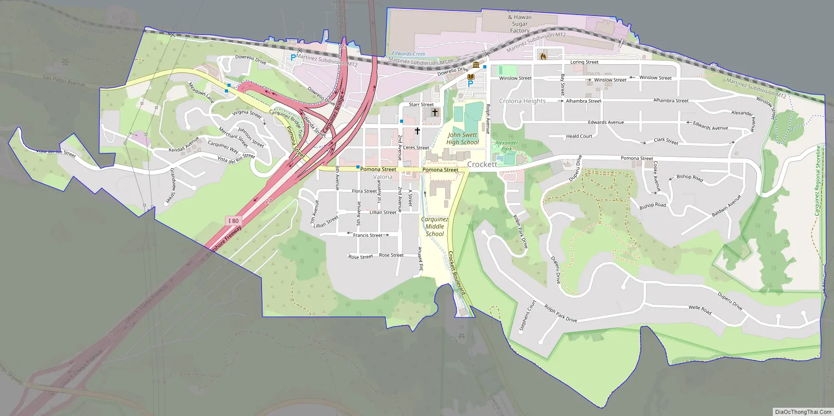
Crockett Road Map
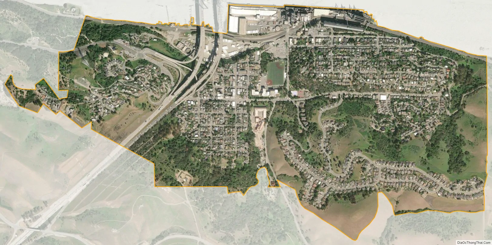
Crockett city Satellite Map
Geography
According to the United States Census Bureau, the CDP has a total area of 1.1 square miles (2.8 km), all of it land.
Crockett is located where the Carquinez Strait meets San Pablo Bay. The Carquinez Bridge, part of Interstate 80, links Crockett with the city of Vallejo to the north across the strait. To the east of Crockett along the south shore of the strait are Port Costa and the city of Martinez. South of Crockett are the town of Rodeo and the city of Hercules. Farther southwest on I-80 are the cities of Richmond, Berkeley and Oakland; in the opposite direction, northeast, is the capital of California, Sacramento.
Climate
This region experiences warm (but not hot) and dry summers, with no average monthly temperatures above 71.6 °F. According to the Köppen Climate Classification system, Crockett has a warm-summer Mediterranean climate, abbreviated “Csb” on climate maps.
See also
Map of California State and its subdivision:- Alameda
- Alpine
- Amador
- Butte
- Calaveras
- Colusa
- Contra Costa
- Del Norte
- El Dorado
- Fresno
- Glenn
- Humboldt
- Imperial
- Inyo
- Kern
- Kings
- Lake
- Lassen
- Los Angeles
- Madera
- Marin
- Mariposa
- Mendocino
- Merced
- Modoc
- Mono
- Monterey
- Napa
- Nevada
- Orange
- Placer
- Plumas
- Riverside
- Sacramento
- San Benito
- San Bernardino
- San Diego
- San Francisco
- San Joaquin
- San Luis Obispo
- San Mateo
- Santa Barbara
- Santa Clara
- Santa Cruz
- Shasta
- Sierra
- Siskiyou
- Solano
- Sonoma
- Stanislaus
- Sutter
- Tehama
- Trinity
- Tulare
- Tuolumne
- Ventura
- Yolo
- Yuba
- Alabama
- Alaska
- Arizona
- Arkansas
- California
- Colorado
- Connecticut
- Delaware
- District of Columbia
- Florida
- Georgia
- Hawaii
- Idaho
- Illinois
- Indiana
- Iowa
- Kansas
- Kentucky
- Louisiana
- Maine
- Maryland
- Massachusetts
- Michigan
- Minnesota
- Mississippi
- Missouri
- Montana
- Nebraska
- Nevada
- New Hampshire
- New Jersey
- New Mexico
- New York
- North Carolina
- North Dakota
- Ohio
- Oklahoma
- Oregon
- Pennsylvania
- Rhode Island
- South Carolina
- South Dakota
- Tennessee
- Texas
- Utah
- Vermont
- Virginia
- Washington
- West Virginia
- Wisconsin
- Wyoming


