Half Moon Bay is a coastal city in San Mateo County, California, United States, approximately 25 miles (40 kilometers) south of San Francisco. Its population was 11,795 as of the 2020 census. Immediately north of Half Moon Bay is Pillar Point Harbor and the unincorporated community of Princeton-by-the-Sea. Half Moon Bay is known for Mavericks, a big-wave surf location. It is called Half Moon Bay because of its crescent shape.
Originally an agricultural outpost to Mission San Francisco de Asís, the town was founded in the 1840s first as San Benito, and then as its Anglo fishing community grew, it was renamed Spanishtown. In 1874, it was again renamed Half Moon Bay. After rail and road connections in the early 1900s, the town grew. The foggy weather of the coast made the town a popular destination for booze-running during Prohibition.
The city’s infrastructure is heavily integrated with the coast, including the Pillar Point Harbor, major roads, and the fire department. The economy of Half Moon Bay is dominated by a handful of businesses, the biggest of which is the Ritz-Carlton Half Moon Bay which employs 500 people and is a major source of property tax and tourism income for the city. Because of this geography, a 2022 study found that the city had over 123 buildings vulnerable to sea level rise.
| Name: | Half Moon Bay city |
|---|---|
| LSAD Code: | 25 |
| LSAD Description: | city (suffix) |
| State: | California |
| County: | San Mateo County |
| Incorporated: | July 15, 1959 |
| Elevation: | 75 ft (23 m) |
| Total Area: | 6.25 sq mi (16.20 km²) |
| Land Area: | 6.24 sq mi (16.17 km²) |
| Water Area: | 0.01 sq mi (0.03 km²) 0.32% |
| Total Population: | 11,795 |
| Population Density: | 1,900/sq mi (730/km²) |
| ZIP code: | 94019 |
| Area code: | 650 |
| FIPS code: | 0631708 |
| Website: | www.half-moon-bay.ca.us |
Online Interactive Map
Click on ![]() to view map in "full screen" mode.
to view map in "full screen" mode.
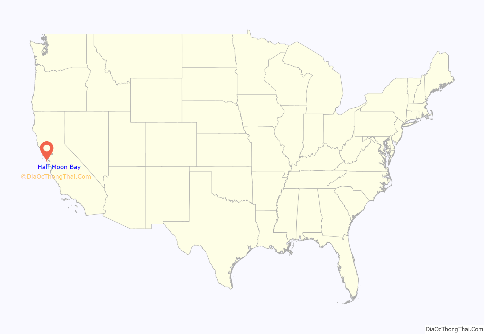
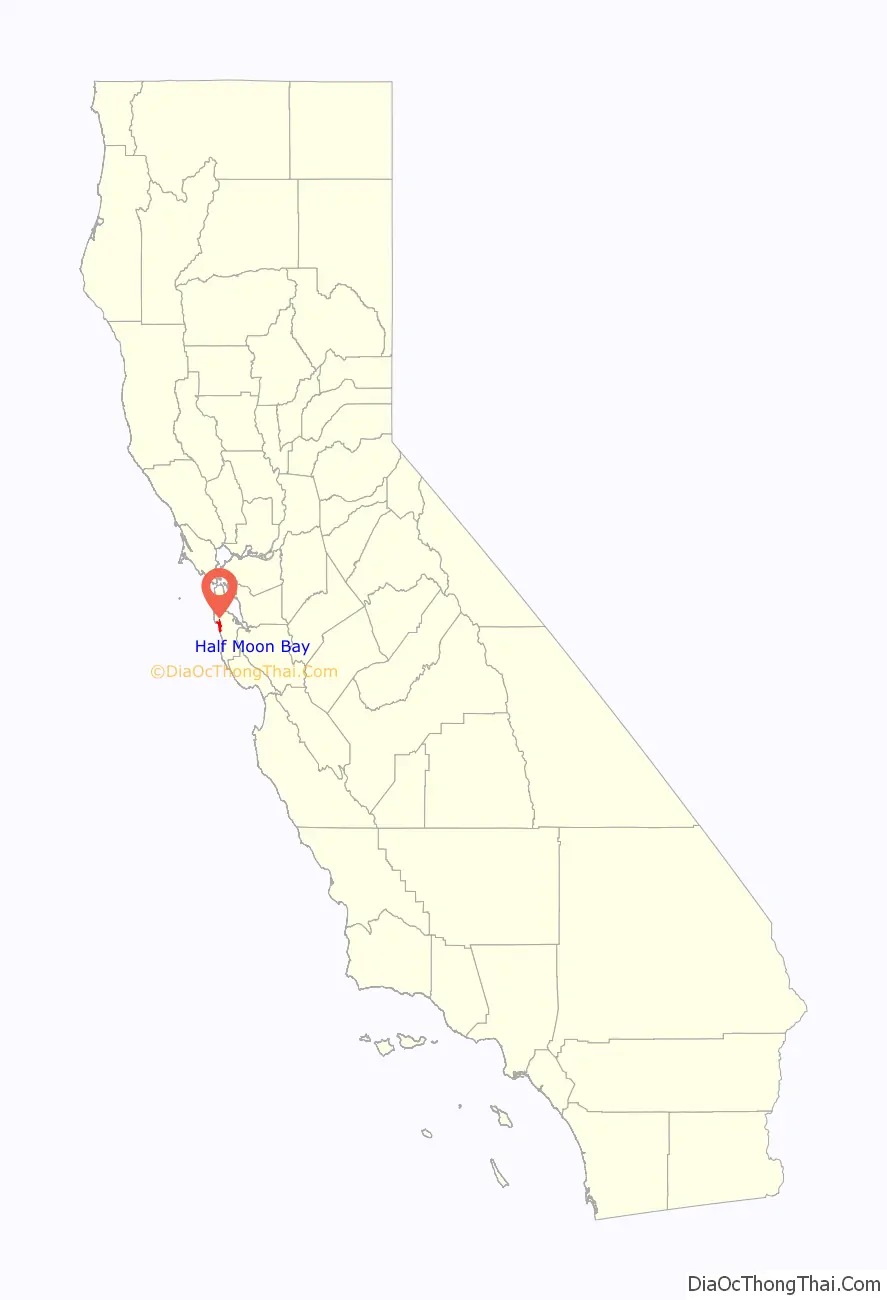
Half Moon Bay location map. Where is Half Moon Bay city?
History
Half Moon Bay began as a rural agricultural area, primarily used by Mission San Francisco de Asís (established in 1776) for grazing cattle, horses, and oxen. After the Mission’s secularization, Tiburcio Vásquez received the Rancho Corral de Tierra Mexican land grant in 1839 and Candelario Miramontes was granted Rancho Miramontes (later known as Rancho San Benito) in 1841.
The community began to develop in the 1840s as San Mateo County’s first real town. Originally, San Benito, the town was renamed Spanishtown and attracted a thriving fishing industry in addition to its continued importance to coastal agriculture. Spanishtown became a racially diverse community, settled by Canadians, Chinese, English, Germans, Irish, Mexicans, Italians, Scots, Portuguese, and Pacific Islanders. Regular stagecoach service was established with San Mateo; coaches also served Purissima, Lobitos, and San Gregorio. Levy Brothers opened a department store downtown. Spanishtown was officially renamed Half Moon Bay in 1874.
The area grew very slowly, even after the Ocean Shore Railroad began serving the community in 1907. The construction of Pedro Mountain Road in 1914 provided better access to San Francisco and probably contributed to the railroad’s demise by 1920. The USS DeLong ran aground at Half Moon Bay on December 1, 1921. During Prohibition “rum runners” took advantage of dense fog and hidden coves in the area to serve several roadhouses and inns, some of which operate today as restaurants (e.g., Moss Beach Distillery). Real growth in the area came after World War II with the construction of numerous subdivisions, eventually leading to Half Moon Bay’s incorporation in 1959. The city preserves a historic downtown district that has buildings dating as far back as 1869.
2008 economic downturn and subsequent recovery
In 2008, financial setbacks endangered the city’s viability. The economic crisis severely affected tourism, which generates the most revenue, and just when the city had finalized an $18 million settlement over a property lawsuit. As the municipal budget was typically $14 million or less, city fathers had issued bonds with annual payments of approximately $1 million over 25 years. As a result of these obstacles, the threat of bankruptcy was very real. Dozens of meetings were held to decide where to cut the budget and finally, 75 percent of municipal employees were laid off and replaced with contract workers. Employee contributions toward retirement benefits were also raised. The city council sought to regain the money paid in the settlement, believing that it should have been paid by the city’s insurers. A lawsuit against the insurers was decided in 2013 and the insurer was ordered to pay the city more than $13 million; the Association of Bay Area Governments partially covered the costs of the lawsuit.
The city’s finances improved afterward. It was able to retire the first of its two 30-year Judgment Obligation Bonds (2009A Series Bonds) 20 years early. The early retirement was expected to save the city over $426,000 in annual General Fund expenses starting in 2015–16.
As of the publication of the Fiscal Year 2015–16 Budget the General Fund budget was balanced and had a structural surplus of $4 million.
2023 mass shootings
On January 23, 2023, mass shootings occurred in Half Moon Bay. A spree killer opened fire at two farms with a semi-automatic pistol, killing seven people and critically injuring an eighth person. A 66-year-old suspect was taken into custody after he arrived in his SUV at the parking lot of the sheriff’s office substation.
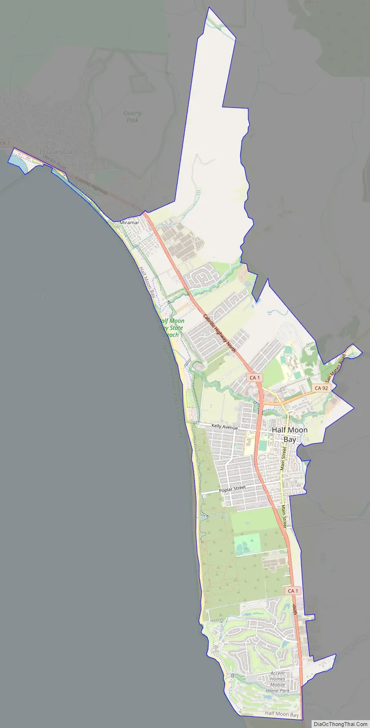
Half Moon Bay Road Map
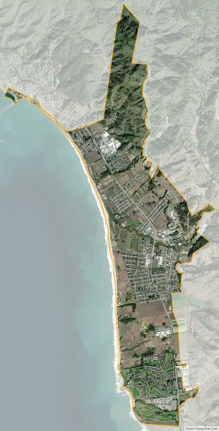
Half Moon Bay city Satellite Map
Geography
Half Moon Bay is approximately 25 miles (40 kilometers) south of San Francisco, 10 miles (16 km) west of San Mateo, and 45 miles (72 km) north of Santa Cruz. Neighboring towns include El Granada, Princeton-by-the-Sea, Moss Beach, and Montara to the north and Purissima, San Gregorio, and Pescadero to the south.
According to the United States Census Bureau, the city has a total area of 6.4 square miles (17 square kilometers), of which, 6.4 square miles (17 km) of it is land and 0.02 square miles (0.052 km) of it (0.32%) is water. The town is situated on a bay of the same name. Major local industries include agriculture (houseplants, floriculture, Christmas trees, pumpkins, artichokes), fishing, and tourism. Historically, Half Moon Bay had been known as San Benito and Spanishtown. A 2022 study of the effects of sea level rise, found that both major tourism attractions, and other infrastructure would be under threat from projected Sea level rise caused by global warming. The study found at least 123 buildings, including the Ritz Carlton (a major employer for the town), Pigeon Point Lighthouse and the Pescadero Cal Fire Station to be flooded under five feet of sea level rise.
A popular spot at Half Moon Bay is the ‘Jetty,’ or as it is sometimes called, ‘The Breakwater.’ This is a man-made break with unusual waves shaped by reflections from the breakwater at Pillar Point Harbor. Creeks in Half Moon Bay include Frenchmans, Pilarcitos and Naples.
Montara State Marine Reserve & Pillar Point State Marine Conservation Area extend offshore from Montara, just north of Half Moon Bay. Like underwater parks, these marine protected areas help conserve ocean wildlife and marine ecosystems.
Climate
Half Moon Bay usually has mild weather throughout the year. Under the Köppen climate classification, it has a cool summer Mediterranean climate (Köppen Csb). Hot weather is rare; the average annual days with highs of 90 degrees Fahrenheit (32 degrees Celsius) or higher is only 0.4 days. Cold weather is also rare with an annual average of 2.5 days with lows of 32 °F (0 °C) or lower. Typical of Northern California, most of the rain falls from November to April. The normal annual precipitation is 26.2 inches (665 millimeters). Snowfall along the coast in Half Moon Bay has never been measurable; however, snow flurries were observed on December 12, 1972, February 5, 1976, and February 23, 2023. There is often fog and overcast during the night and morning hours, usually clearing offshore during the afternoon. Persistent sea breezes help to moderate the climate along the coast; farther from the ocean, in places such as Pilarcitos Creek, days are often warmer and nights cooler than on the coast. For the 37th parallel north, the mild summer temperatures of Half Moon Bay are unmatched across the board. Relatively nearby inland cities see significantly warmer temperatures at the same time. Despite the low latitude and strong maritime influence, nights remain very cool, even in the summer.
January is the coolest month with an average high of 58.4 °F (14.7 °C) and an average low of 42.9 °F (6.1 °C). September is the warmest month with an average high of 66.8 °F (19.3 °C) and an average low of 51.2 °F (10.7 °C).
The most rainfall recorded in Half Moon Bay in one month was 15.70 inches (399 mm) in February 1998. The heaviest 24-hour rainfall was 5.33 inches (135 mm) on January 4, 1982. There is an average of 86 days with measurable rainfall.
See also
Map of California State and its subdivision:- Alameda
- Alpine
- Amador
- Butte
- Calaveras
- Colusa
- Contra Costa
- Del Norte
- El Dorado
- Fresno
- Glenn
- Humboldt
- Imperial
- Inyo
- Kern
- Kings
- Lake
- Lassen
- Los Angeles
- Madera
- Marin
- Mariposa
- Mendocino
- Merced
- Modoc
- Mono
- Monterey
- Napa
- Nevada
- Orange
- Placer
- Plumas
- Riverside
- Sacramento
- San Benito
- San Bernardino
- San Diego
- San Francisco
- San Joaquin
- San Luis Obispo
- San Mateo
- Santa Barbara
- Santa Clara
- Santa Cruz
- Shasta
- Sierra
- Siskiyou
- Solano
- Sonoma
- Stanislaus
- Sutter
- Tehama
- Trinity
- Tulare
- Tuolumne
- Ventura
- Yolo
- Yuba
- Alabama
- Alaska
- Arizona
- Arkansas
- California
- Colorado
- Connecticut
- Delaware
- District of Columbia
- Florida
- Georgia
- Hawaii
- Idaho
- Illinois
- Indiana
- Iowa
- Kansas
- Kentucky
- Louisiana
- Maine
- Maryland
- Massachusetts
- Michigan
- Minnesota
- Mississippi
- Missouri
- Montana
- Nebraska
- Nevada
- New Hampshire
- New Jersey
- New Mexico
- New York
- North Carolina
- North Dakota
- Ohio
- Oklahoma
- Oregon
- Pennsylvania
- Rhode Island
- South Carolina
- South Dakota
- Tennessee
- Texas
- Utah
- Vermont
- Virginia
- Washington
- West Virginia
- Wisconsin
- Wyoming


