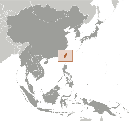
Taiwan is an island country located at the western edge of the Pacific Ocean. The main island of the country covers an area of 35,808 sq. km.
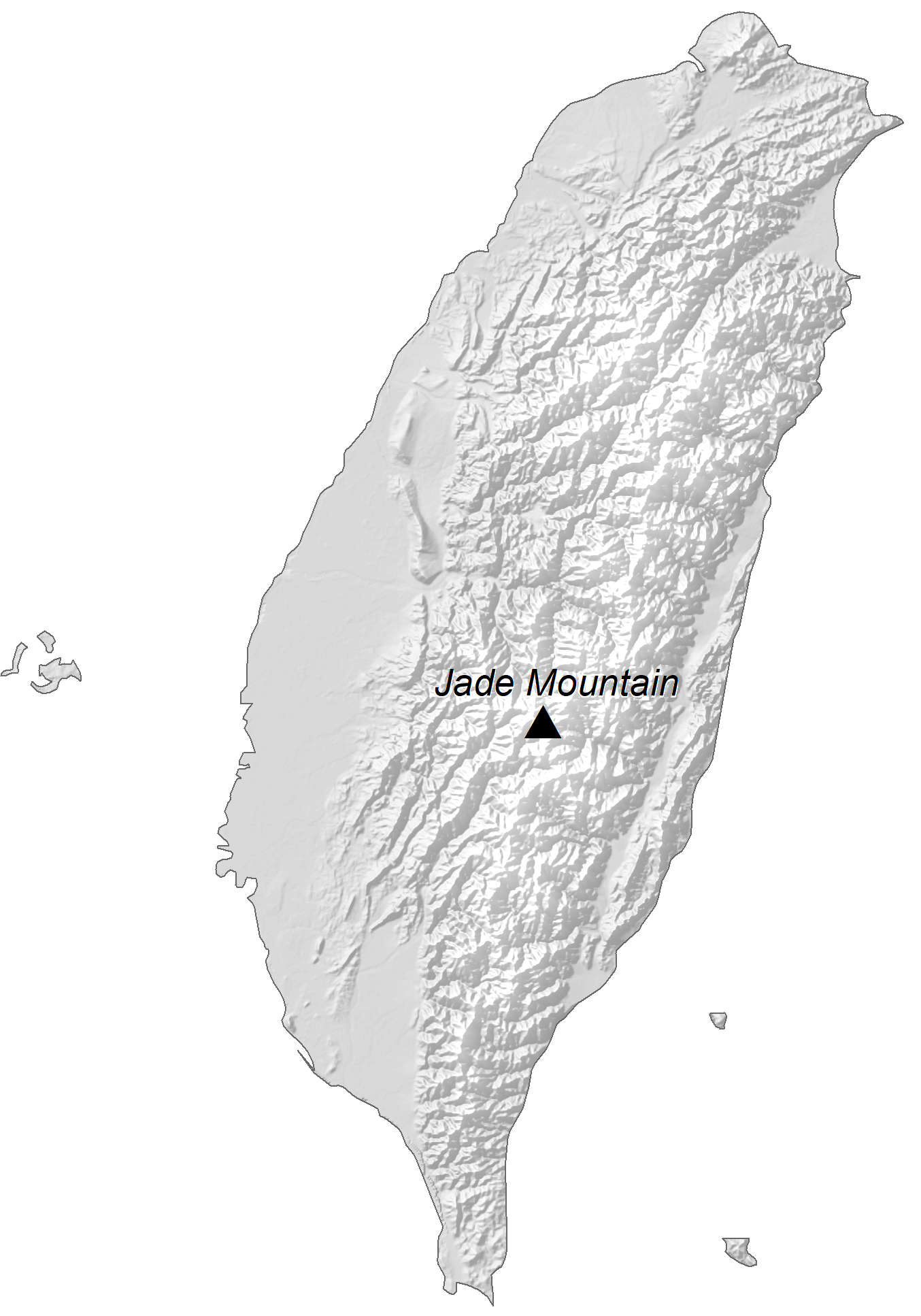
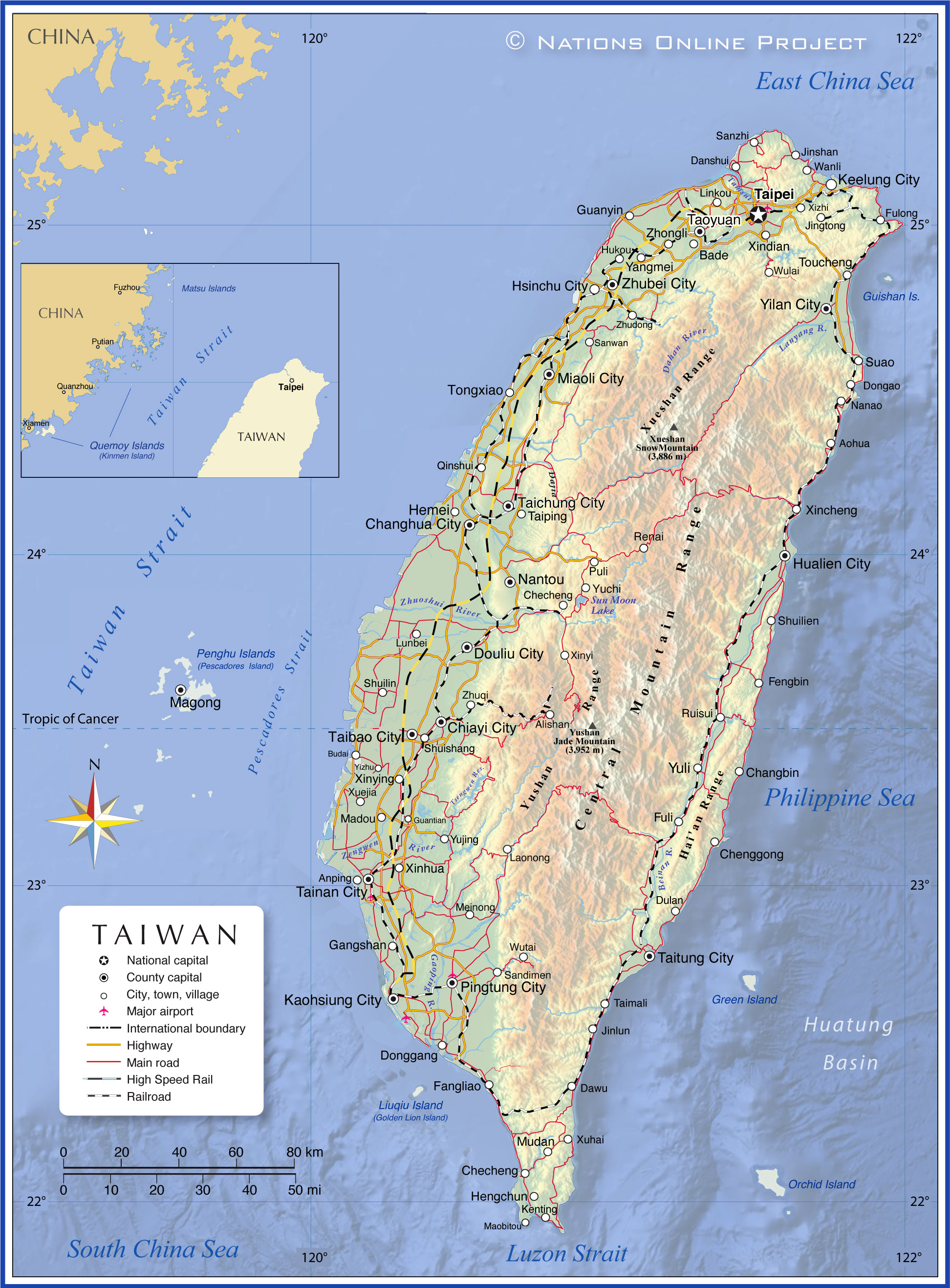
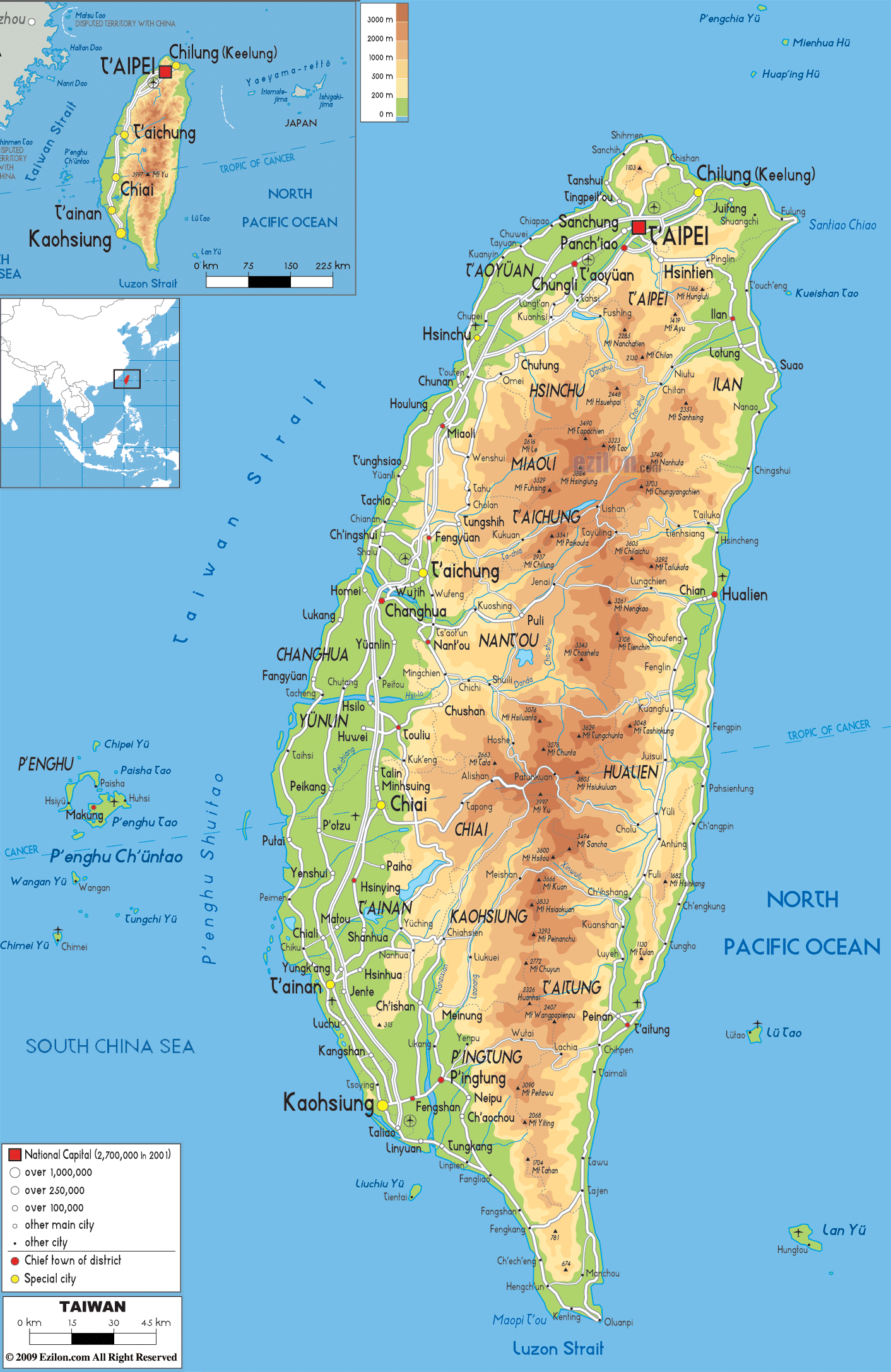
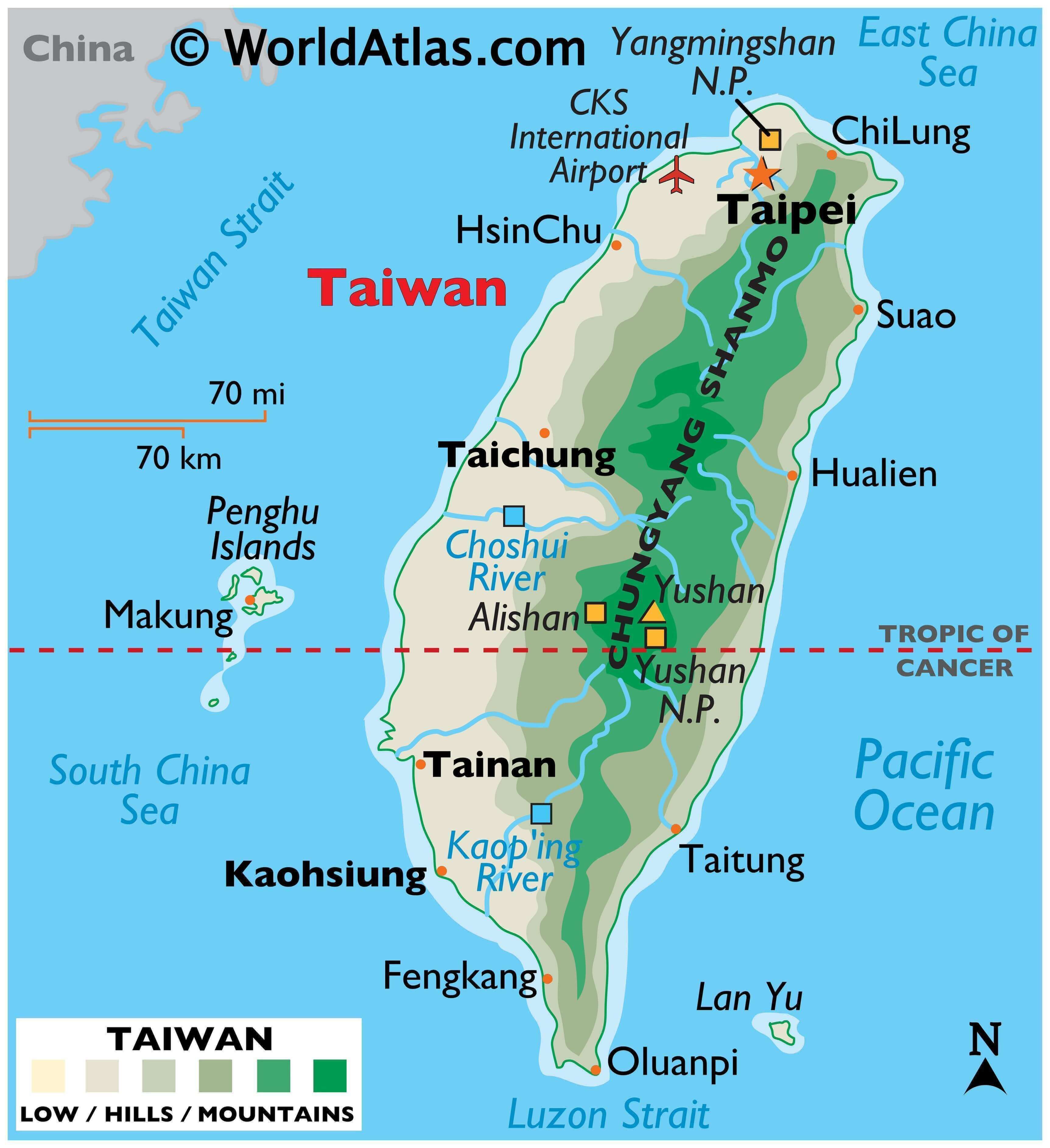
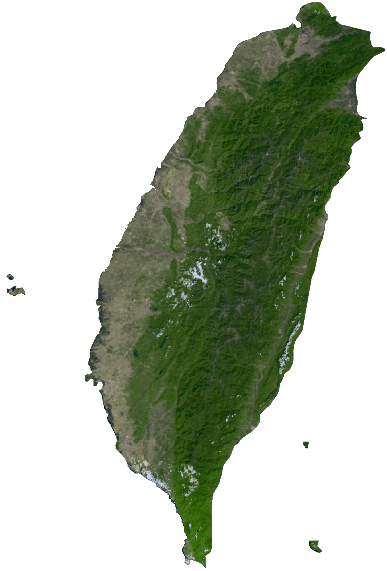
About two-thirds of Taiwan is a rugged mountain landscape. As observed on the physical map of Taiwan, the Chung-yang Shan range (central) dominates the island. It has over 200 peaks exceeding 3,000 m in elevation.
The upright yellow triangle on the map represents the highest point of Taiwan. It is the 3,952 m tall Yu Shan located in the central mountain region.
West of the central mountain range the land is covered by rolling hills that descend gently into a somewhat flat region, north to south.
Taiwan is a geologically active island; earthquakes are frequent and the island is punctuated by numerous steam vents and hot sulfur springs. In fact, Taiwan experiences as much as 15,000 to 18,000 earthquakes each year; 800 to 1,000 of which are noticed by people.
Taiwan is a geologically active island; earthquakes are frequent and the island is punctuated by numerous steam vents and hot sulfur springs. In fact, Taiwan experiences as much as 15,000 to 18,000 earthquakes each year; 800 to 1,000 of which are noticed by people.
The largest body of water in Taiwan is Sun Moon Lake; as well, there are over 150 rivers and large streams rising in the central mountains, with the most significant rivers including the Choshui and Kaoping.
It claims numerous (small) islands within its immediate territories and off the coast of China, including the islands of Quemoy, Matsu and Wuchiu.
The South China Sea is the lowest point of Taiwan at 0 m.
| Flag: |  |
|---|---|
| Legal Name: | Taiwan |
| Capital Value: | Taipei |
| Official languages: | Standard Chinese |
| Demonym(s): | Taiwanese |
| Government: | Unitary parliamentary constitutional republic under a semi-presidential system |
| Legislature: | Legislative Yuan |
| Total Area: | 35,980 km² |
| Land Area: | 32,260 km² |
| Water Area: | 3,720 km² |
| Population: | 23,545,963 |
| Density: | 650/km (1,683.5/sq mi) (10th) |
| Currency Value: | New Taiwan dollars (TWD) |
| Driving side: | right |
| Calling code: | +886 |
| Internet TLD: |
|
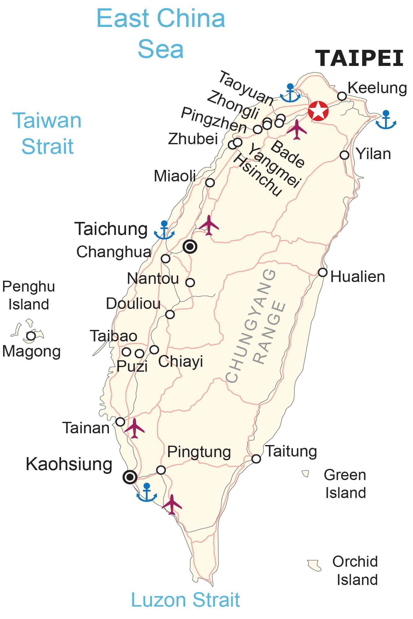
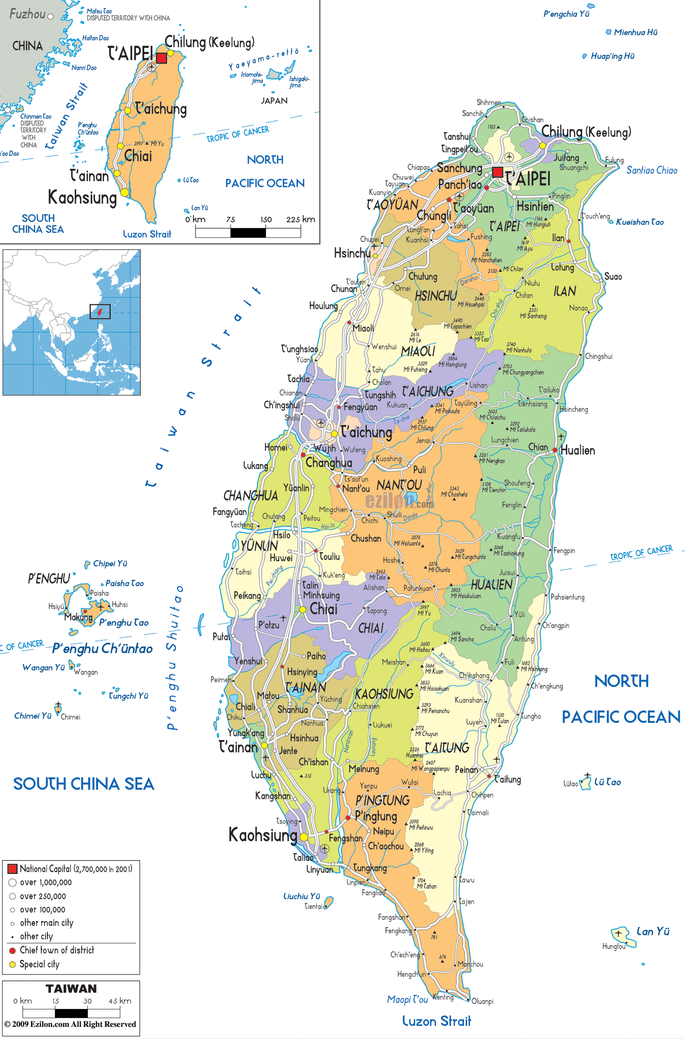
This Taiwan map collection is perfect for travelers looking to explore the country. It features cities, towns, roads, highways, lakes, rivers, and mountains like the majestic Central Mountain Range. With this collection, you can plan your journey and get a better understanding of the geography of this beautiful country. Whether you’re looking to explore the cities or the countryside, this Taiwan map collection has you covered.
Online Interactive Political Map
Click on ![]() to view map in "full screen" mode.
to view map in "full screen" mode.
The country includes the main island of Taiwan plus smaller islands nearby and off coast of China’s Fujian Province.
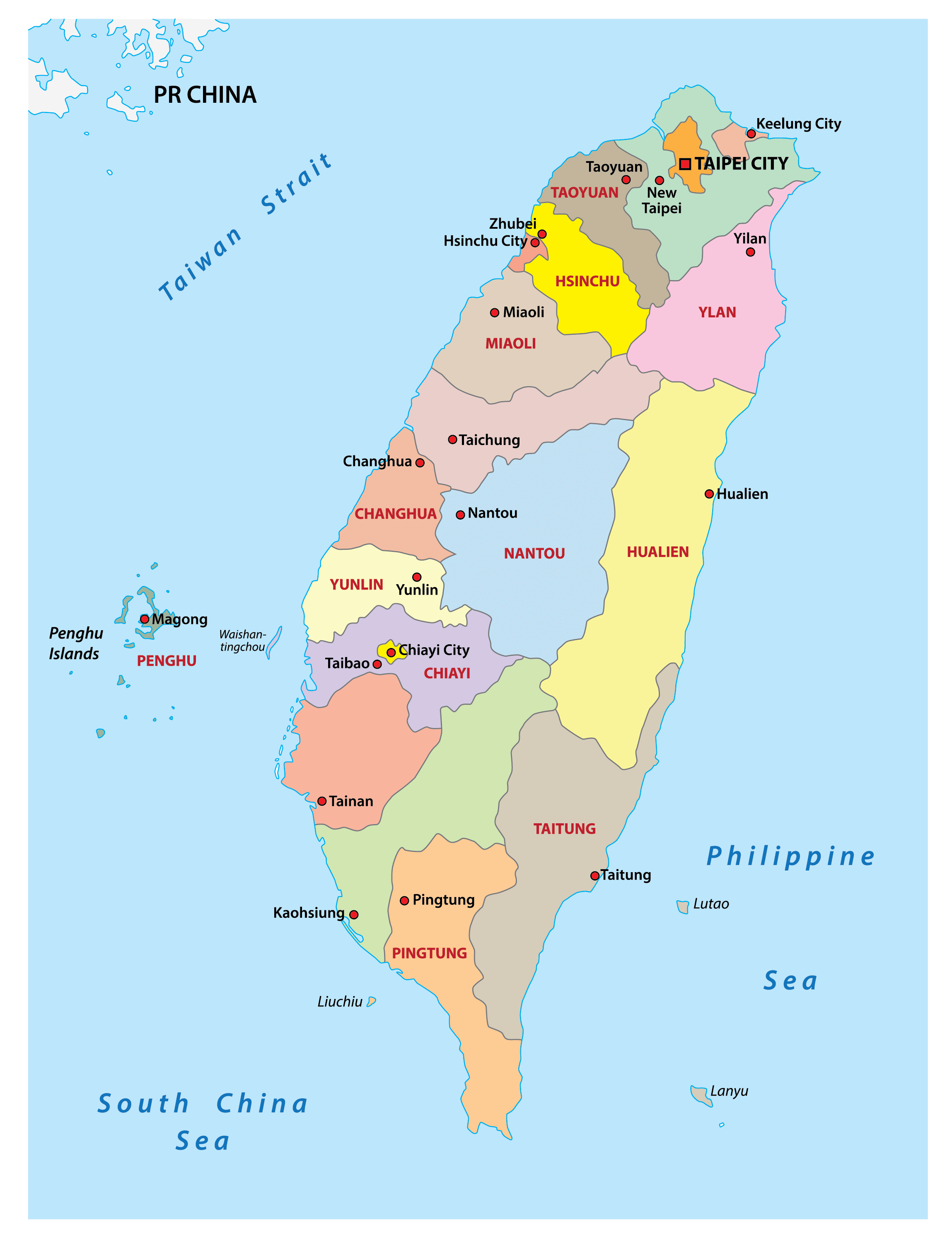
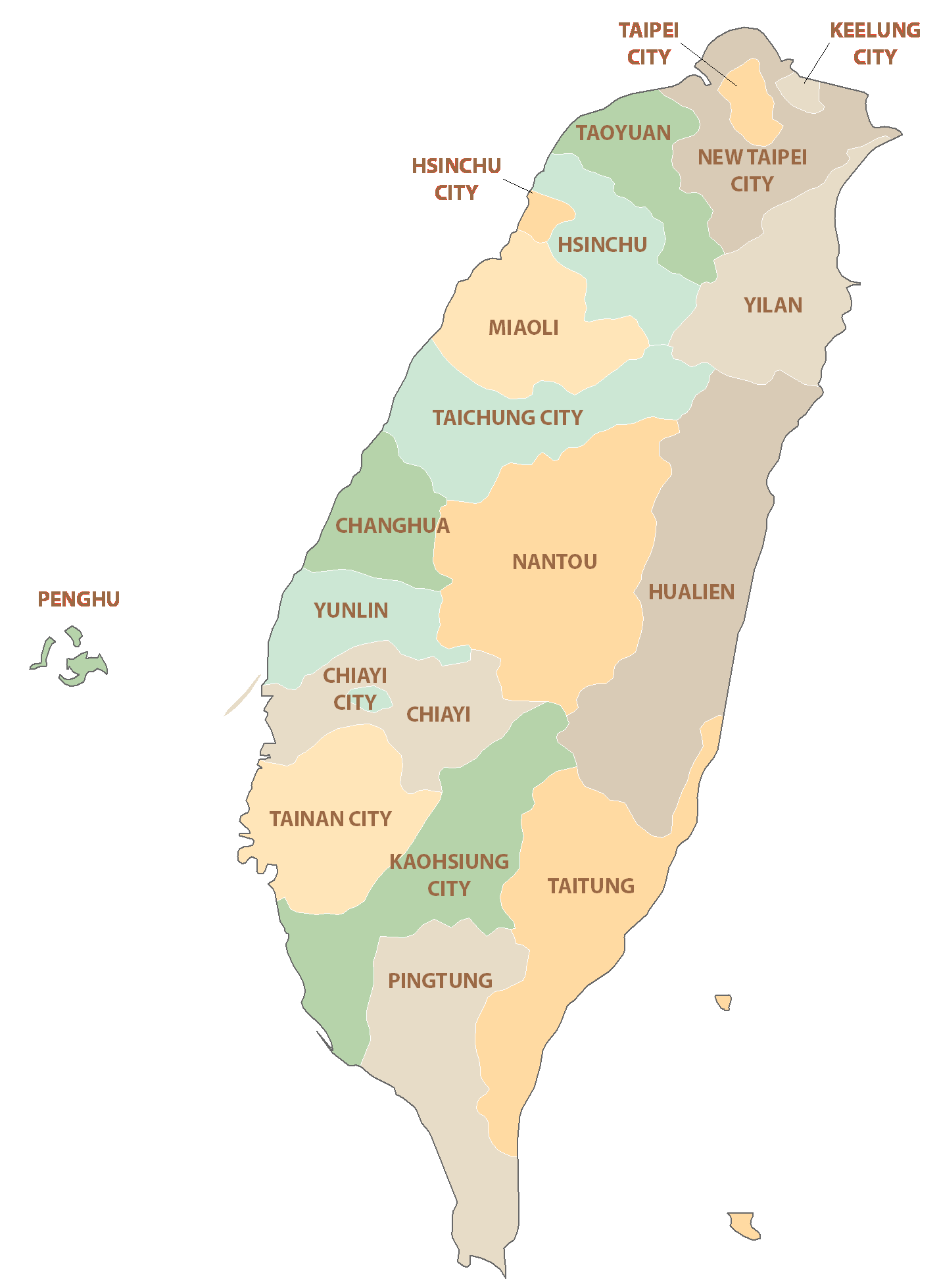
Taiwan is divided into 13 counties, 3 cities, and 6 special municipalities directly under the jurisdiction of the Executive Yuan.
The 13 counties are: Changhua, Chiayi, Hsinchu, Hualien, Kinmen, Lienchiang, Miaoli, Nantou, Penghu, Pingtung, Taitung, Yilan, Yunlin.
The 3 cities are: Chiayi, Hsinchu, Keelung.
The 6 special municipalities are: Kaohsiung (city), New Taipei (city), Taichung (city), Tainan (city), Taipei (city), Taoyuan (city).
Taipei city located in northern Taiwan serves as the country’s capital city.
Location Maps
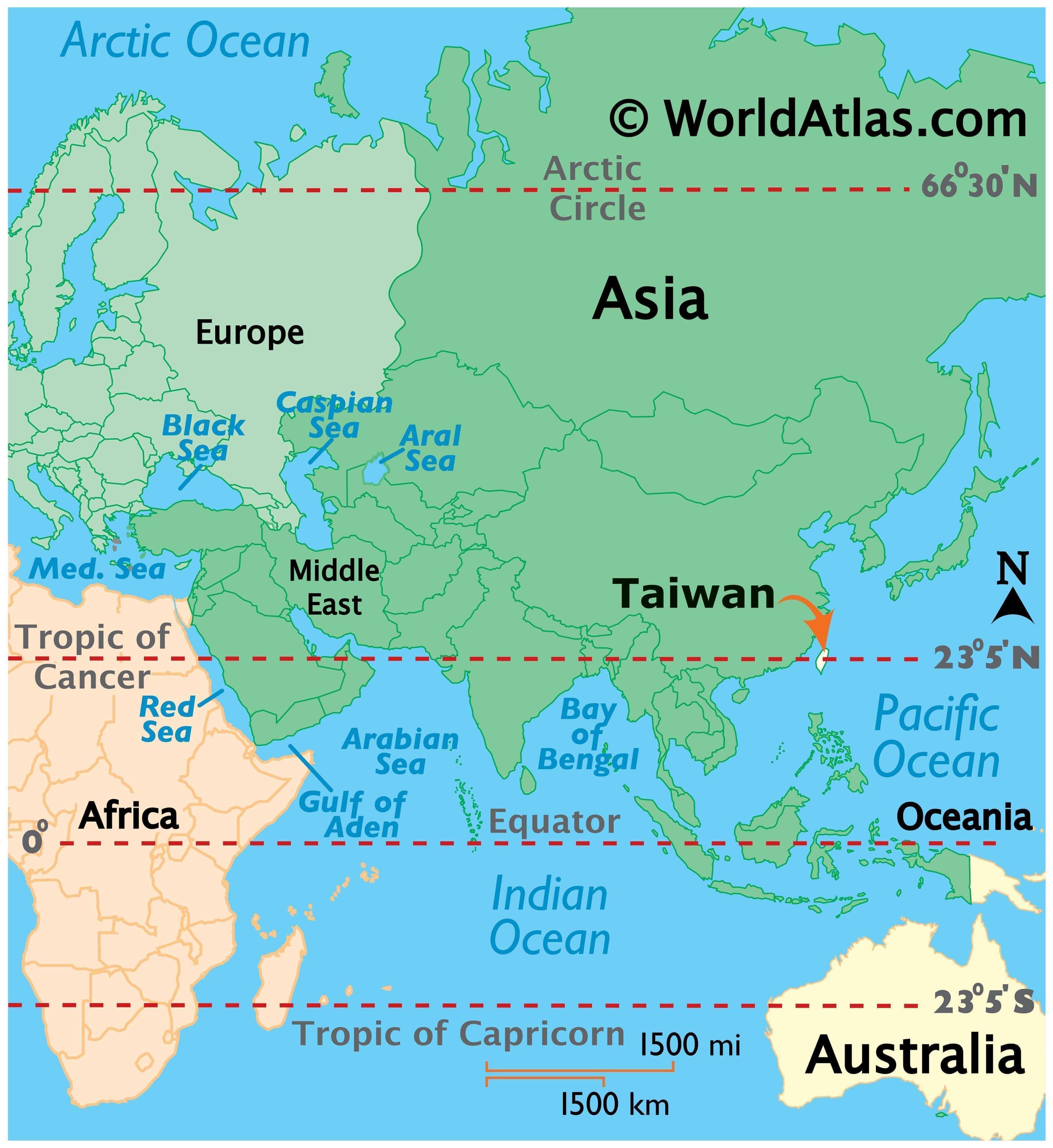
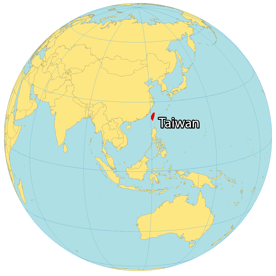
Where is Taiwan?
Taiwan, officially known as the Republic of China, is an island country located in East Asia. It is surrounded by China to the northwest, Hong Kong to the southwest, the Philippines to the south, and Japan to the northeast. Taiwan is often referred to as the “Heart of Asia”, due to its central position in the region. Its capital city is Taipei, and its largest city is New Taipei. Together with Keelung, these three cities form the most densely populated area in the north of Taiwan. Despite its mountainous eastern region, Taiwan is still one of the most densely populated countries in the world. However, its current birth rate is one of the lowest in the world.
High Definition Political Map of Taiwan
Taiwan Administrative Map
Physical Map of Taiwan
Taiwan Satellite Map
Elevation Map