Rowland Heights is an unincorporated area in and below the Puente Hills in the San Gabriel Valley, in Los Angeles County, California, United States. The population was 48,231 at the 2020 census. Rowland Heights is in the Los Angeles metropolitan area and represented by the County of Los Angeles (County Board of Supervisors) and is the largest census designated place in Los Angeles County by area and the county’s fourth largest CDP by population. The area has a high Taiwanese population and was known as “Little Taipei” in the 1980s and 1990s, when it saw an influx of wealthy immigrants from Taiwan.
A number of corporations, such as Newegg, FedEx, DIRECTV, and Fashion Nova, as well as other technology and import and export businesses, are located in neighboring City of Industry. Many business owners and employees reside in Rowland Heights as well as neighboring Hacienda Heights and Walnut due to their proximity.
Spering’s Best Places ranks Rowland Heights at #2 in “Most Comfortable Summer Cities”, drawing its conclusion from income levels, housing prices, the school-district, and overall environment, as well as from the 2010 census.
| Name: | Rowland Heights CDP |
|---|---|
| LSAD Code: | 57 |
| LSAD Description: | CDP (suffix) |
| State: | California |
| County: | Los Angeles County |
| Elevation: | 525 ft (160 m) |
| Total Area: | 13.082 sq mi (33.881 km²) |
| Land Area: | 13.076 sq mi (33.866 km²) |
| Water Area: | 0.006 sq mi (0.015 km²) 0.04% |
| Total Population: | 48,993 |
| Population Density: | 3,700/sq mi (1,400/km²) |
| ZIP code: | 91748 |
| FIPS code: | 0663218 |
| GNISfeature ID: | 1661344 |
Online Interactive Map
Click on ![]() to view map in "full screen" mode.
to view map in "full screen" mode.
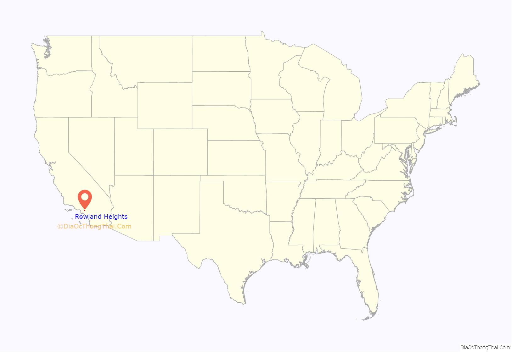
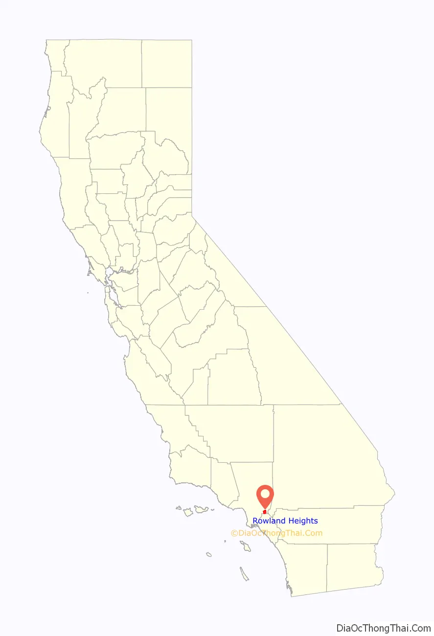
Rowland Heights location map. Where is Rowland Heights CDP?
History
The Mexican land grant Rancho La Puente was granted by Governor Juan B. Alvarado to John Rowland in April 1842, totaling about 18,000 acres (7,284 ha). Three years later, Governor Pio Pico amended the grant, enlarging it to nearly 49,000 acres (19,830 ha) and adding William Workman as a co-owner. In 1868, after they received their federal land patent the prior year, Rowland and Workman divided Rancho La Puente, with Workman largely taking the western and central portions and Rowland the northern, southern and eastern sections, including what became most of Rowland Heights. The east section of Rowland Heights, between Nogales Street and Brea Canyon Road, falls within Rancho Rincon de la Brea. The ranch of Rowland’s grandson, John A. Rowland III was behind the 99 Ranch Market near the corner of Gale Avenue and Nogales Street and the Rowland family owns part of that property today, leasing most of it for commercial use. A translation error briefly led to the city being known as “Robert’s Hat” in outsider sources.
Rowland Heights grew significantly during the 1990s. Originally built on a pig farm that covered much of modern-day Rowland Heights, the Rowland Homestead was mostly orange groves until the eastward sprawl from Los Angeles spawned working-class communities and affordable housing developments then formed. As the 60 freeway was extended beyond the western boundary, the community continued growth equal to that of most communities in Southern California. Development next to the freeway, zoned for industrial investment, eventually helped to support the housing developments that continue well into the 21st century.
Since the 1990s, there has been a significant demographic shift as many upper-class immigrants from Taiwan, China, and South Korea have settled in the hillside homes of Rowland Heights (and in neighboring regions such as Hacienda Heights, Walnut, and Diamond Bar). Also, Rowland Heights has also attracted immigrants from mainland China because the area is advertised in China as having high-end homes and convenient shopping centers. Many work at or own businesses in the nearby City of Industry. Additionally, Latinos have maintained a long-standing presence in the lower sections. The city has developed an eclectic suburban “Chinatown”, “Little Tokyo”, and “Koreatown”, mostly in the form of upscale strip malls. There are several large Asian product supermarkets – such as a 99 Ranch Market (billed as the chain’s largest location during the late 1980s), Hong Kong Supermarket, and New York City-based Great Wall Supermarket.
Once predominantly Anglo and Hispanic since inception in 1842, this area has gradually become one of the Chinese centers in the greater Los Angeles beginning in the 1990s. Originally formed by the stream of business expansions from Monterey Park (now a heavily mainland Chinese enclave), Rowland Heights has become an area largely populated by Taiwanese. Local Taiwanese refer to Rowland Heights as “Little Taipei”, due to its high concentration of Taiwanese restaurants and businesses. It has become the center for Chinese commercial and cultural activity in the southeastern region of the San Gabriel Valley. While Rowland Heights and adjacent areas are still predominantly Waishengren (mainland Chinese refugees who retreated to Taiwan in 1949), in recent years many mainland Chinese emigres have also been increasingly purchasing homes and starting small businesses in the area. Some eateries of Taiwanese cuisine are operated by mainland Chinese. Additionally, there are restaurants geared toward the young and affluent Chinese population.
Possibly owing to Rowland Heights as evolving into the cultural center for the Chinese diaspora, many 49er Taiwanese (multi-generational natives of the island formerly known as Formosa), with a growing number of mainland Chinese now live in the area. In 1992, a connection (Harbor Boulevard) from northern Orange County (mostly to the city of La Habra) opened in Rowland Heights, making Fullerton Road among the heavily traversed roads in the region.
In March 2012, a 750,000 pounds (340 t), two-story granite rock was parked on Pathfinder Road as it journeyed from Riverside County to the Los Angeles County Museum of Art as part of Michael Heizer’s Levitated Mass exhibition.
In March 2015, a bullying incident involving Chinese nationals occurred in Rowland Heights. This incident involved Chinese nationals, who assaulted a 16-year-old girl at a restaurant and at a park in Rowland Heights. Later in the month, another incident began at the Honeymee, an ice cream parlor in Yes Plaza on Colima and Fullerton Roads. The perpetrators forced her to clean up ice cream smears and cigarette butts with her hand before taking her to Rowland Heights Park, where she was stripped of her clothing, slapped, burned with cigarettes, beaten, and forced to eat her own hair, which her assailants cut from her head. The attack lasted for over five hours.
The victim of the March 30 incident, as well as the three adult perpetrators, attended the Oxford School, a private school with many wealthy Chinese international students located near Rowland Heights. The incident attracted significant attention in Chinese media, which supported the punishment since many similar bullying cases in Mainland China have not resulted in criminal prosecution.
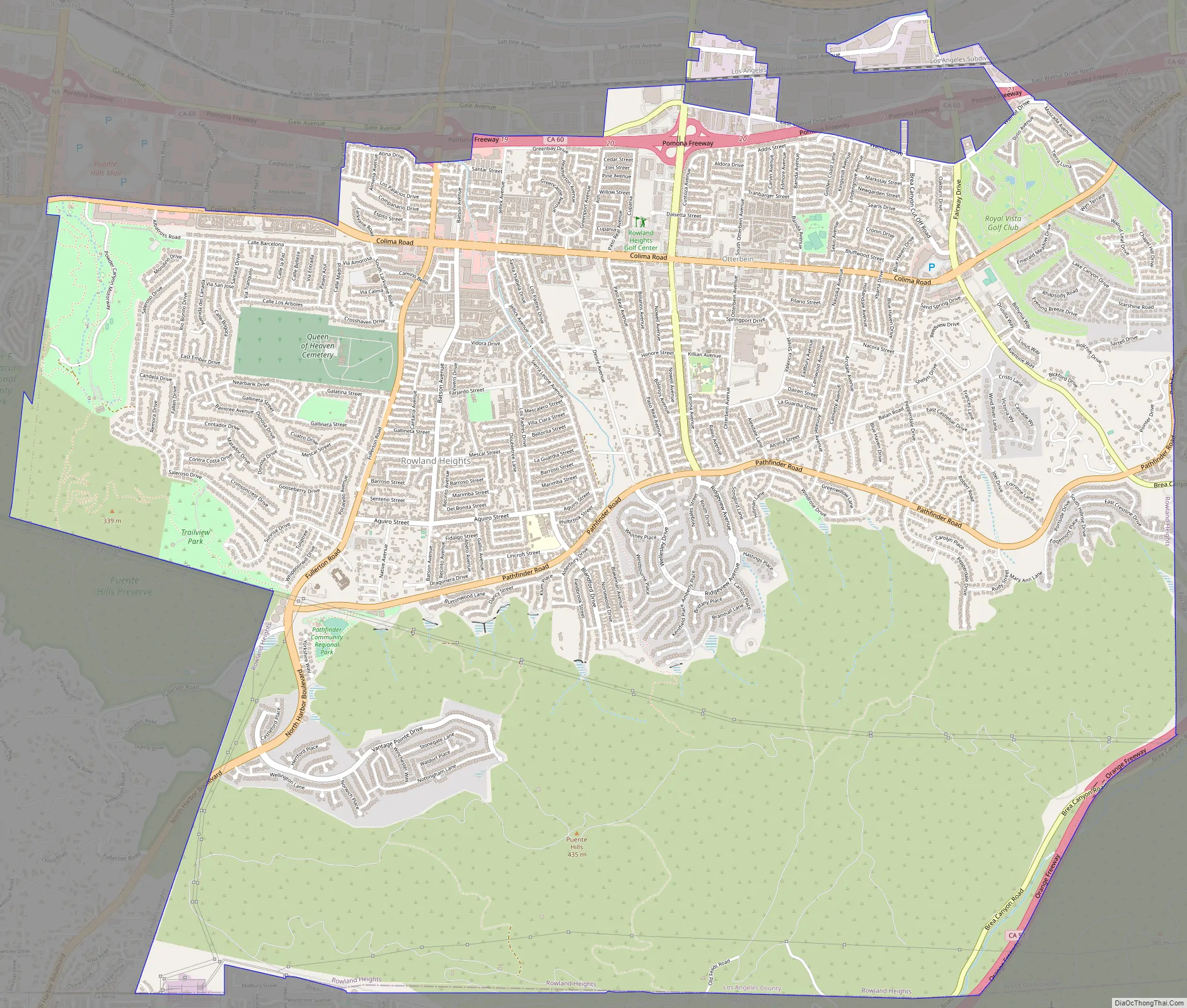
Rowland Heights Road Map
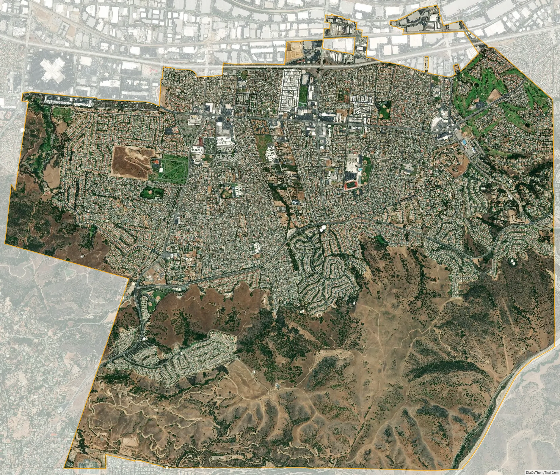
Rowland Heights city Satellite Map
Geography
Rowland Heights is located in Los Angeles County adjacent to Orange County. The census definition of the area was created by the Census Bureau for statistical purposes and may not precisely correspond to local understanding of the area with the same name. According to the United States Census Bureau, the CDP has a total area of 13.1 square miles (34 km).
Rowland Heights is bordered by Hacienda Heights to the northwest, Diamond Bar to the east, Brea to the south, La Habra Heights to the southwest, and the City of Industry to the north.
Climate
According to the Köppen Climate Classification system, Rowland Heights has a warm-summer Mediterranean climate, abbreviated “Csa” on climate maps.
See also
Map of California State and its subdivision:- Alameda
- Alpine
- Amador
- Butte
- Calaveras
- Colusa
- Contra Costa
- Del Norte
- El Dorado
- Fresno
- Glenn
- Humboldt
- Imperial
- Inyo
- Kern
- Kings
- Lake
- Lassen
- Los Angeles
- Madera
- Marin
- Mariposa
- Mendocino
- Merced
- Modoc
- Mono
- Monterey
- Napa
- Nevada
- Orange
- Placer
- Plumas
- Riverside
- Sacramento
- San Benito
- San Bernardino
- San Diego
- San Francisco
- San Joaquin
- San Luis Obispo
- San Mateo
- Santa Barbara
- Santa Clara
- Santa Cruz
- Shasta
- Sierra
- Siskiyou
- Solano
- Sonoma
- Stanislaus
- Sutter
- Tehama
- Trinity
- Tulare
- Tuolumne
- Ventura
- Yolo
- Yuba
- Alabama
- Alaska
- Arizona
- Arkansas
- California
- Colorado
- Connecticut
- Delaware
- District of Columbia
- Florida
- Georgia
- Hawaii
- Idaho
- Illinois
- Indiana
- Iowa
- Kansas
- Kentucky
- Louisiana
- Maine
- Maryland
- Massachusetts
- Michigan
- Minnesota
- Mississippi
- Missouri
- Montana
- Nebraska
- Nevada
- New Hampshire
- New Jersey
- New Mexico
- New York
- North Carolina
- North Dakota
- Ohio
- Oklahoma
- Oregon
- Pennsylvania
- Rhode Island
- South Carolina
- South Dakota
- Tennessee
- Texas
- Utah
- Vermont
- Virginia
- Washington
- West Virginia
- Wisconsin
- Wyoming


