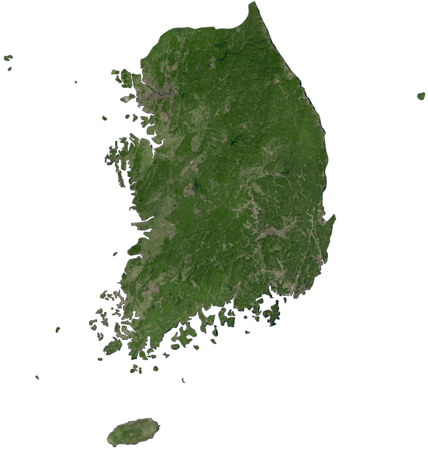
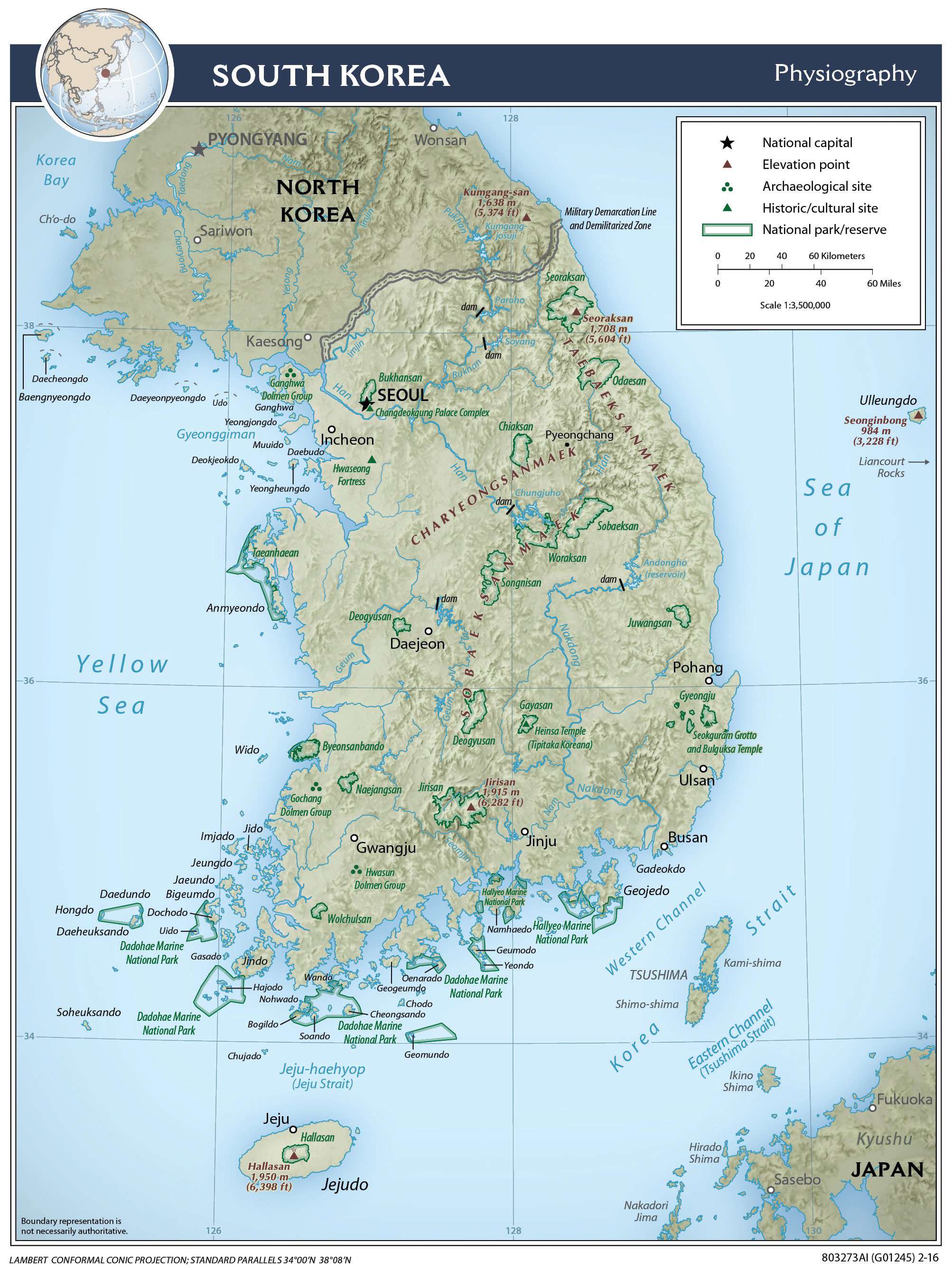
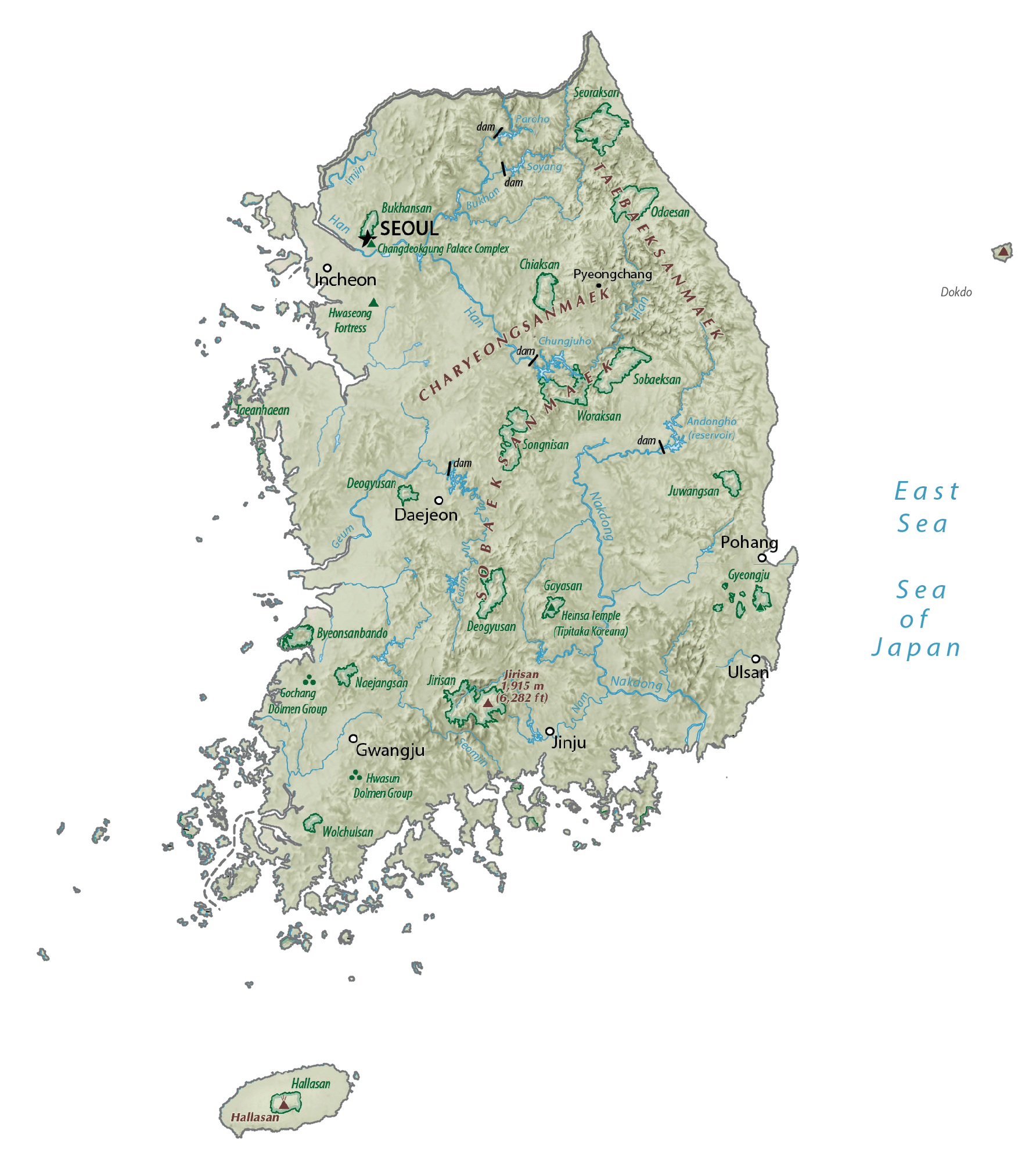
South Korea covers an area of 100,363 sq. km in the southern part of the Korean Peninsula.
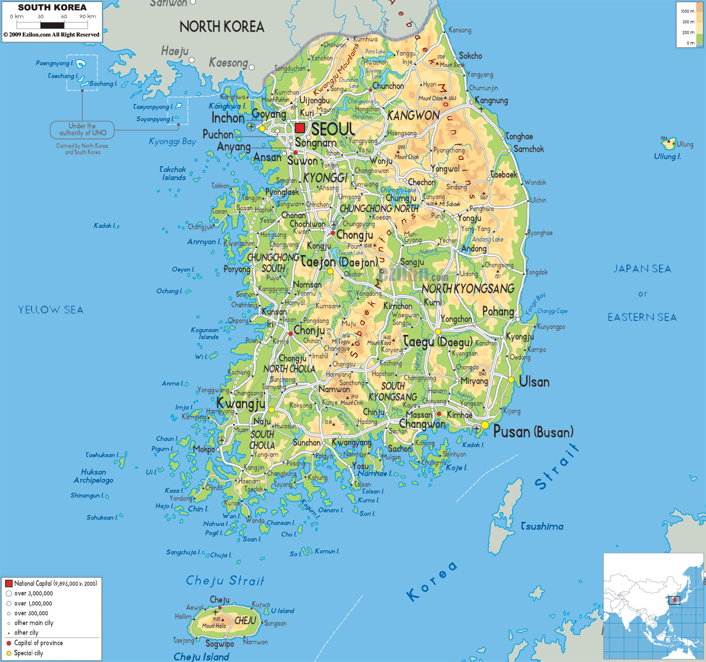
As observed on the physical map above, the country is very hilly and mountainous in the east, where the Taebaek Mountains dominate the landscape. The Sobaek Mountains are found in the southern part of the country.The rugged land slopes west into undulating, flatter coastal plains, where most of its people live, and useable agricultural land is found.
These coastal lowlands formed as a result of mountain erosion, and account for only 30 percent of the country.
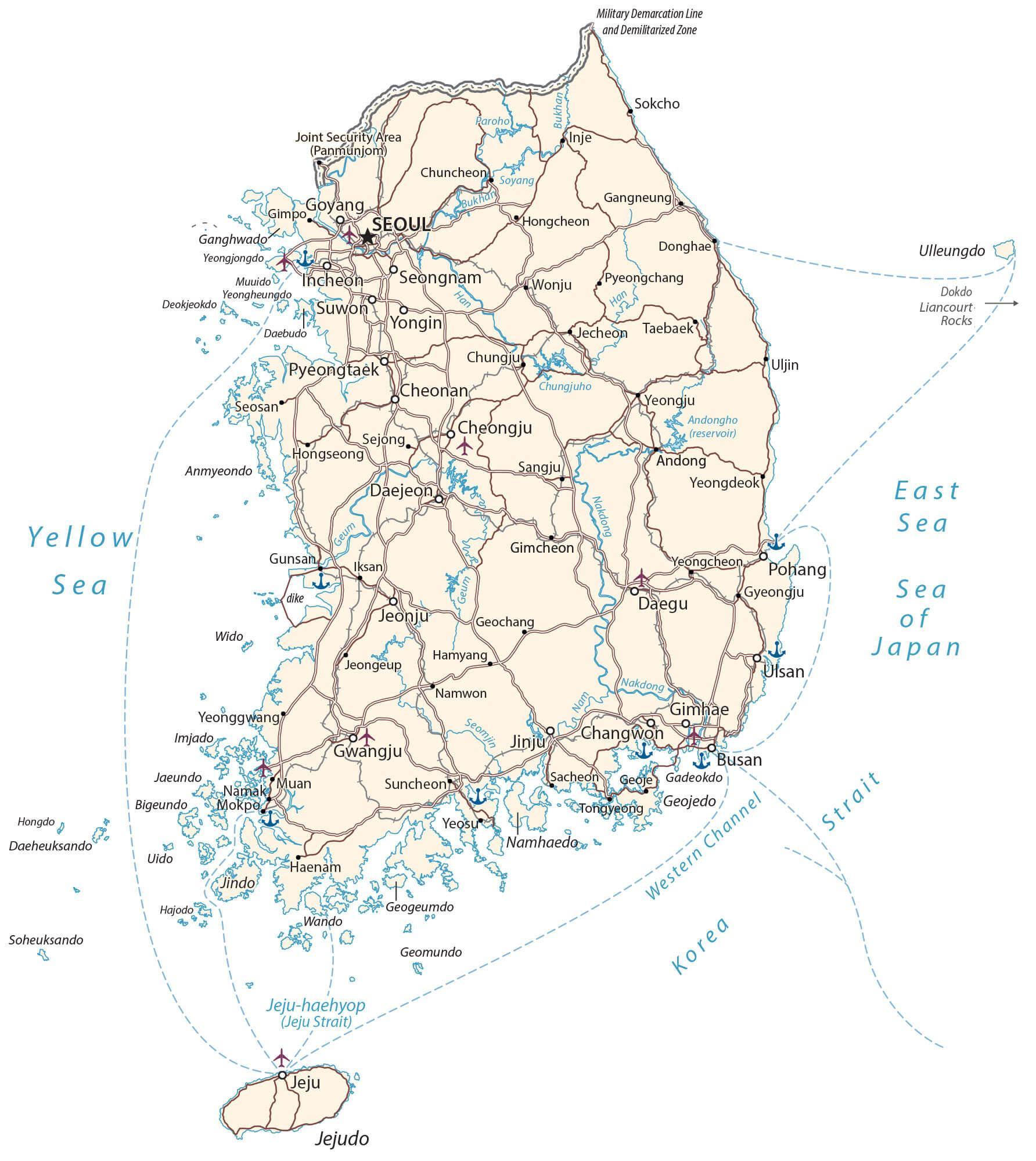
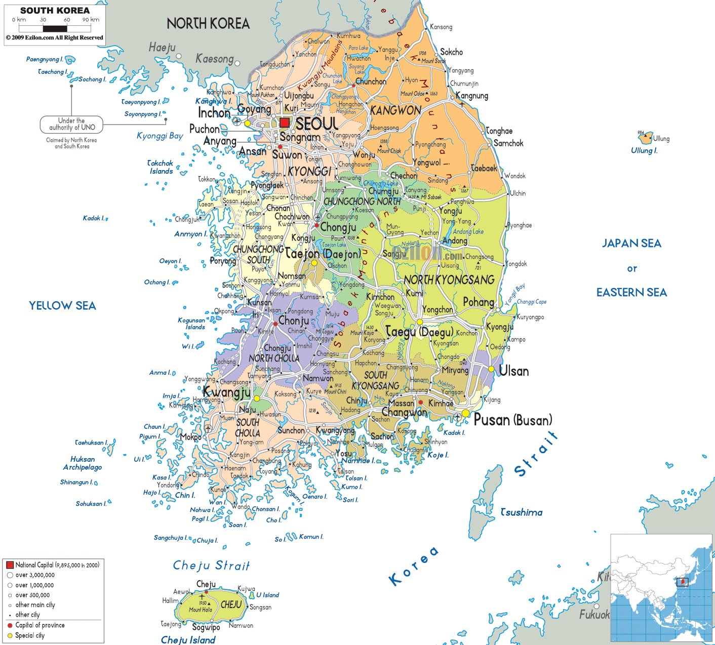
The western and southern coastlines of the country are covered by thousands of islands and narrow channels; significant rivers include the Kum, Han and Naktong.
The country’s highest point is Mt. Halla-san, an extinct volcano located on Cheju Island, at 6,398 ft. (1,950 m). A yellow upright triangle marks the position of this point on the map.
Due to an active reforestation program, over 65% of South Korea’s land is covered in forests; up from 35% in 1955, after much of the country’s forests were cut down during and after World War II.
| Flag: | 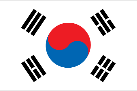 |
|---|---|
| Legal Name: | Republic of Korea |
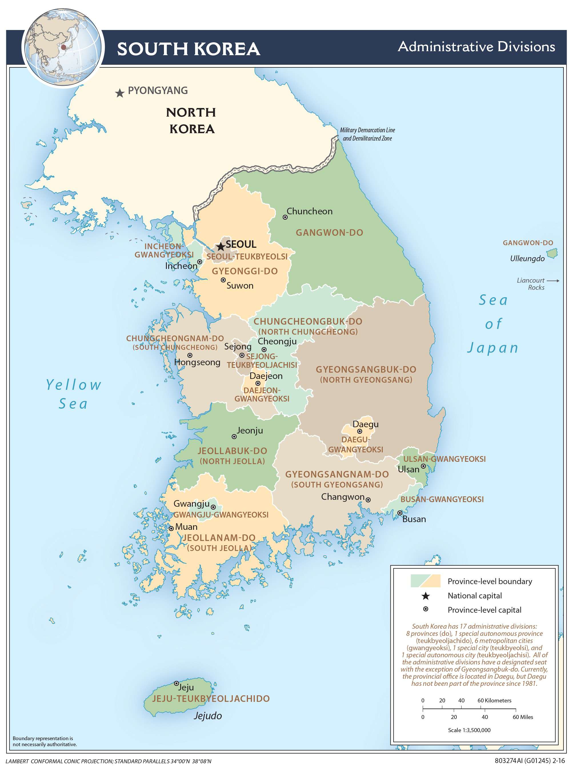
| Capital Value: | Seoul; note – Sejong, located some 120 km (75 mi) south of Seoul, is being developed as a new capital |
| Official languages: | Korean (Pyojuneo) Korean Sign Language |
| Demonym(s): |
|
| Government: | Unitary presidential constitutional republic |
| Legislature: | National Assembly |
| Total Area: | 99,720 km² |
| Land Area: | 96,920 km² |
| Water Area: | 2,800 km² |
| Population: | 51,709,098 |
| Density: | 507/km (1,313.1/sq mi) |
| GDP: | $1.64 Trillion |
| GDP Per Capita: | $31,761.98 |
| Currency Value: | South Korean won (KRW) |
| Driving side: | right |
| Calling code: | +82 |
| Internet TLD: |
|
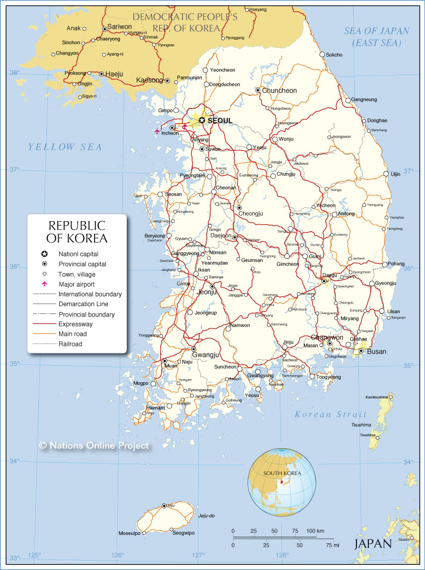
Explore South Korea with this Detailed Map
South Korea is a fascinating country with a long and rich history. It is home to many beautiful cities, towns, highways, roads, rivers, lakes, and islands. To help you explore this wonderful country, we have created a detailed map that includes a reference map, satellite imagery, physical map, and provincial map of South Korea. Whether you are looking to find Jejudo Island, the DMZ, or anything in between, this map has it all!
Online Interactive Political Map
Click on ![]() to view map in "full screen" mode.
to view map in "full screen" mode.
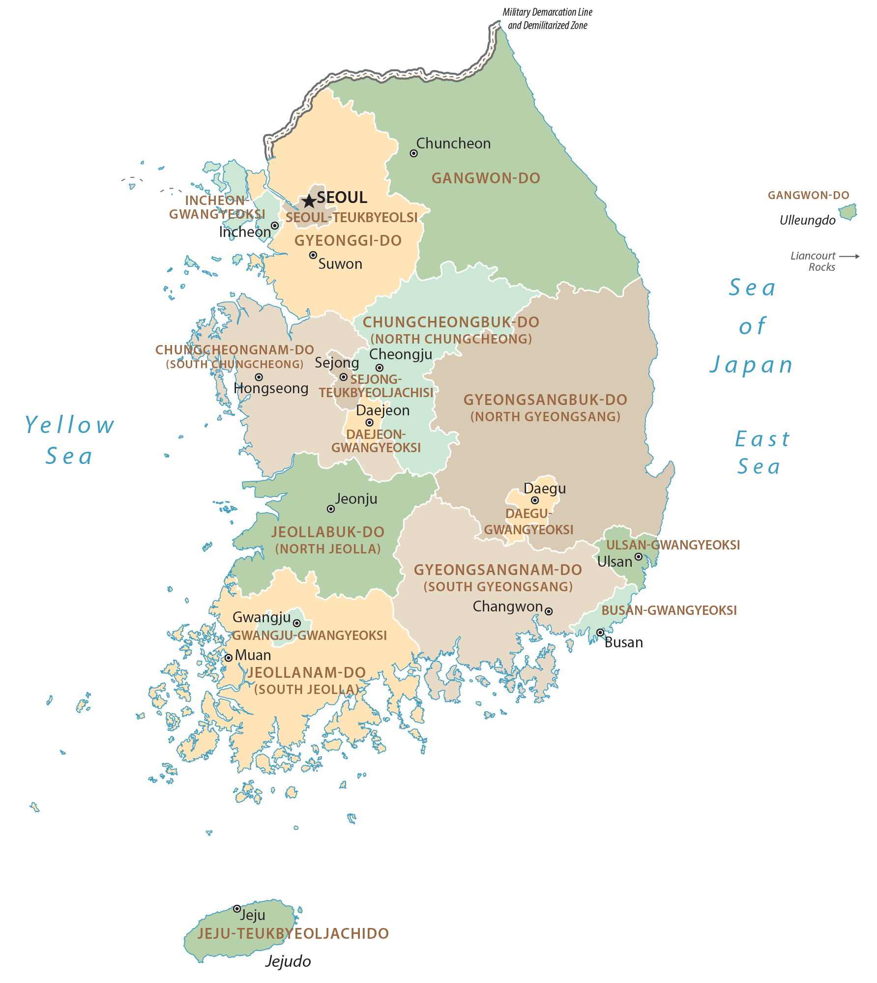
South Korea (officially, Republic of Korea) is divided into 9 administrative provinces, 6 metropolitan cities, 1 special city and 1 special self-governing city. In alphabetical order, the provinces are: Chungbuk (North Chungcheong), Chungnam (South Chungcheong), Gangwon, Gyeongbuk (North Gyeongsang), Gyeonggi, Gyeongnam (South Gyeongsang), Jeju, Jeonbuk (North Jeolla), Jeonnam (South Jeolla). The metropolitan cities are: Busan (Pusan), Daegu (Taegu), Daejeon (Taejon), Gwangju (Kwangju), Incheon (Inch᾿on) and Ulsan. Seoul is a special city; while, Sejong is a special self-governing city. These administrative divisions are further subdivided into a number of smaller subdivisions.
Located in the western part of the heart of the Korean Peninsula, Seoul (officially, the Seoul special city) – the capital and the largest metropolitan city of South Korea. It is also the cultural, political and economic center of South Korea.
Location Maps
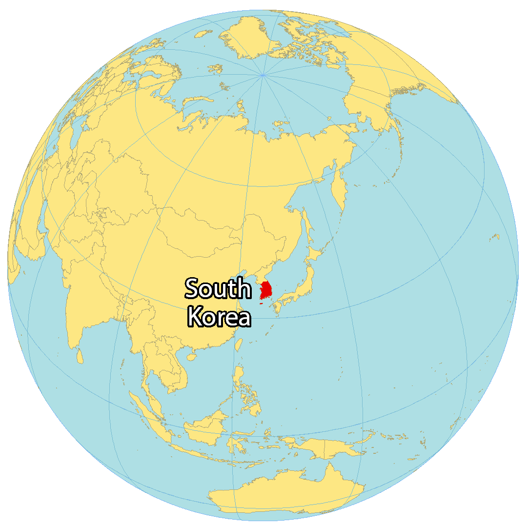
Where is South Korea?
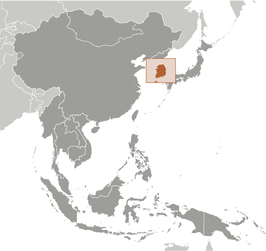
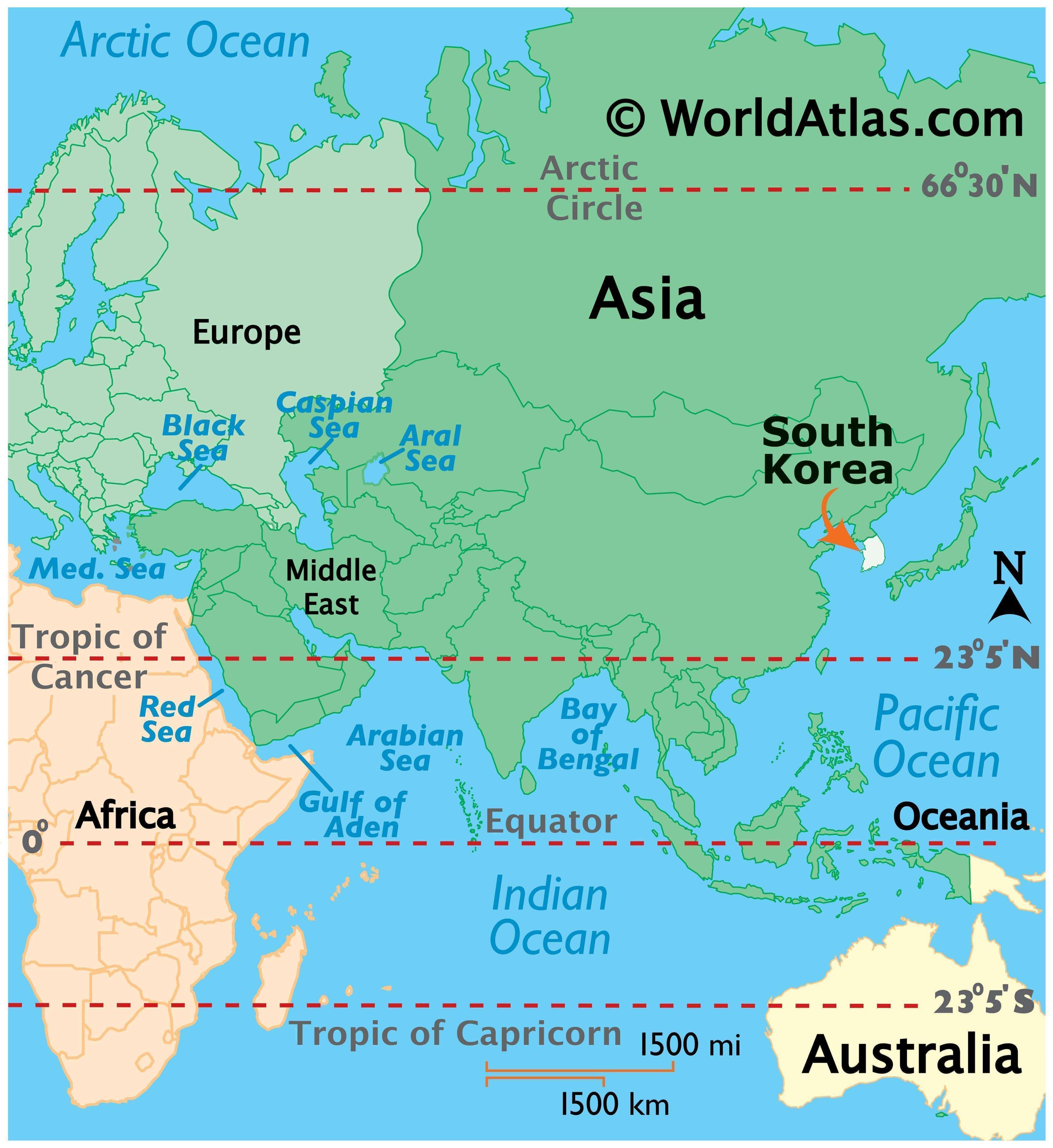
South Korea is located in Eastern Asia, occupying the southern half of the Korean Peninsula. It borders North Korea (Democratic People’s Republic of Korea) to the north by a 250-kilometer-long Demilitarized Zone (DMZ) at the 38th parallel. Additionally, it is close to Kyushu, Japan separated by the Korea Strait at a distance of 200 kilometers (124 mi). South Korea is situated between the East Sea (Sea of Japan) to the east and the Yellow Sea to the west.
The country has a population of 51 million people, making it the 28th most populous country in the world. The capital and largest city is Seoul, which has a population of 10 million people. Other major cities include Busan, Incheon, Daegu, and Daejeon.
High Definition Political Map of South Korea
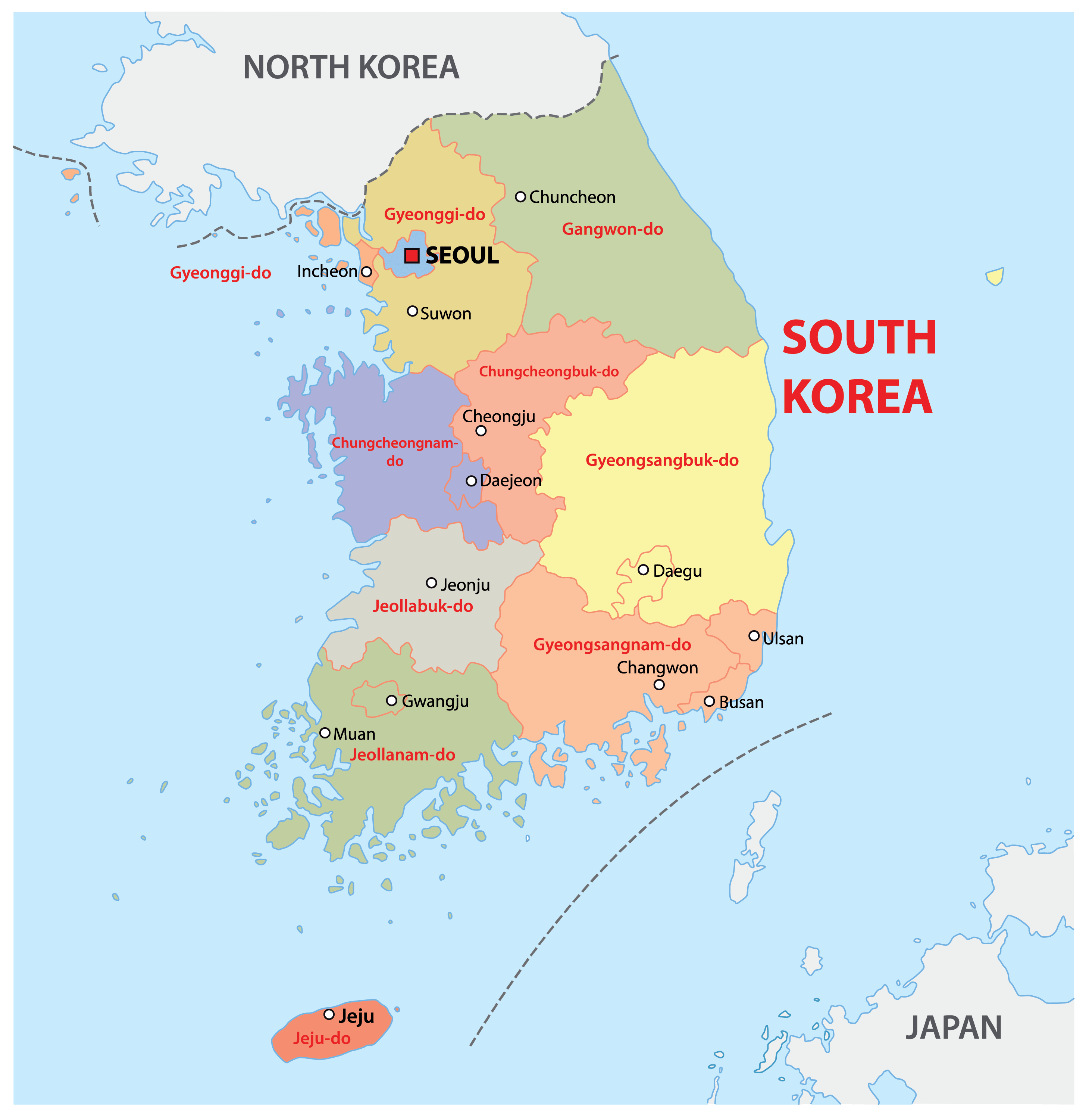
South Korea Administrative Map
Physical Map of South Korea
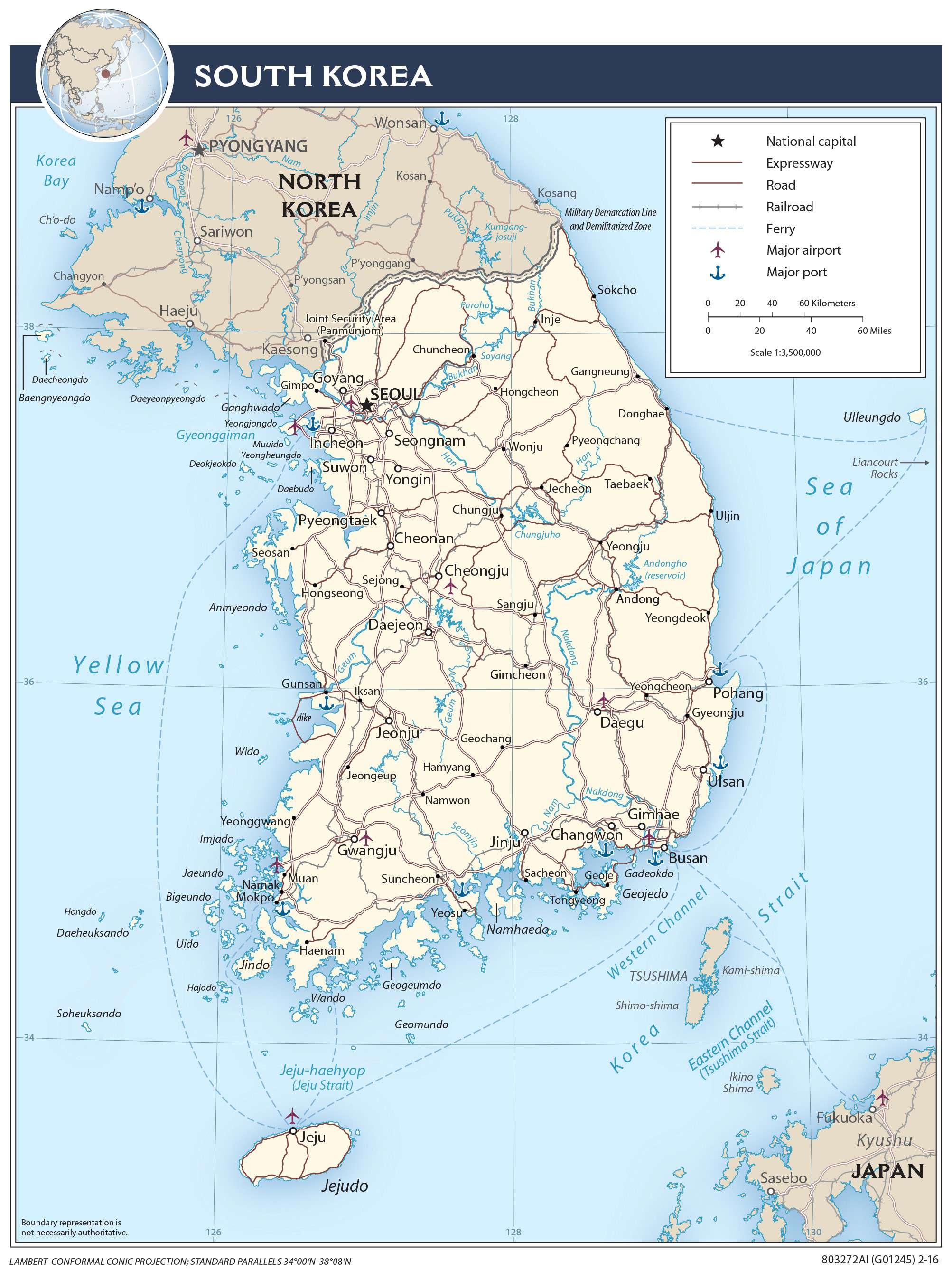
Transportation Map of South Korea
South Korea Satellite Map