The City of Wheat Ridge is a home rule municipality located in Jefferson County, Colorado, United States. Wheat Ridge is located immediately west of Denver and is a part of the Denver–Aurora–Lakewood, CO Metropolitan Statistical Area. The Wheat Ridge Municipal Center is approximately 5 miles (8 km) west-northwest of the Colorado State Capitol in Denver. The city had a population of 32,398 as of the 2020 Census.
| Name: | Wheat Ridge city |
|---|---|
| LSAD Code: | 25 |
| LSAD Description: | city (suffix) |
| State: | Colorado |
| County: | Jefferson County |
| Incorporated: | 1969 |
| Elevation: | 5,459 ft (1,664 m) |
| Total Area: | 9.58 sq mi (24.8 km²) |
| Land Area: | 9.34 sq mi (24.2 km²) |
| Water Area: | 0.24 sq mi (0.6 km²) |
| Total Population: | 32,398 |
| Population Density: | 3,400/sq mi (1,300/km²) |
| ZIP code: | 80212, 80214, 80215, 80033, 80034 |
| Area code: | 303, 720 |
| FIPS code: | 0884440 |
| Website: | www.ci.wheatridge.co.us |
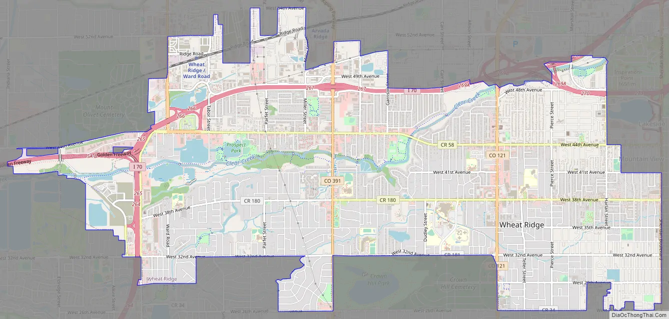
Online Interactive Map
Click on ![]() to view map in "full screen" mode.
to view map in "full screen" mode.
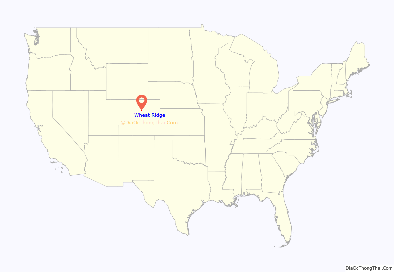
Wheat Ridge location map. Where is Wheat Ridge city?
History
Although Wheat Ridge is a relatively young incorporated city, it has a history based on agriculture and the community’s location along regional travel routes. It grew from a popular rest stop for travelers during the Gold Rush of the late 1850s to an agricultural and suburban community known as the “Carnation City” in the mid 1900s. As the residential areas of unincorporated Jefferson County grew to provide housing to the Denver workforce during the 1950s, the major transportation corridors extending from Denver developed with commercial services. During that era, the formation of numerous utility and fire protection districts provided these unincorporated areas with urban services. Eventually, due to the increasing annexation pressure from nearby municipalities, Wheat Ridge incorporated in 1969.
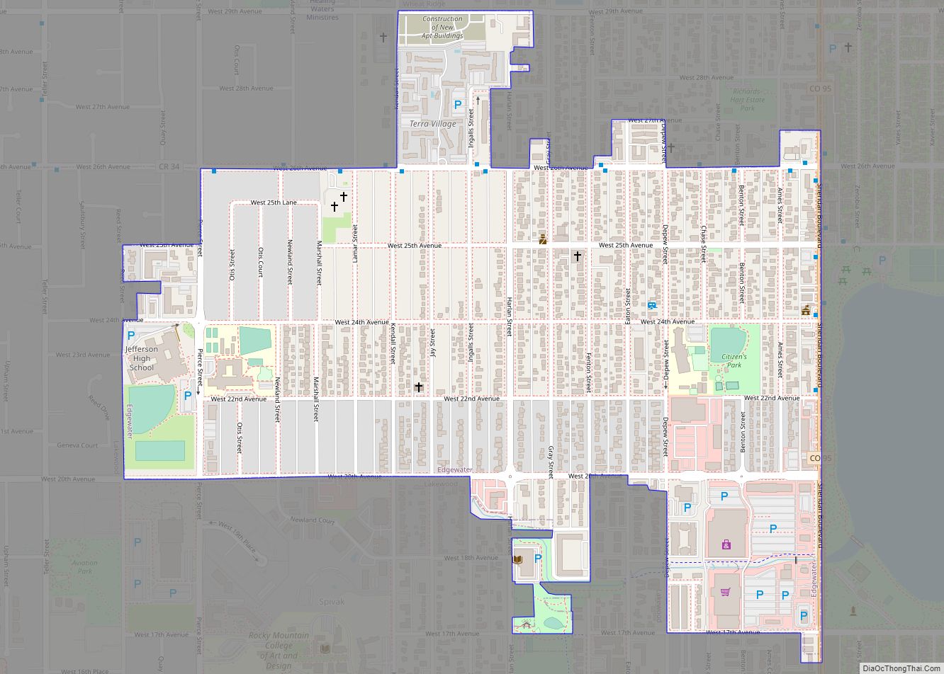
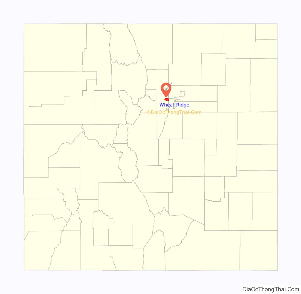
Wheat Ridge Road Map
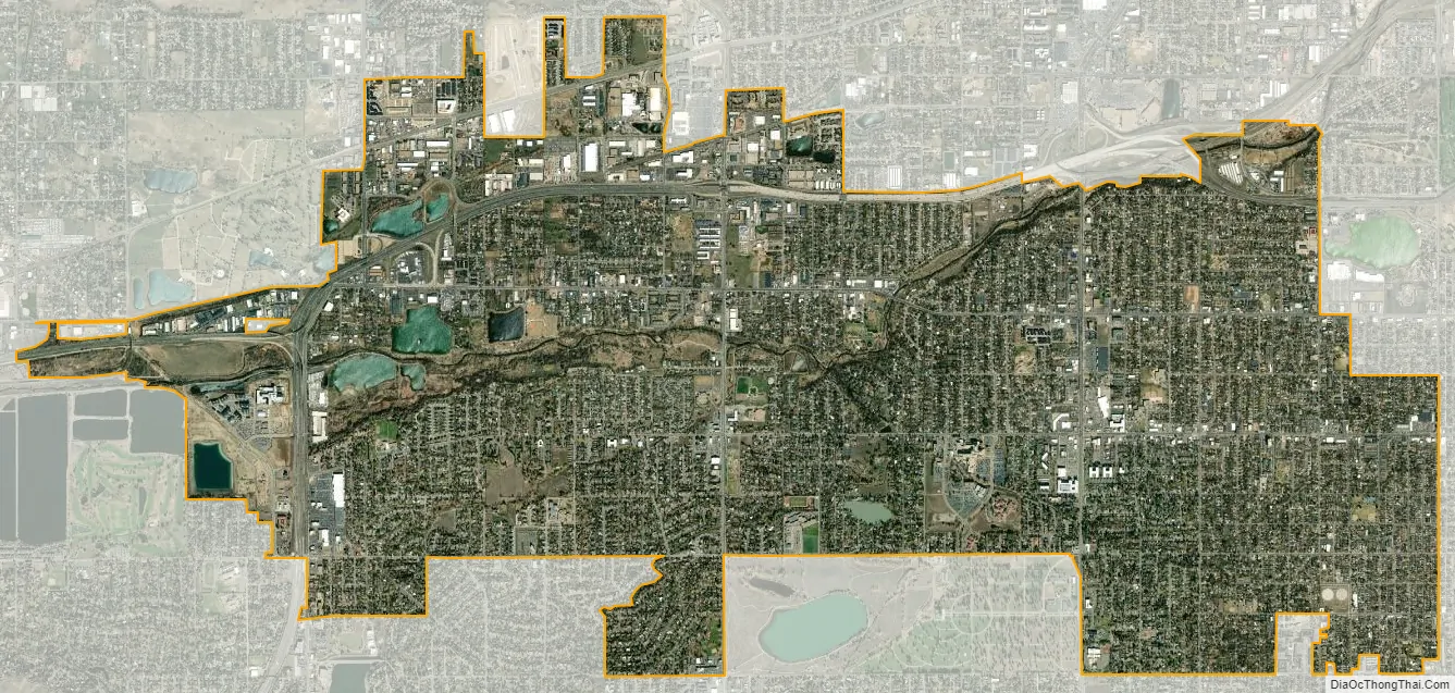
Wheat Ridge city Satellite Map
Geography
Wheat Ridge is located at 39°45′58″N 105°04′38″W / 39.76611°N 105.07722°W / 39.76611; -105.07722 (39.7660980, -105.0772063) at an elevation of 5,459 feet (1,664 m). Located at the junction of Interstate 70 and Colorado State Highway 391 in central Colorado, the city is immediately west of Denver and 66 miles (106 km) north-northwest of Colorado Springs.
Wheat Ridge is located in the Colorado Piedmont on the western edge of the Great Plains just east of the Front Range of the Southern Rocky Mountains. Clear Creek, a tributary of the South Platte River, flows east then northeast through the city. Lena Gulch, a tributary of Clear Creek, flows northeast through the southwest part of the city.
There are several small lakes and reservoirs in Wheat Ridge. Crown Hill Lake, Kestrel Pond, and North Henry Lee Reservoir are located in the south-central part of the city. West Lake, Tabor Lake, and Prospect Lake are located along Clear Creek in the west-central part of the city.
According to the United States Census Bureau, the city has a total area of 9.55 square miles (24.7 km) of which 9.30 square miles (24.1 km) is land and 0.25 square miles (0.65 km) of it (2.6%) is water.
As a suburb of Denver, Wheat Ridge is part of both the greater Denver metropolitan area and the Front Range Urban Corridor. It borders other communities on all sides including: Arvada to the north; Lakeside, Mountain View, and Denver to the east; Edgewater to the southeast; Lakewood to the south; Applewood to the southwest; and Fairmount to the northwest.
Climate
The climate is described as Humid Continental by the Köppen Climate System, abbreviated as Dfb.
See also
Map of Colorado State and its subdivision:- Adams
- Alamosa
- Arapahoe
- Archuleta
- Baca
- Bent
- Boulder
- Broomfield
- Chaffee
- Cheyenne
- Clear Creek
- Conejos
- Costilla
- Crowley
- Custer
- Delta
- Denver
- Dolores
- Douglas
- Eagle
- El Paso
- Elbert
- Fremont
- Garfield
- Gilpin
- Grand
- Gunnison
- Hinsdale
- Huerfano
- Jackson
- Jefferson
- Kiowa
- Kit Carson
- La Plata
- Lake
- Larimer
- Las Animas
- Lincoln
- Logan
- Mesa
- Mineral
- Moffat
- Montezuma
- Montrose
- Morgan
- Otero
- Ouray
- Park
- Phillips
- Pitkin
- Prowers
- Pueblo
- Rio Blanco
- Rio Grande
- Routt
- Saguache
- San Juan
- San Miguel
- Sedgwick
- Summit
- Teller
- Washington
- Weld
- Yuma
- Alabama
- Alaska
- Arizona
- Arkansas
- California
- Colorado
- Connecticut
- Delaware
- District of Columbia
- Florida
- Georgia
- Hawaii
- Idaho
- Illinois
- Indiana
- Iowa
- Kansas
- Kentucky
- Louisiana
- Maine
- Maryland
- Massachusetts
- Michigan
- Minnesota
- Mississippi
- Missouri
- Montana
- Nebraska
- Nevada
- New Hampshire
- New Jersey
- New Mexico
- New York
- North Carolina
- North Dakota
- Ohio
- Oklahoma
- Oregon
- Pennsylvania
- Rhode Island
- South Carolina
- South Dakota
- Tennessee
- Texas
- Utah
- Vermont
- Virginia
- Washington
- West Virginia
- Wisconsin
- Wyoming