Adel (/ˈeɪdəl/ AY-dəl) is a city in and the county seat of Dallas County, Iowa. It is located along the North Raccoon River. Its population was 6,153 at the time of the 2020 Census.
| Name: | Adel city |
|---|---|
| LSAD Code: | 25 |
| LSAD Description: | city (suffix) |
| State: | Iowa |
| County: | Dallas County |
| Incorporated: | 1847 |
| Elevation: | 892 ft (272 m) |
| Total Area: | 5.36 sq mi (13.88 km²) |
| Land Area: | 5.34 sq mi (13.83 km²) |
| Water Area: | 0.02 sq mi (0.05 km²) |
| Total Population: | 6,153 |
| Population Density: | 1,152.25/sq mi (444.90/km²) |
| ZIP code: | 50003 |
| Area code: | 515 |
| FIPS code: | 1900505 |
| GNISfeature ID: | 0454097 |
| Website: | adeliowa.org |
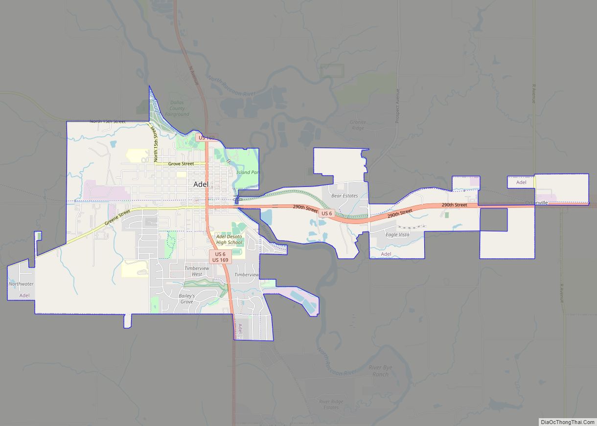
Online Interactive Map
Click on ![]() to view map in "full screen" mode.
to view map in "full screen" mode.
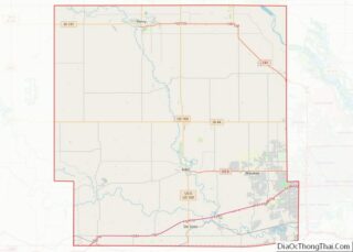
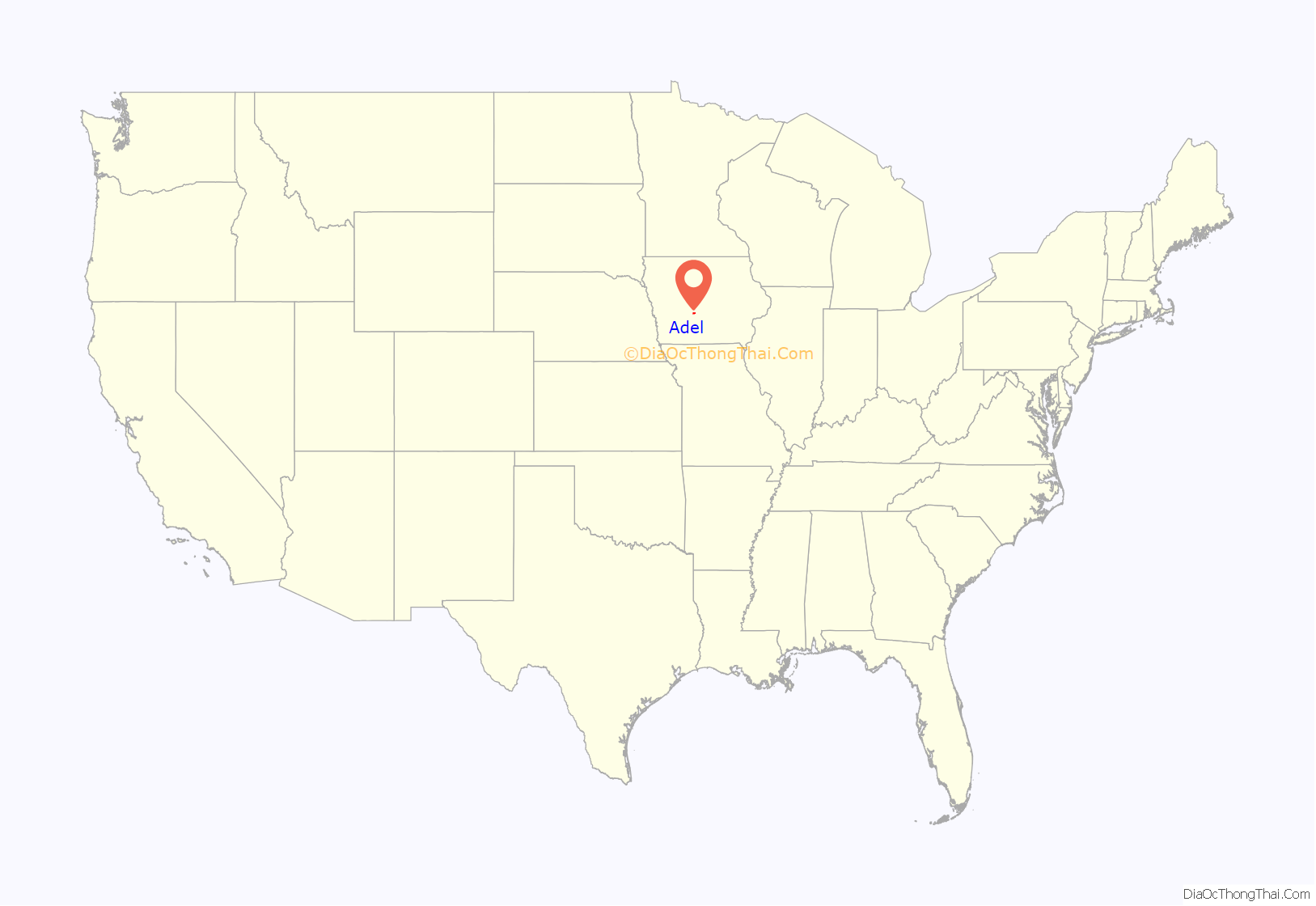
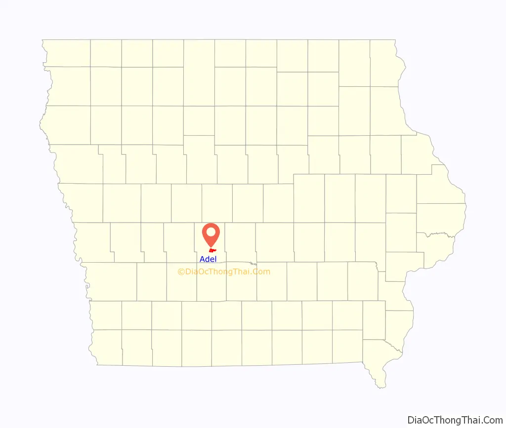
Adel location map. Where is Adel city?
History
Adel is the oldest town within Dallas County. Originally called Penoach, Adel was incorporated in 1847, and changed to its current name in 1849. In 1855, there were about twenty-five houses in Adel and three stores. From that time onward, the city began to grow at a faster rate.
Situated along the river, Adel had a good supply of water-power for a flour mill. It was to be situated on a section of property owned by Noeingerl Cantrel & Co. J. H. Strong of Des Moines, and H. H. Moffatt built the mill in 1856–57 at a cost of $20,000. The dam was constructed with about eight feet of head water. The mill was kept in good repair, able to average from twelve to fifteen bushels per hour, with a capability of thirty per hour, but was destroyed in 1913.
The railroad reached other towns in Dallas County before Adel, and the town was threatened with losing the county seat. Adel business owners backed the Des Moines Western Railroad Company, which was soon renamed as the Des Moines, Adel, and Western. A narrow gauge railroad was built in the 1870s. The line was rebuilt as standard gauge after the Milwaukee Road purchased the line in the 1890s. Passenger service to Adel was discontinued in 1952, and the line was abandoned in 1987. The line has been repurposed into the popular Raccoon River Valley Trail.
The Adel bank was robbed on March 6, 1895. Two men entered in a buggy and shot a teller, who, though wounded, managed to close the vault and turn the tumblers, preventing the thieves from taking off with a substantial amount. Future Governor of Iowa George W. Clarke had a law office on the second floor. As Clarke descended the stairs, a robber fired his gun. However, the weapon misfired, sparing Clarke’s life.
The Dallas County Courthouse, was completed in 1902 at a cost of about $109,000, is located at the center of downtown Adel.
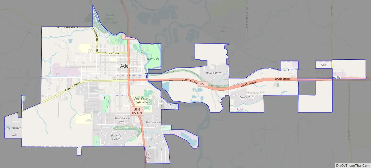
Adel Road Map
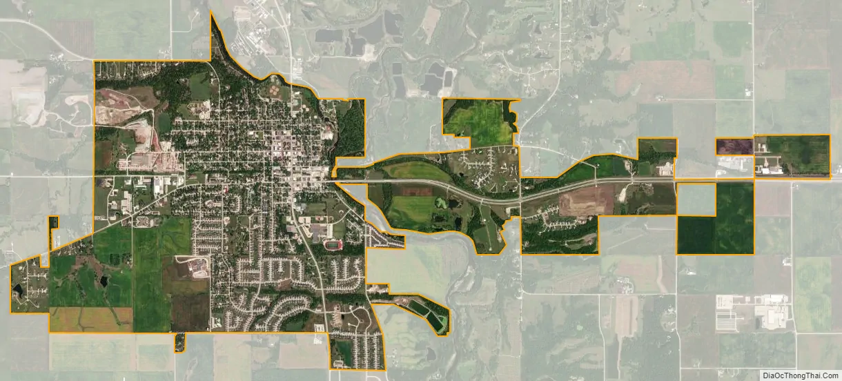
Adel city Satellite Map
Geography
Adel’s longitude and latitude coordinates in decimal form are 41.616773, -94.021731.
According to the United States Census Bureau, the city has a total area of 3.28 square miles (8.50 km), of which 3.27 square miles (8.47 km) is land and 0.01 square miles (0.03 km) is water.
See also
Map of Iowa State and its subdivision:- Adair
- Adams
- Allamakee
- Appanoose
- Audubon
- Benton
- Black Hawk
- Boone
- Bremer
- Buchanan
- Buena Vista
- Butler
- Calhoun
- Carroll
- Cass
- Cedar
- Cerro Gordo
- Cherokee
- Chickasaw
- Clarke
- Clay
- Clayton
- Clinton
- Crawford
- Dallas
- Davis
- Decatur
- Delaware
- Des Moines
- Dickinson
- Dubuque
- Emmet
- Fayette
- Floyd
- Franklin
- Fremont
- Greene
- Grundy
- Guthrie
- Hamilton
- Hancock
- Hardin
- Harrison
- Henry
- Howard
- Humboldt
- Ida
- Iowa
- Jackson
- Jasper
- Jefferson
- Johnson
- Jones
- Keokuk
- Kossuth
- Lee
- Linn
- Louisa
- Lucas
- Lyon
- Madison
- Mahaska
- Marion
- Marshall
- Mills
- Mitchell
- Monona
- Monroe
- Montgomery
- Muscatine
- O'Brien
- Osceola
- Page
- Palo Alto
- Plymouth
- Pocahontas
- Polk
- Pottawattamie
- Poweshiek
- Ringgold
- Sac
- Scott
- Shelby
- Sioux
- Story
- Tama
- Taylor
- Union
- Van Buren
- Wapello
- Warren
- Washington
- Wayne
- Webster
- Winnebago
- Winneshiek
- Woodbury
- Worth
- Wright
- Alabama
- Alaska
- Arizona
- Arkansas
- California
- Colorado
- Connecticut
- Delaware
- District of Columbia
- Florida
- Georgia
- Hawaii
- Idaho
- Illinois
- Indiana
- Iowa
- Kansas
- Kentucky
- Louisiana
- Maine
- Maryland
- Massachusetts
- Michigan
- Minnesota
- Mississippi
- Missouri
- Montana
- Nebraska
- Nevada
- New Hampshire
- New Jersey
- New Mexico
- New York
- North Carolina
- North Dakota
- Ohio
- Oklahoma
- Oregon
- Pennsylvania
- Rhode Island
- South Carolina
- South Dakota
- Tennessee
- Texas
- Utah
- Vermont
- Virginia
- Washington
- West Virginia
- Wisconsin
- Wyoming