Ames (/eɪmz/) is a city in Story County, Iowa, United States, located approximately 30 miles (48 km) north of Des Moines in central Iowa. It is best known as the home of Iowa State University (ISU), with leading agriculture, design, engineering, and veterinary medicine colleges. A United States Department of Energy national laboratory, Ames Laboratory, is located on the ISU campus.
According to the 2020 census, Ames had a population of 66,427, making it the state’s ninth largest city. Iowa State University was home to 27,854 students as of spring 2023, which make up approximately one half of the city’s population.
Ames also hosts United States Department of Agriculture (USDA) sites: the largest federal animal disease center in the United States, the USDA Agricultural Research Service’s National Animal Disease Center (NADC), as well as one of two national USDA sites for the Animal and Plant Health Inspection Service (APHIS), which comprises the National Veterinary Services Laboratory and the Center for Veterinary Biologics. Ames also hosts the headquarters for the Iowa Department of Transportation.
| Name: | Ames city |
|---|---|
| LSAD Code: | 25 |
| LSAD Description: | city (suffix) |
| State: | Iowa |
| County: | Story County |
| Incorporated: | 1864 |
| Elevation: | 942 ft (287 m) |
| Land Area: | 27.58 sq mi (71.43 km²) |
| Water Area: | 0.34 sq mi (0.89 km²) |
| Population Density: | 2,408.61/sq mi (929.96/km²) |
| FIPS code: | 1901855 |
| GNISfeature ID: | 0454167 |
| Website: | www.cityofames.org |
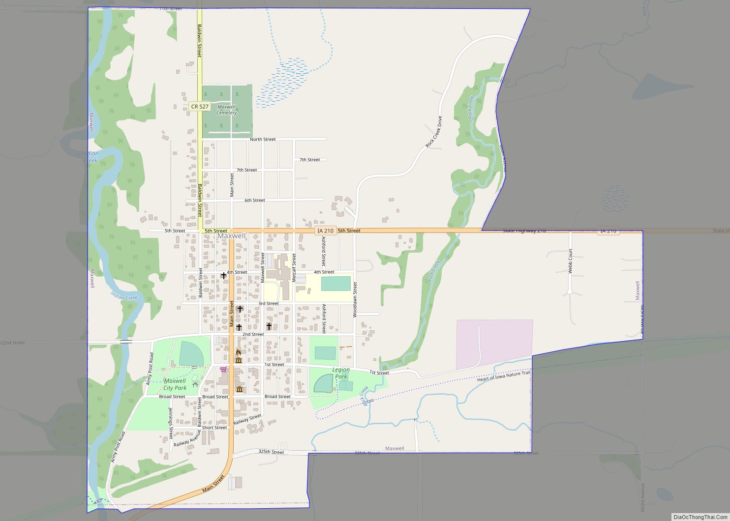
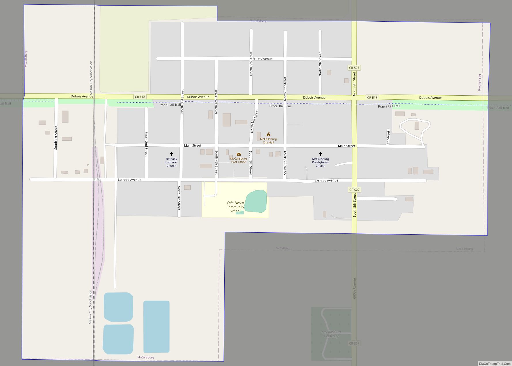
Online Interactive Map
Click on ![]() to view map in "full screen" mode.
to view map in "full screen" mode.
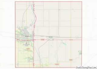
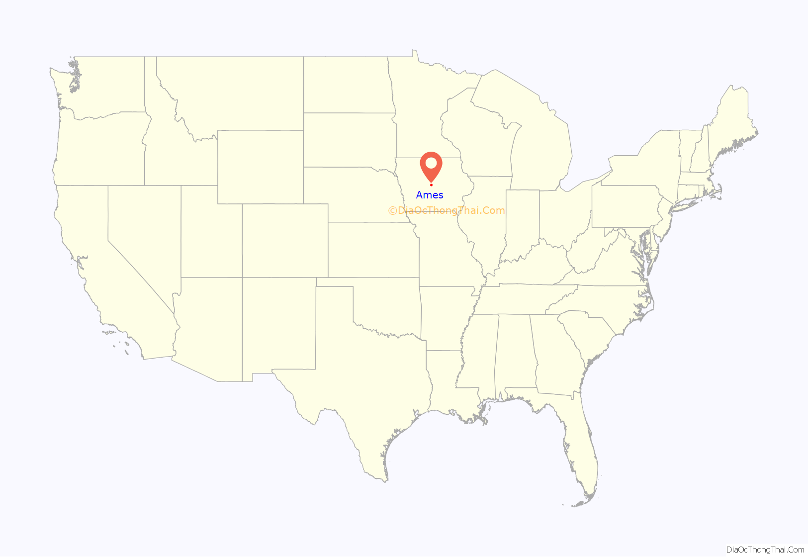
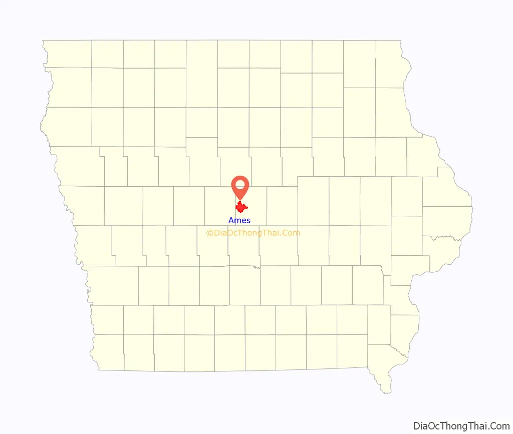
Ames location map. Where is Ames city?
History
The city was formed in 1864 as a station stop on the Cedar Rapids and Missouri Railroad and was named after 19th century U.S. Congressman Oakes Ames of Massachusetts, who was influential in the building of the transcontinental railroad. Ames was founded by local resident Cynthia Olive Duff (née Kellogg) and railroad magnate John Insley Blair, near a location that was deemed favorable for a railroad crossing of the Skunk River.
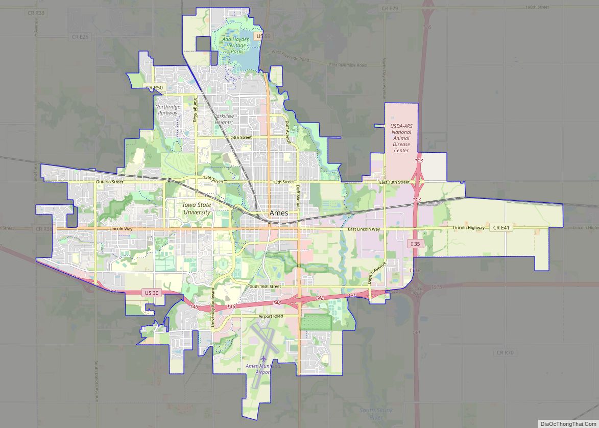
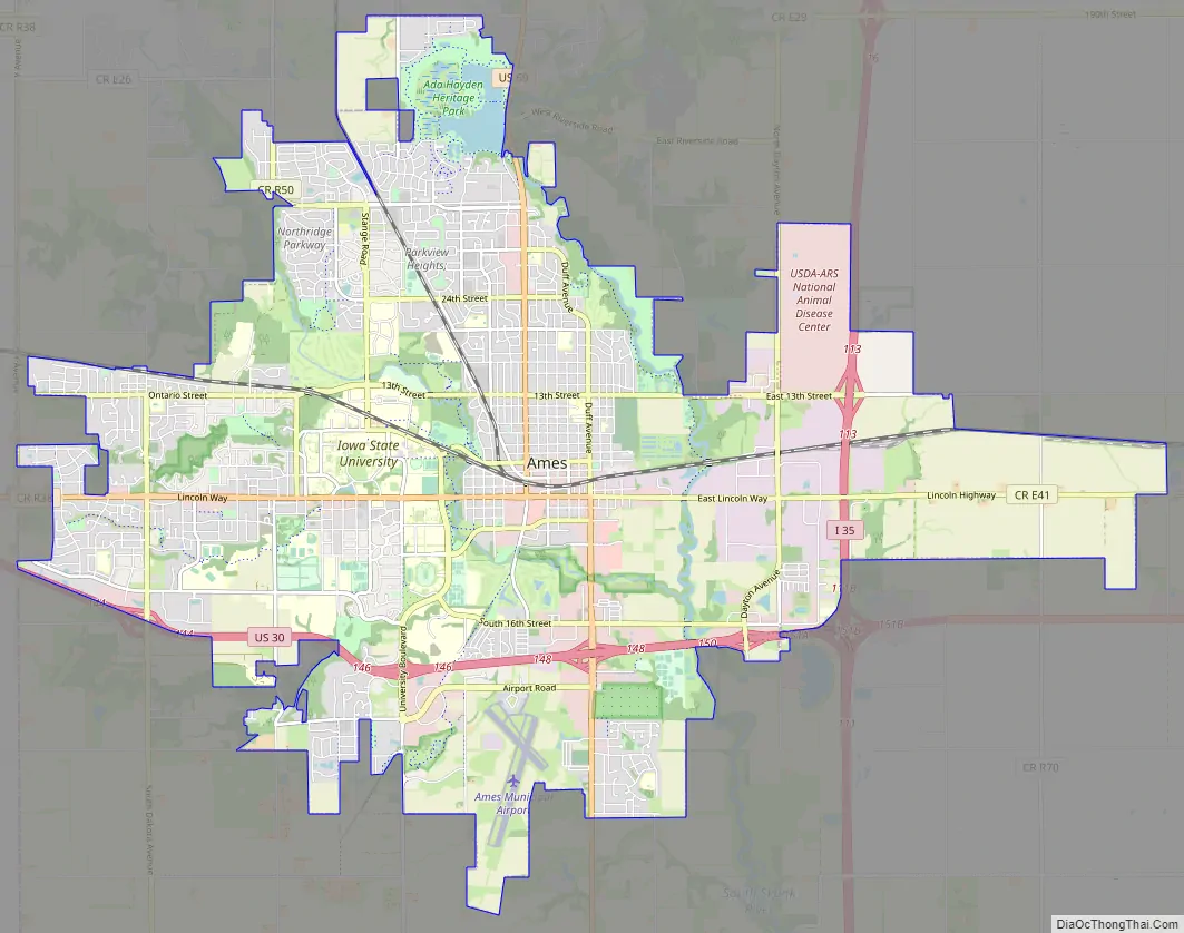
Ames Road Map
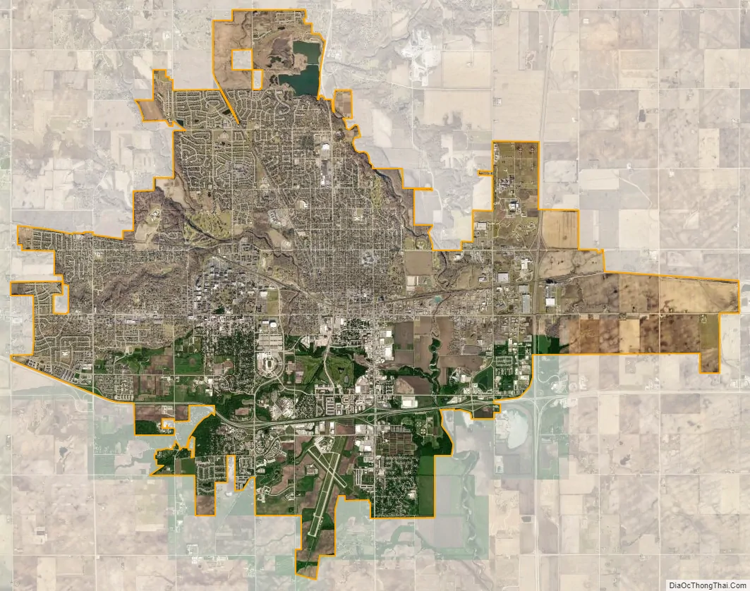
Ames city Satellite Map
Geography
Ames is located along the western edge of Story County, roughly 30 miles (48 km) north of the state capital, Des Moines, near the intersection of Interstate 35 and U.S. Route 30. A smaller highway, U.S. Route 69, passes through the town. Also passing through Ames is the cross country line of the Union Pacific Railroad and two small streams (the South Skunk River and Ioway Creek).
According to the United States Census Bureau, the city has a total area of 24.27 square miles (62.86 km), of which 24.21 square miles (62.70 km) is land and 0.06 square miles (0.16 km) is water.
Campustown
Campustown is the neighborhood directly south of Iowa State University Central Campus bordered by Lincoln Way on the north. Campustown is a high-density mixed-use neighborhood that is home to many student apartments, nightlife venues, restaurants, and numerous other establishments, most of which are unique to Ames.
Climate
Ames has a humid continental climate (Köppen climate classification Dfa). On average, the warmest month is July and the coldest is January. The highest recorded temperature was 102 °F (39 °C) in 1988 and the lowest was −28 °F (−33 °C) in 1996.
See also
Map of Iowa State and its subdivision:- Adair
- Adams
- Allamakee
- Appanoose
- Audubon
- Benton
- Black Hawk
- Boone
- Bremer
- Buchanan
- Buena Vista
- Butler
- Calhoun
- Carroll
- Cass
- Cedar
- Cerro Gordo
- Cherokee
- Chickasaw
- Clarke
- Clay
- Clayton
- Clinton
- Crawford
- Dallas
- Davis
- Decatur
- Delaware
- Des Moines
- Dickinson
- Dubuque
- Emmet
- Fayette
- Floyd
- Franklin
- Fremont
- Greene
- Grundy
- Guthrie
- Hamilton
- Hancock
- Hardin
- Harrison
- Henry
- Howard
- Humboldt
- Ida
- Iowa
- Jackson
- Jasper
- Jefferson
- Johnson
- Jones
- Keokuk
- Kossuth
- Lee
- Linn
- Louisa
- Lucas
- Lyon
- Madison
- Mahaska
- Marion
- Marshall
- Mills
- Mitchell
- Monona
- Monroe
- Montgomery
- Muscatine
- O'Brien
- Osceola
- Page
- Palo Alto
- Plymouth
- Pocahontas
- Polk
- Pottawattamie
- Poweshiek
- Ringgold
- Sac
- Scott
- Shelby
- Sioux
- Story
- Tama
- Taylor
- Union
- Van Buren
- Wapello
- Warren
- Washington
- Wayne
- Webster
- Winnebago
- Winneshiek
- Woodbury
- Worth
- Wright
- Alabama
- Alaska
- Arizona
- Arkansas
- California
- Colorado
- Connecticut
- Delaware
- District of Columbia
- Florida
- Georgia
- Hawaii
- Idaho
- Illinois
- Indiana
- Iowa
- Kansas
- Kentucky
- Louisiana
- Maine
- Maryland
- Massachusetts
- Michigan
- Minnesota
- Mississippi
- Missouri
- Montana
- Nebraska
- Nevada
- New Hampshire
- New Jersey
- New Mexico
- New York
- North Carolina
- North Dakota
- Ohio
- Oklahoma
- Oregon
- Pennsylvania
- Rhode Island
- South Carolina
- South Dakota
- Tennessee
- Texas
- Utah
- Vermont
- Virginia
- Washington
- West Virginia
- Wisconsin
- Wyoming