Aplington is a city in Butler County, Iowa, United States. The population was 1,116 at the 2020 census.
| Name: | Aplington city |
|---|---|
| LSAD Code: | 25 |
| LSAD Description: | city (suffix) |
| State: | Iowa |
| County: | Butler County |
| Elevation: | 974 ft (297 m) |
| Total Area: | 0.73 sq mi (1.90 km²) |
| Land Area: | 0.73 sq mi (1.90 km²) |
| Water Area: | 0.00 sq mi (0.00 km²) |
| Total Population: | 1,116 |
| Population Density: | 1,518.37/sq mi (586.53/km²) |
| ZIP code: | 50604 |
| Area code: | 319 |
| FIPS code: | 1902395 |
| GNISfeature ID: | 0454209 |
Online Interactive Map
Click on ![]() to view map in "full screen" mode.
to view map in "full screen" mode.
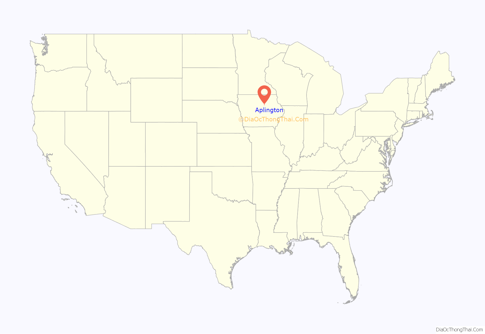
Aplington location map. Where is Aplington city?
History
In the summer of 1857, the village of Aplington was laid out and platted by the proprietors, Thomas Nash, R. R. Parriott, Zenas Aplington and Theodore A. Wilson on Sec. 29 [of Monroe Township]. At the time one house stood on the tract of land, which had been erected and occupied by Charles Savage, a New Englander, a settler of short duration. The town was incorporated in the ’80s [1880s] and has grown to be a lively and thriving trading point of 500 people. No better soil or finer farms lie out of doors than those contributing to the wealth of this community and with the Iowa division of the Illinois Central Railroad good transportation facilities appreciably add to the desirability of Aplington as a place for business activity and easy communication with the outside world. The town was named by its promoters in honor of one of their number, Zenas Aplington, a resident of Illinois, who never lived here. He owned part of the land, however, and took a lively interest in the town’s welfare until his death, which occurred while serving his country in the War of the Rebellion.
The first building erected in Aplington was built by Zenas Aplington in 1856. He also furnish a stock of general merchandise. The building stood on the south side of Parriott Street, and the first Aplington merchant, George W. Hunter, sold goods over the counters here about one year for Mr. Aplington. He was succeeded by Chester Stilson, who ran the store eighteen months; then it closed its doors. However, in 1864, Isaac Hall opened a general store in this building. He sold his stock to C. S. Price, who a year later closed out at auction.
The father of Charles Savage was an early settler in this part of the county and set up a blacksmith forge in a roofless sod house. This was the first smithy in the southern part of Butler County. William Bisbee came here in 1857 and opened a blacksmith shop for Zenas Aplington and managed it one year that enterprising non-resident. He then engaged in the trade for himself and continued therein for many years.
Mrs. Rachel Quinn built and presided over the first hotel in 1858. E. Y. Royer bought the property in 1866 and sold it to Edward Bourns in 1867, who continued the hotel a few years. The building was then purchased by Henry Kers and used as a residence. The present hotel is an old frame structure showing the wear and tear of the elements. Yet the traveler is well taken care of and give a good, generous meal by the proprietor.
The first grain elevator in Aplington was built by Alonzo McKey, at the time of the coming of the Illinois Central Railroad in 1865. Among the several managers was C. M. Mead. The next was built by the firm of Wright Brothers and run by the firm until 1877. Several persons have been in charge of the business since then. The third elevator was built by S. L. Kemmerer in 1872. He sold the property to A. M. Whaley in 1876. In 1879, a fourth elevator was built. The firm of Chrystie & Prince, proprietors, disposed of their interests to Mr. Willis.
Aplington was early noted for its mills and creamery. Edward Hiller would have built a mill in the ’60s [1860s], but being unable to secure on reasonable terms, the right of way for a tail race, he gave up the project. However, John Matthews & Son, of Jackson county formed a stock company, with a capital of $14,000, in 1872. A mill was built, but before its completion certain of the stockholders refused to meet their obligations on stock issued them, which retarded the industry for a while. The Matthews finally turned over their interest to William Dobbins and the latter disposed of a controlling amount of the stock to A. L. Morris & Son, who had the mill running in September 1877. After this the mill had several owners.
Spring Hill Creamery began operations in the spring of 1881, on section 20. The proprietors at that time, Markley & Dodswell gave employment to a number of men and consumed vast quantities of milk which were delivered from the surrounding farms. One of the largest and most lucrative industries of this section of the county is dairying.
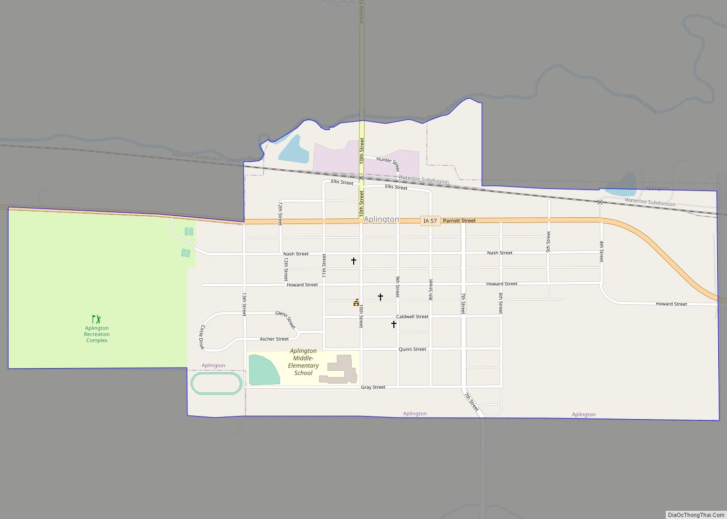
Aplington Road Map
Aplington city Satellite Map
Geography
Aplington’s longitude and latitude coordinates
in decimal form are 42.582543, -92.882530.
According to the United States Census Bureau, the city has a total area of 0.83 square miles (2.15 km), all land.
See also
Map of Iowa State and its subdivision:- Adair
- Adams
- Allamakee
- Appanoose
- Audubon
- Benton
- Black Hawk
- Boone
- Bremer
- Buchanan
- Buena Vista
- Butler
- Calhoun
- Carroll
- Cass
- Cedar
- Cerro Gordo
- Cherokee
- Chickasaw
- Clarke
- Clay
- Clayton
- Clinton
- Crawford
- Dallas
- Davis
- Decatur
- Delaware
- Des Moines
- Dickinson
- Dubuque
- Emmet
- Fayette
- Floyd
- Franklin
- Fremont
- Greene
- Grundy
- Guthrie
- Hamilton
- Hancock
- Hardin
- Harrison
- Henry
- Howard
- Humboldt
- Ida
- Iowa
- Jackson
- Jasper
- Jefferson
- Johnson
- Jones
- Keokuk
- Kossuth
- Lee
- Linn
- Louisa
- Lucas
- Lyon
- Madison
- Mahaska
- Marion
- Marshall
- Mills
- Mitchell
- Monona
- Monroe
- Montgomery
- Muscatine
- O'Brien
- Osceola
- Page
- Palo Alto
- Plymouth
- Pocahontas
- Polk
- Pottawattamie
- Poweshiek
- Ringgold
- Sac
- Scott
- Shelby
- Sioux
- Story
- Tama
- Taylor
- Union
- Van Buren
- Wapello
- Warren
- Washington
- Wayne
- Webster
- Winnebago
- Winneshiek
- Woodbury
- Worth
- Wright
- Alabama
- Alaska
- Arizona
- Arkansas
- California
- Colorado
- Connecticut
- Delaware
- District of Columbia
- Florida
- Georgia
- Hawaii
- Idaho
- Illinois
- Indiana
- Iowa
- Kansas
- Kentucky
- Louisiana
- Maine
- Maryland
- Massachusetts
- Michigan
- Minnesota
- Mississippi
- Missouri
- Montana
- Nebraska
- Nevada
- New Hampshire
- New Jersey
- New Mexico
- New York
- North Carolina
- North Dakota
- Ohio
- Oklahoma
- Oregon
- Pennsylvania
- Rhode Island
- South Carolina
- South Dakota
- Tennessee
- Texas
- Utah
- Vermont
- Virginia
- Washington
- West Virginia
- Wisconsin
- Wyoming
