Greene is a city in Butler County, Iowa, United States, along the Shell Rock River, and along Butler County’s northern border, where Butler and Floyd counties meet. The population was 990 at the time of the 2020 census.
| Name: | Greene city |
|---|---|
| LSAD Code: | 25 |
| LSAD Description: | city (suffix) |
| State: | Iowa |
| County: | Butler County, Floyd County |
| Elevation: | 948 ft (289 m) |
| Total Area: | 1.21 sq mi (3.13 km²) |
| Land Area: | 1.14 sq mi (2.96 km²) |
| Water Area: | 0.07 sq mi (0.18 km²) |
| Total Population: | 990 |
| Population Density: | 867.66/sq mi (334.89/km²) |
| ZIP code: | 50636 |
| Area code: | 641 |
| FIPS code: | 1932745 |
| GNISfeature ID: | 0457119 |
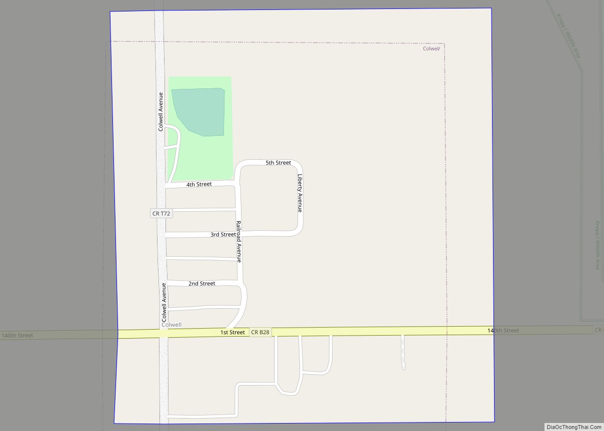
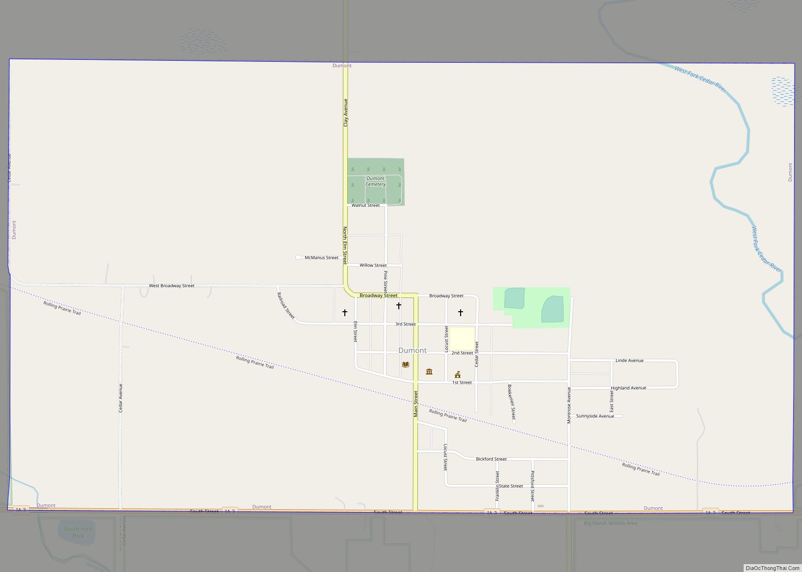
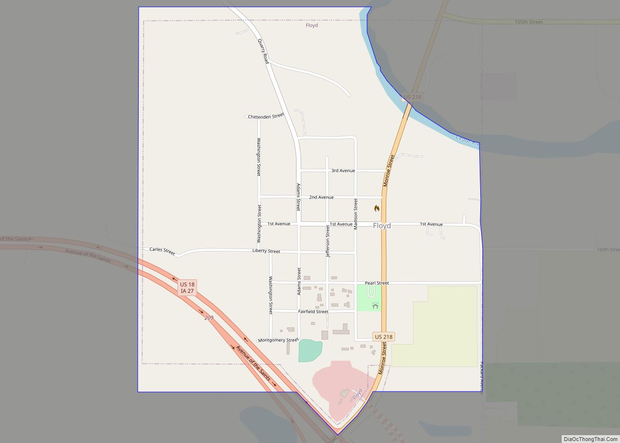
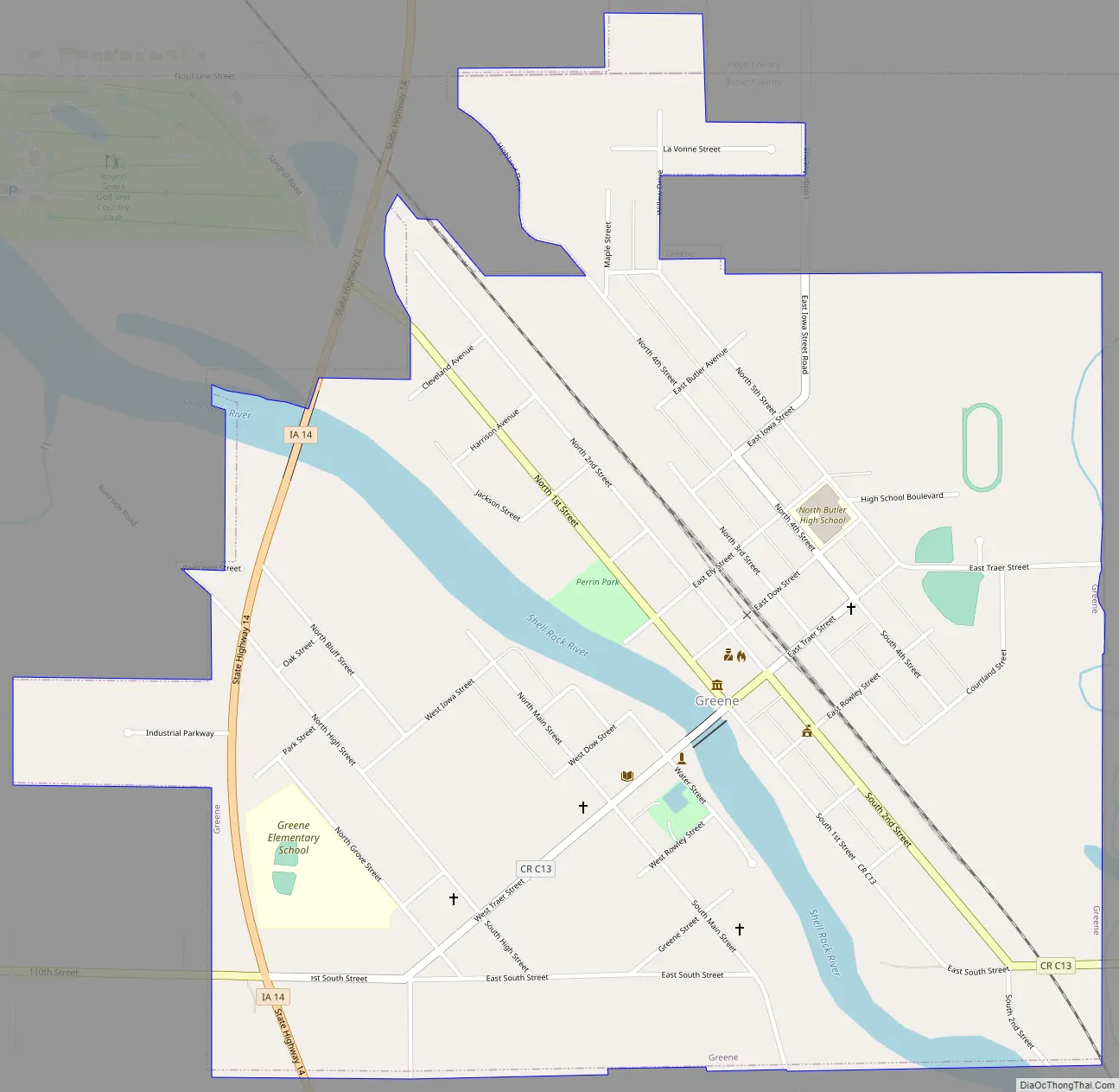
Online Interactive Map
Click on ![]() to view map in "full screen" mode.
to view map in "full screen" mode.
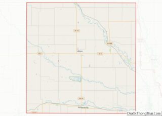
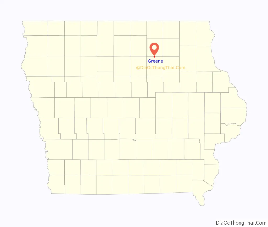
Greene location map. Where is Greene city?

History
The community of Greene was first a postal area called, “Elm Springs” that was established in 1855 three miles southwest of the current town on Coldwater Creek. In 1871, the railroad selected a site on the east side of the Shell Rock River for a train depot and roundhouse, drawing the Elm Springs Post Office and community to that site. In 1871, the postal area name was changed from Elm Springs to Greene in honor of Judge George Greene, president of the Burlington, Cedar Rapids and Minnesota railroad who, along with J. W. Traer and others, purchased the land for the new community. Judge Greene gave generously of land and money for the new town. In 1879, the Greene postal area was incorporated as The Town of Greene.
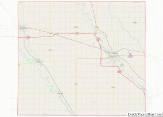
Greene Road Map
Greene city Satellite Map

Geography
The city is located along the northern edge of Butler County, with a small portion extending north into Floyd County. According to the United States Census Bureau, the city has a total area of 1.22 square miles (3.16 km), of which 1.14 square miles (2.95 km) is land and 0.08 square miles (0.21 km) is water.
The Shell Rock River bisects the town, with the state Highway 14 and County Road 13 bridges connecting the two sections.
See also
Map of Iowa State and its subdivision:- Adair
- Adams
- Allamakee
- Appanoose
- Audubon
- Benton
- Black Hawk
- Boone
- Bremer
- Buchanan
- Buena Vista
- Butler
- Calhoun
- Carroll
- Cass
- Cedar
- Cerro Gordo
- Cherokee
- Chickasaw
- Clarke
- Clay
- Clayton
- Clinton
- Crawford
- Dallas
- Davis
- Decatur
- Delaware
- Des Moines
- Dickinson
- Dubuque
- Emmet
- Fayette
- Floyd
- Franklin
- Fremont
- Greene
- Grundy
- Guthrie
- Hamilton
- Hancock
- Hardin
- Harrison
- Henry
- Howard
- Humboldt
- Ida
- Iowa
- Jackson
- Jasper
- Jefferson
- Johnson
- Jones
- Keokuk
- Kossuth
- Lee
- Linn
- Louisa
- Lucas
- Lyon
- Madison
- Mahaska
- Marion
- Marshall
- Mills
- Mitchell
- Monona
- Monroe
- Montgomery
- Muscatine
- O'Brien
- Osceola
- Page
- Palo Alto
- Plymouth
- Pocahontas
- Polk
- Pottawattamie
- Poweshiek
- Ringgold
- Sac
- Scott
- Shelby
- Sioux
- Story
- Tama
- Taylor
- Union
- Van Buren
- Wapello
- Warren
- Washington
- Wayne
- Webster
- Winnebago
- Winneshiek
- Woodbury
- Worth
- Wright
- Alabama
- Alaska
- Arizona
- Arkansas
- California
- Colorado
- Connecticut
- Delaware
- District of Columbia
- Florida
- Georgia
- Hawaii
- Idaho
- Illinois
- Indiana
- Iowa
- Kansas
- Kentucky
- Louisiana
- Maine
- Maryland
- Massachusetts
- Michigan
- Minnesota
- Mississippi
- Missouri
- Montana
- Nebraska
- Nevada
- New Hampshire
- New Jersey
- New Mexico
- New York
- North Carolina
- North Dakota
- Ohio
- Oklahoma
- Oregon
- Pennsylvania
- Rhode Island
- South Carolina
- South Dakota
- Tennessee
- Texas
- Utah
- Vermont
- Virginia
- Washington
- West Virginia
- Wisconsin
- Wyoming