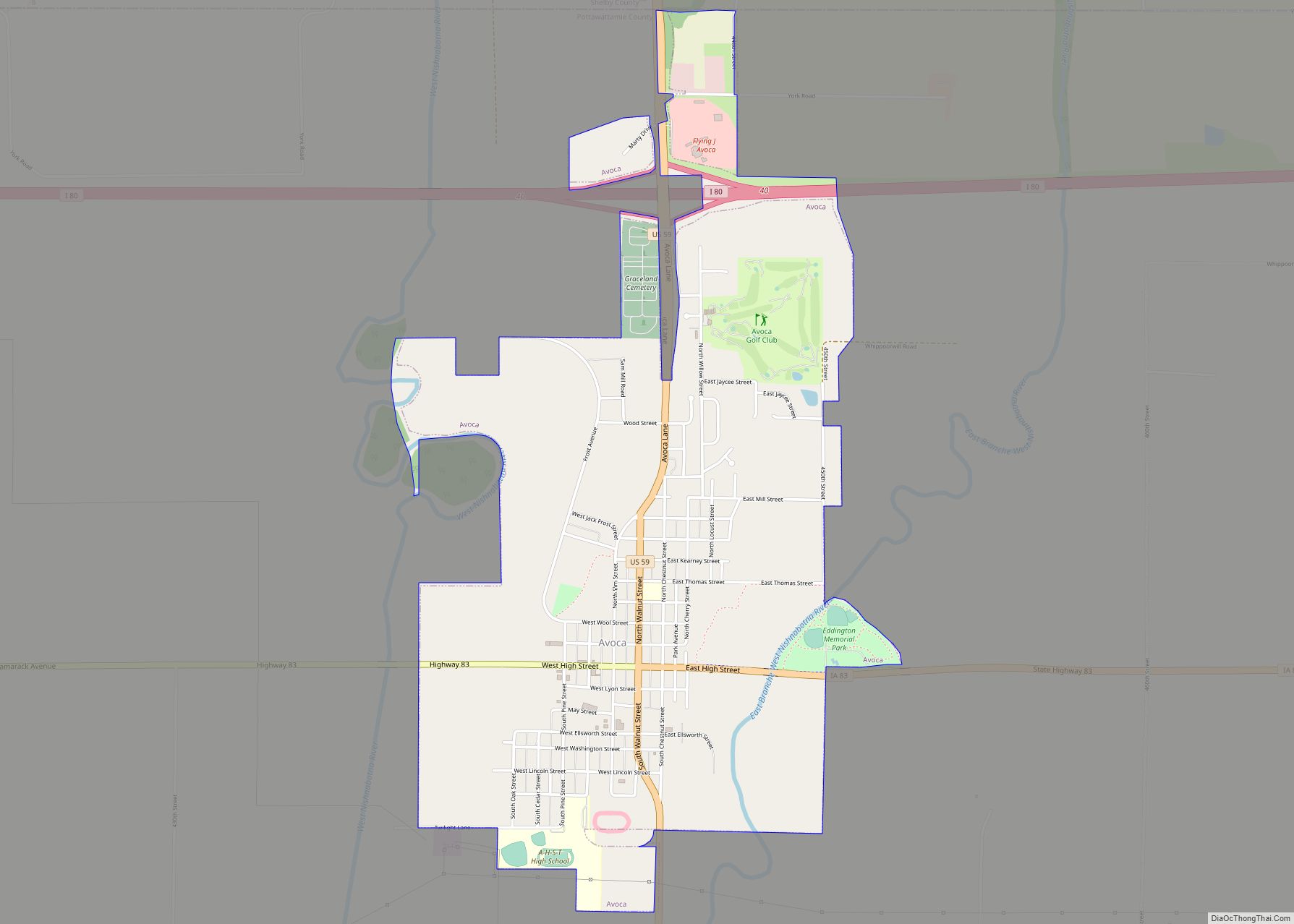
Avoca (Irish: Abhóca, meaning ‘the great river’) is a city in Pottawattamie County, Iowa, United States. The population was 1,672 at the 2020 census.
| Name: | Avoca city |
|---|---|
| LSAD Code: | 25 |
| LSAD Description: | city (suffix) |
| State: | Iowa |
| County: | Pottawattamie County |
| Elevation: | 1,194 ft (364 m) |
| Total Area: | 2.38 sq mi (6.17 km²) |
| Land Area: | 2.38 sq mi (6.17 km²) |
| Water Area: | 0.00 sq mi (0.00 km²) |
| Total Population: | 1,672 |
| Population Density: | 706.55/sq mi (272.75/km²) |
| ZIP code: | 51521 |
| Area code: | 712 |
| FIPS code: | 1903970 |
| GNISfeature ID: | 0454290 |
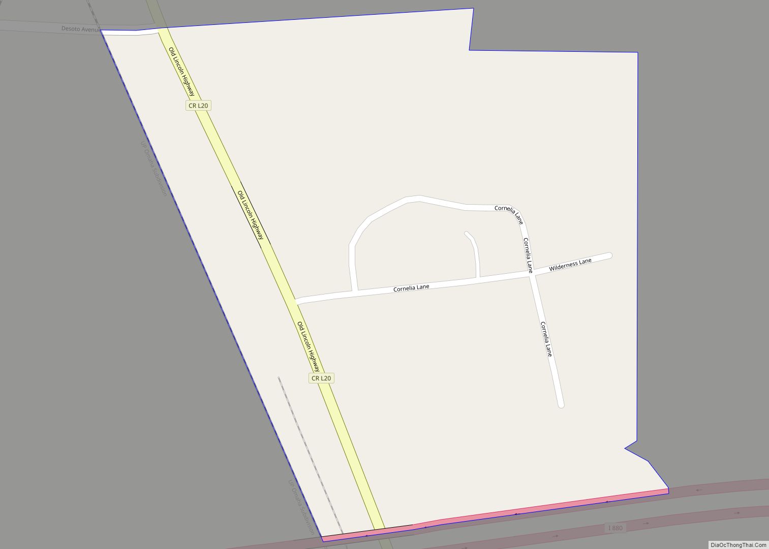
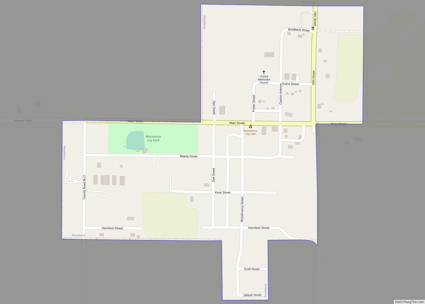
Online Interactive Map
Click on ![]() to view map in "full screen" mode.
to view map in "full screen" mode.
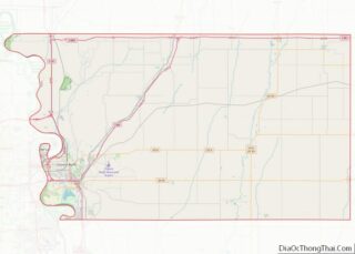
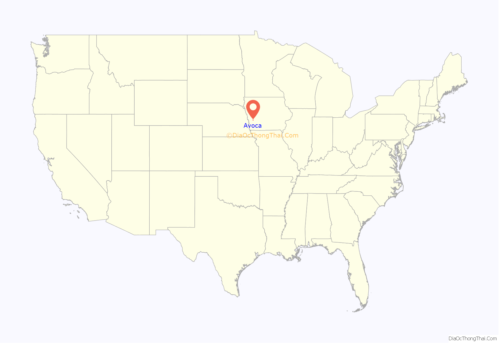
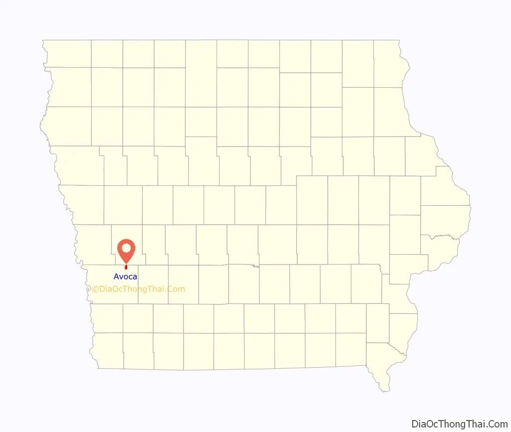
Avoca location map. Where is Avoca city?
History
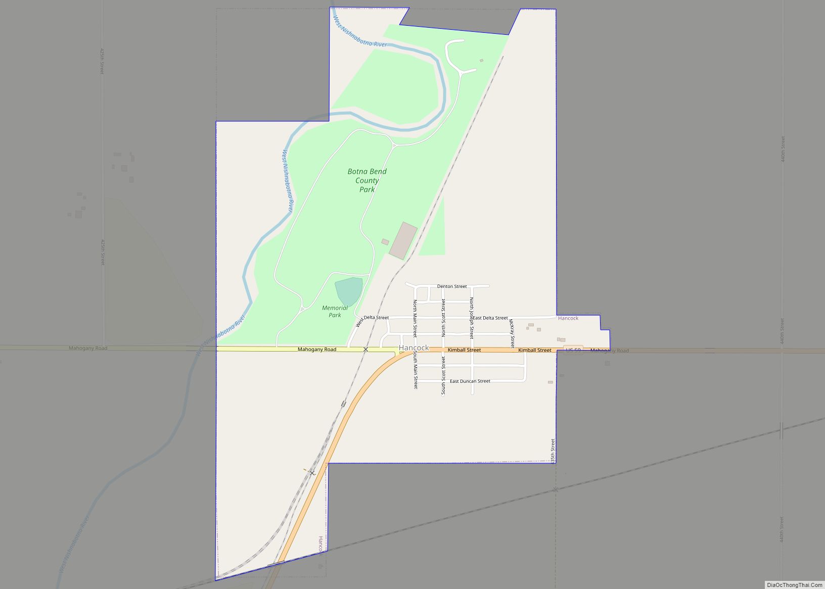
Avoca was founded in 1869 in connection with the construction of the Chicago, Rock Island and Pacific Railroad through the area. It is named after Avoca in Ireland. It quickly developed as a regional service center for the surrounding farms.
In 2005, Avoca opened a local pool.
The Pottawatomie County, Iowa county government maintains a second courthouse in Avoca to serve the northeastern portion of the county. Council Bluffs, which is the county seat is in the extreme southwestern part of this large county.
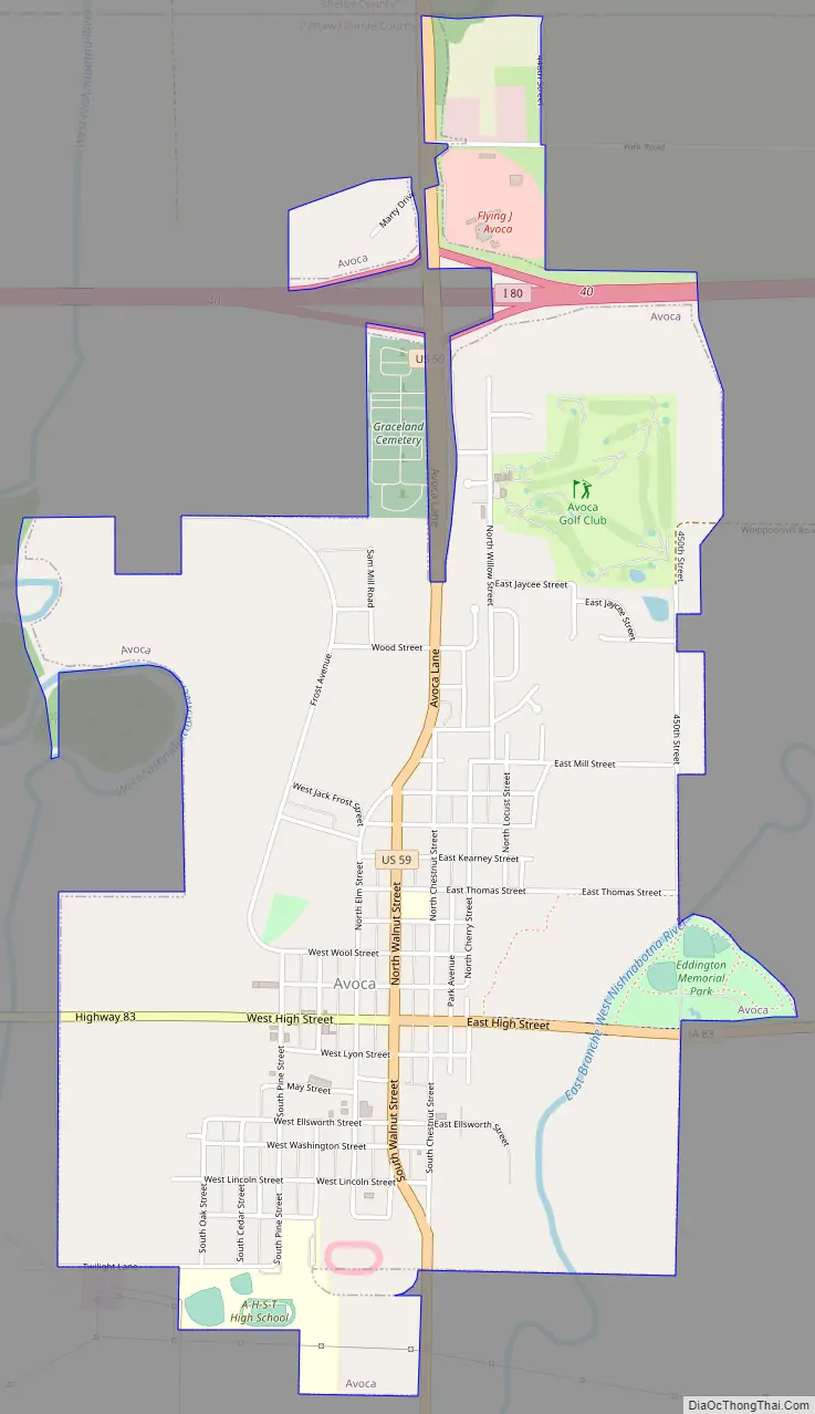
Avoca Road Map
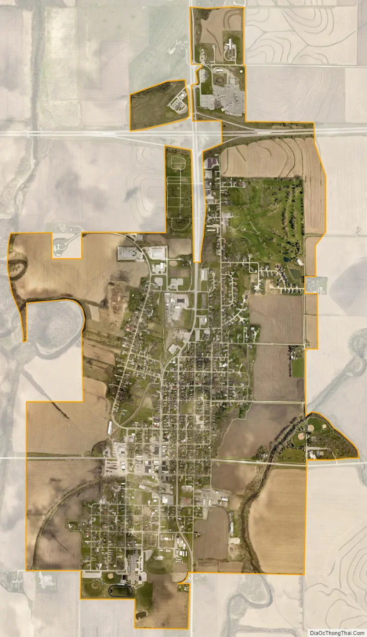
Avoca city Satellite Map
Geography
Avoca is located at 41°29′N 95°20′W / 41.483°N 95.333°W / 41.483; -95.333 (41.4790, -95.3373). The city is situated within Iowa’s Loess Hills and located between the West Nishnabotna River and its East Branch. According to the United States Census Bureau, the city has a total area of 2.13 square miles (5.52 km), all land.
See also
Map of Iowa State and its subdivision:- Adair
- Adams
- Allamakee
- Appanoose
- Audubon
- Benton
- Black Hawk
- Boone
- Bremer
- Buchanan
- Buena Vista
- Butler
- Calhoun
- Carroll
- Cass
- Cedar
- Cerro Gordo
- Cherokee
- Chickasaw
- Clarke
- Clay
- Clayton
- Clinton
- Crawford
- Dallas
- Davis
- Decatur
- Delaware
- Des Moines
- Dickinson
- Dubuque
- Emmet
- Fayette
- Floyd
- Franklin
- Fremont
- Greene
- Grundy
- Guthrie
- Hamilton
- Hancock
- Hardin
- Harrison
- Henry
- Howard
- Humboldt
- Ida
- Iowa
- Jackson
- Jasper
- Jefferson
- Johnson
- Jones
- Keokuk
- Kossuth
- Lee
- Linn
- Louisa
- Lucas
- Lyon
- Madison
- Mahaska
- Marion
- Marshall
- Mills
- Mitchell
- Monona
- Monroe
- Montgomery
- Muscatine
- O'Brien
- Osceola
- Page
- Palo Alto
- Plymouth
- Pocahontas
- Polk
- Pottawattamie
- Poweshiek
- Ringgold
- Sac
- Scott
- Shelby
- Sioux
- Story
- Tama
- Taylor
- Union
- Van Buren
- Wapello
- Warren
- Washington
- Wayne
- Webster
- Winnebago
- Winneshiek
- Woodbury
- Worth
- Wright
- Alabama
- Alaska
- Arizona
- Arkansas
- California
- Colorado
- Connecticut
- Delaware
- District of Columbia
- Florida
- Georgia
- Hawaii
- Idaho
- Illinois
- Indiana
- Iowa
- Kansas
- Kentucky
- Louisiana
- Maine
- Maryland
- Massachusetts
- Michigan
- Minnesota
- Mississippi
- Missouri
- Montana
- Nebraska
- Nevada
- New Hampshire
- New Jersey
- New Mexico
- New York
- North Carolina
- North Dakota
- Ohio
- Oklahoma
- Oregon
- Pennsylvania
- Rhode Island
- South Carolina
- South Dakota
- Tennessee
- Texas
- Utah
- Vermont
- Virginia
- Washington
- West Virginia
- Wisconsin
- Wyoming