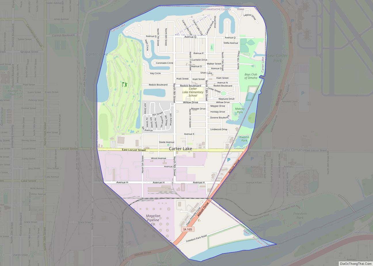
Carter Lake is a city in Pottawattamie County, Iowa, United States. A suburb of Omaha, Nebraska, it sits surrounding the south and west sides of the region’s major airport, Eppley Airfield. It is separated from the rest of Iowa by the Missouri River, effectively making it an exclave. The population was 3,791 at the 2020 census.
| Name: | Carter Lake city |
|---|---|
| LSAD Code: | 25 |
| LSAD Description: | city (suffix) |
| State: | Iowa |
| County: | Pottawattamie County |
| Elevation: | 981 ft (299 m) |
| Total Area: | 2.02 sq mi (5.23 km²) |
| Land Area: | 1.79 sq mi (4.65 km²) |
| Water Area: | 0.22 sq mi (0.58 km²) |
| Total Population: | 3,791 |
| Population Density: | 2,113.15/sq mi (815.71/km²) |
| ZIP code: | 51510 |
| Area code: | 712 |
| FIPS code: | 1911215 |
| GNISfeature ID: | 0455192 |
| Website: | www.cityofcarterlake.com |
Online Interactive Map
Click on ![]() to view map in "full screen" mode.
to view map in "full screen" mode.
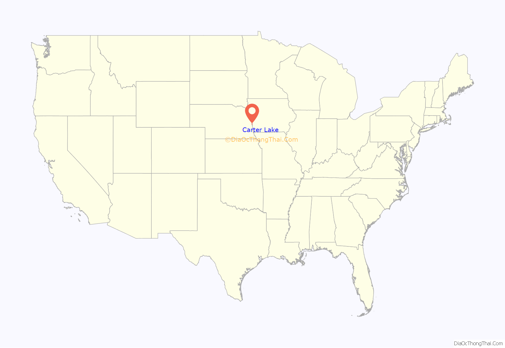
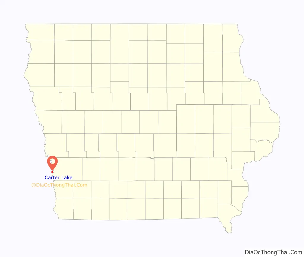
Carter Lake location map. Where is Carter Lake city?
History
Carter Lake is an example of the border irregularities of the United States, being the only city in Iowa located west of the Missouri River. In March 1877, a flood redirected the course of the river 1.25 mi (2 km) to the southeast. The remnants of the old river course, called Saratoga Bend, became an oxbow lake, named Carter Lake. Soon after the formation of the lake, the site became a flourishing recreational area. It included “a boathouse at the foot of Locust street, hotels and club houses were numerous and the lake was the scene of many a pleasant rowing and fishing party.”
In 1892, after extensive litigation between Iowa and Nebraska, the Supreme Court of the United States ruled that Carter Lake belonged to Iowa in Nebraska v. Iowa, 143 U.S. 359 (1892). Although the general rule is that state boundaries follow gradual changes in the course of a river, the Court ruled that an exception exists when a river avulses one of its bends. In 1972, the Supreme Court made another ruling on the circumstances of Carter Lake when it ruled on a boundary dispute between the two states in Nebraska v. Iowa, 406 U.S. 117 (1972).
Although Carter Lake was legally considered part of Council Bluffs, residents paid city taxes but lacked the basic city services enjoyed by residents east of the Missouri River. The community successfully seceded from Council Bluffs in the 1920s, intending to become part of Omaha, Nebraska, but Omaha did not want to pay to extend sewers or water lines.
Two early, separate amusement parks were located in Carter Lake: from 1905 to 1917, there was the Courtland Beach Amusement Park, and from 1917 to 1933, the Lakeview Amusement Park. The Munchoff Brothers, who were the original operators of Omaha’s Krug Park, ran both parks; in 1917, they moved rides from Courtland to Lakeview. In 1945, one of the brothers donated the rides from the old parks to the World War II metal drives.
On July 2, 1930, Carter Lake was incorporated as a city, in the state of Iowa.
In the 1930s and 40s, Carter Lake became a gambling hot spot, as law enforcement was limited and because of its important location. At The Chez Paree, you “could listen to Sophie Tucker, have the best prime rib in town and enjoy a gambling raid or two.” Patrons could “bet on any horse race in the United States,” and the business was described as “the most active casino between Chicago and the West Coast.”
The mistaken belief that a defendant corporation located in Carter Lake was a legal resident of Nebraska resulted in another U.S. Supreme Court case, Owen Equipment & Erection Co. v. Kroger, 437 U.S. 365 (1978). The case clarified the law regarding ancillary jurisdiction, which allows claims based on state law to be heard in a federal court when related to a claim based on federal law.
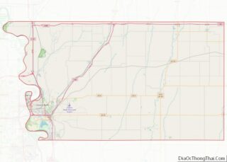
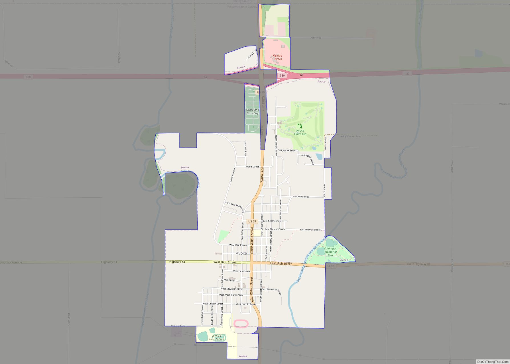
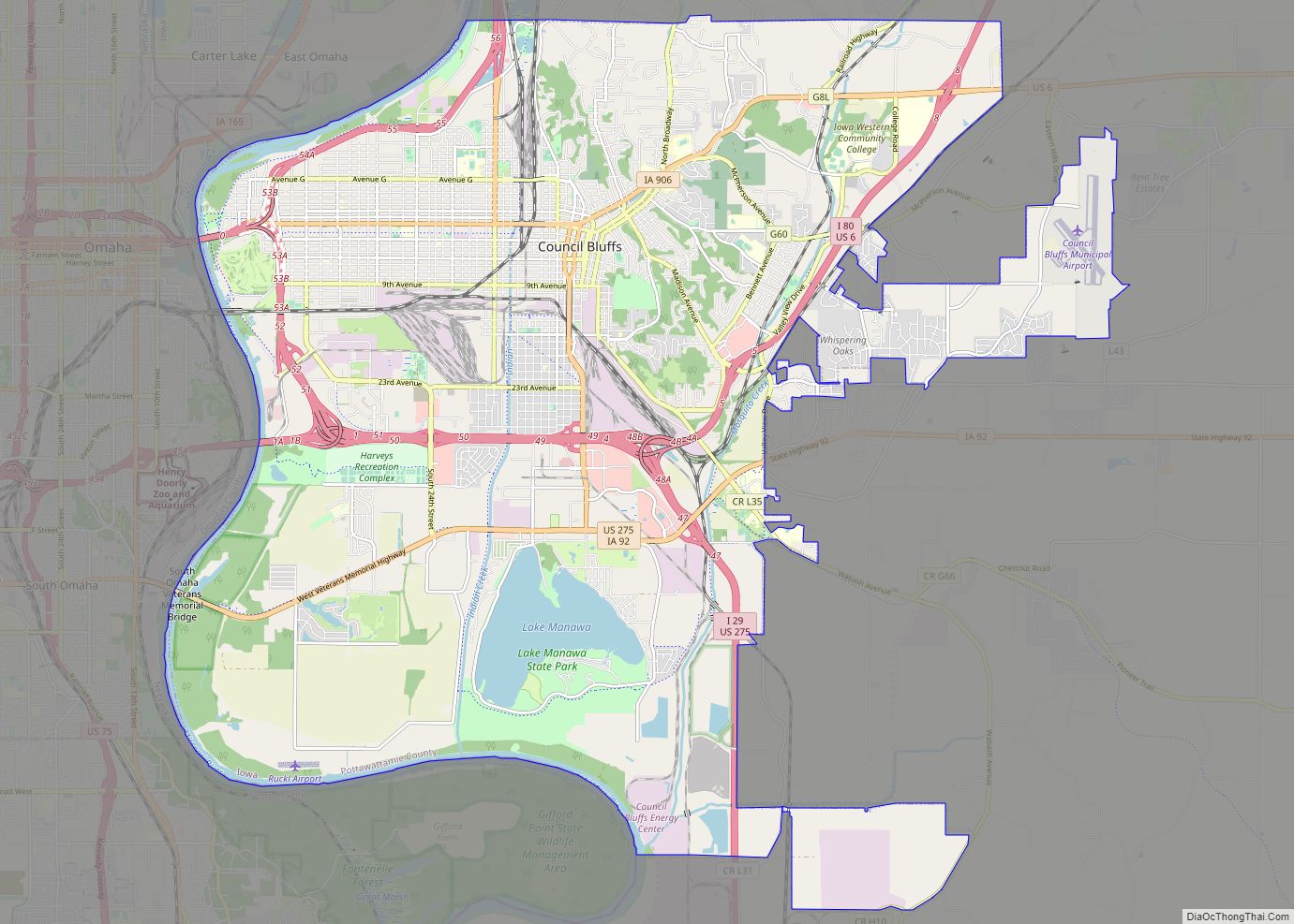
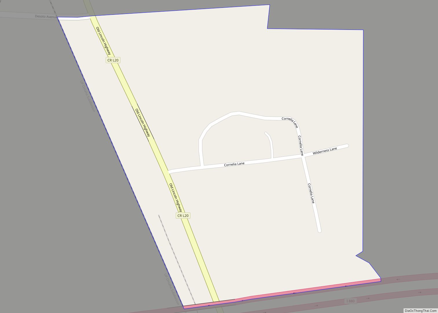
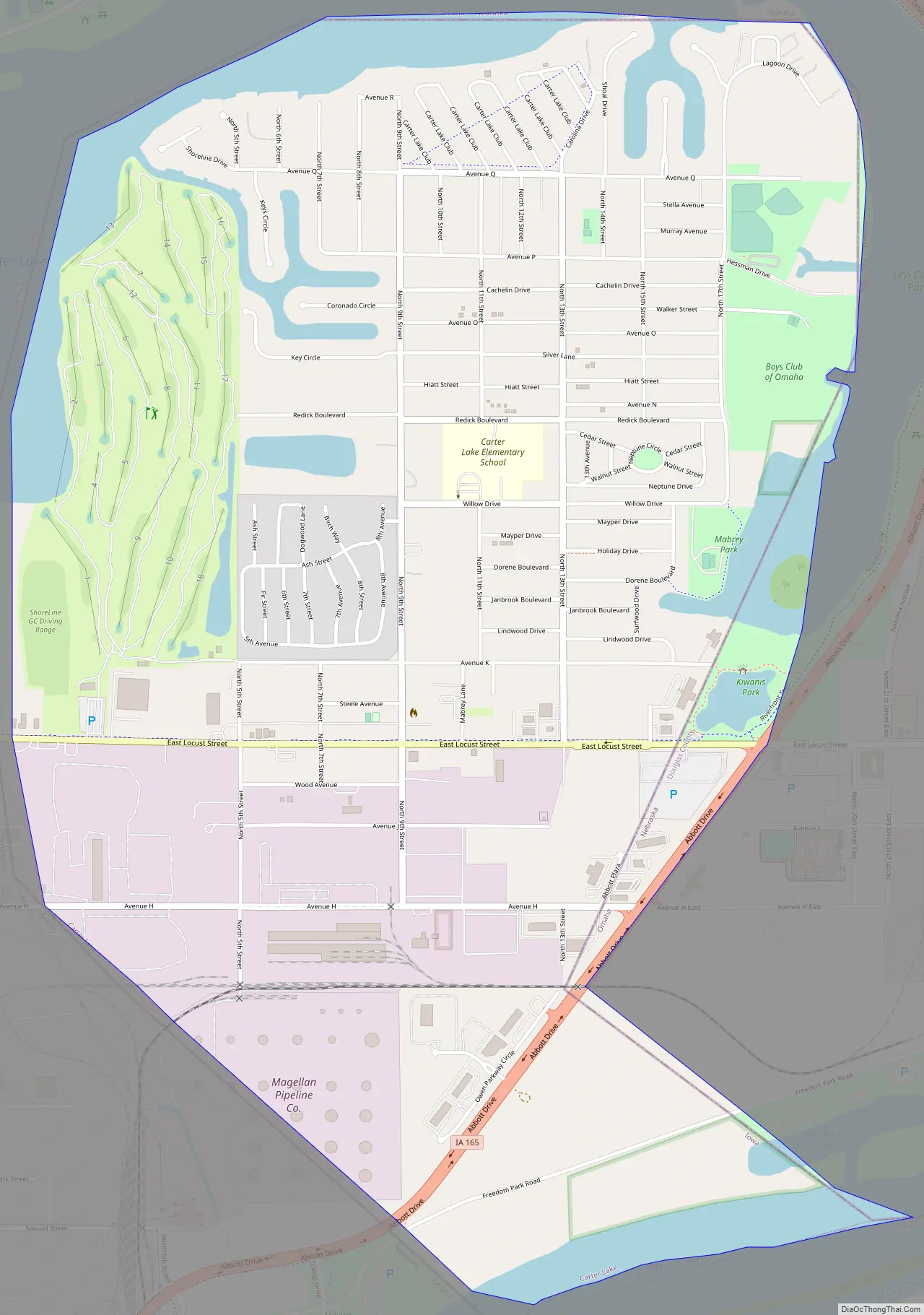
Carter Lake Road Map
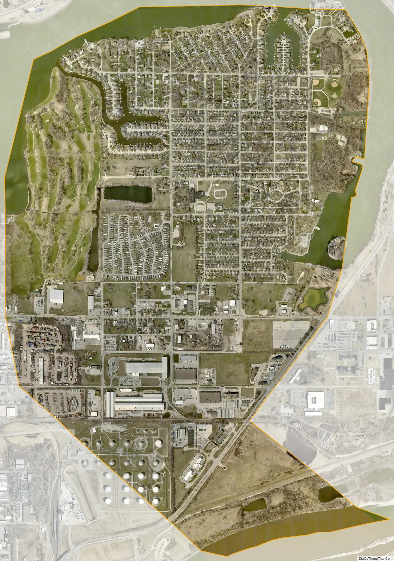
Carter Lake city Satellite Map
Geography
Carter Lake is located at 41°17′34″N 95°54′50″W / 41.29278°N 95.91389°W / 41.29278; -95.91389 (41.292647, -95.913989).
The city is surrounded on three sides by Omaha, Nebraska, and on the fourth by the Missouri River.
According to the United States Census Bureau, the city has a total area of 2.02 square miles (5.23 km), of which 1.87 square miles (4.84 km) is land and 0.15 square miles (0.39 km) is water.
Carter Lake creates a geographic oddity for travelers going to Eppley Airfield, which it surrounds on the south and west. Consequently, travelers going to Eppley Airfield from anywhere except North Omaha will go through Carter Lake, Iowa. It has caused great confusion when travelers not used to the area go through and see a “Welcome to Iowa” sign on their way to and from the airport.
See also
Map of Iowa State and its subdivision:- Adair
- Adams
- Allamakee
- Appanoose
- Audubon
- Benton
- Black Hawk
- Boone
- Bremer
- Buchanan
- Buena Vista
- Butler
- Calhoun
- Carroll
- Cass
- Cedar
- Cerro Gordo
- Cherokee
- Chickasaw
- Clarke
- Clay
- Clayton
- Clinton
- Crawford
- Dallas
- Davis
- Decatur
- Delaware
- Des Moines
- Dickinson
- Dubuque
- Emmet
- Fayette
- Floyd
- Franklin
- Fremont
- Greene
- Grundy
- Guthrie
- Hamilton
- Hancock
- Hardin
- Harrison
- Henry
- Howard
- Humboldt
- Ida
- Iowa
- Jackson
- Jasper
- Jefferson
- Johnson
- Jones
- Keokuk
- Kossuth
- Lee
- Linn
- Louisa
- Lucas
- Lyon
- Madison
- Mahaska
- Marion
- Marshall
- Mills
- Mitchell
- Monona
- Monroe
- Montgomery
- Muscatine
- O'Brien
- Osceola
- Page
- Palo Alto
- Plymouth
- Pocahontas
- Polk
- Pottawattamie
- Poweshiek
- Ringgold
- Sac
- Scott
- Shelby
- Sioux
- Story
- Tama
- Taylor
- Union
- Van Buren
- Wapello
- Warren
- Washington
- Wayne
- Webster
- Winnebago
- Winneshiek
- Woodbury
- Worth
- Wright
- Alabama
- Alaska
- Arizona
- Arkansas
- California
- Colorado
- Connecticut
- Delaware
- District of Columbia
- Florida
- Georgia
- Hawaii
- Idaho
- Illinois
- Indiana
- Iowa
- Kansas
- Kentucky
- Louisiana
- Maine
- Maryland
- Massachusetts
- Michigan
- Minnesota
- Mississippi
- Missouri
- Montana
- Nebraska
- Nevada
- New Hampshire
- New Jersey
- New Mexico
- New York
- North Carolina
- North Dakota
- Ohio
- Oklahoma
- Oregon
- Pennsylvania
- Rhode Island
- South Carolina
- South Dakota
- Tennessee
- Texas
- Utah
- Vermont
- Virginia
- Washington
- West Virginia
- Wisconsin
- Wyoming