Beaman is a city in Grundy County, Iowa, United States. The population was 161 at the 2020 census. It is part of the Waterloo−Cedar Falls Metropolitan Statistical Area.
| Name: | Beaman city |
|---|---|
| LSAD Code: | 25 |
| LSAD Description: | city (suffix) |
| State: | Iowa |
| County: | Grundy County |
| Elevation: | 994 ft (304 m) |
| Total Area: | 0.19 sq mi (0.50 km²) |
| Land Area: | 0.19 sq mi (0.48 km²) |
| Water Area: | 0.01 sq mi (0.02 km²) |
| Total Population: | 161 |
| Population Density: | 860.96/sq mi (333.11/km²) |
| ZIP code: | 50609 |
| Area code: | 641 |
| FIPS code: | 1905140 |
| GNISfeature ID: | 0454401 |
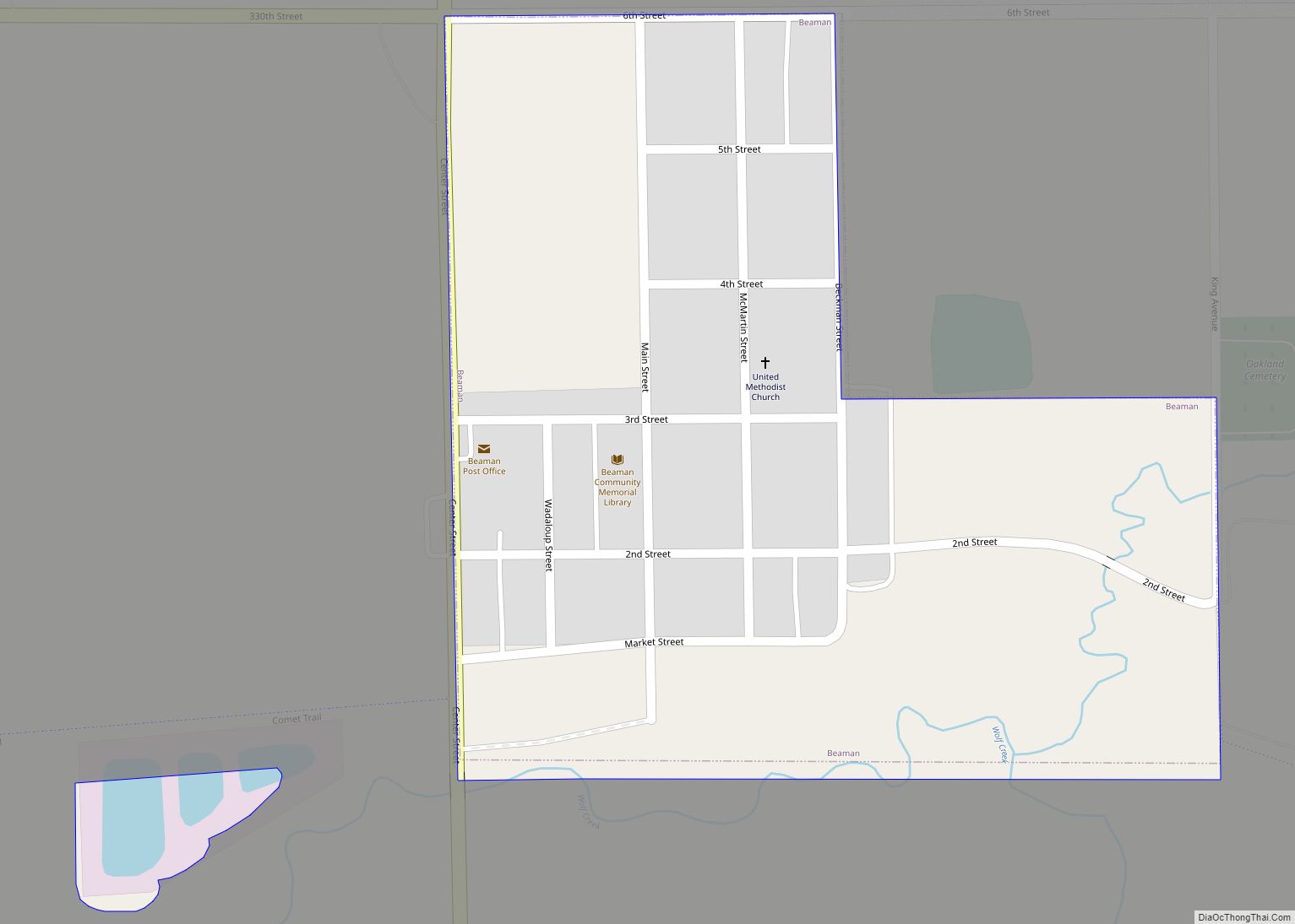
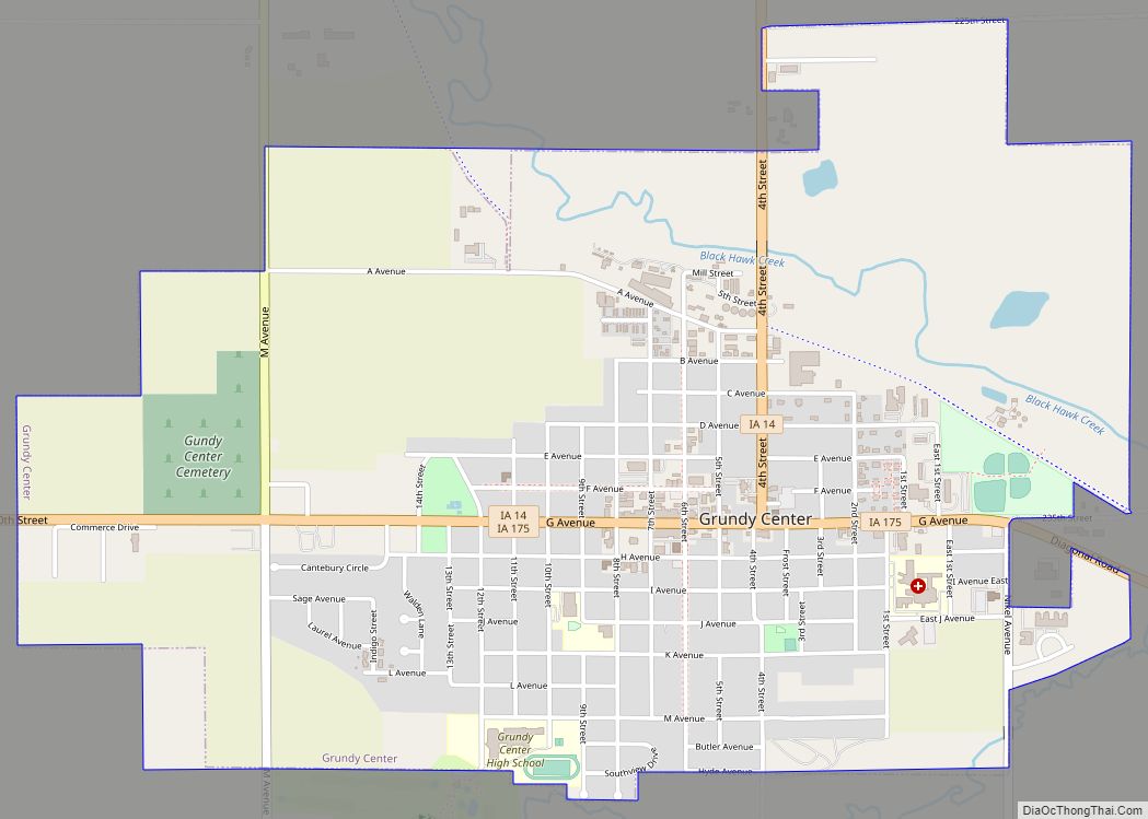
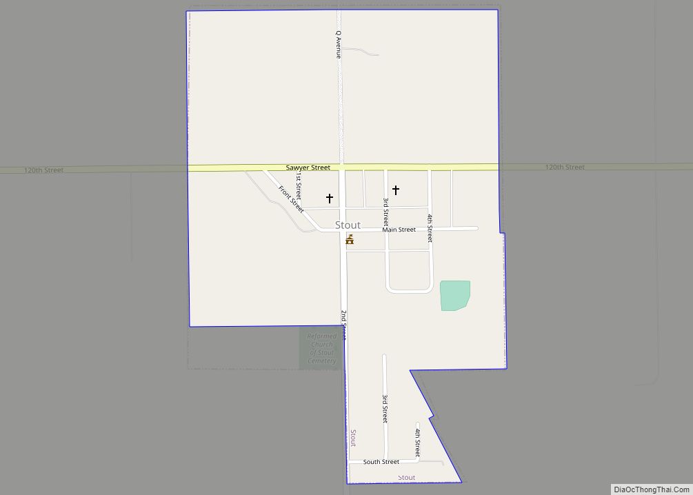
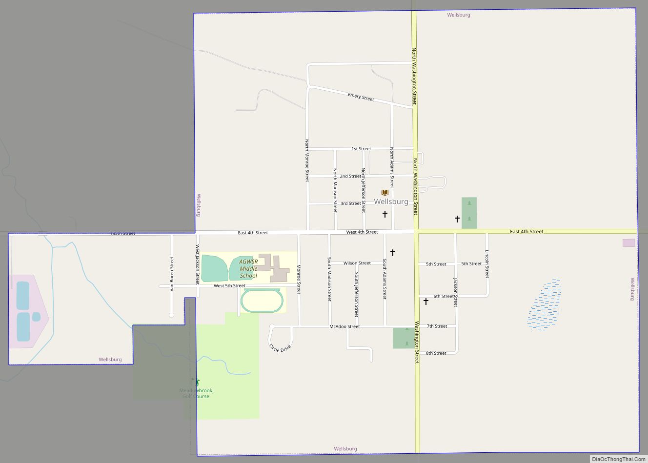
Online Interactive Map
Click on ![]() to view map in "full screen" mode.
to view map in "full screen" mode.
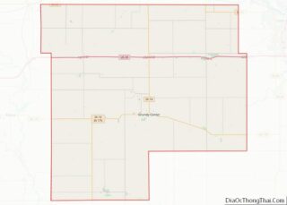
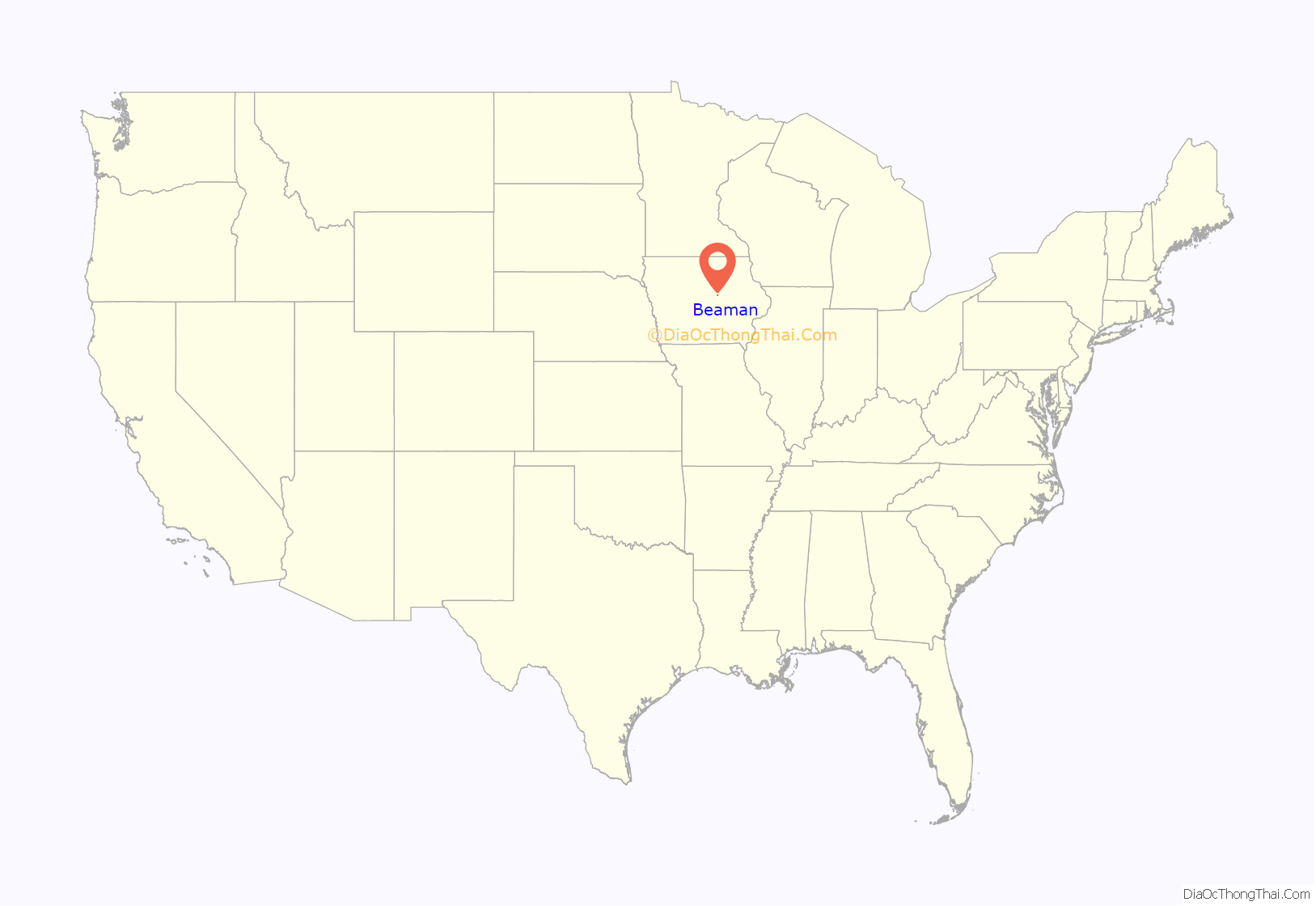
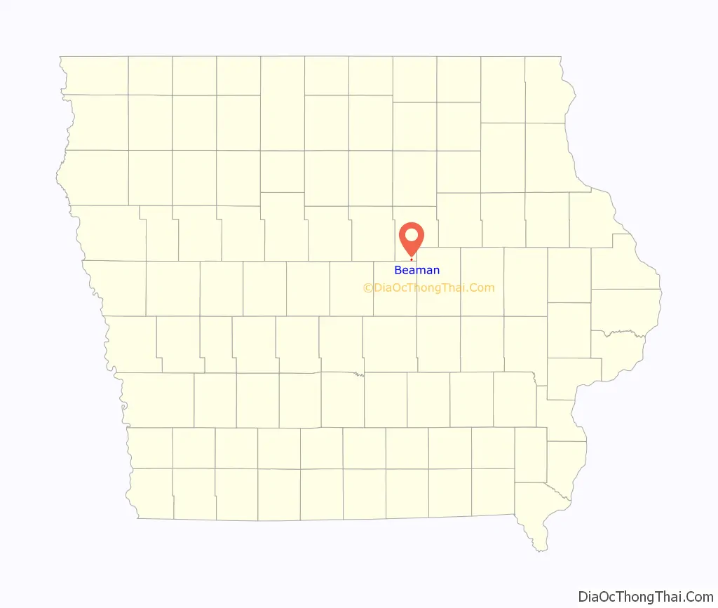
Beaman location map. Where is Beaman city?
History
Beaman was originally called Wadiloupe. The present name is for H. H. Beaman, the original owner of the town site.
A post office was established as Wadiloup in 1867, renamed Beaman in 1875, and remains in operation.
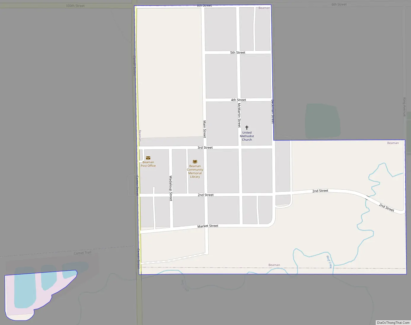
Beaman Road Map
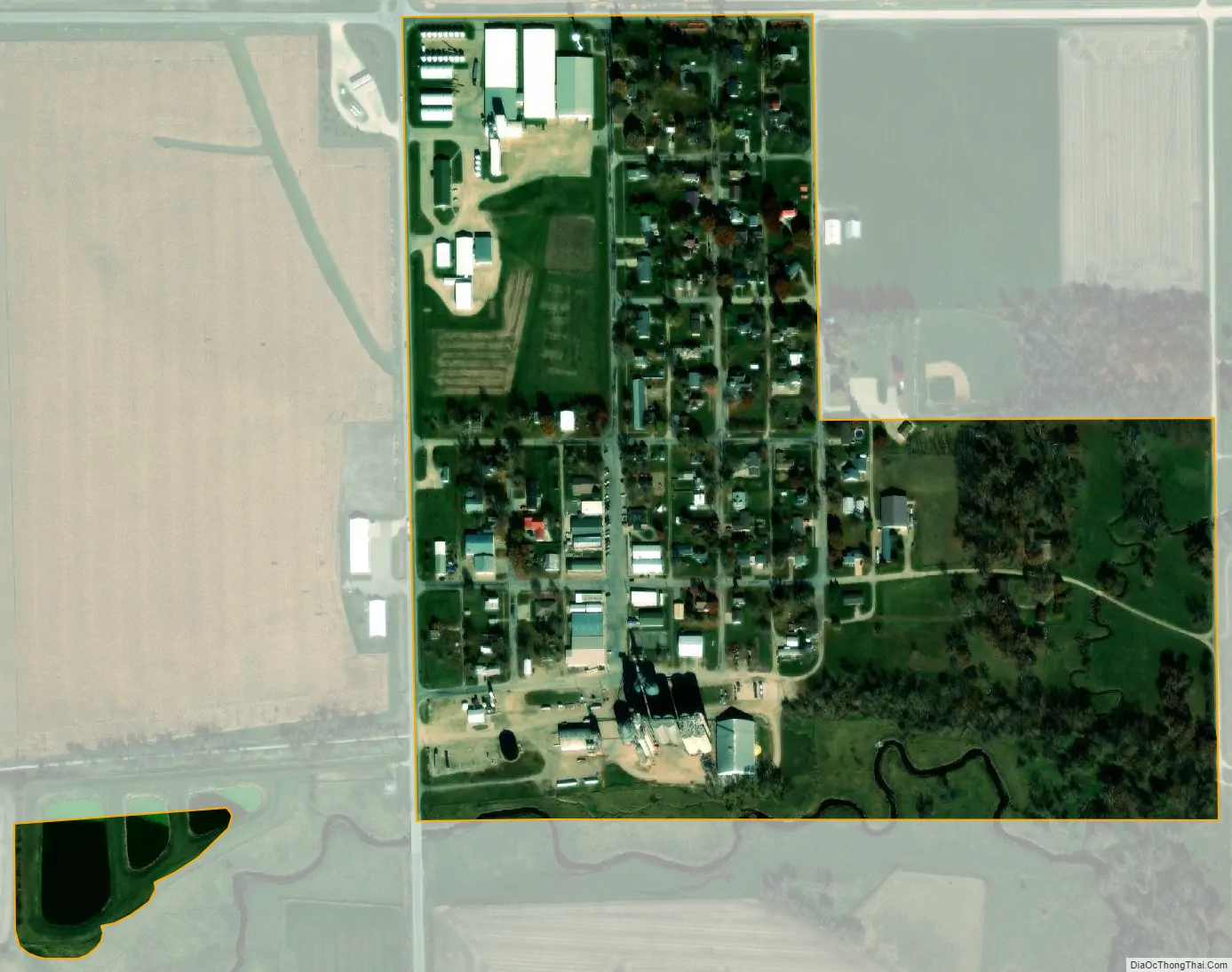
Beaman city Satellite Map
Geography
Beaman is located at 42°13′12″N 92°49′23″W / 42.22000°N 92.82306°W / 42.22000; -92.82306 (42.219997, −92.822985).
According to the United States Census Bureau, the city has a total area of 0.20 square miles (0.52 km), of which 0.19 square miles (0.49 km) is land and 0.01 square miles (0.03 km) is water.
Climate
Designated as having a humid continental climate, this region typically has a large seasonal temperature differences, with warm to hot (and often humid) summers and cold (sometimes severely cold) winters. Precipitation is relatively well distributed year-round in many areas with this climate. The Köppen Climate Classification subtype for this climate is “Dfa”. (Hot Summer Continental Climate).
See also
Map of Iowa State and its subdivision:- Adair
- Adams
- Allamakee
- Appanoose
- Audubon
- Benton
- Black Hawk
- Boone
- Bremer
- Buchanan
- Buena Vista
- Butler
- Calhoun
- Carroll
- Cass
- Cedar
- Cerro Gordo
- Cherokee
- Chickasaw
- Clarke
- Clay
- Clayton
- Clinton
- Crawford
- Dallas
- Davis
- Decatur
- Delaware
- Des Moines
- Dickinson
- Dubuque
- Emmet
- Fayette
- Floyd
- Franklin
- Fremont
- Greene
- Grundy
- Guthrie
- Hamilton
- Hancock
- Hardin
- Harrison
- Henry
- Howard
- Humboldt
- Ida
- Iowa
- Jackson
- Jasper
- Jefferson
- Johnson
- Jones
- Keokuk
- Kossuth
- Lee
- Linn
- Louisa
- Lucas
- Lyon
- Madison
- Mahaska
- Marion
- Marshall
- Mills
- Mitchell
- Monona
- Monroe
- Montgomery
- Muscatine
- O'Brien
- Osceola
- Page
- Palo Alto
- Plymouth
- Pocahontas
- Polk
- Pottawattamie
- Poweshiek
- Ringgold
- Sac
- Scott
- Shelby
- Sioux
- Story
- Tama
- Taylor
- Union
- Van Buren
- Wapello
- Warren
- Washington
- Wayne
- Webster
- Winnebago
- Winneshiek
- Woodbury
- Worth
- Wright
- Alabama
- Alaska
- Arizona
- Arkansas
- California
- Colorado
- Connecticut
- Delaware
- District of Columbia
- Florida
- Georgia
- Hawaii
- Idaho
- Illinois
- Indiana
- Iowa
- Kansas
- Kentucky
- Louisiana
- Maine
- Maryland
- Massachusetts
- Michigan
- Minnesota
- Mississippi
- Missouri
- Montana
- Nebraska
- Nevada
- New Hampshire
- New Jersey
- New Mexico
- New York
- North Carolina
- North Dakota
- Ohio
- Oklahoma
- Oregon
- Pennsylvania
- Rhode Island
- South Carolina
- South Dakota
- Tennessee
- Texas
- Utah
- Vermont
- Virginia
- Washington
- West Virginia
- Wisconsin
- Wyoming