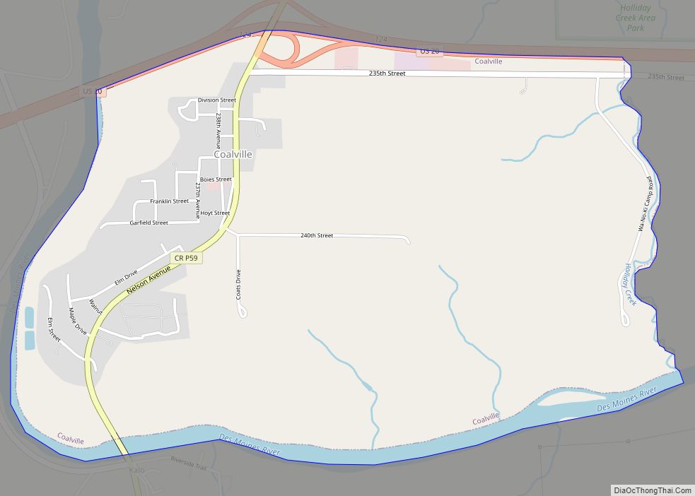
Coalville is a census-designated place (CDP) in Webster County, Iowa, United States. The population was 610 at the 2010 census. The community is located on U.S. Route 20 near Fort Dodge’s large gypsum mines.
| Name: | Coalville CDP |
|---|---|
| LSAD Code: | 57 |
| LSAD Description: | CDP (suffix) |
| State: | Iowa |
| County: | Webster County |
| Elevation: | 1,115 ft (340 m) |
| Total Area: | 2.26 sq mi (5.85 km²) |
| Land Area: | 2.18 sq mi (5.65 km²) |
| Water Area: | 0.07 sq mi (0.19 km²) |
| Total Population: | 651 |
| Population Density: | 298.21/sq mi (115.15/km²) |
| ZIP code: | 50501 |
| Area code: | 515 |
| FIPS code: | 1914835 |
| GNISfeature ID: | 0455503 |
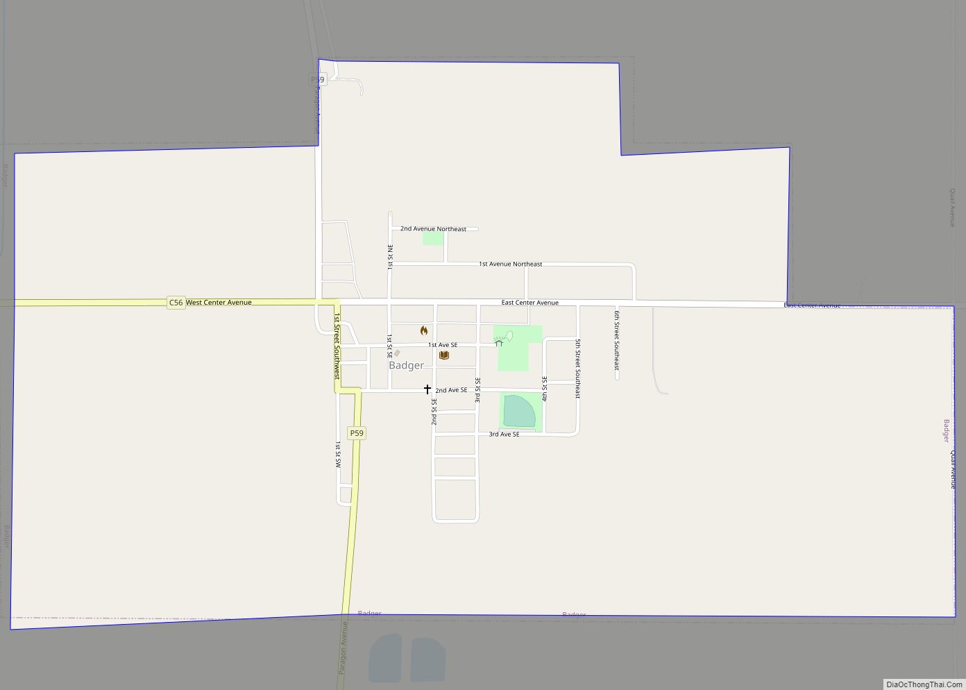
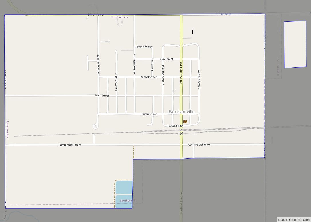
Online Interactive Map
Click on ![]() to view map in "full screen" mode.
to view map in "full screen" mode.
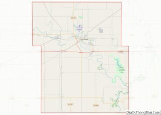
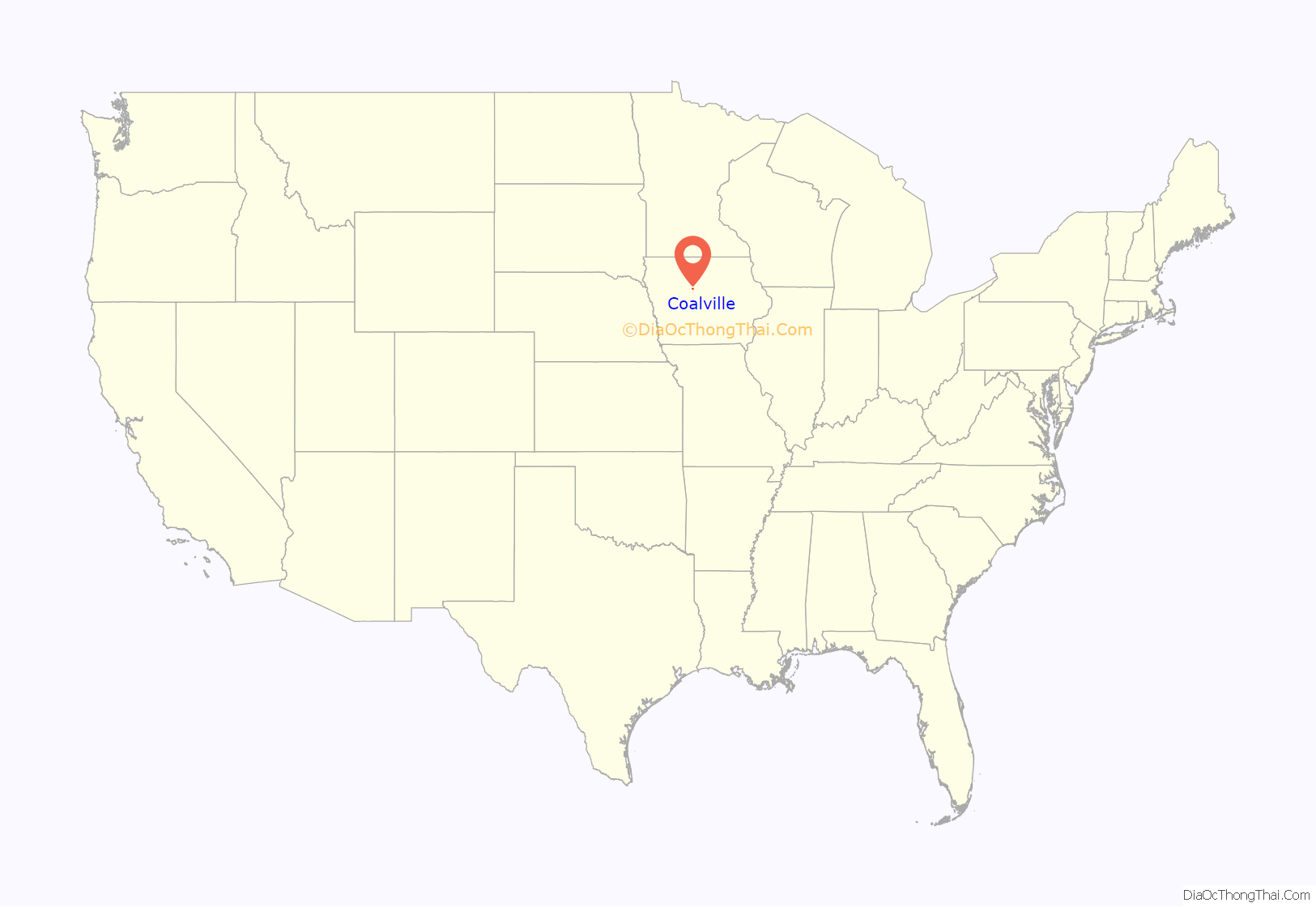
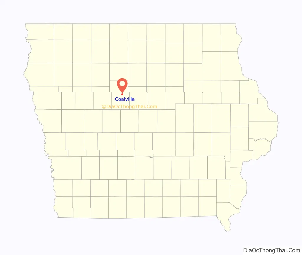
Coalville location map. Where is Coalville CDP?
History
Coalville takes its name from the coal mines of the area. It began as one of the northernmost coal mining towns in Iowa. Early settlers were mining coal from outcrops along the Des Moines River by 1860, and in 1870, a mine was opened on Holiday Creek, approximately one mile east of Coalville, with a three-mile tramway to the Dubuque and Sioux City Railroad (later the Illinois Central). Later in 1870, a shaft was sunk at Coalville. The Fort Dodge Coal company took over these mines and opened several more in the Coalville area. By 1880, manual labor was being augmented with machinery in these mines. In 1883, the Fort Dodge Coal company employed 350 miners to produce 30 carloads of coal daily.
The Pleasant Valley Coal Company sank a 105-foot shaft in Coalville in 1895, employing 100 men to mine a six-foot coal bed. This was mined out in the early 20th century. The Gleason Coal Company sank a shaft in 1899 that operated until 1907, producing 200,000 tons of coal over its lifetime. Gleason sank a new shaft in 1908. United Mine Workers local 392 was organized in Coalville in 1899; by 1907, it had 133 members. Mine wages varied from $1.91 to $2.56 per day.
Coalville’s population was 26 in 1902.
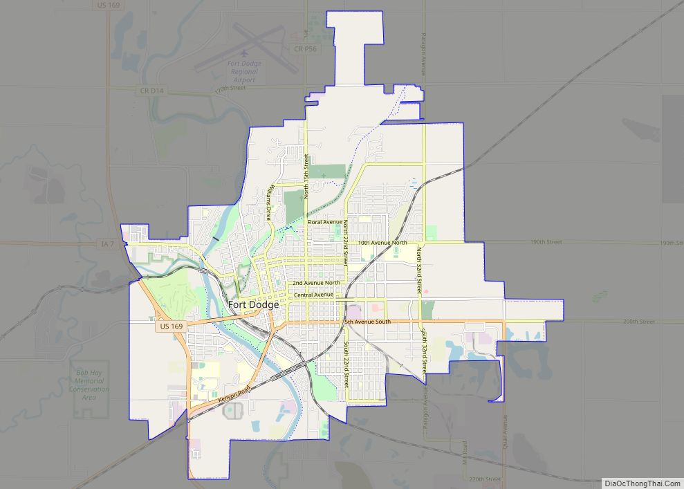
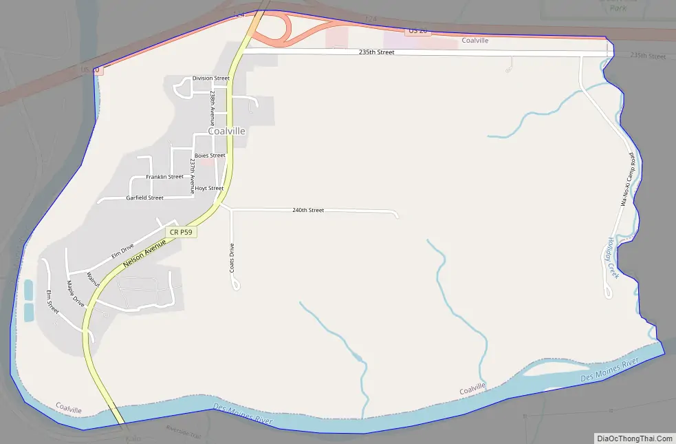
Coalville Road Map
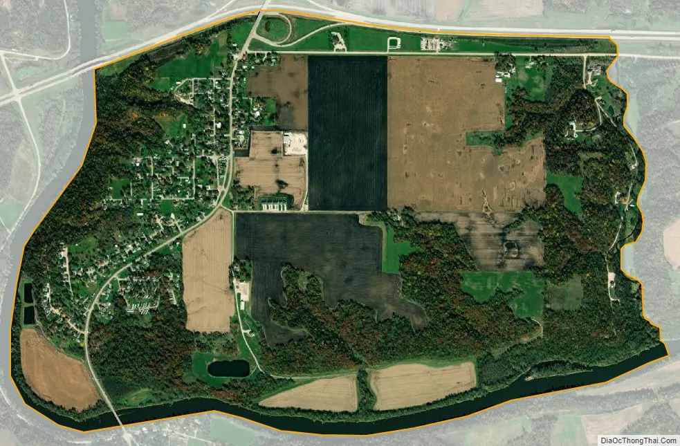
Coalville city Satellite Map
Geography
Coalville is located at 42°26′37″N 94°07′43″W / 42.443522°N 94.128558°W / 42.443522; -94.128558 (42.443522, −94.128558). on the west bank of the Des Moines River.
According to the United States Census Bureau, the city has a total area of 2.26 square miles (5.85 km), of which 2.18 square miles (5.66 km) of it is land and 0.07 square miles (0.19 km) is water.
See also
Map of Iowa State and its subdivision:- Adair
- Adams
- Allamakee
- Appanoose
- Audubon
- Benton
- Black Hawk
- Boone
- Bremer
- Buchanan
- Buena Vista
- Butler
- Calhoun
- Carroll
- Cass
- Cedar
- Cerro Gordo
- Cherokee
- Chickasaw
- Clarke
- Clay
- Clayton
- Clinton
- Crawford
- Dallas
- Davis
- Decatur
- Delaware
- Des Moines
- Dickinson
- Dubuque
- Emmet
- Fayette
- Floyd
- Franklin
- Fremont
- Greene
- Grundy
- Guthrie
- Hamilton
- Hancock
- Hardin
- Harrison
- Henry
- Howard
- Humboldt
- Ida
- Iowa
- Jackson
- Jasper
- Jefferson
- Johnson
- Jones
- Keokuk
- Kossuth
- Lee
- Linn
- Louisa
- Lucas
- Lyon
- Madison
- Mahaska
- Marion
- Marshall
- Mills
- Mitchell
- Monona
- Monroe
- Montgomery
- Muscatine
- O'Brien
- Osceola
- Page
- Palo Alto
- Plymouth
- Pocahontas
- Polk
- Pottawattamie
- Poweshiek
- Ringgold
- Sac
- Scott
- Shelby
- Sioux
- Story
- Tama
- Taylor
- Union
- Van Buren
- Wapello
- Warren
- Washington
- Wayne
- Webster
- Winnebago
- Winneshiek
- Woodbury
- Worth
- Wright
- Alabama
- Alaska
- Arizona
- Arkansas
- California
- Colorado
- Connecticut
- Delaware
- District of Columbia
- Florida
- Georgia
- Hawaii
- Idaho
- Illinois
- Indiana
- Iowa
- Kansas
- Kentucky
- Louisiana
- Maine
- Maryland
- Massachusetts
- Michigan
- Minnesota
- Mississippi
- Missouri
- Montana
- Nebraska
- Nevada
- New Hampshire
- New Jersey
- New Mexico
- New York
- North Carolina
- North Dakota
- Ohio
- Oklahoma
- Oregon
- Pennsylvania
- Rhode Island
- South Carolina
- South Dakota
- Tennessee
- Texas
- Utah
- Vermont
- Virginia
- Washington
- West Virginia
- Wisconsin
- Wyoming