Colfax is a city in Jasper County, Iowa, United States. Colfax is located approximately 24 miles east of Des Moines. The town was founded in 1866, and was named after Schuyler Colfax, vice president under Ulysses S. Grant. The population was 2,255 at the time of the 2020 census. Newton is the county seat; both were named after Revolutionary War soldiers.
| Name: | Colfax city |
|---|---|
| LSAD Code: | 25 |
| LSAD Description: | city (suffix) |
| State: | Iowa |
| County: | Jasper County |
| Incorporated: | August 10, 1875 |
| Elevation: | 801 ft (244 m) |
| Total Area: | 2.64 sq mi (6.84 km²) |
| Land Area: | 2.42 sq mi (6.25 km²) |
| Water Area: | 0.23 sq mi (0.59 km²) |
| Total Population: | 2,255 |
| Population Density: | 933.75/sq mi (360.59/km²) |
| ZIP code: | 50054 |
| Area code: | 515 |
| FIPS code: | 1915060 |
| GNISfeature ID: | 0455527 |
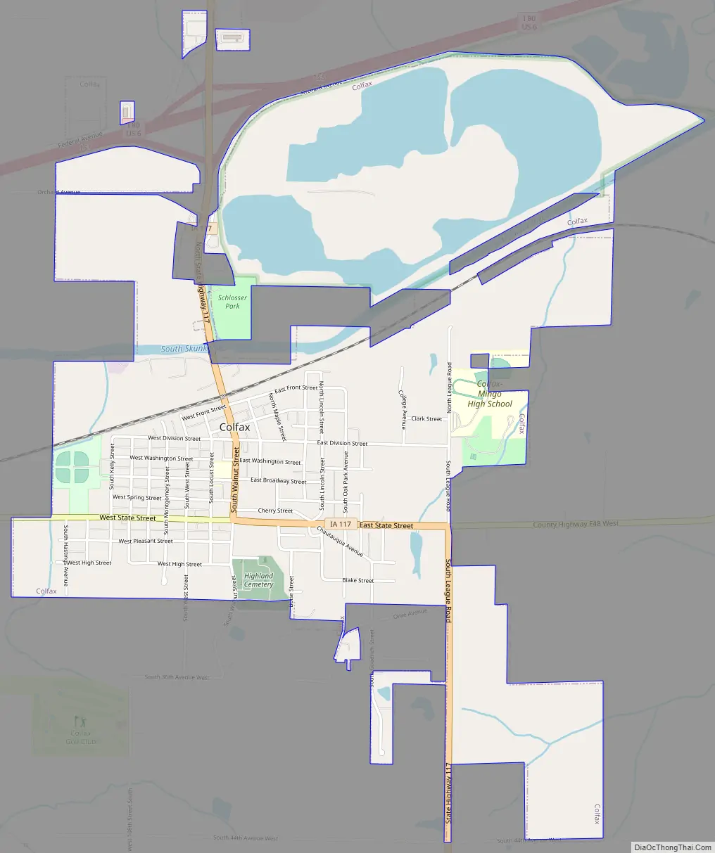
Online Interactive Map
Click on ![]() to view map in "full screen" mode.
to view map in "full screen" mode.
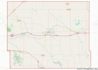
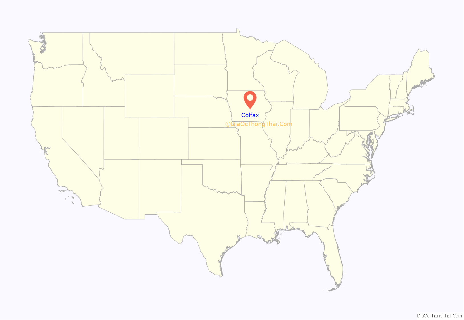
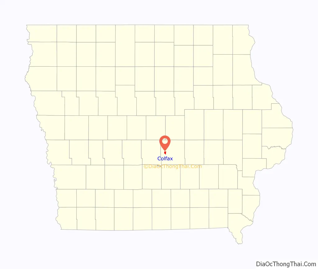
Colfax location map. Where is Colfax city?
History
Colfax was laid out in 1866. It is named for Schuyler Colfax.
In its heyday, the city of Colfax had two main industries that drew thousands to the area: the mining of coal, and the use of the mineral springs discovered near the city.
The first large scale coal mine in Jasper County was the Watson No. 1 Mine, 5 miles southeast of town, connected to the Rock Island by a long railroad spur. From 1881 to 1900, the Jasper County Coal and Railway Company operated a number of mines north of Colfax. The Colfax Consolidated Coal Company formed in 1902, bringing the mines of Colfax under a common operator. They opened mine No. 8 in 1905; this was one of the best equipped mines in the state. The coal camp of Severs was run by this company.
United Mine Workers local 56 was organized in Colfax in 1899; by 1907, it had 352 members. Mine wages varied from $2.36 to $2.56 per day. In 1912, the UMW union had two locals based in Colfax, Local 56, with 350 members, and Local 671, with 230 members.
In the process of drilling for coal in 1875, a well containing high mineral content was discovered near Colfax. The city flourished with this new discovery, and over the next four decades, thousands of people visited the town to partake in the healing powers of the fourteen mineral springs there. Nine hotels offering mineral baths and spa treatments opened to house guests, and four bottling companies opened to produce bottled mineral water for the masses. In 1912–1913, the city received funding to build a Carnegie library. The library is still in use today. The booming business of the city’s mineral springs industry declined and died out as the Great Depression swept the country.
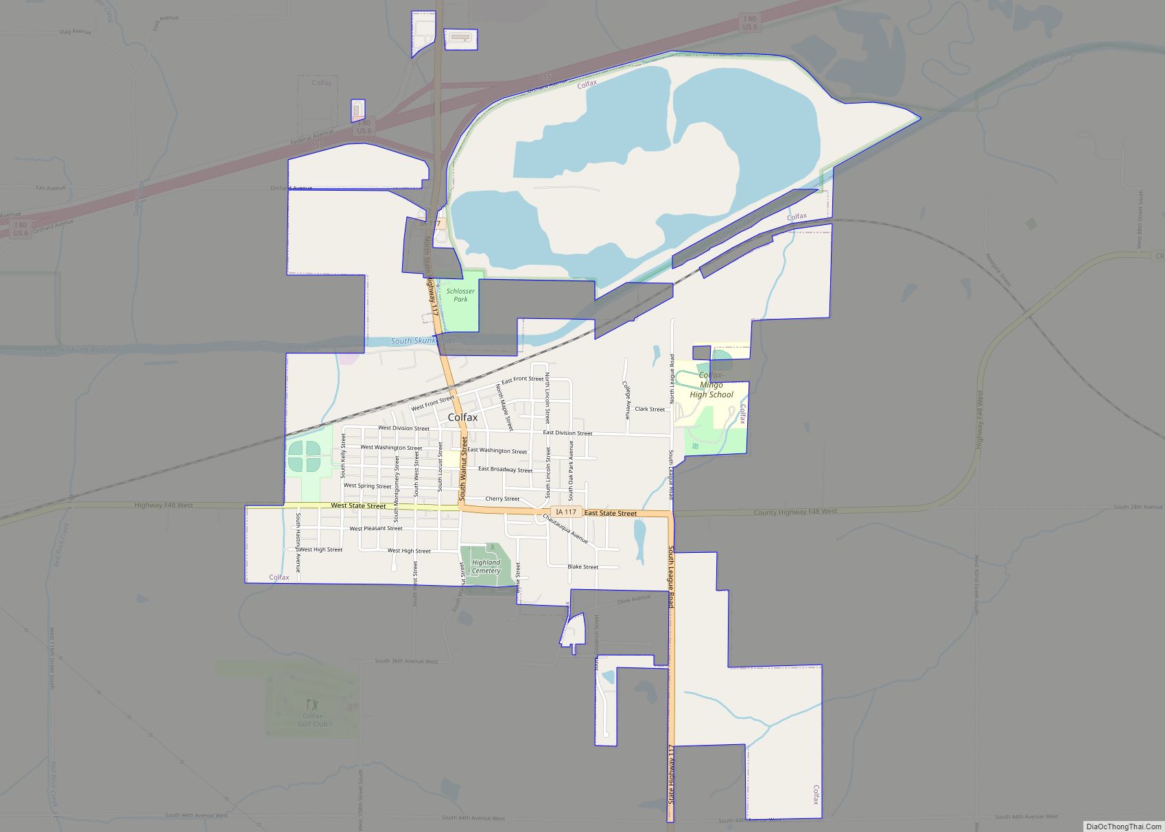
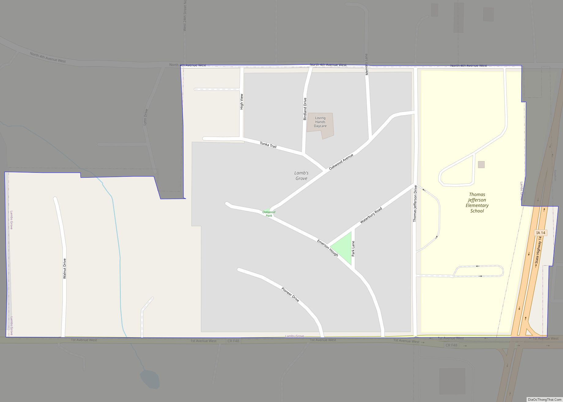
Colfax Road Map
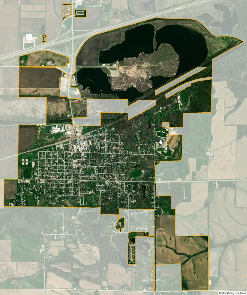
Colfax city Satellite Map
Geography
According to the United States Census Bureau, the city has a total area of 1.80 square miles (4.66 km), of which 1.79 square miles (4.64 km) is land and 0.01 square miles (0.03 km) is water.
See also
Map of Iowa State and its subdivision:- Adair
- Adams
- Allamakee
- Appanoose
- Audubon
- Benton
- Black Hawk
- Boone
- Bremer
- Buchanan
- Buena Vista
- Butler
- Calhoun
- Carroll
- Cass
- Cedar
- Cerro Gordo
- Cherokee
- Chickasaw
- Clarke
- Clay
- Clayton
- Clinton
- Crawford
- Dallas
- Davis
- Decatur
- Delaware
- Des Moines
- Dickinson
- Dubuque
- Emmet
- Fayette
- Floyd
- Franklin
- Fremont
- Greene
- Grundy
- Guthrie
- Hamilton
- Hancock
- Hardin
- Harrison
- Henry
- Howard
- Humboldt
- Ida
- Iowa
- Jackson
- Jasper
- Jefferson
- Johnson
- Jones
- Keokuk
- Kossuth
- Lee
- Linn
- Louisa
- Lucas
- Lyon
- Madison
- Mahaska
- Marion
- Marshall
- Mills
- Mitchell
- Monona
- Monroe
- Montgomery
- Muscatine
- O'Brien
- Osceola
- Page
- Palo Alto
- Plymouth
- Pocahontas
- Polk
- Pottawattamie
- Poweshiek
- Ringgold
- Sac
- Scott
- Shelby
- Sioux
- Story
- Tama
- Taylor
- Union
- Van Buren
- Wapello
- Warren
- Washington
- Wayne
- Webster
- Winnebago
- Winneshiek
- Woodbury
- Worth
- Wright
- Alabama
- Alaska
- Arizona
- Arkansas
- California
- Colorado
- Connecticut
- Delaware
- District of Columbia
- Florida
- Georgia
- Hawaii
- Idaho
- Illinois
- Indiana
- Iowa
- Kansas
- Kentucky
- Louisiana
- Maine
- Maryland
- Massachusetts
- Michigan
- Minnesota
- Mississippi
- Missouri
- Montana
- Nebraska
- Nevada
- New Hampshire
- New Jersey
- New Mexico
- New York
- North Carolina
- North Dakota
- Ohio
- Oklahoma
- Oregon
- Pennsylvania
- Rhode Island
- South Carolina
- South Dakota
- Tennessee
- Texas
- Utah
- Vermont
- Virginia
- Washington
- West Virginia
- Wisconsin
- Wyoming