Newton is the county seat of, and most populous city in, Jasper County, Iowa, United States. Located 30 miles (48 km) east of Des Moines, Newton is in Central Iowa. As of the 2020 Census, the city population was 15,760. It is the home of Iowa Speedway and Maytag Dairy Farms.
| Name: | Newton city |
|---|---|
| LSAD Code: | 25 |
| LSAD Description: | city (suffix) |
| State: | Iowa |
| County: | Jasper County |
| Elevation: | 951 ft (290 m) |
| Total Area: | 11.34 sq mi (29.37 km²) |
| Land Area: | 11.34 sq mi (29.37 km²) |
| Water Area: | 0.00 sq mi (0.00 km²) |
| Total Population: | 15,760 |
| Population Density: | 1,390.02/sq mi (536.69/km²) |
| ZIP code: | 50208 |
| Area code: | 641 |
| FIPS code: | 1956505 |
| GNISfeature ID: | 0459514 |
| Website: | www.newtongov.org |
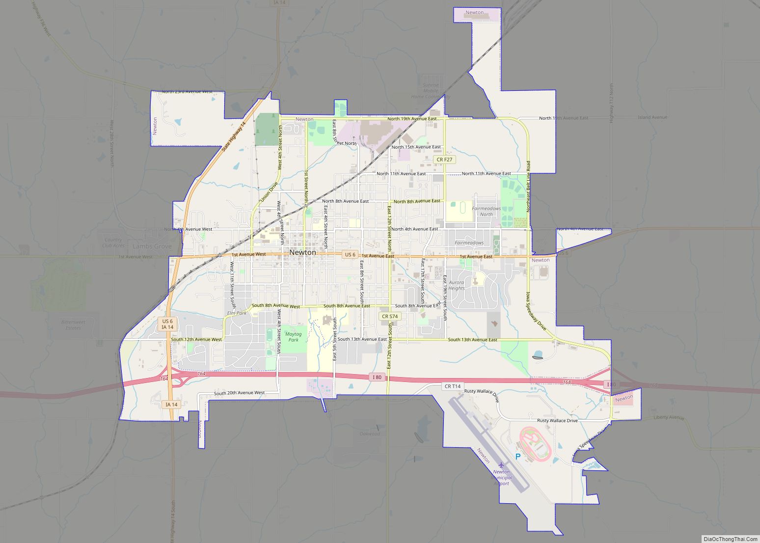
Online Interactive Map
Click on ![]() to view map in "full screen" mode.
to view map in "full screen" mode.
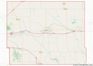
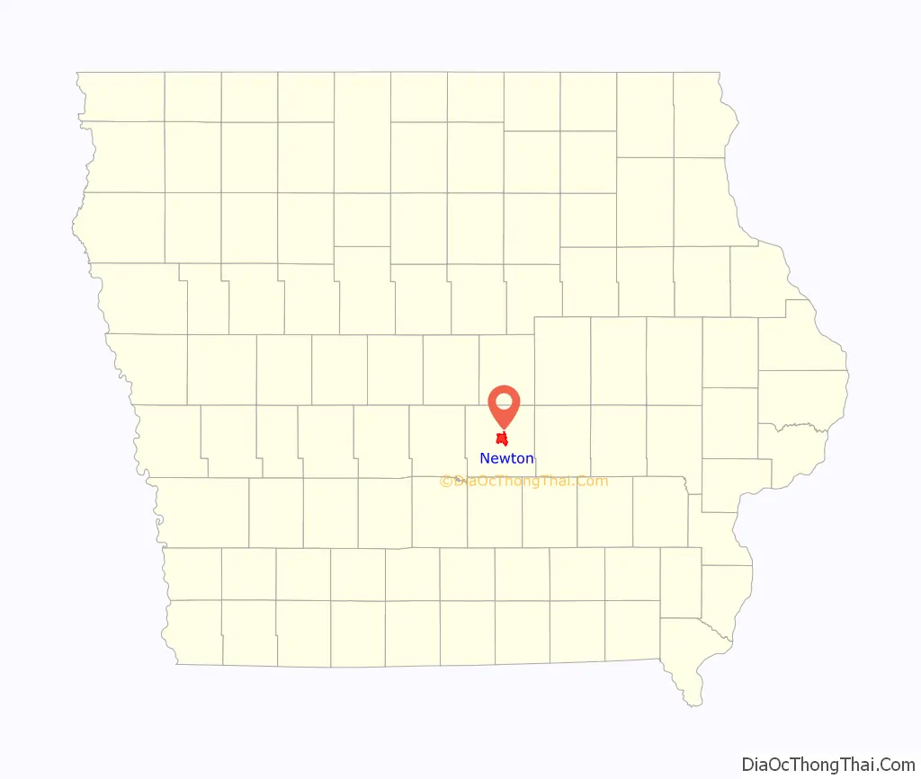
Newton location map. Where is Newton city?

History
Early history
Newton was founded in 1846 as Newton City, then shortened to Newton in 1847 and incorporated as a city in 1857. It was named to pair with Jasper County, following a common American naming scheme at the time in honor of Revolutionary War soldiers John Newton and William Jasper. In the late 19th century, Newton’s growth was fueled by the development of coal mines in the region. The first significant mine in the area was the Couch mine of the Jasper County Coal and Railway Company, opened in the 1870s. For a while, it was the largest mine in the county, producing 70 tons per day. William Snooks opened a mine near Newton in 1886. In the early 20th century, large scale mining in the Newton area had declined, but there were still several mines in the area that were worked intermittently.
Maytag and the era of growth
In the 20th century, Newton was a manufacturing community, much of its growth derived from the washing machine industry. Its most distinctive landmark, the Jasper County Courthouse, was built in 1911.
Newton entered the national stage in 1938 when martial law was declared during a strike at the Maytag Washing Machine Company. Iowa governor Nelson Kraschel ordered the Iowa National Guard to protect the company with tanks and machine guns ready against the workers. With the backing of four troops (companies) of the 113th Cavalry Regiment, Maytag company beat the strike and forced workers to return to work with a 10% pay cut.
At the conclusion of World War II, the Maytag Washing Machine Company expanded its operations in Newton, becoming the Maytag Corporation. Known for its dependable line of washing machines and clothes dryers, the company later persuaded the town of Newton to change the name of its headquarters address in the city to “One Dependability Square.” In 2001, a decision to cut labor costs resulted in a reduction of the labor force at the Newton plant in favor of newer Maytag facilities in Mexico. Layoffs at the Newton plant continued through 2005. Whirlpool’s acquisition of Maytag in early 2006 led to speculation over the future of Maytag operations in Newton. On May 10, 2006, Whirlpool announced that it would close the Newton plant and corporate offices in the fall of 2007. The plant employed about 1,000 workers and the corporate offices employed about 800 at the time of the announcement.
In January 2007, Whirlpool said in a statement that it sold most of the Maytag headquarters complex to Iowa Telecommunications Services Inc., a Newton-based telephone company which would use the complex to consolidate employees in a single location.
Although the company did not disclose financial details, Newton economic development officials said Iowa Telecom paid $1.5 million for the buildings assessed at more than $12 million. The Maytag plant officially ended production on October 25, 2007.
“Newton’s future” and the rebound after Maytag
After Maytag announced its departure, community leaders and City administration worked together to develop a plan to diversify Newton’s economy. After the Maytag plant closed, unemployment skyrocketed—rising to almost 10%. In 2010, Jasper County had the highest unemployment rate of Iowa’s 99 counties at 8.2%. However, in the following years, the unemployment rate dropped considerably—down to 5.4% in 2013. More impressively, Newton’s population did not drop following the departure of Maytag. Newton has had a steady population of about 15,000 since the 1960s.
Between 2007 and 2017, the following companies started in or moved to Newton: Underwriter’s Laboratory, Trinity Structural Towers, TPI Composites, Aueron, Walter G. Anderson, the Iowa Speedway, Health Enterprises, Engineered Plastics Company, Pact Manufacturing, Advanced Wheel Sales, and Hawkeye Stages.
Legacy Plaza, the former Maytag corporate campus, contains eight buildings dating back to the early 1900s. The site was donated to Des Moines Area Community College (DMACC) by Reza Kargarzadeh in 2016. Some of the space is leased; current tenants include Compass Mortgage, DMACC Business Resources, Thombert, Aureon, Gezellig Brewing Company, Murph & Mary’s Pub, CIRAS, Iowa Lean Consortium, Aerocare, MCG and Edward Jones.
One of the industrial sectors Newton has attracted in recent years is green manufacturing. In December 2007, TPI Composites announced plans to open a plant to manufacture massive wind turbine blades, which are now in production. Today, TPI Composites employs over 1,100 people and has expanded its operations by 100,000 square feet as they began manufacturing composite bus bodies with Proterra.
Additionally, Trinity Structural Towers, a company which manufactures wind turbine towers, opened in 2008. President Barack Obama visited the Trinity Structural Towers plant on April 22, 2009, that year’s Earth Day. While at the factory in Newton, the President said that he traveled to the factory to usher in “a new era of energy exploration in America.”
Newton was awarded the National Sustainable Community of the Year Award (Small City Category) by Siemens and the US Chamber of Commerce in 2010 for its successful, pro-active approach to recovery.
In 2012, the Newton City Council passed “Newton’s Future: A Comprehensive Plan.” The Comprehensive Plan was written with the input of Newton citizens and reflects the community’s goals for the future; the top goals identified in the plan were to grow Newton’s population with an emphasis toward targeting young families, increase employment opportunities, improve the City’s curb appeal, and fill vacant buildings and increase local shopping options.
Newton Road Map

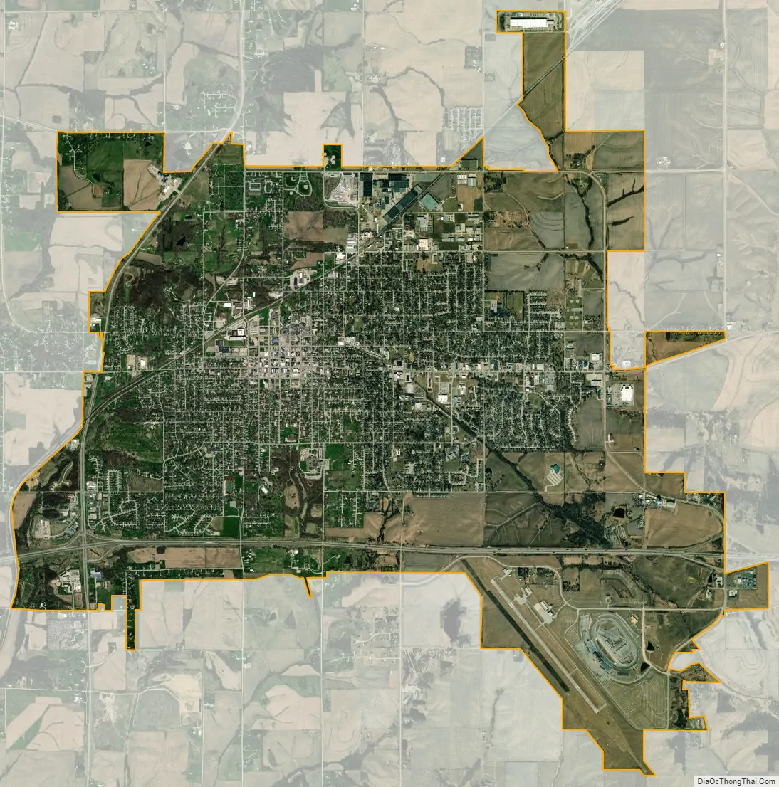
Newton city Satellite Map
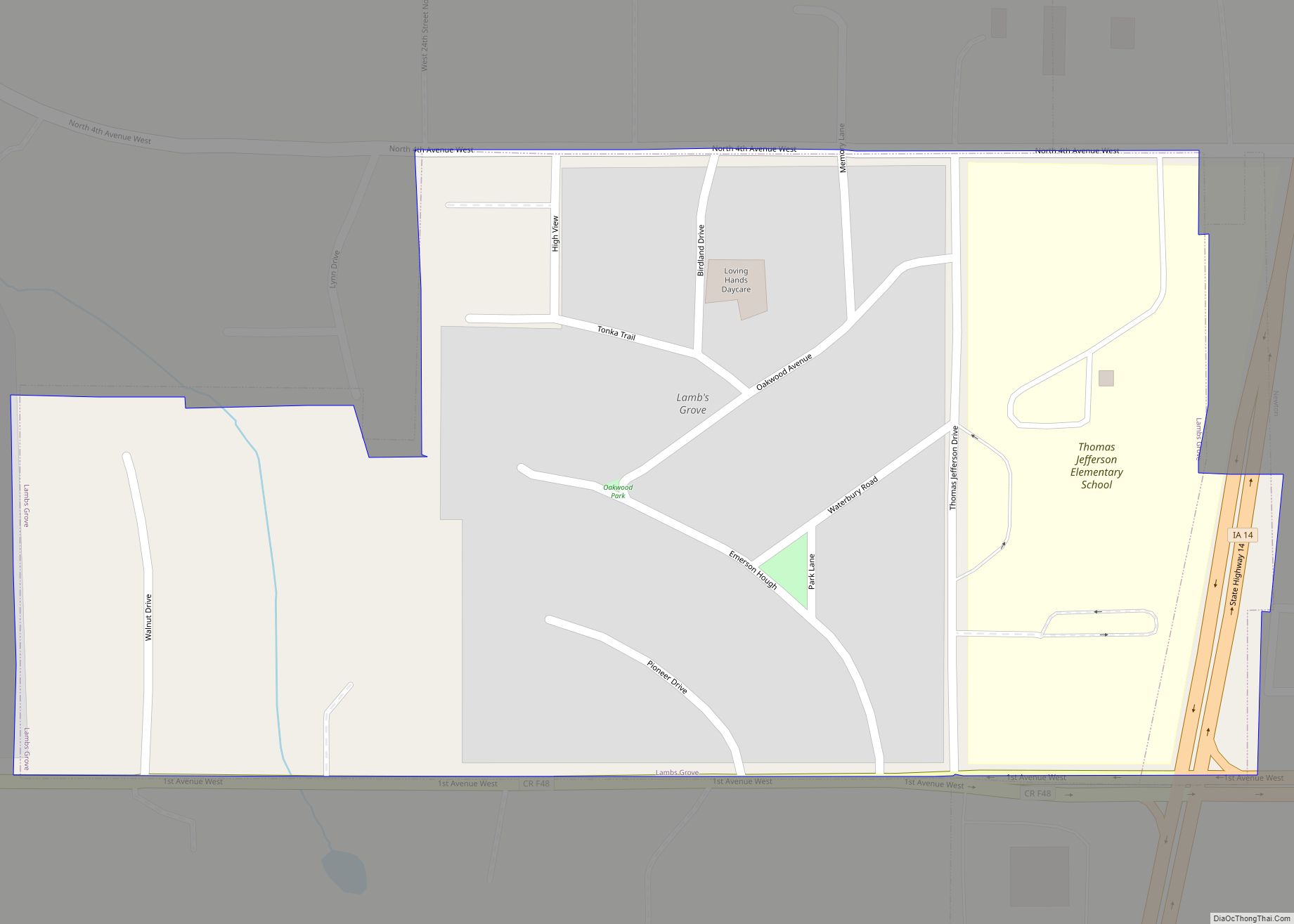
Geography
According to the United States Census Bureau, the city has a total area of 11.19 square miles (28.98 km), all land.
Streets and addresses
Newton is divided into four quadrants: 1st Avenue divides the north and south segments of Newton, and 1st Street divides the east and west segments. Roads labeled as avenues run east and west, while roads labeled as streets run north and south. Newton’s street numbering system also extends into rural Jasper County.
A typical street name would appear “E 5th St S”. The east or west label comes first, followed by the street, then followed by the north or south label. This example indicates the street is in the southeast quadrant of Newton.
A typical avenue name would appear “N 5th Ave W”. In the case of avenues, the north or south label comes first, followed by the avenue, and then followed by the east or west label. This example indicates the avenue is in the northwest quadrant of Newton.
All addresses within Newton fall within the 50208 ZIP Code.
See also
Map of Iowa State and its subdivision:- Adair
- Adams
- Allamakee
- Appanoose
- Audubon
- Benton
- Black Hawk
- Boone
- Bremer
- Buchanan
- Buena Vista
- Butler
- Calhoun
- Carroll
- Cass
- Cedar
- Cerro Gordo
- Cherokee
- Chickasaw
- Clarke
- Clay
- Clayton
- Clinton
- Crawford
- Dallas
- Davis
- Decatur
- Delaware
- Des Moines
- Dickinson
- Dubuque
- Emmet
- Fayette
- Floyd
- Franklin
- Fremont
- Greene
- Grundy
- Guthrie
- Hamilton
- Hancock
- Hardin
- Harrison
- Henry
- Howard
- Humboldt
- Ida
- Iowa
- Jackson
- Jasper
- Jefferson
- Johnson
- Jones
- Keokuk
- Kossuth
- Lee
- Linn
- Louisa
- Lucas
- Lyon
- Madison
- Mahaska
- Marion
- Marshall
- Mills
- Mitchell
- Monona
- Monroe
- Montgomery
- Muscatine
- O'Brien
- Osceola
- Page
- Palo Alto
- Plymouth
- Pocahontas
- Polk
- Pottawattamie
- Poweshiek
- Ringgold
- Sac
- Scott
- Shelby
- Sioux
- Story
- Tama
- Taylor
- Union
- Van Buren
- Wapello
- Warren
- Washington
- Wayne
- Webster
- Winnebago
- Winneshiek
- Woodbury
- Worth
- Wright
- Alabama
- Alaska
- Arizona
- Arkansas
- California
- Colorado
- Connecticut
- Delaware
- District of Columbia
- Florida
- Georgia
- Hawaii
- Idaho
- Illinois
- Indiana
- Iowa
- Kansas
- Kentucky
- Louisiana
- Maine
- Maryland
- Massachusetts
- Michigan
- Minnesota
- Mississippi
- Missouri
- Montana
- Nebraska
- Nevada
- New Hampshire
- New Jersey
- New Mexico
- New York
- North Carolina
- North Dakota
- Ohio
- Oklahoma
- Oregon
- Pennsylvania
- Rhode Island
- South Carolina
- South Dakota
- Tennessee
- Texas
- Utah
- Vermont
- Virginia
- Washington
- West Virginia
- Wisconsin
- Wyoming