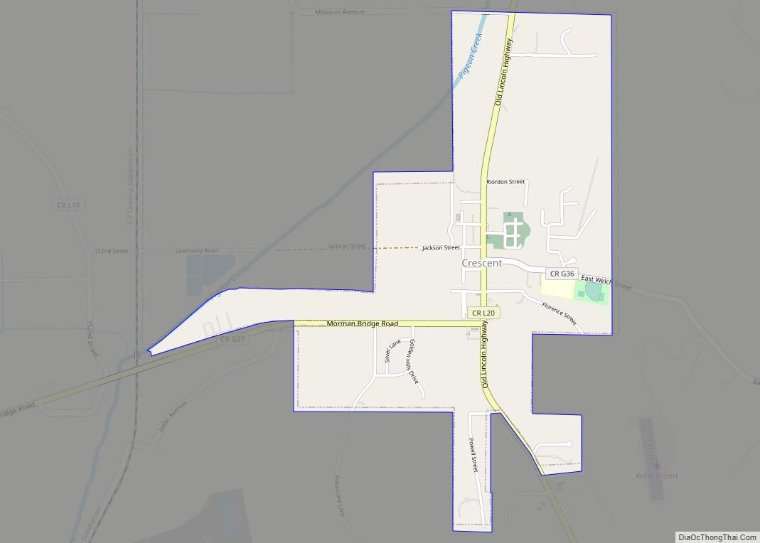
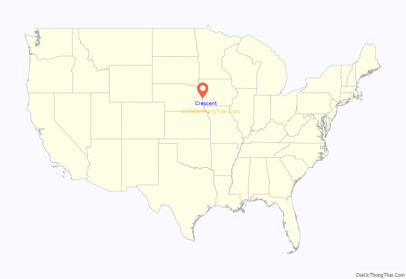
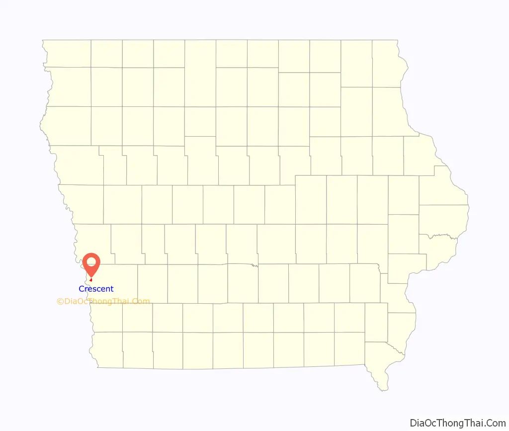
Crescent is a city in Pottawattamie County, Iowa, United States. The population was 628 at the 2020 census.
| Name: | Crescent city |
|---|---|
| LSAD Code: | 25 |
| LSAD Description: | city (suffix) |
| State: | Iowa |
| County: | Pottawattamie County |
| Elevation: | 1,010 ft (308 m) |
| Total Area: | 0.97 sq mi (2.51 km²) |
| Land Area: | 0.97 sq mi (2.50 km²) |
| Water Area: | 0.00 sq mi (0.01 km²) |
| Total Population: | 628 |
| Population Density: | 649.43/sq mi (250.71/km²) |
| ZIP code: | 51526 |
| Area code: | 712 |
| FIPS code: | 1917175 |
| GNISfeature ID: | 0455709 |
Online Interactive Map
Click on ![]() to view map in "full screen" mode.
to view map in "full screen" mode.
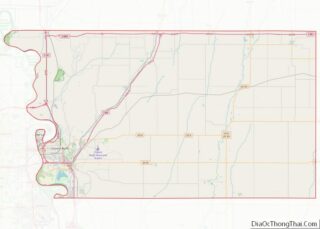
Crescent location map. Where is Crescent city?
History
Crescent was originally laid out by Joseph E. Johnson, a Latter-day Saint who also published a paper there in the 1850s. Before the near universal exodus of the Mormons to Utah in 1852, (many left beginning in 1847, but they were the majority of the population until 1852) the area was known as Brownell’s Grove and Farmersville.
Crescent had about 300 residents in 1950.
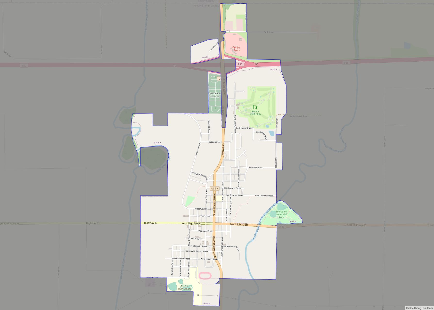
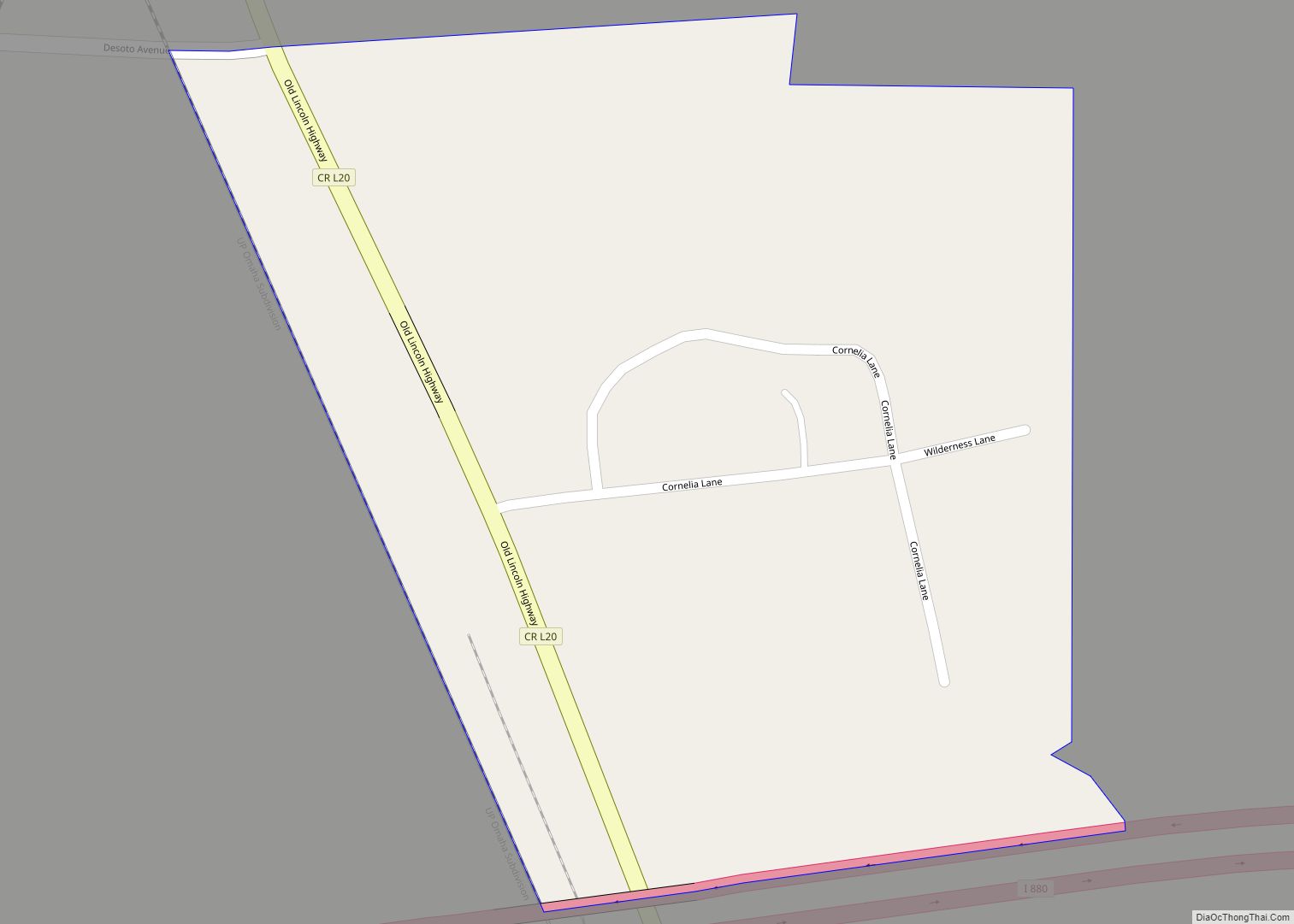
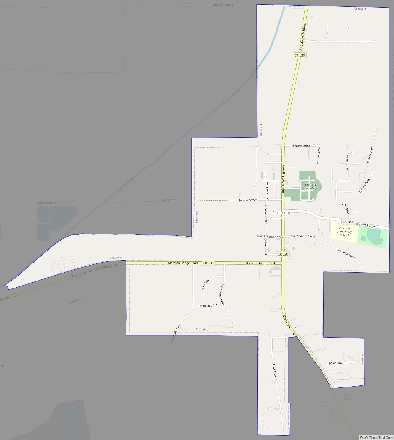
Crescent Road Map
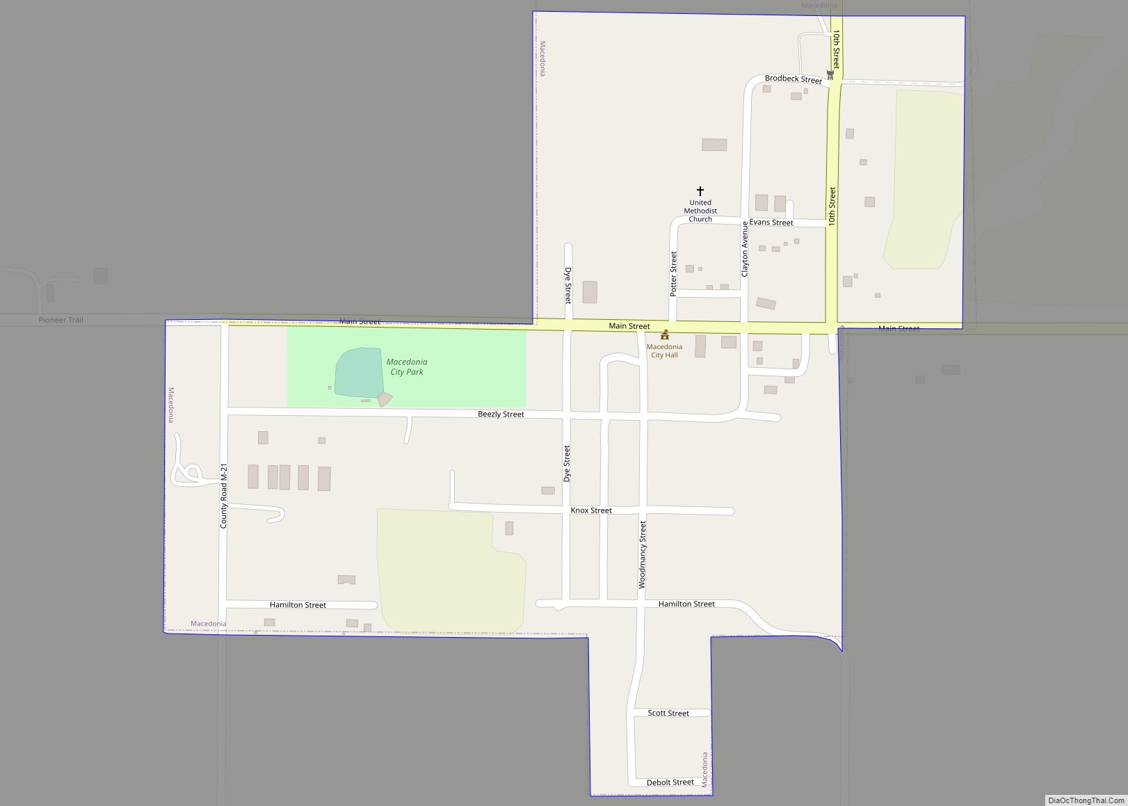
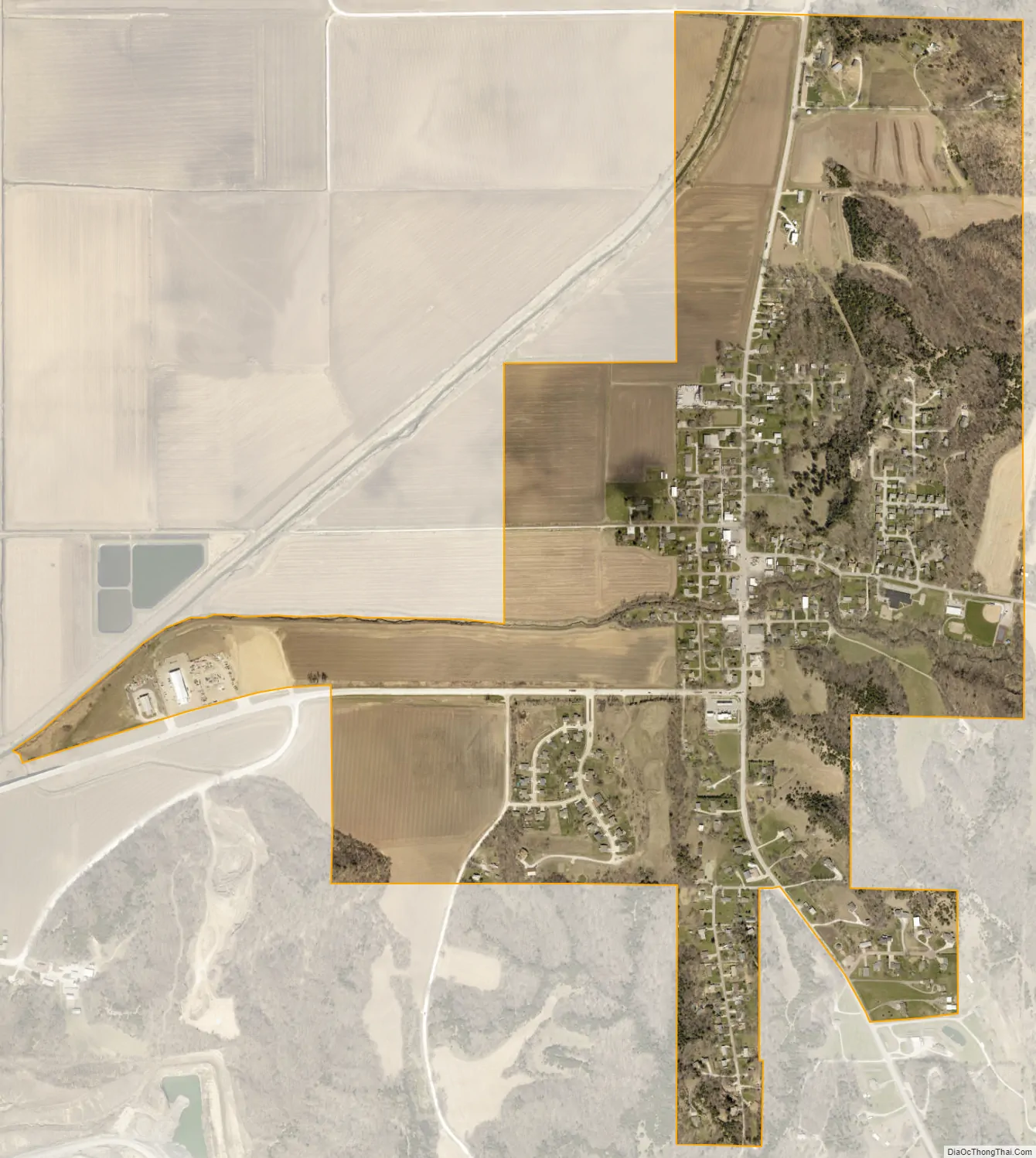
Crescent city Satellite Map
Geography
Crescent is located at 41°21′49″N 95°51′32″W / 41.36361°N 95.85889°W / 41.36361; -95.85889 (41.363656, -95.858789).
According to the United States Census Bureau, the city has a total area of 1.09 square miles (2.82 km), all land.
The city lies directly across the Mormon Bridge from North Omaha, and is located at the base of the Loess Hills. The Mount Crescent skiing area lies near the town, and is the nearest ski and snowboarding slope to the Omaha-Council Bluffs metropolitan area. In the summer the area serves as a recreational facility for activities such as paintball and cross-country running. Neighboring Hitchcock Park supports various types of wildlife and many miles of hiking trails.
See also
Map of Iowa State and its subdivision:- Adair
- Adams
- Allamakee
- Appanoose
- Audubon
- Benton
- Black Hawk
- Boone
- Bremer
- Buchanan
- Buena Vista
- Butler
- Calhoun
- Carroll
- Cass
- Cedar
- Cerro Gordo
- Cherokee
- Chickasaw
- Clarke
- Clay
- Clayton
- Clinton
- Crawford
- Dallas
- Davis
- Decatur
- Delaware
- Des Moines
- Dickinson
- Dubuque
- Emmet
- Fayette
- Floyd
- Franklin
- Fremont
- Greene
- Grundy
- Guthrie
- Hamilton
- Hancock
- Hardin
- Harrison
- Henry
- Howard
- Humboldt
- Ida
- Iowa
- Jackson
- Jasper
- Jefferson
- Johnson
- Jones
- Keokuk
- Kossuth
- Lee
- Linn
- Louisa
- Lucas
- Lyon
- Madison
- Mahaska
- Marion
- Marshall
- Mills
- Mitchell
- Monona
- Monroe
- Montgomery
- Muscatine
- O'Brien
- Osceola
- Page
- Palo Alto
- Plymouth
- Pocahontas
- Polk
- Pottawattamie
- Poweshiek
- Ringgold
- Sac
- Scott
- Shelby
- Sioux
- Story
- Tama
- Taylor
- Union
- Van Buren
- Wapello
- Warren
- Washington
- Wayne
- Webster
- Winnebago
- Winneshiek
- Woodbury
- Worth
- Wright
- Alabama
- Alaska
- Arizona
- Arkansas
- California
- Colorado
- Connecticut
- Delaware
- District of Columbia
- Florida
- Georgia
- Hawaii
- Idaho
- Illinois
- Indiana
- Iowa
- Kansas
- Kentucky
- Louisiana
- Maine
- Maryland
- Massachusetts
- Michigan
- Minnesota
- Mississippi
- Missouri
- Montana
- Nebraska
- Nevada
- New Hampshire
- New Jersey
- New Mexico
- New York
- North Carolina
- North Dakota
- Ohio
- Oklahoma
- Oregon
- Pennsylvania
- Rhode Island
- South Carolina
- South Dakota
- Tennessee
- Texas
- Utah
- Vermont
- Virginia
- Washington
- West Virginia
- Wisconsin
- Wyoming