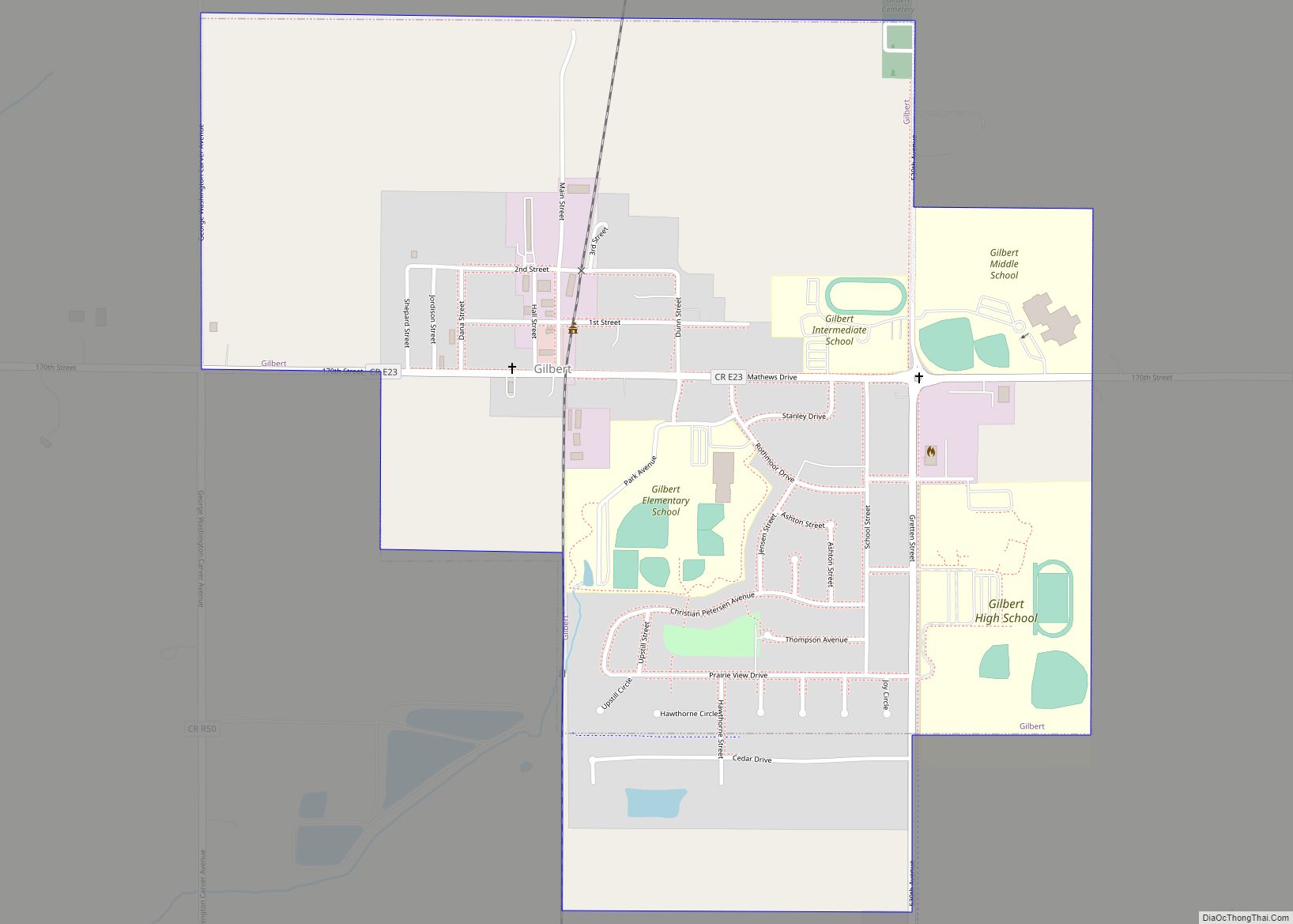
Gilbert is a city in Story County, Iowa, United States. The population was 1,211 at the time of the 2020 census. It is part of the Ames, Iowa Metropolitan Statistical Area, which is a part of the larger Ames-Boone, Iowa Combined Statistical Area.
| Name: | Gilbert city |
|---|---|
| LSAD Code: | 25 |
| LSAD Description: | city (suffix) |
| State: | Iowa |
| County: | Story County |
| Elevation: | 991 ft (302 m) |
| Total Area: | 1.10 sq mi (2.85 km²) |
| Land Area: | 1.10 sq mi (2.85 km²) |
| Water Area: | 0.00 sq mi (0.00 km²) |
| Total Population: | 1,211 |
| Population Density: | 1,099.91/sq mi (424.72/km²) |
| ZIP code: | 50105 |
| Area code: | 515 |
| FIPS code: | 1930630 |
| GNISfeature ID: | 0456899 |
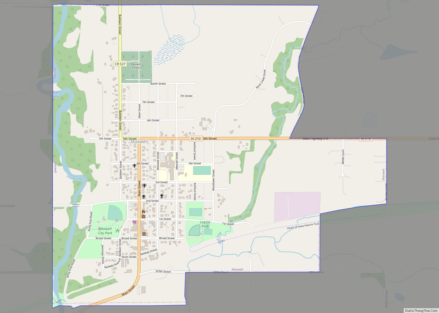
Online Interactive Map
Click on ![]() to view map in "full screen" mode.
to view map in "full screen" mode.
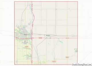
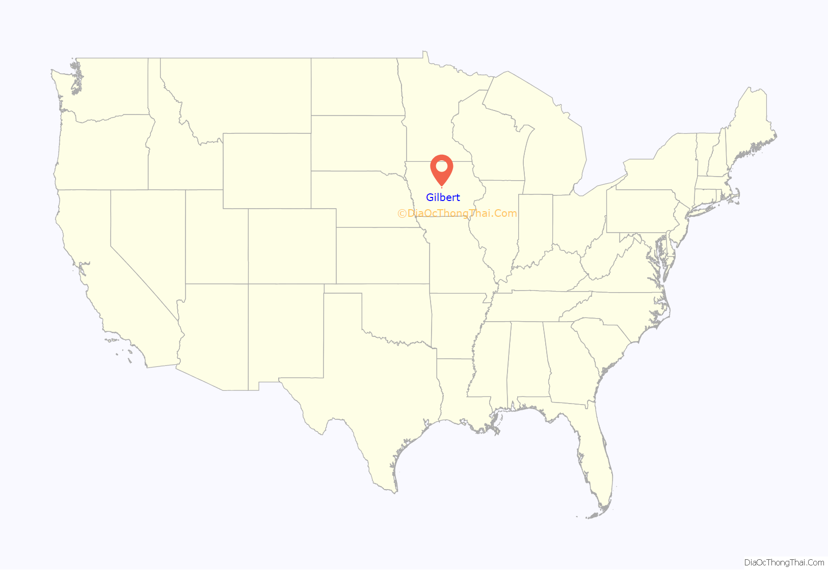
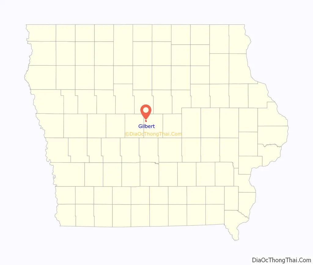
Gilbert location map. Where is Gilbert city?
History
Gilbert was named for Hezekiah Gilbert, who owned the land upon which the town was built up.
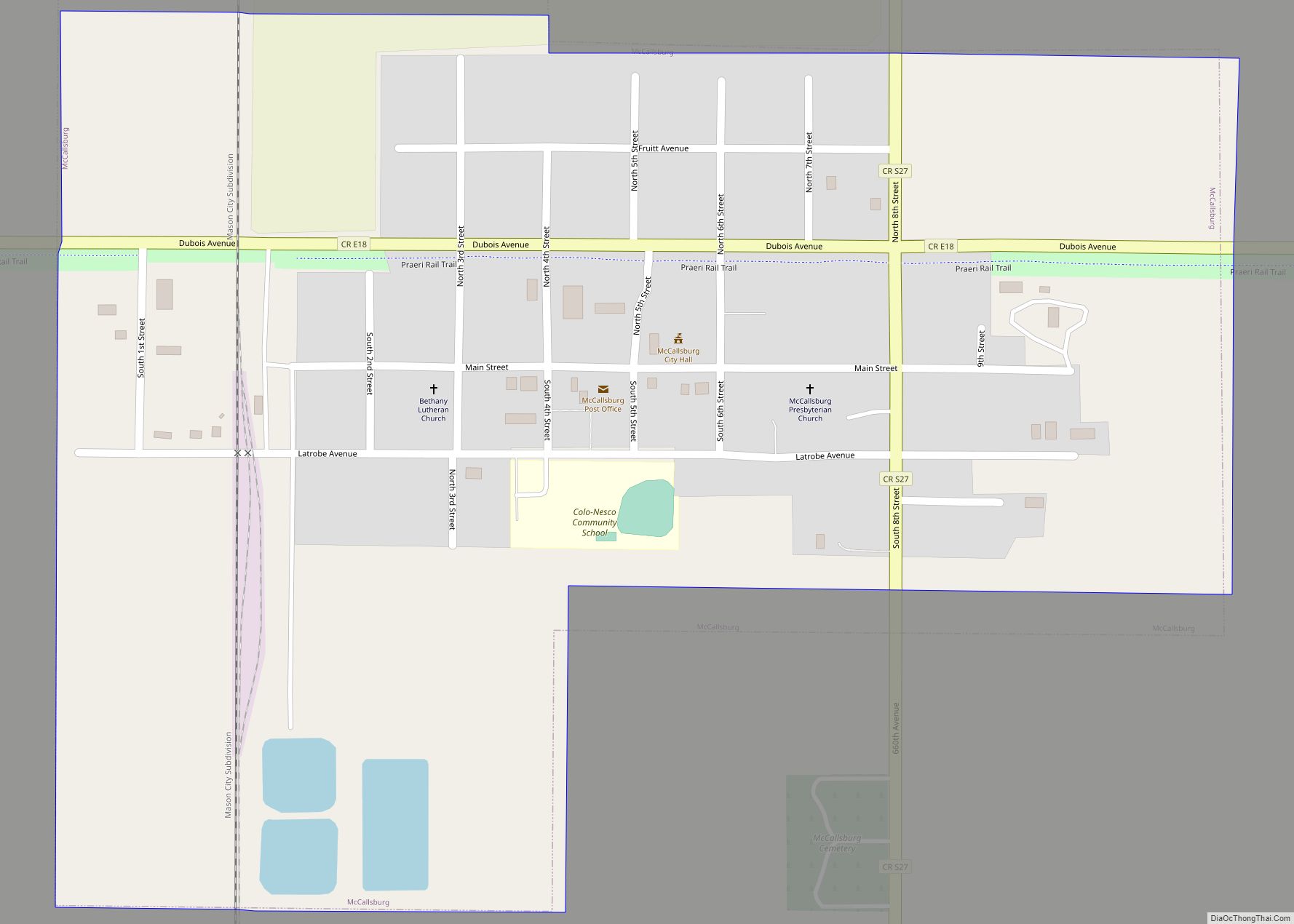
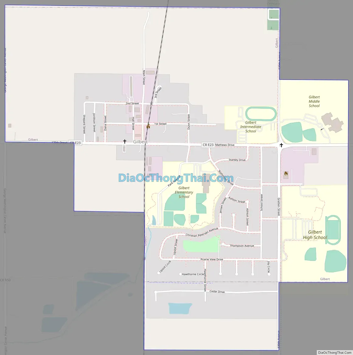
Gilbert Road Map
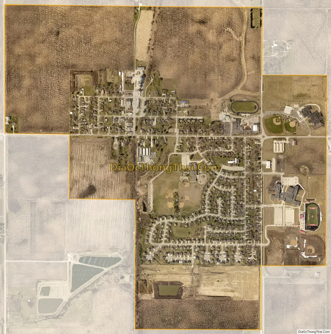
Gilbert city Satellite Map
Geography
Gilbert is located at 42°06′21″N 93°38′43″W / 42.105858°N 93.645185°W / 42.105858; -93.645185 (42.105858, -93.645185).
According to the United States Census Bureau, the city has a total area of 9.1 square miles (23.57 km), all land.
The landscape surrounding the city consists of rolling hills dotted with conventional farm buildings and livestock as well as row crop farming systems. Some suburban-style subdivisions lie a short distance to the south.
Gilbert’s southern boundary is two miles north of the Ames boundary that was extended when the Ada Hayden Heritage Park was developed.
See also
Map of Iowa State and its subdivision:- Adair
- Adams
- Allamakee
- Appanoose
- Audubon
- Benton
- Black Hawk
- Boone
- Bremer
- Buchanan
- Buena Vista
- Butler
- Calhoun
- Carroll
- Cass
- Cedar
- Cerro Gordo
- Cherokee
- Chickasaw
- Clarke
- Clay
- Clayton
- Clinton
- Crawford
- Dallas
- Davis
- Decatur
- Delaware
- Des Moines
- Dickinson
- Dubuque
- Emmet
- Fayette
- Floyd
- Franklin
- Fremont
- Greene
- Grundy
- Guthrie
- Hamilton
- Hancock
- Hardin
- Harrison
- Henry
- Howard
- Humboldt
- Ida
- Iowa
- Jackson
- Jasper
- Jefferson
- Johnson
- Jones
- Keokuk
- Kossuth
- Lee
- Linn
- Louisa
- Lucas
- Lyon
- Madison
- Mahaska
- Marion
- Marshall
- Mills
- Mitchell
- Monona
- Monroe
- Montgomery
- Muscatine
- O'Brien
- Osceola
- Page
- Palo Alto
- Plymouth
- Pocahontas
- Polk
- Pottawattamie
- Poweshiek
- Ringgold
- Sac
- Scott
- Shelby
- Sioux
- Story
- Tama
- Taylor
- Union
- Van Buren
- Wapello
- Warren
- Washington
- Wayne
- Webster
- Winnebago
- Winneshiek
- Woodbury
- Worth
- Wright
- Alabama
- Alaska
- Arizona
- Arkansas
- California
- Colorado
- Connecticut
- Delaware
- District of Columbia
- Florida
- Georgia
- Hawaii
- Idaho
- Illinois
- Indiana
- Iowa
- Kansas
- Kentucky
- Louisiana
- Maine
- Maryland
- Massachusetts
- Michigan
- Minnesota
- Mississippi
- Missouri
- Montana
- Nebraska
- Nevada
- New Hampshire
- New Jersey
- New Mexico
- New York
- North Carolina
- North Dakota
- Ohio
- Oklahoma
- Oregon
- Pennsylvania
- Rhode Island
- South Carolina
- South Dakota
- Tennessee
- Texas
- Utah
- Vermont
- Virginia
- Washington
- West Virginia
- Wisconsin
- Wyoming