Guttenberg is a city in Clayton County, Iowa, United States, along the Mississippi River. The population was 1,817 at the time of the 2020 census, down from 1,987 at the 2000 census.
| Name: | Guttenberg city |
|---|---|
| LSAD Code: | 25 |
| LSAD Description: | city (suffix) |
| State: | Iowa |
| County: | Clayton County |
| Incorporated: | 1851 |
| Elevation: | 625 ft (188 m) |
| Total Area: | 2.23 sq mi (5.77 km²) |
| Land Area: | 2.19 sq mi (5.68 km²) |
| Water Area: | 0.04 sq mi (0.09 km²) |
| Total Population: | 1,817 |
| Population Density: | 828.17/sq mi (319.72/km²) |
| Area code: | 563 |
| FIPS code: | 1933465 |
| GNISfeature ID: | 0457187 |
| Website: | www.cityofguttenberg.com |
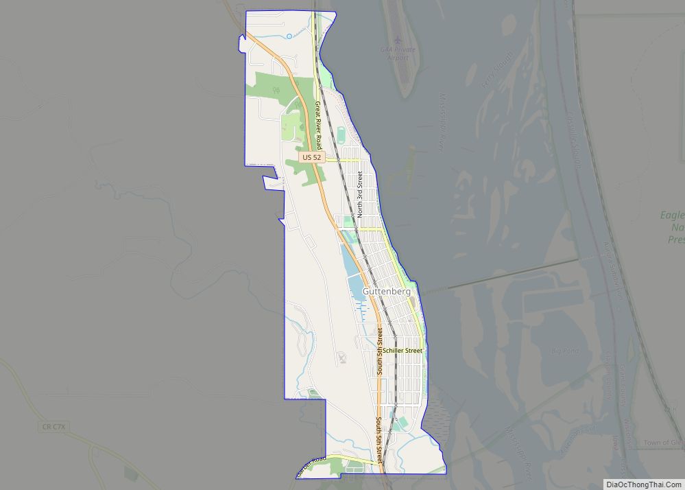
Online Interactive Map
Click on ![]() to view map in "full screen" mode.
to view map in "full screen" mode.
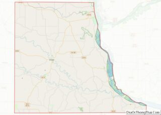
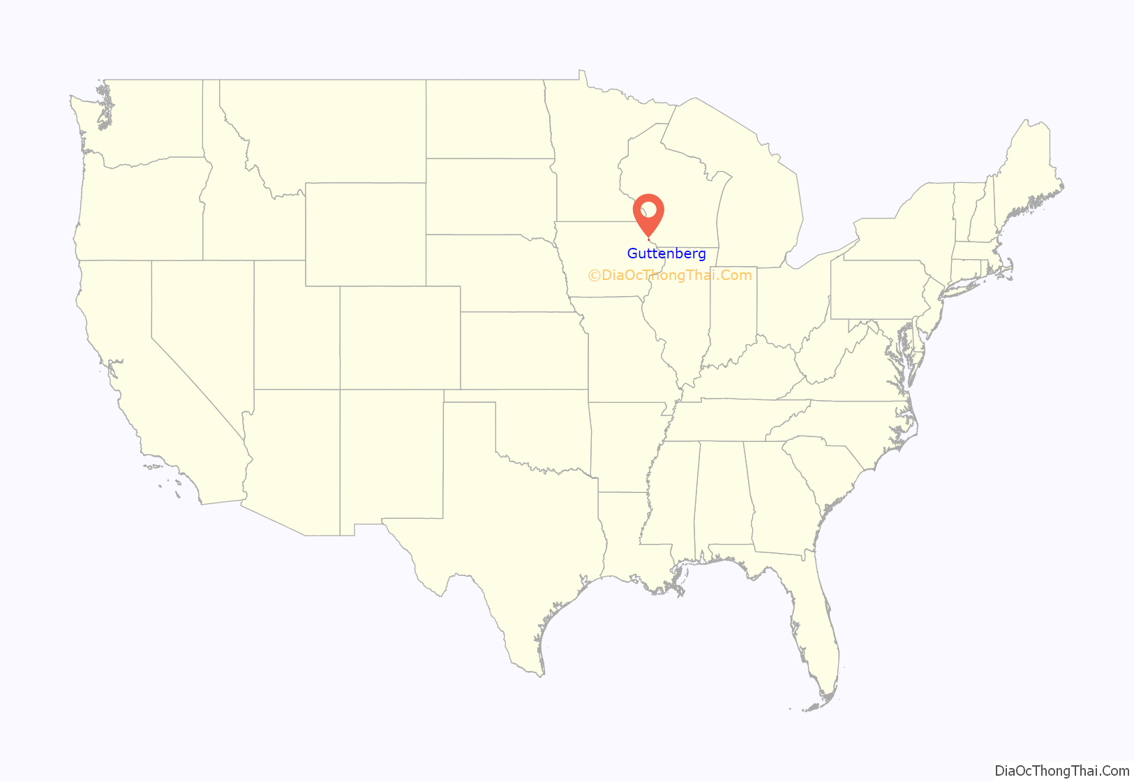
Guttenberg location map. Where is Guttenberg city?
History
Prairie La Porte, meaning “the door to the prairie,” was the first name given to Guttenberg by French explorers in 1673. The Guttenberg area was a site of Sac and Fox campgrounds until 1823. The Louisiana Purchase of 1803 transferred ownership to the United States and the Black Hawk Purchase of 1833 finally opened the area for legal settlement.
Guttenberg’s past is preserved today in the many limestone buildings built by German immigrants in the mid-to-late 19th century. These structures were used for both residential and commercial purposes. Many such as the Albertus Building are pre-Civil War era and are preserved in the Front Street Historic District.
Guttenberg’s riverfront location was pivotal in its early commercial development. The town first served as a focal point for westward settlement and as an early governmental and administrative center. It was the early location of the county seat from 1838 to 1843. Guttenberg served as a supply center for the general area until the Civil War, when railroads and an interior road system combined to detract from Guttenberg’s role as a market center.
The earliest businesses included general supply stores, blacksmith, wagon shops, and hotels. The loss of the county seat in 1843 slowed growth and the population declined. Economic revival began in 1845 with the influx of hundreds of German immigrants under the auspices of the Western Settlement Society of Cincinnati and continued with the development of the lead mining industry along Miners Creek.
The German immigration began in 1845, and by 1850 the town was sizable and nearly all German. The city takes its name from Johannes Gutenberg, the inventor of movable type. Many of the town’s streets are named for 18th & 19th century German writers, poets, playwrights and philosophers such as Koerner, Herman, Weiland, Lessing, Schiller, Herder and Goethe, whose writings became prolific in Germany because of Johannes Gutenberg’s invention. A replica of a Bible Gutenberg printed is on display at the public library.
Guttenberg incorporated in 1851. The influence of the German population was best indicated by the construction during the period between 1845 and 1865 for over one hundred stone buildings. The bluff limestone was easily obtained and good, local clay and lime for construction was available. Four large riverside warehouses opened and a large flour mill, stores, and hotels appeared during this period. The steamboat trade deposited merchandise and picked up farm produce, milled flour and lead ore.
Guttenberg experienced many floods, the most recent and devastating being in 1965, after which a levee was built. Today, Guttenberg’s population is 1,817 and it is the largest town in Clayton County.
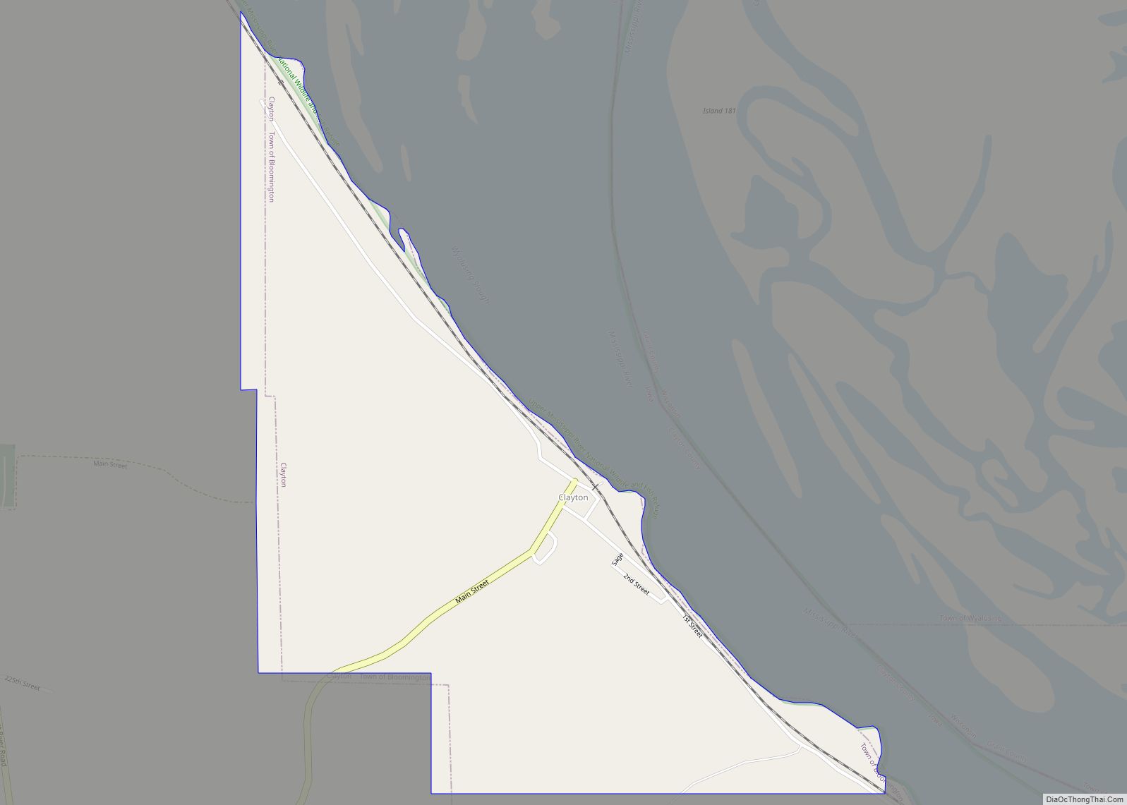
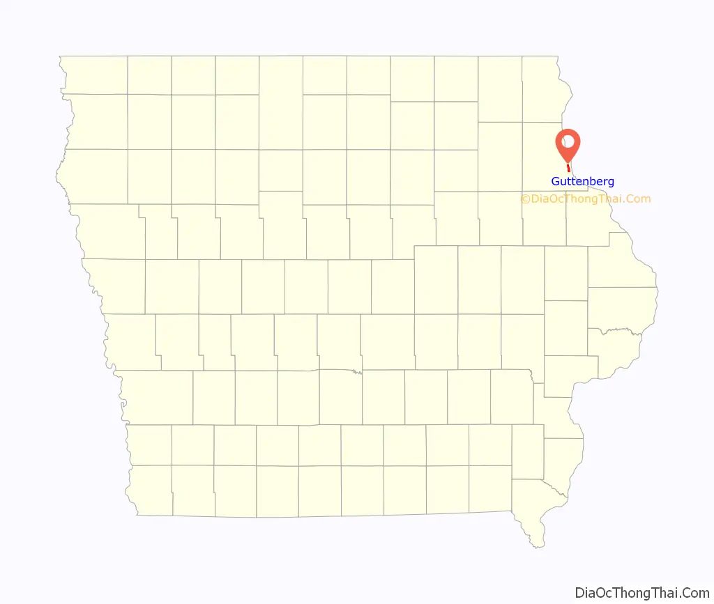
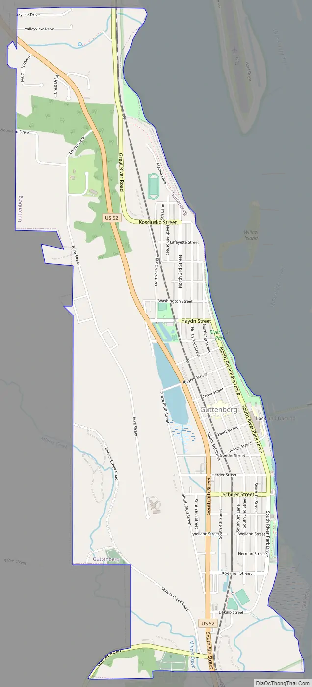
Guttenberg Road Map
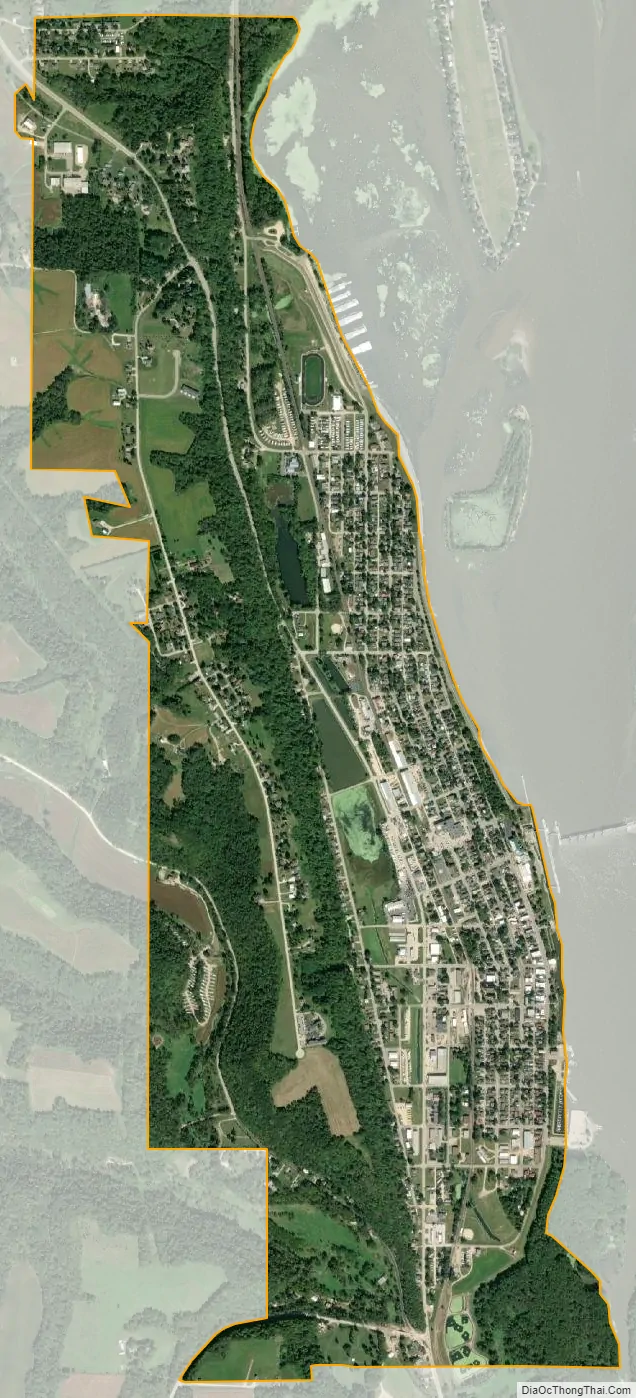
Guttenberg city Satellite Map
Geography
Guttenberg is located at 42°47′10″N 91°6′5″W / 42.78611°N 91.10139°W / 42.78611; -91.10139 (42.785992, -91.101366).
According to the United States Census Bureau, the city has a total area of 2.12 square miles (5.49 km), of which, 2.09 square miles (5.41 km) is land and 0.03 square miles (0.08 km) is water.
The community is next to the Mississippi River across from Wisconsin and is on US Route 52.
Climate
Guttenberg has a humid continental climate (Köppen climate classification Dfa).
See also
Map of Iowa State and its subdivision:- Adair
- Adams
- Allamakee
- Appanoose
- Audubon
- Benton
- Black Hawk
- Boone
- Bremer
- Buchanan
- Buena Vista
- Butler
- Calhoun
- Carroll
- Cass
- Cedar
- Cerro Gordo
- Cherokee
- Chickasaw
- Clarke
- Clay
- Clayton
- Clinton
- Crawford
- Dallas
- Davis
- Decatur
- Delaware
- Des Moines
- Dickinson
- Dubuque
- Emmet
- Fayette
- Floyd
- Franklin
- Fremont
- Greene
- Grundy
- Guthrie
- Hamilton
- Hancock
- Hardin
- Harrison
- Henry
- Howard
- Humboldt
- Ida
- Iowa
- Jackson
- Jasper
- Jefferson
- Johnson
- Jones
- Keokuk
- Kossuth
- Lee
- Linn
- Louisa
- Lucas
- Lyon
- Madison
- Mahaska
- Marion
- Marshall
- Mills
- Mitchell
- Monona
- Monroe
- Montgomery
- Muscatine
- O'Brien
- Osceola
- Page
- Palo Alto
- Plymouth
- Pocahontas
- Polk
- Pottawattamie
- Poweshiek
- Ringgold
- Sac
- Scott
- Shelby
- Sioux
- Story
- Tama
- Taylor
- Union
- Van Buren
- Wapello
- Warren
- Washington
- Wayne
- Webster
- Winnebago
- Winneshiek
- Woodbury
- Worth
- Wright
- Alabama
- Alaska
- Arizona
- Arkansas
- California
- Colorado
- Connecticut
- Delaware
- District of Columbia
- Florida
- Georgia
- Hawaii
- Idaho
- Illinois
- Indiana
- Iowa
- Kansas
- Kentucky
- Louisiana
- Maine
- Maryland
- Massachusetts
- Michigan
- Minnesota
- Mississippi
- Missouri
- Montana
- Nebraska
- Nevada
- New Hampshire
- New Jersey
- New Mexico
- New York
- North Carolina
- North Dakota
- Ohio
- Oklahoma
- Oregon
- Pennsylvania
- Rhode Island
- South Carolina
- South Dakota
- Tennessee
- Texas
- Utah
- Vermont
- Virginia
- Washington
- West Virginia
- Wisconsin
- Wyoming