Iowa City, officially the City of Iowa City, is a city in Johnson County, Iowa, United States. It is the home of the University of Iowa and county seat of Johnson County, at the center of the Iowa City Metropolitan Statistical Area. At the time of the 2020 census the population was 74,828, making it the state’s fifth-largest city. The metropolitan area, which encompasses Johnson and Washington counties, has a population of over 171,000. The Iowa City Metropolitan Statistical Area (MSA) is also a part of a Combined Statistical Area (CSA) with the Cedar Rapids MSA. This CSA plus two additional counties are known as the Iowa City-Cedar Rapids region which collectively has a population of nearly 500,000.
Iowa City was the second capital of the Iowa Territory and the first capital city of the State of Iowa. The Old Capitol building is a National Historic Landmark in the center of the University of Iowa campus. The University of Iowa Art Museum and Plum Grove, the home of the first Governor of Iowa, are also tourist attractions. In 2008, Forbes magazine named Iowa City the second-best small metropolitan area for doing business in the United States.
| Name: | Iowa City city |
|---|---|
| LSAD Code: | 25 |
| LSAD Description: | city (suffix) |
| State: | Iowa |
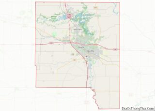
| County: | Johnson County |
| Elevation: | 668 ft (203.6 m) |
| Land Area: | 25.65 sq mi (66.43 km²) |
| Water Area: | 0.54 sq mi (1.40 km²) |
| Population Density: | 2,917.50/sq mi (1,126.47/km²) |
| ZIP code: | 52240, 52242 – 52246 |
| Area code: | 319 |
| FIPS code: | 1938595 |
| GNISfeature ID: | 0457827 |
| Website: | icgov.org |
Online Interactive Map
Click on ![]() to view map in "full screen" mode.
to view map in "full screen" mode.
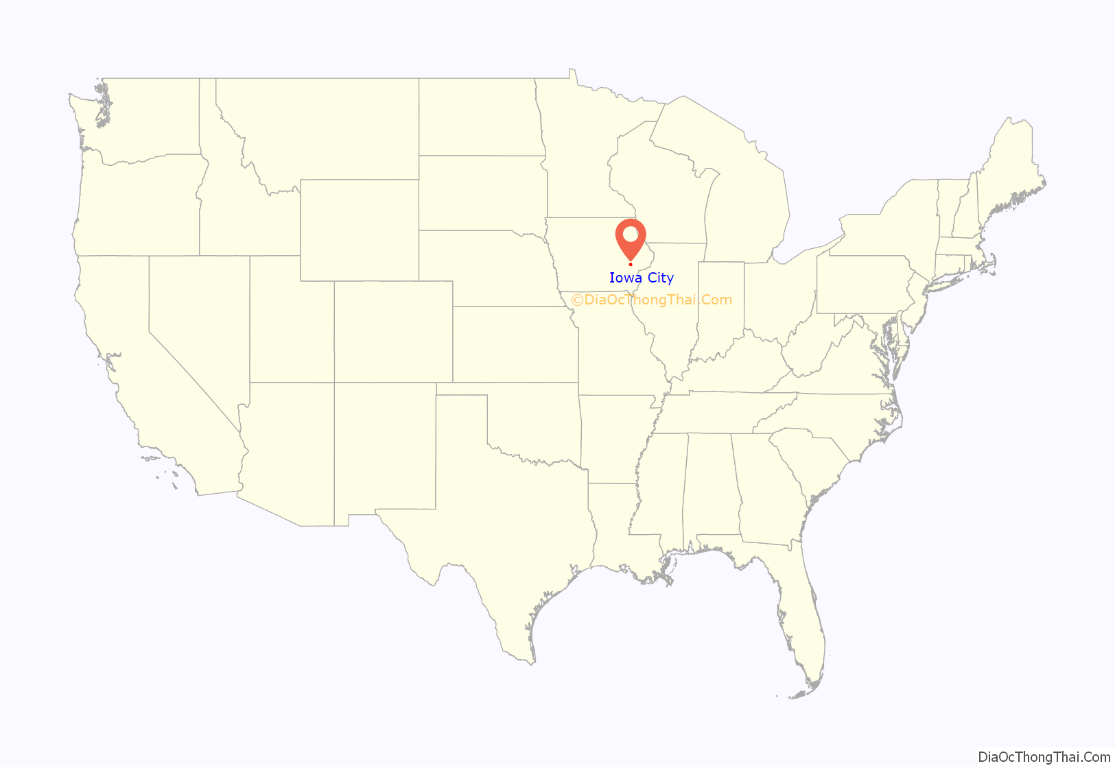
Iowa City location map. Where is Iowa City city?
History
Iowa City was created by an act of Legislative Assembly of the Iowa Territory on January 21, 1839, fulfilling the desire of Governor Robert Lucas to move the capital out of Burlington and closer to the center of the territory. This act began:
Commissioners Chauncey Swan and John Ronalds met on May 1 in the small settlement of Napoleon, south of present-day Iowa City, to select a site for the new capital city. The following day the commissioners selected a site on bluffs above the Iowa River north of Napoleon, placed a stake in the center of the proposed site and began planning the new capital city. Commissioner Swan, in a report to the legislature in Burlington, described the site:
By June of that year, the town had been platted and surveyed from Brown St. in the north to Burlington St. in the south, and from the Iowa River eastward to Governor St.
While Iowa City was selected as the territorial capital in 1839, it did not officially become the capital city until 1841; after construction on the capitol building had begun. The capitol building was completed in 1842, and the last four territorial legislatures and the first six Iowa General Assemblies met there until 1857, when the state capital was moved to Des Moines.
Iowa Old Capitol Building
John F. Rague is credited with designing the Territorial Capitol Building. He had previously designed the 1837 capitol of Illinois and was supervising its construction when he got the commission to design the new Iowa capitol in 1839. He quit the Iowa project after five months, claiming his design was not followed, but the resemblance to the Illinois capitol suggests he strongly influenced the final Iowa design. One surviving 1839 sketch of the proposed capital shows a radically different layout, with two domes and a central tower. The cornerstone of the Old Capitol Building was laid in Iowa City on July 4, 1840. Iowa City served as the third and last territorial capital of Iowa, and the last four territorial legislatures met at the Old Capitol Building until December 28, 1846, when Iowa was admitted into the United States as the 29th state of the union. Iowa City was declared the state capital of Iowa, and the government convened in the Old Capitol Building.
1843 cemetery
Oakland Cemetery was deeded to “the people of Iowa City” by the Iowa territorial legislature on February 13, 1843. The original plot was one block square, with the southwest corner at Governor and Church. Over the years the cemetery has been expanded and now encompasses 40 acres. Oakland Cemetery is a non-perpetual care city cemetery. This cemetery is supported by city taxes. The staff is strongly committed to the maintenance and preservation of privately owned lots and accessories. Since its establishment, the cemetery has become the final resting place of many men and women important in the history of Iowa, of Iowa City and the University of Iowa. These include Robert E. Lucas, first governor of the territory (1838–41); Samuel J. Kirkwood, governor during the Civil War (1860–64), again in 1876, a U.S. senator in 1877, and subsequently secretary of the interior and U.S. minister to Spain; well-known presidents of the university, Walter A. Jessup (1915–33) and Virgil M. Hancher (1940–64); Cordelia Swan, daughter of one of the three commissioners who selected the site for Iowa City and the new territorial capitol; and Irving B. Weber (1900–1997), noted Iowa City historian. It is also home to the legendary monument called the “Black Angel”, which is an 8.5-foot tall monument for the Feldevert family erected in 1912. The facts behind the Black Angel long ago gave way to myths, superstitions and legend surrounding its mysterious change in color from a golden bronze cast to an eerie black.
1847 University founding
Founded in 1847, today’s University of Iowa offers more than 100 areas of study to 31,112 students. The university includes a medical school and one of the United States’ largest university-owned teaching hospitals, providing patient care within 16 medical specialties. Iowa City is also the location of Mercy Hospital. The University of Iowa College of Law is located there.
1970 riots
The spring of 1970 was a tumultuous time on college campuses. On April 30, President Richard Nixon announced that U.S. forces would invade Cambodia because of the recent communist coup. Students around the country protested this escalation of the Vietnam War. On May 4, the National Guard fired on students at Kent State University, killing four and wounding nine people, which ignited protests all over the country.
Anti-war protests were not new to Iowa City or to elsewhere in Iowa; protests had been occurring throughout the 1960s. Spring of 1970 was different.
After the Kent State shootings, students marched on the National Guard Armory, broke windows there as well as in some downtown businesses. The City Council gave the mayor curfew powers. On May 6, there was a student boycott of classes. That night, about 400 people had a “sleep-in” in front of the Old Capitol. That night also, about 50 people broke into the Old Capitol and set off a smoke bomb. The protesters left voluntarily when asked to do so. Around 2 am Friday morning, President Boyd requested arrest of the students on the Pentacrest by highway patrolmen, but the next day he regretted the mass arrests and said he had received faulty information. On May 8, President Boyd cancelled the 89th annual Governor’s day ROTC observance for the following day. On Friday and Saturday a National Guard helicopter circled the Pentacrest.
In the early morning hours of Saturday, May 9, the Old Armory Temporary (O.A.T.), also known as “Big Pink”, which housed the writing lab, was burned down. This building was located next to the Old Armory, where the Adler Journalism and Mass Communications building currently is located. O.A.T was said to be at the top of a list of buildings for burning, probably due to its poor condition and was considered a firetrap.
The Iowa Alumni Review includes an article about the fire in which the author states: “Only the ends stayed upright. … On the south, Lou Kelly’s Writing lab bearing the sign ‘another mother for peace,’ escaped.” There was a second, smaller fire on Saturday evening in a restroom in the East Hall Annex.
By Sunday morning, President Boyd gave students the option to leave. Classes were not cancelled but students could leave and take the grade they currently had. An account of the May 1970 protests can be read in the June–July issue of the Iowa Alumni Review.
In his autobiography, My Iowa Journey: The Life Story of the University of Iowa’s First African American Professor, Philip Hubbard (University Vice-Provost in 1970) gives an administrator’s perspective of all the protests of the 1960s. He supported the students’ right to protest and in 1966 stated: “Students should not accept everything that is dished out to them. We don’t want to dictate what they should or should not do. However, student demonstrations should remain within the law and good taste without interfering with the university’s primary purpose of instructing students.”
During this time, there was also a strong ROTC presence on campus. Their presence on campus and the academic credit they received for their service was called into question by both students and faculty in the spring of 1970, but Boyd said he could not abolish ROTC. The Alumni Review had an article called “ROTC: Alive and well at Iowa” in the December 1969 issue which helps provide a more complete picture of this period in history.
2006 tornadoes
On the evening of April 13, 2006, a confirmed EF2 tornado struck Iowa City, causing severe property damage and displacing many from their homes, including many University of Iowa students. It was the first tornado ever recorded to hit the city directly. No serious injuries were reported in the Iowa City area.
A popular Dairy Queen, which had been in business for 54 years, was a victim of the storm (but it reopened in late September), along with two large car dealerships, and several other businesses along Riverside Drive and Iowa Highway 1. The 134-year-old Saint Patrick’s Catholic Church was heavily damaged only minutes after Holy Thursday Mass, with most of its roof destroyed. The building was ruled a total loss and has since been demolished. The downtown business district as well as the eastern residential area and several parks suffered scattered damage of varying degrees.
Additionally, several houses in the sorority row area were destroyed. The Alpha Chi Omega house was nearly destroyed, though no one was injured. The building was later razed. Cleanup efforts were under way almost immediately as local law enforcement, volunteer workers from all over the state, and Iowa City residents and college students worked together to restore the city. The total cost of damage was estimated at $12 million–$4 million of which was attributed to Iowa City and Johnson County property.
2008 flood
A local newspaper reported on June 11, 2008, that water exceeded the emergency spillway at the Coralville Reservoir outside of Iowa City. As a result, the City of Iowa City and the University of Iowa were seriously affected by unprecedented flooding of the Iowa River, which caused widespread property damage and forced evacuations in large sections of the city. By Friday, June 13, 2008, the Iowa River had risen to a record level of 30.46 feet (9.28 m) (5:00 pm CST) with a crest of approximately 33 feet (10 m) predicted for Wednesday, June 18, 2008. Much of the city’s 500-year floodplain saw mild to catastrophic effects of the rapidly flowing, polluted water. Officials at the University of Iowa reported that up to 19 buildings were affected by rising waters. Extensive efforts to move materials from the university’s main library were undertaken as large groups of sandbagging volunteers began to construct a massive levee near the building. Approximately $300 million worth of art, including work by Picasso, owned by the university was secretly moved to a holding place in the Chicago area before the fine arts area was heavily hit with flood water.
On Friday, June 13, university employees were encouraged to stay home, and travel was strongly discouraged in Iowa City; one city statement advised, “If you live in east Iowa City, stay in east Iowa City; if you live in west Iowa City, stay in west Iowa City.” The Burlington St. bridge was the only bridge that remained open, other than the I-80 bridge on the edge of town, to connect the east and west sides of the Iowa River. On Saturday, June 14, officials at the University of Iowa began to power down the university’s primary power generating plant along the Iowa River to prevent structural damage. Backup units continued to provide necessary power and steam services for essential University services, including the University of Iowa Hospitals and Clinics. Water began touching the bottom of the Park St. bridge forcing the Army Corps of Engineers to drill several holes in the bridge to allow air trapped underneath to escape. Also on Saturday, Mayor Regenia Bailey issued a curfew restricting anyone except those authorized by law enforcement from being within 100 yards (91 m) of any area affected by the flood between 8:30 pm and 6 am.
2010s and environmental issues
On October 4, 2019, a Friday climate school strike with Greta Thunberg was held in Iowa City, where school youths protested against coal power.
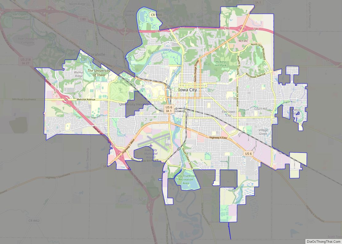
Iowa City Road Map
Iowa City city Satellite Map
Geography
Iowa City is located in eastern Iowa, along the Iowa River, on Interstate 80, approximately 60 miles (97 km) west of the Quad Cities (Davenport and Bettendorf, Iowa, and Moline and Rock Island, Illinois).
According to the United States Census Bureau, the city has a total area of 25.28 square miles (65.47 km), of which 25.01 square miles (64.78 km) is land and 0.27 square miles (0.70 km) is water.
The elevation at the Iowa City Municipal Airport is 668 ft (203.6 m) above sea level.
Iowa City has a humid continental climate, hot-summer subtype (Dfa in the Köppen climate classification). Average monthly temperatures range from about 22.8 °F (−5.1 °C) in January to 75.8 °F (24.3 °C) in July. Average monthly precipitation is lowest in winter and peaks significantly from May to August, with June being the average wettest month. Showers and thunderstorms are common from May to September, and can be severe, especially from May to July. In winter, snowfall is moderate, occasionally heavy in single storms. Snow cover is occasional in drier and/or warmer winter seasons, but (rarely) can be continuous in the coldest seasons, such as that of 1978–79. The Iowa City area was struck by a severe hailstorm on May 18, 1997, and by tornadoes on April 13, 2006. Overall, Iowa City’s tornado risk is lower than that of areas to the south and southwest, such as Oklahoma, Kansas and Missouri.
See also
Map of Iowa State and its subdivision:- Adair
- Adams
- Allamakee
- Appanoose
- Audubon
- Benton
- Black Hawk
- Boone
- Bremer
- Buchanan
- Buena Vista
- Butler
- Calhoun
- Carroll
- Cass
- Cedar
- Cerro Gordo
- Cherokee
- Chickasaw
- Clarke
- Clay
- Clayton
- Clinton
- Crawford
- Dallas
- Davis
- Decatur
- Delaware
- Des Moines
- Dickinson
- Dubuque
- Emmet
- Fayette
- Floyd
- Franklin
- Fremont
- Greene
- Grundy
- Guthrie
- Hamilton
- Hancock
- Hardin
- Harrison
- Henry
- Howard
- Humboldt
- Ida
- Iowa
- Jackson
- Jasper
- Jefferson
- Johnson
- Jones
- Keokuk
- Kossuth
- Lee
- Linn
- Louisa
- Lucas
- Lyon
- Madison
- Mahaska
- Marion
- Marshall
- Mills
- Mitchell
- Monona
- Monroe
- Montgomery
- Muscatine
- O'Brien
- Osceola
- Page
- Palo Alto
- Plymouth
- Pocahontas
- Polk
- Pottawattamie
- Poweshiek
- Ringgold
- Sac
- Scott
- Shelby
- Sioux
- Story
- Tama
- Taylor
- Union
- Van Buren
- Wapello
- Warren
- Washington
- Wayne
- Webster
- Winnebago
- Winneshiek
- Woodbury
- Worth
- Wright
- Alabama
- Alaska
- Arizona
- Arkansas
- California
- Colorado
- Connecticut
- Delaware
- District of Columbia
- Florida
- Georgia
- Hawaii
- Idaho
- Illinois
- Indiana
- Iowa
- Kansas
- Kentucky
- Louisiana
- Maine
- Maryland
- Massachusetts
- Michigan
- Minnesota
- Mississippi
- Missouri
- Montana
- Nebraska
- Nevada
- New Hampshire
- New Jersey
- New Mexico
- New York
- North Carolina
- North Dakota
- Ohio
- Oklahoma
- Oregon
- Pennsylvania
- Rhode Island
- South Carolina
- South Dakota
- Tennessee
- Texas
- Utah
- Vermont
- Virginia
- Washington
- West Virginia
- Wisconsin
- Wyoming
