Larchwood is a city in Lyon County, Iowa, United States. The population was 926 at the time of the 2020 census.
| Name: | Larchwood city |
|---|---|
| LSAD Code: | 25 |
| LSAD Description: | city (suffix) |
| State: | Iowa |
| County: | Lyon County |
| Elevation: | 1,476 ft (450 m) |
| Total Area: | 1.04 sq mi (2.69 km²) |
| Land Area: | 1.04 sq mi (2.69 km²) |
| Water Area: | 0.00 sq mi (0.00 km²) |
| Total Population: | 926 |
| Population Density: | 892.96/sq mi (344.85/km²) |
| ZIP code: | 51241 |
| Area code: | 712 |
| FIPS code: | 1943410 |
| GNISfeature ID: | 0458230 |
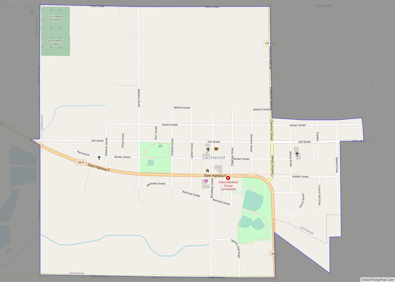
Online Interactive Map
Click on ![]() to view map in "full screen" mode.
to view map in "full screen" mode.
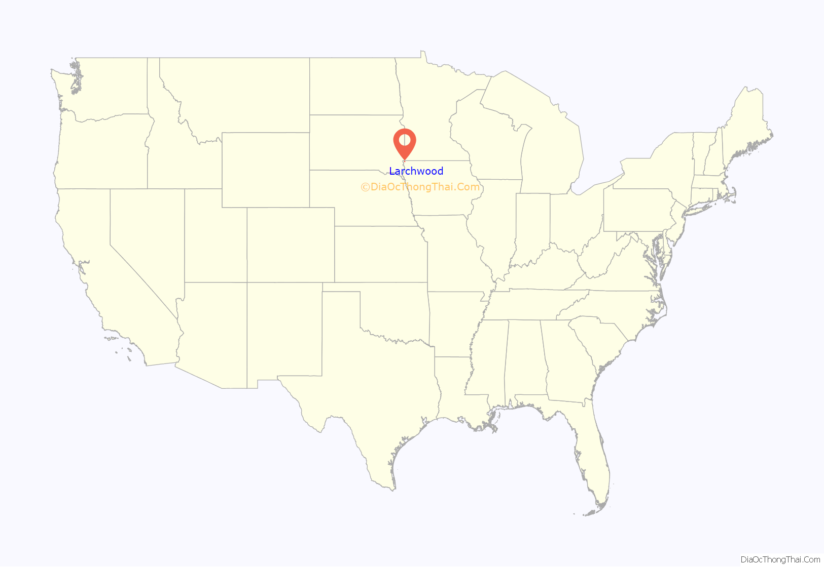
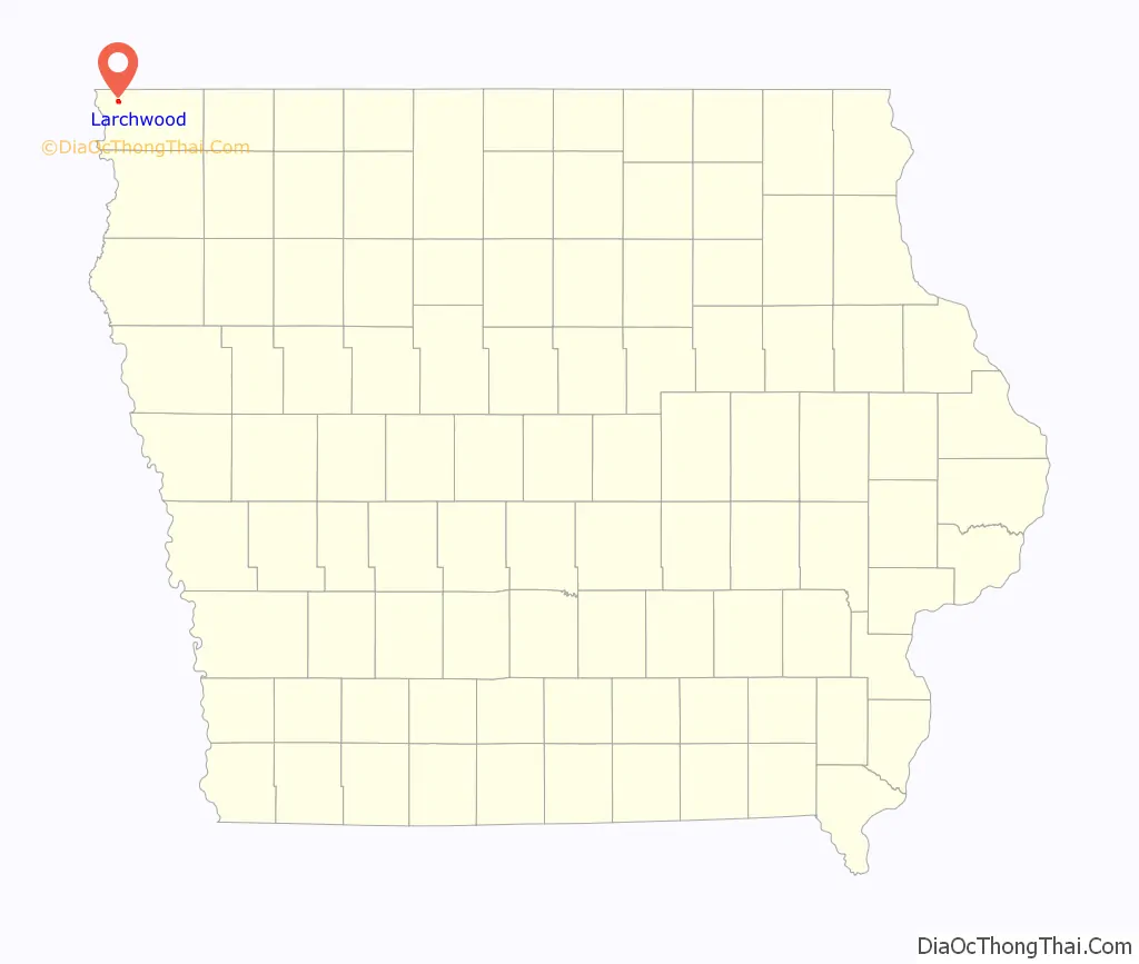
Larchwood location map. Where is Larchwood city?
History
Larchwood was founded circa 1872 by a group of McLean County, Illinois land developers: Jesse W. Fell (10 November 1808 – 25 February 1887) and Charles W. Holder (25 September 1819 – 10 April 1900). Fell was born in Pennsylvania, had settled in Bloomington, Illinois, in 1831 and had played an active role in founding many Illinois towns, including Clinton, Normal, Pontiac, and Towanda. He was a close friend of Abraham Lincoln, and with his brother Kersey Fell had persuaded Lincoln to write his famous autography. He was nationally known for his love of trees. Holder was a partner in many of Fell’s projects, including Towanda and Normal. Holder, Illinois was named in his honor. In the summer of 1869, Fell traveled to northwestern Iowa and selected a tract of about forty sections, more than 25,000 acres (100 km) of land. Fell wrote, “I have never beheld such a large body of surpassingly beautiful prairie as is here to be found. There is absolutely no waste of land, and scarce a quarter of a section not affording an admirable building site.” Holder then entered the land. Larchwood was established at the center of their holdings. Fell frequently visited the site and in May 1873 and personally supervised the planting of some 100,000 saplings and tree cuttings. The town did not grow as rapidly as expected, and in 1881 the development was sold to an Englishman, Richard Sykes.
Larchwood Road Map
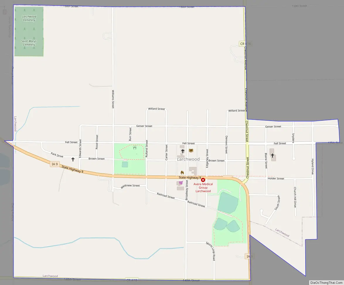
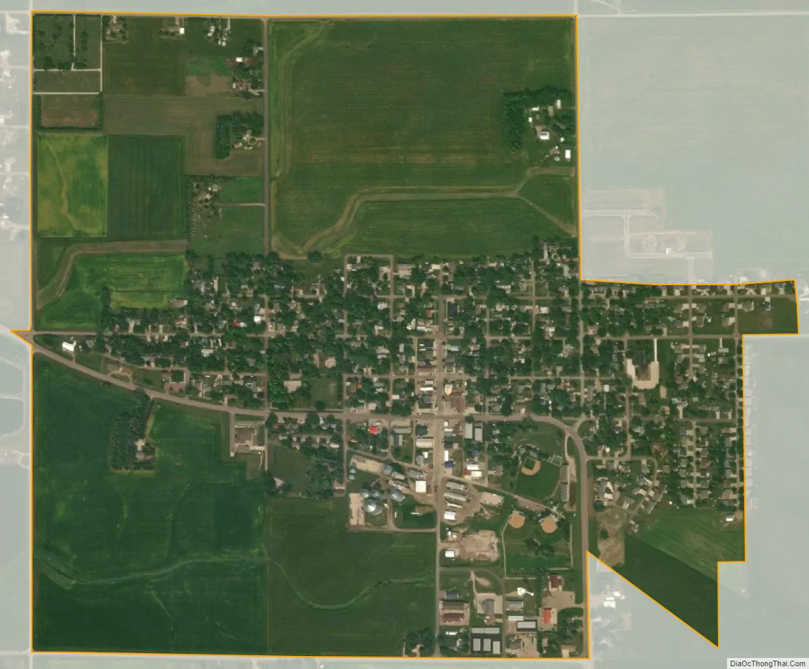
Larchwood city Satellite Map
Geography
Larchwood’s latitude and longitude coordinates in decimal form are 43.454351, -96.434897 respectively. It is the northwesternmost community in Iowa and the most distant from the capitol, Des Moines. According to the United States Census Bureau, the city has a total area of 0.99 square miles (2.56 km), all land.
See also
Map of Iowa State and its subdivision:- Adair
- Adams
- Allamakee
- Appanoose
- Audubon
- Benton
- Black Hawk
- Boone
- Bremer
- Buchanan
- Buena Vista
- Butler
- Calhoun
- Carroll
- Cass
- Cedar
- Cerro Gordo
- Cherokee
- Chickasaw
- Clarke
- Clay
- Clayton
- Clinton
- Crawford
- Dallas
- Davis
- Decatur
- Delaware
- Des Moines
- Dickinson
- Dubuque
- Emmet
- Fayette
- Floyd
- Franklin
- Fremont
- Greene
- Grundy
- Guthrie
- Hamilton
- Hancock
- Hardin
- Harrison
- Henry
- Howard
- Humboldt
- Ida
- Iowa
- Jackson
- Jasper
- Jefferson
- Johnson
- Jones
- Keokuk
- Kossuth
- Lee
- Linn
- Louisa
- Lucas
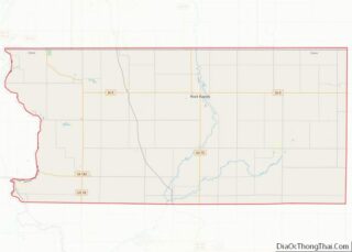
- Lyon
- Madison
- Mahaska
- Marion
- Marshall
- Mills
- Mitchell
- Monona
- Monroe
- Montgomery
- Muscatine
- O'Brien
- Osceola
- Page
- Palo Alto
- Plymouth
- Pocahontas
- Polk
- Pottawattamie
- Poweshiek
- Ringgold
- Sac
- Scott
- Shelby
- Sioux
- Story
- Tama
- Taylor
- Union
- Van Buren
- Wapello
- Warren
- Washington
- Wayne
- Webster
- Winnebago
- Winneshiek
- Woodbury
- Worth
- Wright
- Alabama
- Alaska
- Arizona
- Arkansas
- California
- Colorado
- Connecticut
- Delaware
- District of Columbia
- Florida
- Georgia
- Hawaii
- Idaho
- Illinois
- Indiana
- Iowa
- Kansas
- Kentucky
- Louisiana
- Maine
- Maryland
- Massachusetts
- Michigan
- Minnesota
- Mississippi
- Missouri
- Montana
- Nebraska
- Nevada
- New Hampshire
- New Jersey
- New Mexico
- New York
- North Carolina
- North Dakota
- Ohio
- Oklahoma
- Oregon
- Pennsylvania
- Rhode Island
- South Carolina
- South Dakota
- Tennessee
- Texas
- Utah
- Vermont
- Virginia
- Washington
- West Virginia
- Wisconsin
- Wyoming