Bloomington is a city in and the county seat of McLean County, Illinois, United States. It is adjacent to the town of Normal, and is the more populous of the two principal municipalities of the Bloomington–Normal metropolitan area. Bloomington is 135 miles (217 km) southwest of Chicago and 162 miles (261 km) northeast of St. Louis. The 2020 census showed the city had a population of 78,680, making it the 13th-most populated city in Illinois and the fifth-most populous outside the Chicago Metropolitan Area. Combined with Normal, the twin cities have a population of roughly 130,000. The Bloomington area is home to Illinois Wesleyan University and Illinois State University. It also serves as the headquarters for State Farm Insurance and Country Financial.
| Name: | Bloomington city |
|---|---|
| LSAD Code: | 25 |
| LSAD Description: | city (suffix) |
| State: | Illinois |
| County: | McLean County |
| Founded: | 1831 |
| Incorporated: | 1831 |
| Elevation: | 840 ft (260 m) |
| Land Area: | 27.12 sq mi (70.24 km²) |
| Water Area: | 0.12 sq mi (0.32 km²) |
| Population Density: | 2,901.29/sq mi (1,120.18/km²) |
| Area code: | 309 |
| FIPS code: | 1706613 |
| Website: | www.cityblm.org |
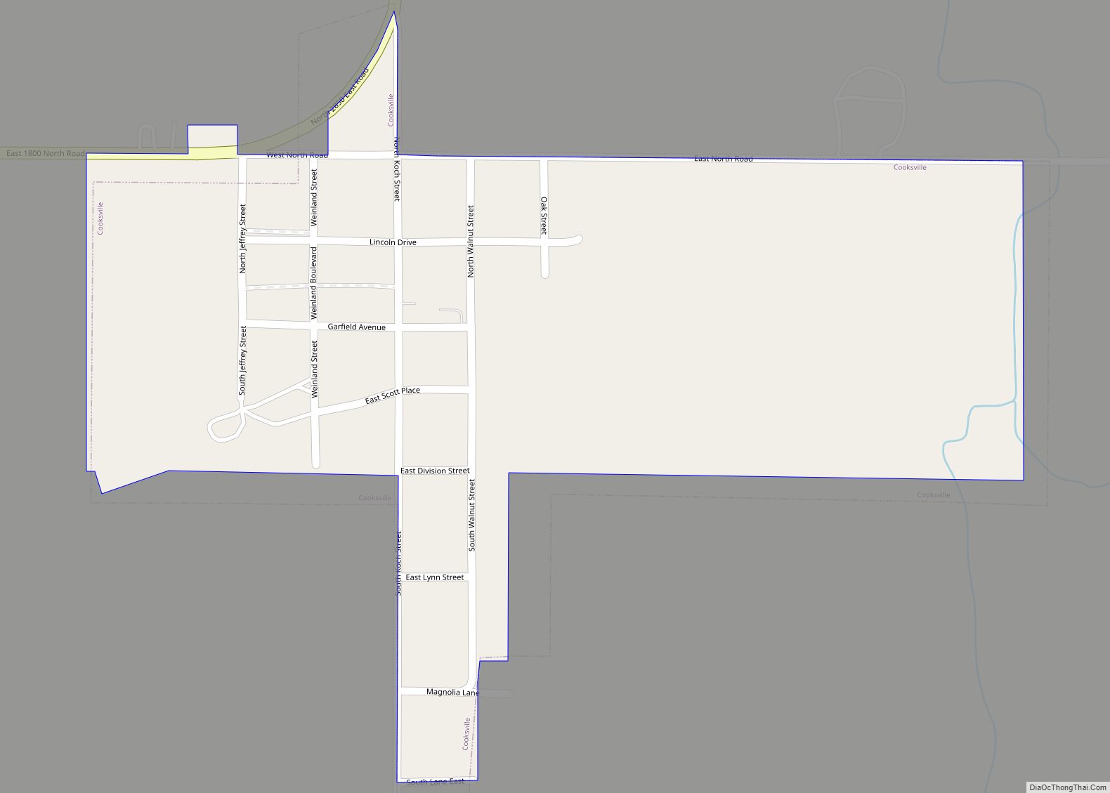
Online Interactive Map
Click on ![]() to view map in "full screen" mode.
to view map in "full screen" mode.
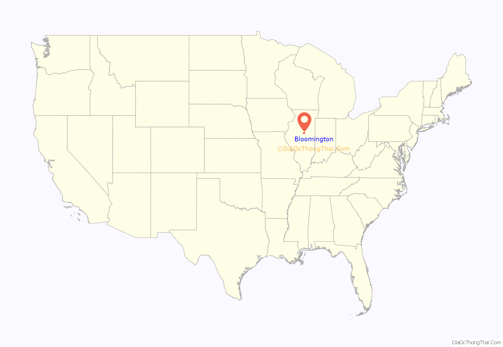
Bloomington location map. Where is Bloomington city?
History
The Bloomington area was at the edge of a large grove occupied by the Kickapoo people before the first Euro-American settlers arrived in the early 1820s. Springing from the settlement of Keg Grove, later called Blooming Grove, Bloomington was named as county seat on December 25, 1830, when McLean County was created.
When the County of McLean was incorporated, a county seat was established, but the legislation stated the site of Bloomington “would be located later.” James Allin, one of the new county’s promoters, offered to donate 60 acres (240,000 m) of his land for the new town. His offer was accepted, and Bloomington was laid out. Its lots were sold at a well-attended and noisy auction on July 4, 1831. At this time there were few roads, but rich soils brought new farmers who began commerce by conducting their business in the county. People came from all over to trade and do business at the town’s center, known today as Downtown Bloomington, including Abraham Lincoln, who worked as a lawyer in nearby Springfield. Prominent Bloomington resident Jesse W. Fell, who founded the Bloomington Pantagraph and was most prominent in local real estate, had suggested the Lincoln-Douglas debates in 1854 and played a prominent role in pushing Lincoln to run for president.
In 1900, an officer on patrol discovered a fire in a laundry across the street from the old city hall and police station. He sounded the alarm but the fire destroyed most the downtown, especially the areas north and east of the courthouse. The burnt area was quickly rebuilt from the designs of local architects George Miller and Paul O. Moratz.
During the first two decades of the 20th century, Bloomington continued to grow. Agriculture, the construction of highways and railroads, and the growth of the insurance business (mainly State Farm Insurance) all influenced the growth of Bloomington and its downtown. The downtown area became a regional shopping center attracting trade from adjoining counties. Labor unions grew in strength.
In 1997, Judy Markowitz was elected as the city’s first female and Jewish mayor. During her two terms as mayor, an arena was built in downtown Bloomington and the city’s performing arts center began restoration. Bloomington also approved a gay rights ordinance in 2002. In 2021, Mboka Mwilambwe was elected as the city’s first black mayor.
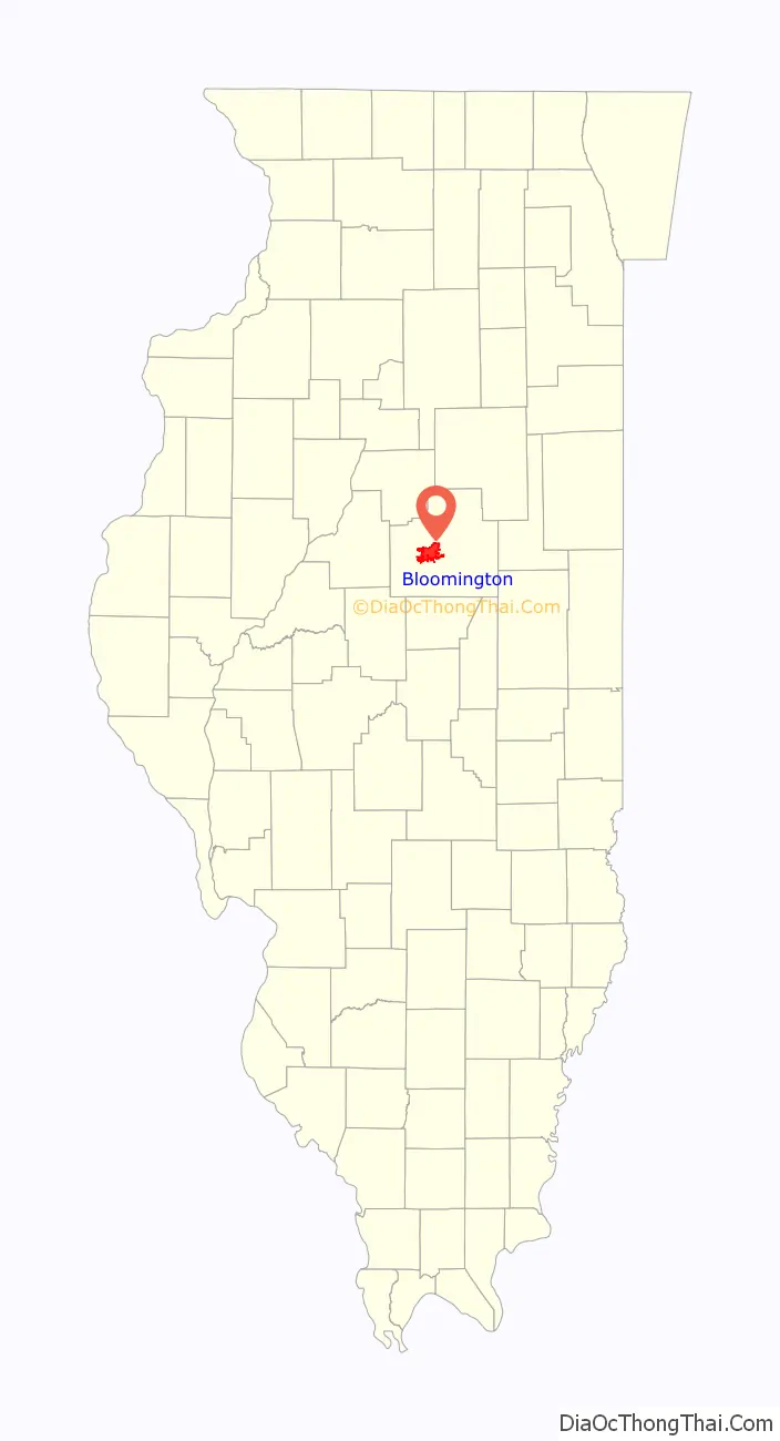
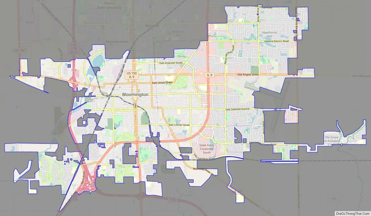
Bloomington Road Map
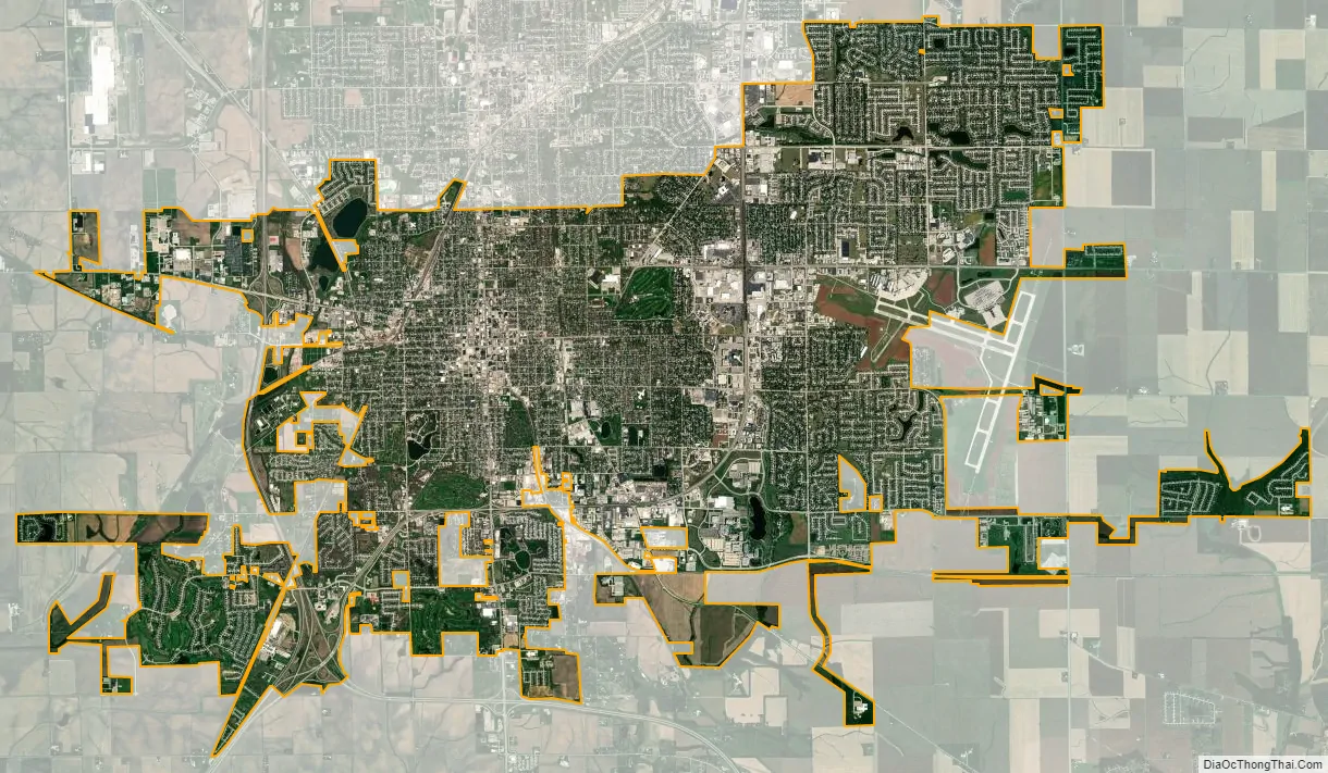
Bloomington city Satellite Map
Geography
Bloomington is located at 40°29′03″N 88°59′37″W. The city is at an elevation of 797 feet (243 m) above sea level. According to the 2010 census, Bloomington has an area of 27.229 square miles (70.52 km), of which 27.22 square miles (70.50 km) (99.97%) is land and 0.009 square miles (0.02 km) (0.03%) is water.
See also
Map of Illinois State and its subdivision:- Adams
- Alexander
- Bond
- Boone
- Brown
- Bureau
- Calhoun
- Carroll
- Cass
- Champaign
- Christian
- Clark
- Clay
- Clinton
- Coles
- Cook
- Crawford
- Cumberland
- De Kalb
- De Witt
- Douglas
- Dupage
- Edgar
- Edwards
- Effingham
- Fayette
- Ford
- Franklin
- Fulton
- Gallatin
- Greene
- Grundy
- Hamilton
- Hancock
- Hardin
- Henderson
- Henry
- Iroquois
- Jackson
- Jasper
- Jefferson
- Jersey
- Jo Daviess
- Johnson
- Kane
- Kankakee
- Kendall
- Knox
- La Salle
- Lake
- Lake Michigan
- Lawrence
- Lee
- Livingston
- Logan
- Macon
- Macoupin
- Madison
- Marion
- Marshall
- Mason
- Massac
- McDonough
- McHenry
- McLean
- Menard
- Mercer
- Monroe
- Montgomery
- Morgan
- Moultrie
- Ogle
- Peoria
- Perry
- Piatt
- Pike
- Pope
- Pulaski
- Putnam
- Randolph
- Richland
- Rock Island
- Saint Clair
- Saline
- Sangamon
- Schuyler
- Scott
- Shelby
- Stark
- Stephenson
- Tazewell
- Union
- Vermilion
- Wabash
- Warren
- Washington
- Wayne
- White
- Whiteside
- Will
- Williamson
- Winnebago
- Woodford
- Alabama
- Alaska
- Arizona
- Arkansas
- California
- Colorado
- Connecticut
- Delaware
- District of Columbia
- Florida
- Georgia
- Hawaii
- Idaho
- Illinois
- Indiana
- Iowa
- Kansas
- Kentucky
- Louisiana
- Maine
- Maryland
- Massachusetts
- Michigan
- Minnesota
- Mississippi
- Missouri
- Montana
- Nebraska
- Nevada
- New Hampshire
- New Jersey
- New Mexico
- New York
- North Carolina
- North Dakota
- Ohio
- Oklahoma
- Oregon
- Pennsylvania
- Rhode Island
- South Carolina
- South Dakota
- Tennessee
- Texas
- Utah
- Vermont
- Virginia
- Washington
- West Virginia
- Wisconsin
- Wyoming