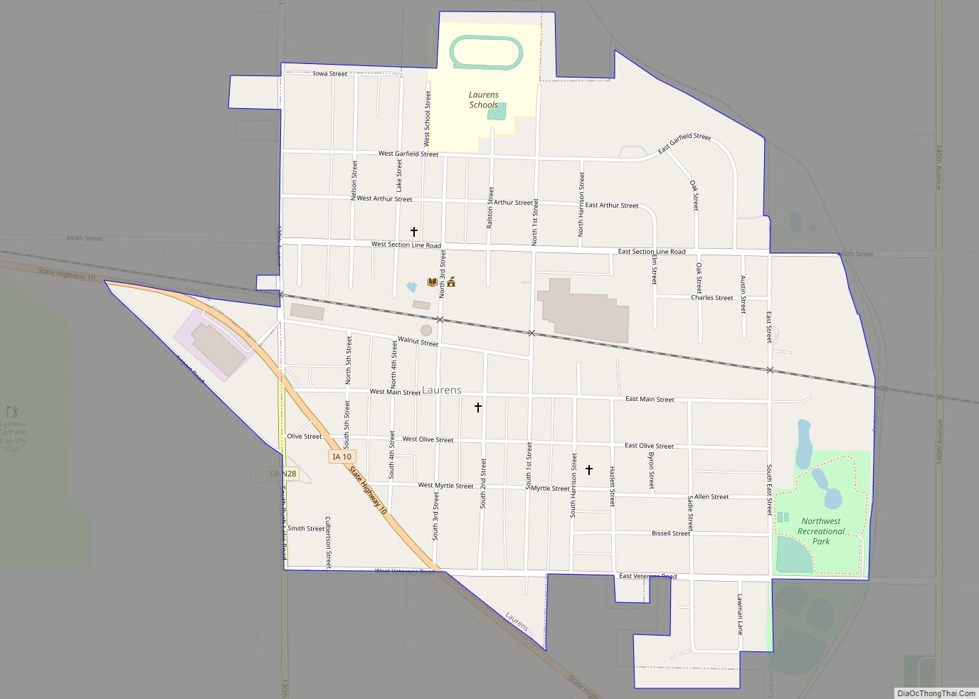
Laurens is a city in Pocahontas County, Iowa, United States. Its population was 1,264 at the 2020 census.
| Name: | Laurens city |
|---|---|
| LSAD Code: | 25 |
| LSAD Description: | city (suffix) |
| State: | Iowa |
| County: | Pocahontas County |
| Elevation: | 1,309 ft (399 m) |
| Total Area: | 0.76 sq mi (1.96 km²) |
| Land Area: | 0.76 sq mi (1.96 km²) |
| Water Area: | 0.00 sq mi (0.00 km²) |
| Total Population: | 1,264 |
| Population Density: | 1,669.75/sq mi (644.79/km²) |
| ZIP code: | 50554 |
| Area code: | 712 |
| FIPS code: | 1943725 |
| GNISfeature ID: | 0458243 |
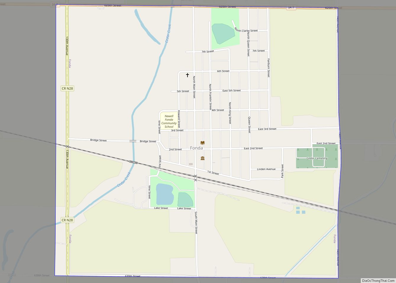
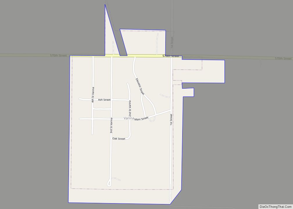
Online Interactive Map
Click on ![]() to view map in "full screen" mode.
to view map in "full screen" mode.
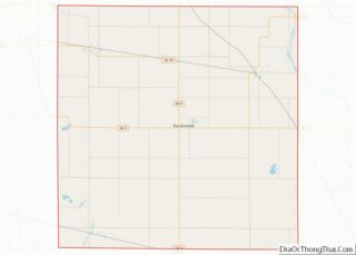
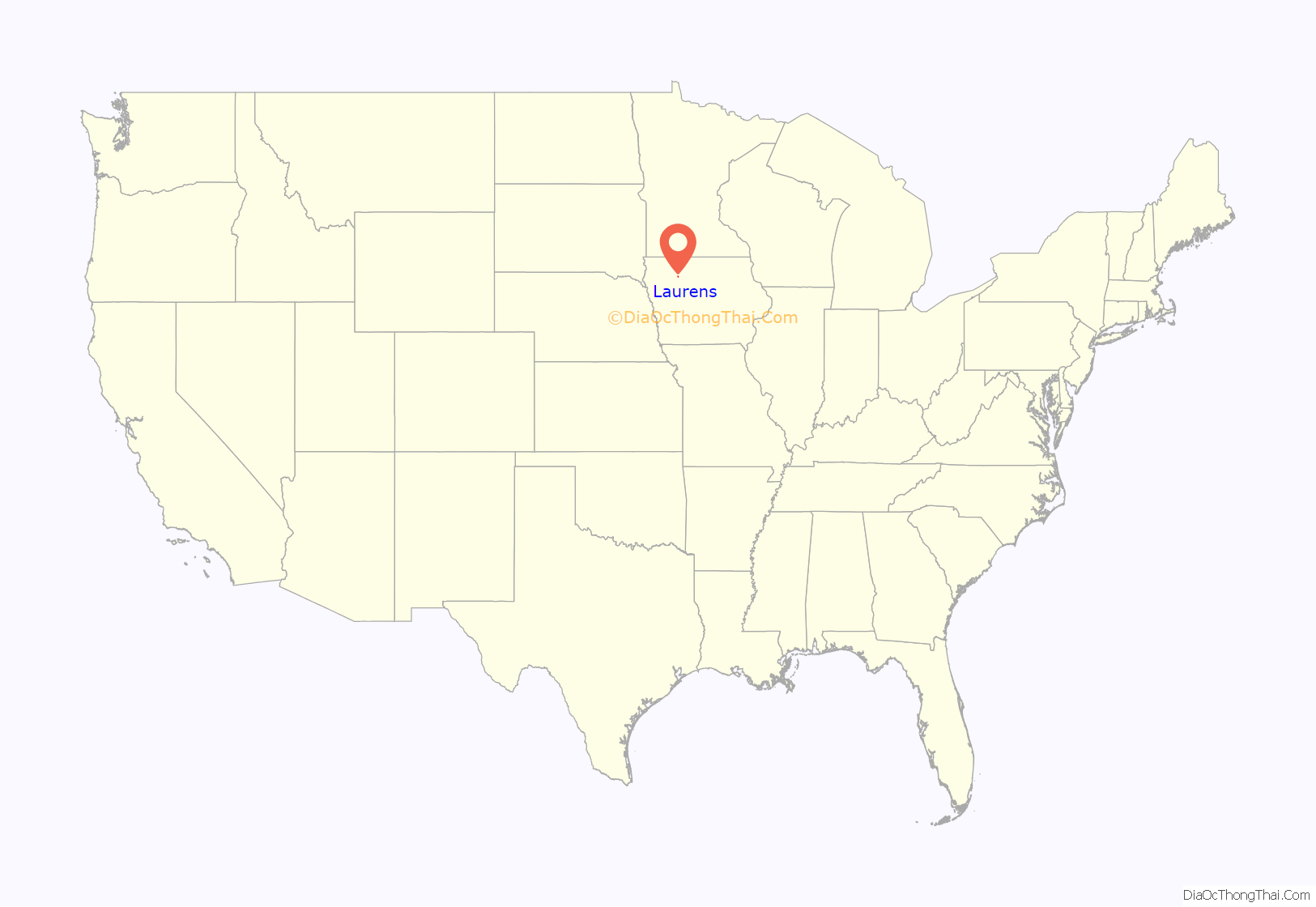
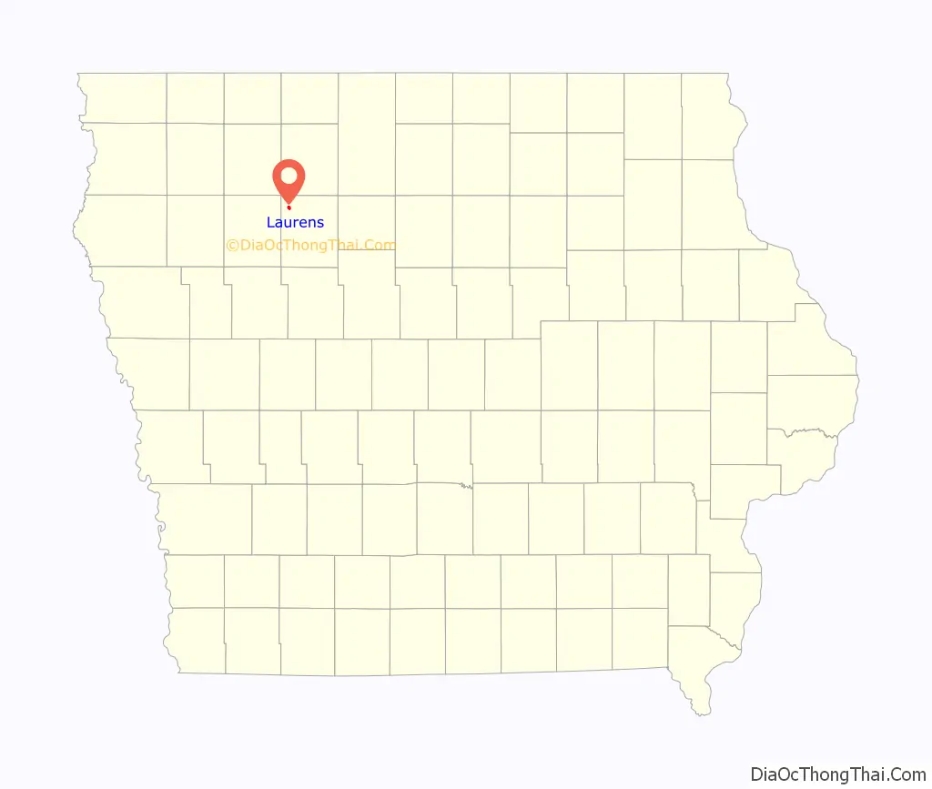
Laurens location map. Where is Laurens city?
History
Laurens was platted in 1881. It was named in honor of Henry and John Laurens, father and son, two French Huguenots who became residents of Charleston, South Carolina, and were loyal to the Colonies during the Revolution.
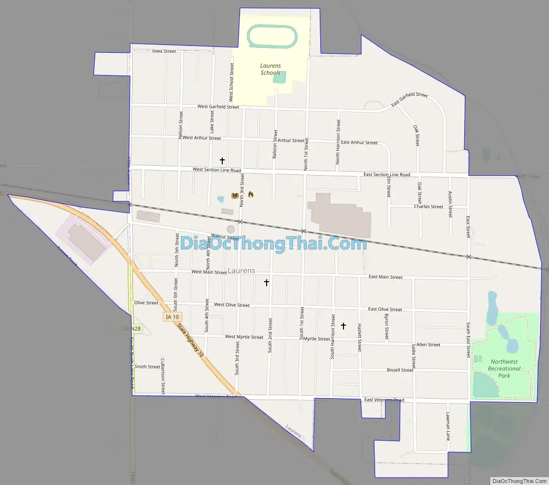
Laurens Road Map
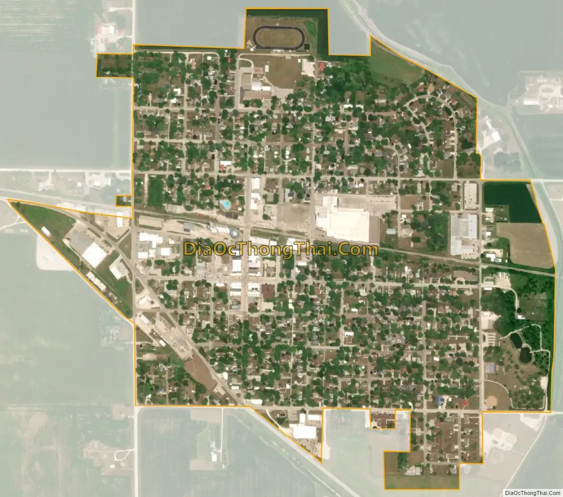
Laurens city Satellite Map
Geography
Laurens is located at 42°50′50″N 94°50′58″W / 42.84722°N 94.84944°W / 42.84722; -94.84944 (42.847105, -94.849542).
According to the United States Census Bureau, the city has a total area of 0.73 square miles (1.89 km), all land.
See also
Map of Iowa State and its subdivision:- Adair
- Adams
- Allamakee
- Appanoose
- Audubon
- Benton
- Black Hawk
- Boone
- Bremer
- Buchanan
- Buena Vista
- Butler
- Calhoun
- Carroll
- Cass
- Cedar
- Cerro Gordo
- Cherokee
- Chickasaw
- Clarke
- Clay
- Clayton
- Clinton
- Crawford
- Dallas
- Davis
- Decatur
- Delaware
- Des Moines
- Dickinson
- Dubuque
- Emmet
- Fayette
- Floyd
- Franklin
- Fremont
- Greene
- Grundy
- Guthrie
- Hamilton
- Hancock
- Hardin
- Harrison
- Henry
- Howard
- Humboldt
- Ida
- Iowa
- Jackson
- Jasper
- Jefferson
- Johnson
- Jones
- Keokuk
- Kossuth
- Lee
- Linn
- Louisa
- Lucas
- Lyon
- Madison
- Mahaska
- Marion
- Marshall
- Mills
- Mitchell
- Monona
- Monroe
- Montgomery
- Muscatine
- O'Brien
- Osceola
- Page
- Palo Alto
- Plymouth
- Pocahontas
- Polk
- Pottawattamie
- Poweshiek
- Ringgold
- Sac
- Scott
- Shelby
- Sioux
- Story
- Tama
- Taylor
- Union
- Van Buren
- Wapello
- Warren
- Washington
- Wayne
- Webster
- Winnebago
- Winneshiek
- Woodbury
- Worth
- Wright
- Alabama
- Alaska
- Arizona
- Arkansas
- California
- Colorado
- Connecticut
- Delaware
- District of Columbia
- Florida
- Georgia
- Hawaii
- Idaho
- Illinois
- Indiana
- Iowa
- Kansas
- Kentucky
- Louisiana
- Maine
- Maryland
- Massachusetts
- Michigan
- Minnesota
- Mississippi
- Missouri
- Montana
- Nebraska
- Nevada
- New Hampshire
- New Jersey
- New Mexico
- New York
- North Carolina
- North Dakota
- Ohio
- Oklahoma
- Oregon
- Pennsylvania
- Rhode Island
- South Carolina
- South Dakota
- Tennessee
- Texas
- Utah
- Vermont
- Virginia
- Washington
- West Virginia
- Wisconsin
- Wyoming