Madrid /ˈmædrɪd/ is a city in Douglas Township, Boone County, Iowa, United States. The population was 2,802 at the time of the 2020 census. It is part of the Boone, Iowa Micropolitan Statistical Area, which is a part of the larger Ames-Boone, Iowa Combined Statistical Area.
| Name: | Madrid city |
|---|---|
| LSAD Code: | 25 |
| LSAD Description: | city (suffix) |
| State: | Iowa |
| County: | Boone County |
| Elevation: | 1,017 ft (310 m) |
| Total Area: | 1.22 sq mi (3.17 km²) |
| Land Area: | 1.22 sq mi (3.17 km²) |
| Water Area: | 0.00 sq mi (0.00 km²) |
| Total Population: | 2,802 |
| Population Density: | 2,289.22/sq mi (883.64/km²) |
| ZIP code: | 50156 |
| Area code: | 515 |
| FIPS code: | 1948450 |
| GNISfeature ID: | 0458731 |
| Website: | www.madridiowa.com www.madridiowa.org |
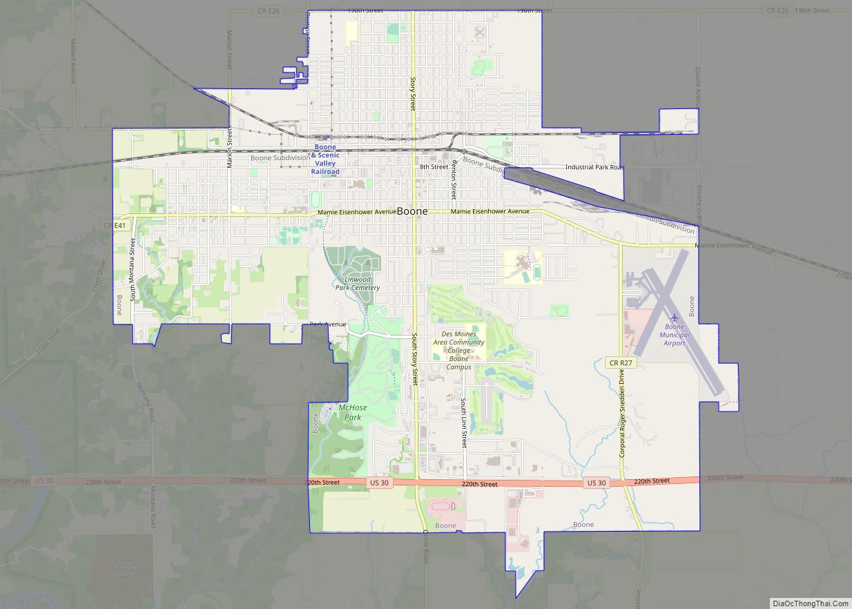
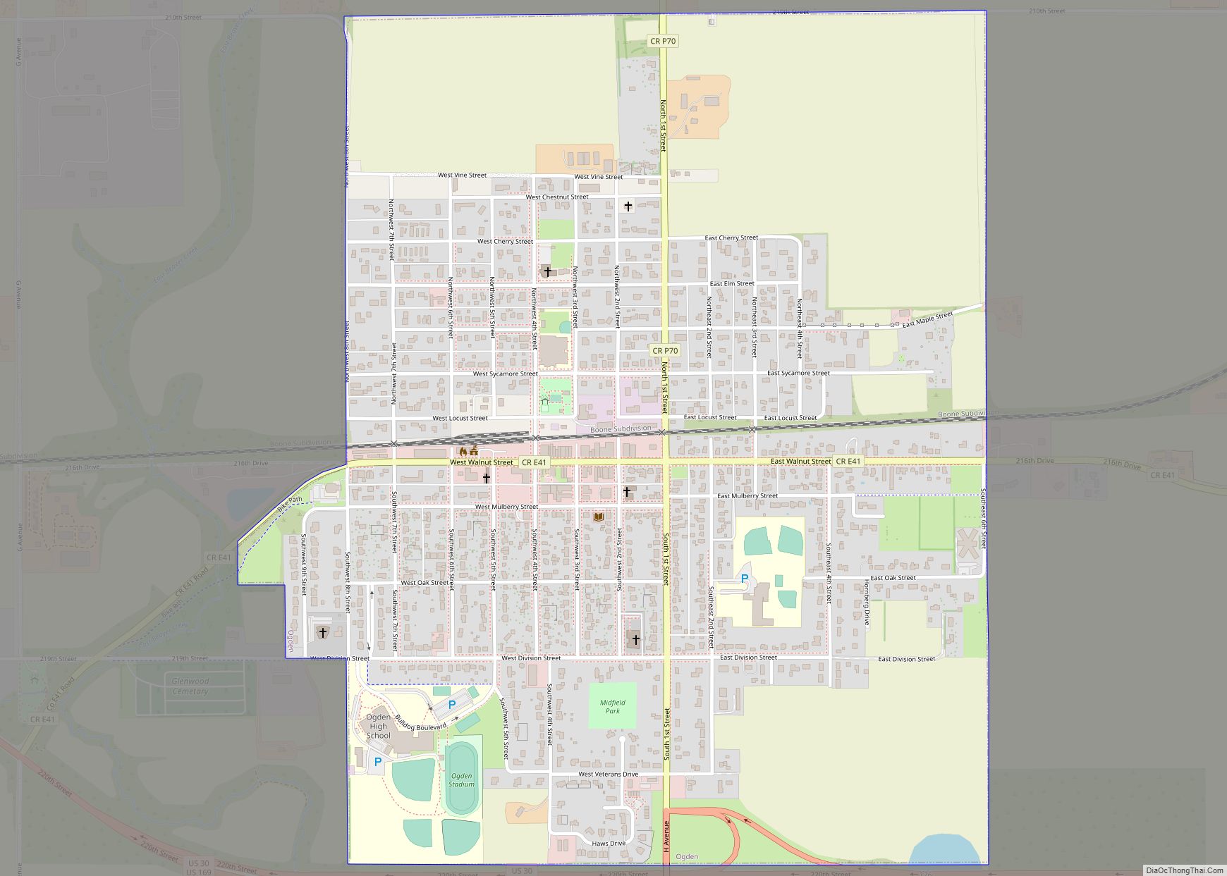
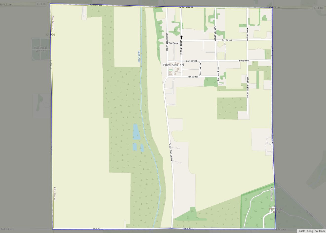
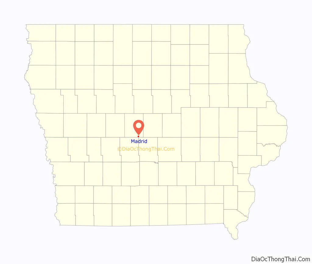
Online Interactive Map
Click on ![]() to view map in "full screen" mode.
to view map in "full screen" mode.
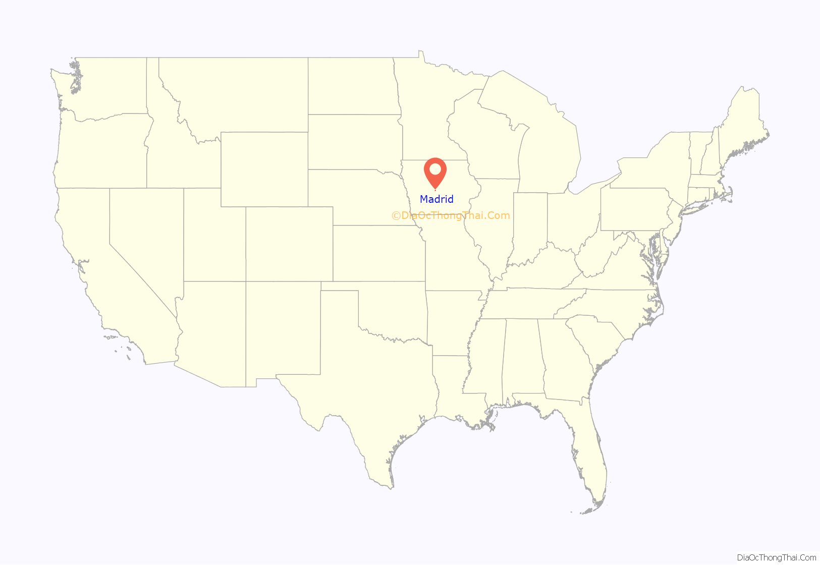
Madrid location map. Where is Madrid city?
History
Madrid was a small coal mining community during the winter and a farming community during the summer. Mining became a larger part of its economy as time went on. Initially, coal was used locally for winter heating, hence the reason for it being considered a part-time job by most residents. The Carpenter Coal Company opened a mine between Madrid and Woodward in 1901, and the Reese Brothers Coal Company opened two mine shafts near Madrid. The Carpenter Brothers named their coal camp Scandia, and changed their corporate name to match. By 1914, The Scandia Coal Company of Madrid produced over 100,000 tons of coal per year, ranking among the top 24 coal producers in the state. In 1912, Locals 709 and 2460 of the United Mine Workers union, both based in Madrid, had an aggregate membership of 397, representing about 1/3 of the total population in 1910.
Madrid gained a large Italian and Croatian population who worked in its coal mines during the 1920s and 1930s. In 2017 the town was featured in an episode of Madrid de sol a sol, a show from Spanish public channel Telemadrid exploring locations named “Madrid”. (Madrid is Spain‘s capital.)
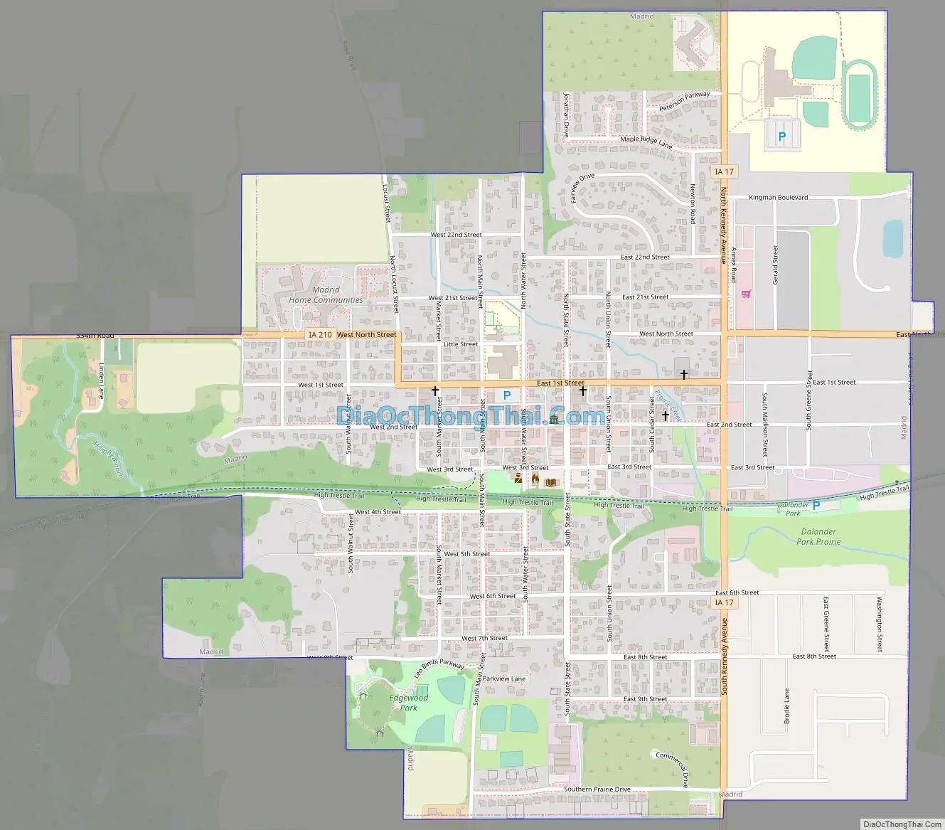
Madrid Road Map
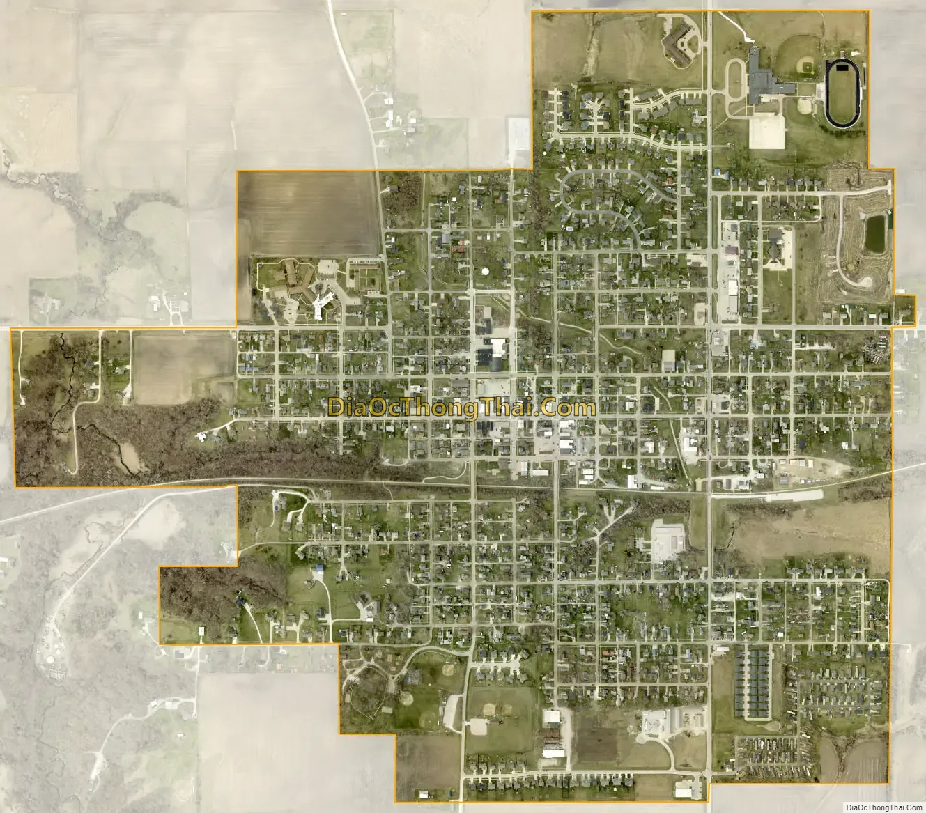
Madrid city Satellite Map
Geography
Madrid is located at 41°52′32″N 93°49′12″W / 41.87556°N 93.82000°W / 41.87556; -93.82000 (41.875435, −93.819931).
According to the United States Census Bureau, the city has a total area of 1.19 square miles (3.08 km), all land.
See also
Map of Iowa State and its subdivision:- Adair
- Adams
- Allamakee
- Appanoose
- Audubon
- Benton
- Black Hawk
- Boone
- Bremer
- Buchanan
- Buena Vista
- Butler
- Calhoun
- Carroll
- Cass
- Cedar
- Cerro Gordo
- Cherokee
- Chickasaw
- Clarke
- Clay
- Clayton
- Clinton
- Crawford
- Dallas
- Davis
- Decatur
- Delaware
- Des Moines
- Dickinson
- Dubuque
- Emmet
- Fayette
- Floyd
- Franklin
- Fremont
- Greene
- Grundy
- Guthrie
- Hamilton
- Hancock
- Hardin
- Harrison
- Henry
- Howard
- Humboldt
- Ida
- Iowa
- Jackson
- Jasper
- Jefferson
- Johnson
- Jones
- Keokuk
- Kossuth
- Lee
- Linn
- Louisa
- Lucas
- Lyon
- Madison
- Mahaska
- Marion
- Marshall
- Mills
- Mitchell
- Monona
- Monroe
- Montgomery
- Muscatine
- O'Brien
- Osceola
- Page
- Palo Alto
- Plymouth
- Pocahontas
- Polk
- Pottawattamie
- Poweshiek
- Ringgold
- Sac
- Scott
- Shelby
- Sioux
- Story
- Tama
- Taylor
- Union
- Van Buren
- Wapello
- Warren
- Washington
- Wayne
- Webster
- Winnebago
- Winneshiek
- Woodbury
- Worth
- Wright
- Alabama
- Alaska
- Arizona
- Arkansas
- California
- Colorado
- Connecticut
- Delaware
- District of Columbia
- Florida
- Georgia
- Hawaii
- Idaho
- Illinois
- Indiana
- Iowa
- Kansas
- Kentucky
- Louisiana
- Maine
- Maryland
- Massachusetts
- Michigan
- Minnesota
- Mississippi
- Missouri
- Montana
- Nebraska
- Nevada
- New Hampshire
- New Jersey
- New Mexico
- New York
- North Carolina
- North Dakota
- Ohio
- Oklahoma
- Oregon
- Pennsylvania
- Rhode Island
- South Carolina
- South Dakota
- Tennessee
- Texas
- Utah
- Vermont
- Virginia
- Washington
- West Virginia
- Wisconsin
- Wyoming