Magnolia is a city in Harrison County, Iowa, United States. The population was 190 at the time of the 2020 census.
| Name: | Magnolia city |
|---|---|
| LSAD Code: | 25 |
| LSAD Description: | city (suffix) |
| State: | Iowa |
| County: | Harrison County |
| Elevation: | 1,339 ft (408 m) |
| Total Area: | 0.61 sq mi (1.58 km²) |
| Land Area: | 0.61 sq mi (1.58 km²) |
| Water Area: | 0.00 sq mi (0.00 km²) |
| Total Population: | 190 |
| Population Density: | 311.48/sq mi (120.26/km²) |
| ZIP code: | 51550 |
| Area code: | 712 |
| FIPS code: | 1948495 |
| GNISfeature ID: | 0458733 |
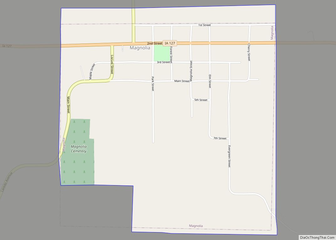
Online Interactive Map
Click on ![]() to view map in "full screen" mode.
to view map in "full screen" mode.
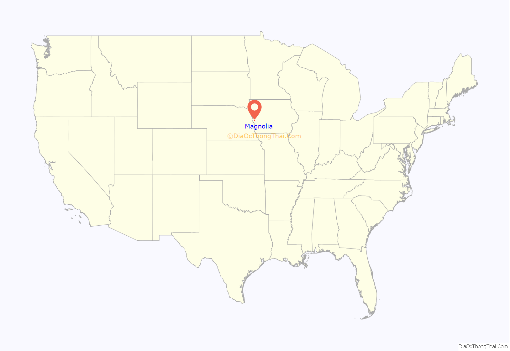
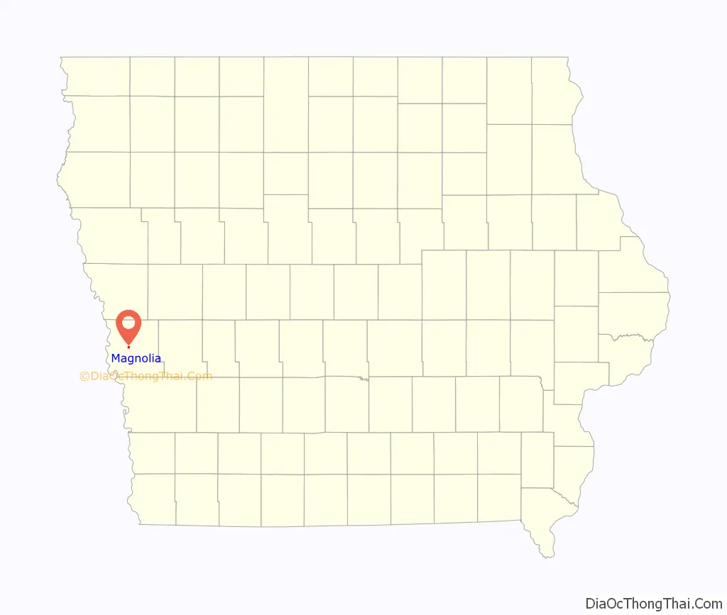
Magnolia location map. Where is Magnolia city?
History
Harrison County was established in 1851 and organized on March 7, 1853. Abram Fletcher, Charles Wolcott and A. D. Jones were appointed by the Iowa General Assembly as Commissioners to organize the county and establish a county seat. They chose the location for Magnolia and gave it its name. The third building that was erected in the town for the county courthouse in 1873 was listed on the National Register of Historic Places. The building was demolished in 2019 due to extreme disrepair and the lack of funds to maintain it.
The county seat was transferred to Logan from Magnolia in 1875.
Magnolia Road Map
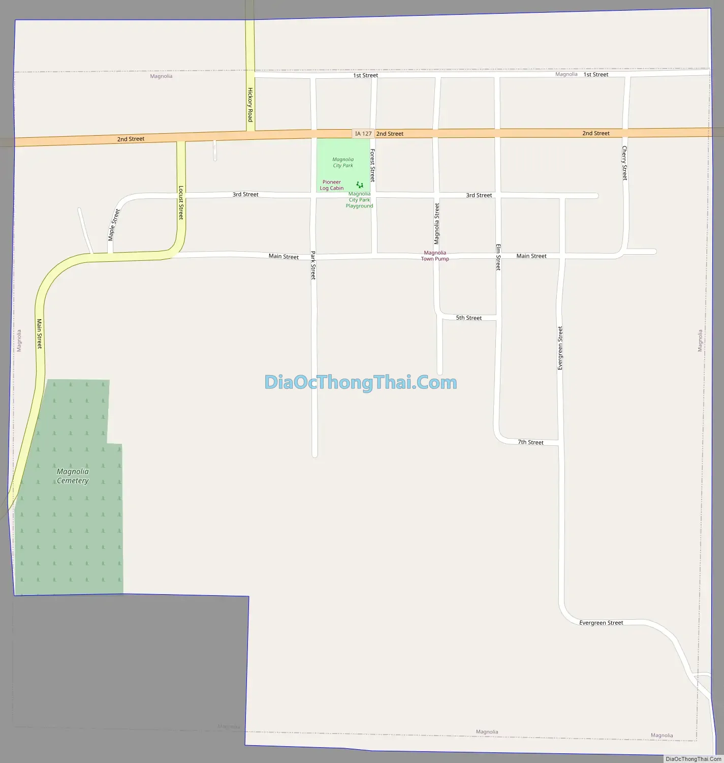
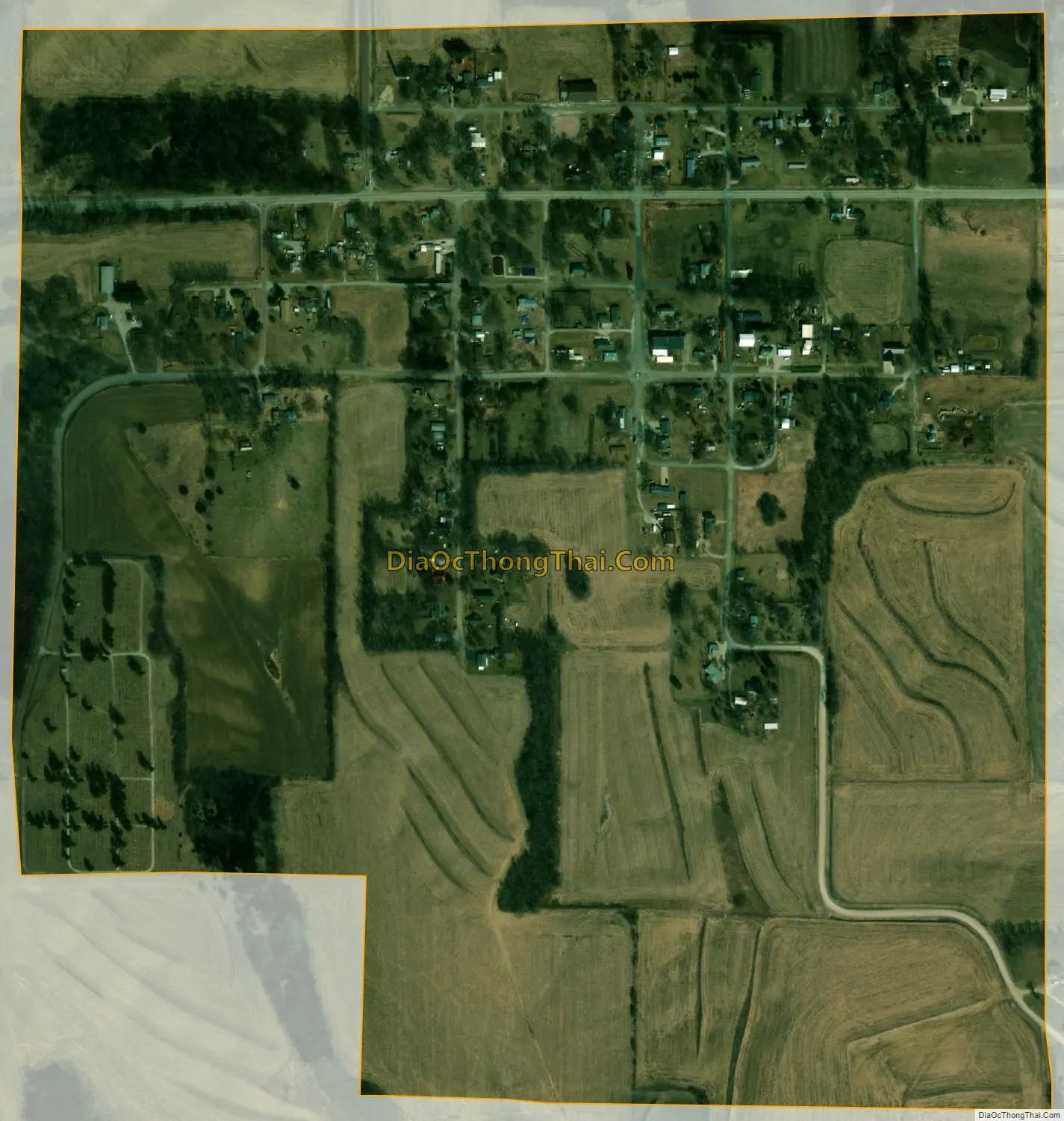
Magnolia city Satellite Map
Geography
Magnolia is located at 41°41′40″N 95°52′25″W / 41.69444°N 95.87361°W / 41.69444; -95.87361 (41.694404, -95.873516).
According to the United States Census Bureau, the city has a total area of 0.57 square miles (1.48 km), all of it land.
See also
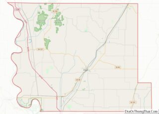
Map of Iowa State and its subdivision:- Adair
- Adams
- Allamakee
- Appanoose
- Audubon
- Benton
- Black Hawk
- Boone
- Bremer
- Buchanan
- Buena Vista
- Butler
- Calhoun
- Carroll
- Cass
- Cedar
- Cerro Gordo
- Cherokee
- Chickasaw
- Clarke
- Clay
- Clayton
- Clinton
- Crawford
- Dallas
- Davis
- Decatur
- Delaware
- Des Moines
- Dickinson
- Dubuque
- Emmet
- Fayette
- Floyd
- Franklin
- Fremont
- Greene
- Grundy
- Guthrie
- Hamilton
- Hancock
- Hardin
- Harrison
- Henry
- Howard
- Humboldt
- Ida
- Iowa
- Jackson
- Jasper
- Jefferson
- Johnson
- Jones
- Keokuk
- Kossuth
- Lee
- Linn
- Louisa
- Lucas
- Lyon
- Madison
- Mahaska
- Marion
- Marshall
- Mills
- Mitchell
- Monona
- Monroe
- Montgomery
- Muscatine
- O'Brien
- Osceola
- Page
- Palo Alto
- Plymouth
- Pocahontas
- Polk
- Pottawattamie
- Poweshiek
- Ringgold
- Sac
- Scott
- Shelby
- Sioux
- Story
- Tama
- Taylor
- Union
- Van Buren
- Wapello
- Warren
- Washington
- Wayne
- Webster
- Winnebago
- Winneshiek
- Woodbury
- Worth
- Wright
- Alabama
- Alaska
- Arizona
- Arkansas
- California
- Colorado
- Connecticut
- Delaware
- District of Columbia
- Florida
- Georgia
- Hawaii
- Idaho
- Illinois
- Indiana
- Iowa
- Kansas
- Kentucky
- Louisiana
- Maine
- Maryland
- Massachusetts
- Michigan
- Minnesota
- Mississippi
- Missouri
- Montana
- Nebraska
- Nevada
- New Hampshire
- New Jersey
- New Mexico
- New York
- North Carolina
- North Dakota
- Ohio
- Oklahoma
- Oregon
- Pennsylvania
- Rhode Island
- South Carolina
- South Dakota
- Tennessee
- Texas
- Utah
- Vermont
- Virginia
- Washington
- West Virginia
- Wisconsin
- Wyoming