Maxwell is a city in Story County, Iowa, United States. The population was 859 at the time of the 2020 census. It is part of the Ames, Iowa Metropolitan Statistical Area, which is a part of the larger Ames-Boone, Iowa Combined Statistical Area.
| Name: | Maxwell city |
|---|---|
| LSAD Code: | 25 |
| LSAD Description: | city (suffix) |
| State: | Iowa |
| County: | Story County |
| Elevation: | 883 ft (269 m) |
| Total Area: | 1.09 sq mi (2.83 km²) |
| Land Area: | 1.09 sq mi (2.83 km²) |
| Water Area: | 0.00 sq mi (0.00 km²) |
| Total Population: | 859 |
| Population Density: | 786.63/sq mi (303.75/km²) |
| ZIP code: | 50161 |
| Area code: | 515 |
| FIPS code: | 1950520 |
| GNISfeature ID: | 0458863 |
| Website: | http://www.welcometomaxwell.com |
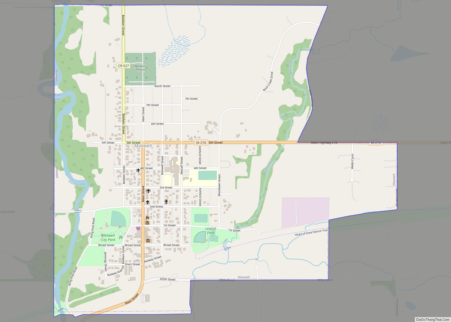
Online Interactive Map
Click on ![]() to view map in "full screen" mode.
to view map in "full screen" mode.
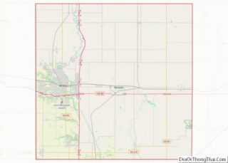
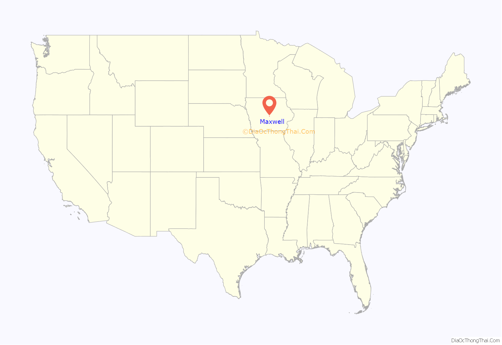
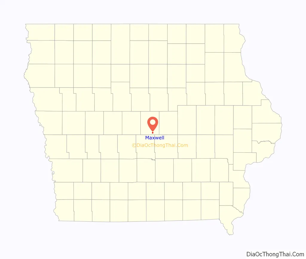
Maxwell location map. Where is Maxwell city?
History
When the Chicago, Milwaukee, and Saint Paul railways made the decision to come to the junction of the Calamus and Indian Creek valleys, the people began moving to the railroad. J. W. Maxwell and F. M. Baldwin had purchased some land near the railroad, and gave the land upon which the first town of Maxwell was platted. The town was after the donor and because he was the first to move there. Soon, large buildings were moved from Iowa Center and Peoria City to what is now the site of the town of Maxwell. The first building was the railroad depot. Several new buildings were constructed, the largest of which was occupied by the Mercantile firm of Maxwell and Baldwin and is now occupied by Logsdon’s Grocery Store.
Because of the excessive wet season and heavy snow of the winter of 1881–1882, there was a considerable flood. Both creeks, surrounding the town, were out of their banks and formed one solid body of water just south of the depot, marooning many of the construction gangs who made their headquarters that winter in Maxwell. Because they could not work on account of the interference of the water, two saloons sprang up and did a flourishing business.
Before the close of 1882, there were twelve or more business houses in town, and more under construction. By 1887, there were 40 businesses located in Maxwell.
Maxwell became incorporated in 1883, and a town election was held. The town hall was located behind the Maxwell Baldwin building. It had a cupola with a bell to ring in case of emergencies. The first church met at the lumber yard owned by J. O. French. Planks were arranged as seats. Later, the Methodist and Presbyterian churches were built.
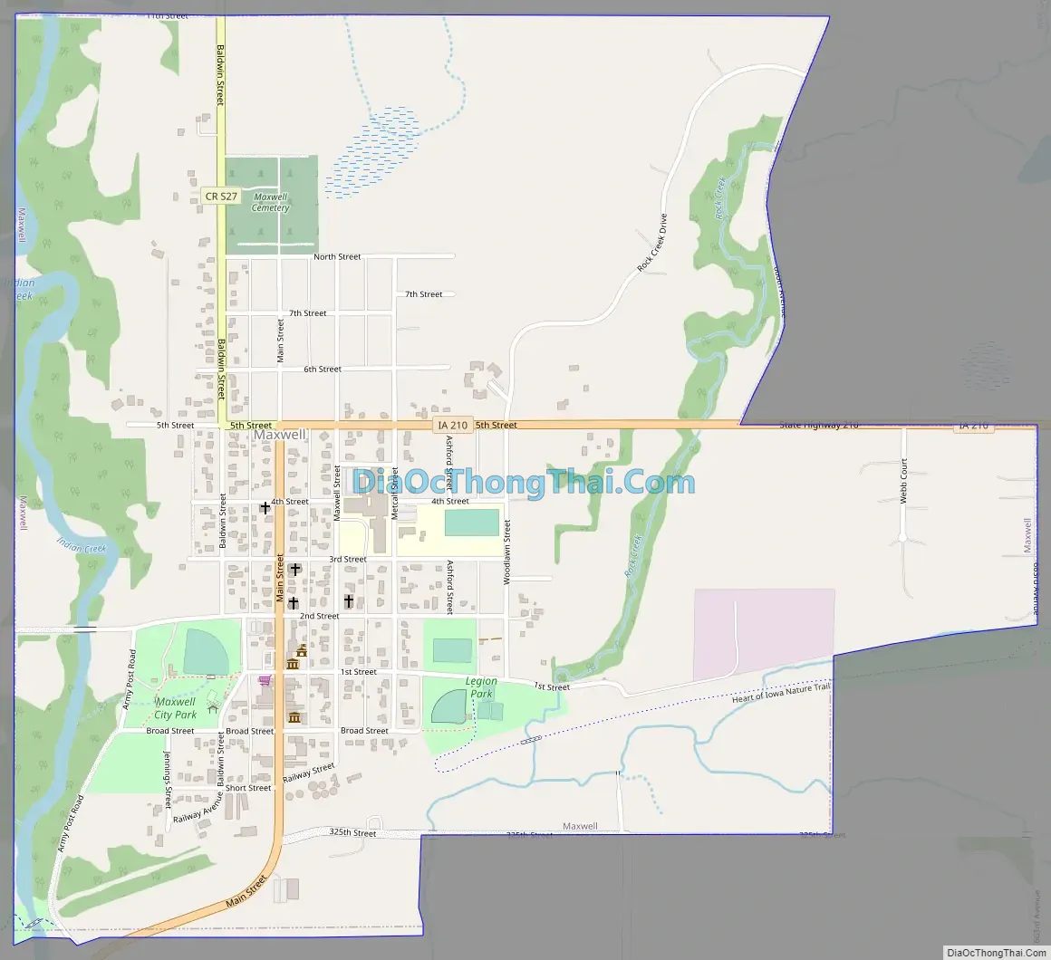
Maxwell Road Map
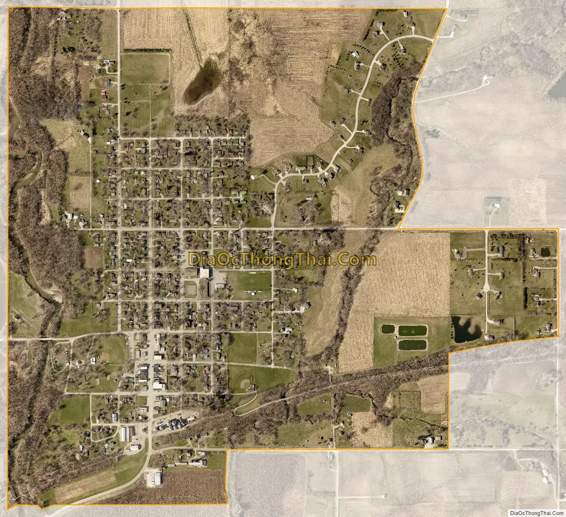
Maxwell city Satellite Map
Geography
Maxwell is located at 41°53′25″N 93°23′52″W / 41.890232°N 93.397657°W / 41.890232; -93.397657 (41.890232, -93.397657).
According to the United States Census Bureau, the city has a total area of 1.11 square miles (2.87 km), all land.
See also
Map of Iowa State and its subdivision:- Adair
- Adams
- Allamakee
- Appanoose
- Audubon
- Benton
- Black Hawk
- Boone
- Bremer
- Buchanan
- Buena Vista
- Butler
- Calhoun
- Carroll
- Cass
- Cedar
- Cerro Gordo
- Cherokee
- Chickasaw
- Clarke
- Clay
- Clayton
- Clinton
- Crawford
- Dallas
- Davis
- Decatur
- Delaware
- Des Moines
- Dickinson
- Dubuque
- Emmet
- Fayette
- Floyd
- Franklin
- Fremont
- Greene
- Grundy
- Guthrie
- Hamilton
- Hancock
- Hardin
- Harrison
- Henry
- Howard
- Humboldt
- Ida
- Iowa
- Jackson
- Jasper
- Jefferson
- Johnson
- Jones
- Keokuk
- Kossuth
- Lee
- Linn
- Louisa
- Lucas
- Lyon
- Madison
- Mahaska
- Marion
- Marshall
- Mills
- Mitchell
- Monona
- Monroe
- Montgomery
- Muscatine
- O'Brien
- Osceola
- Page
- Palo Alto
- Plymouth
- Pocahontas
- Polk
- Pottawattamie
- Poweshiek
- Ringgold
- Sac
- Scott
- Shelby
- Sioux
- Story
- Tama
- Taylor
- Union
- Van Buren
- Wapello
- Warren
- Washington
- Wayne
- Webster
- Winnebago
- Winneshiek
- Woodbury
- Worth
- Wright
- Alabama
- Alaska
- Arizona
- Arkansas
- California
- Colorado
- Connecticut
- Delaware
- District of Columbia
- Florida
- Georgia
- Hawaii
- Idaho
- Illinois
- Indiana
- Iowa
- Kansas
- Kentucky
- Louisiana
- Maine
- Maryland
- Massachusetts
- Michigan
- Minnesota
- Mississippi
- Missouri
- Montana
- Nebraska
- Nevada
- New Hampshire
- New Jersey
- New Mexico
- New York
- North Carolina
- North Dakota
- Ohio
- Oklahoma
- Oregon
- Pennsylvania
- Rhode Island
- South Carolina
- South Dakota
- Tennessee
- Texas
- Utah
- Vermont
- Virginia
- Washington
- West Virginia
- Wisconsin
- Wyoming