Moravia is a city in Appanoose County, Iowa, United States. The population was 637 at the time of the 2020 census.
| Name: | Moravia city |
|---|---|
| LSAD Code: | 25 |
| LSAD Description: | city (suffix) |
| State: | Iowa |
| County: | Appanoose County, Monroe County |
| Elevation: | 994 ft (303 m) |
| Total Area: | 1.18 sq mi (3.05 km²) |
| Land Area: | 1.18 sq mi (3.05 km²) |
| Water Area: | 0.00 sq mi (0.00 km²) |
| Total Population: | 637 |
| Population Density: | 541.67/sq mi (209.16/km²) |
| ZIP code: | 52571 |
| Area code: | 641 |
| FIPS code: | 1953985 |
| GNISfeature ID: | 0459222 |
| Website: | http://moraviaia.com |
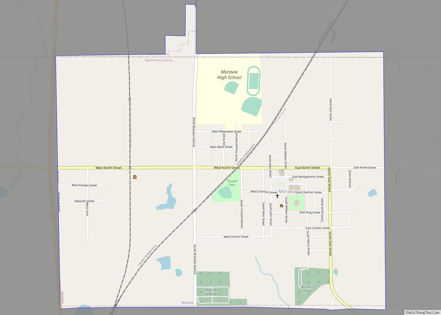
Online Interactive Map
Click on ![]() to view map in "full screen" mode.
to view map in "full screen" mode.
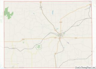
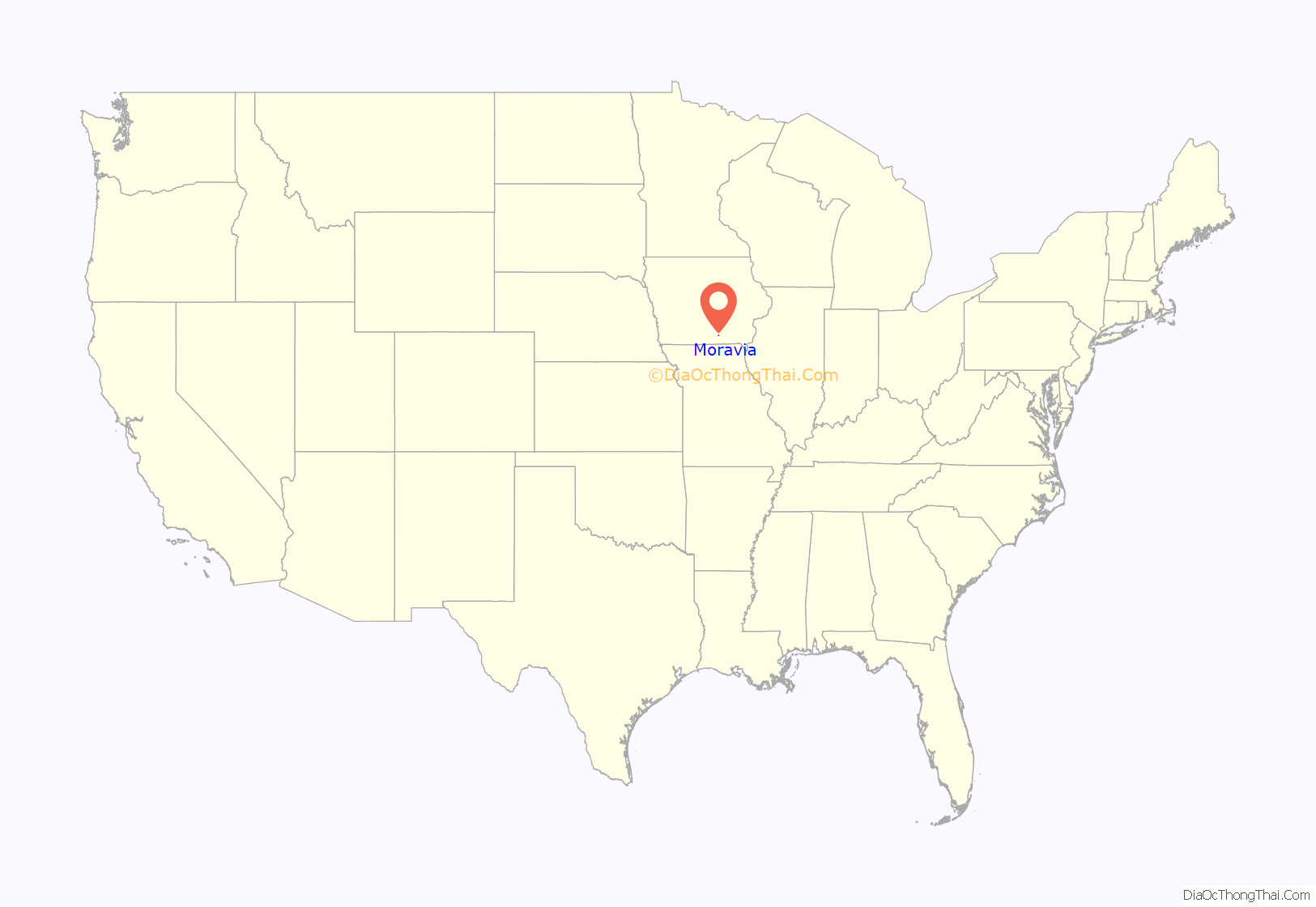
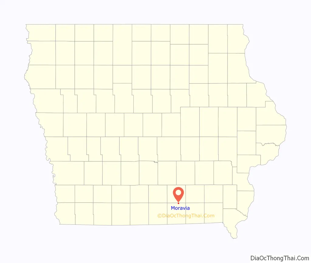
Moravia location map. Where is Moravia city?
History
Moravia is named for the religious faith. Moravian families left Salem, North Carolina in 1849 to start a colony in the west. Money was sent to purchase forty acres of land for a town site by several benevolent Moravian sisters. It was their wish that town lots be sold and the money be used to build a Moravian Church. The families made the long journey to Iowa and acquired many acres of land.
The town site of Moravia was laid out on June 27, 1850 and was recorded July 15, 1851. The surveying was done using a pocket compass and tapeline for measuring instruments. The old ridge road from Unionville, Iowa to Moravia and west to Iconium, Iowa was the Mormon Trail of 1846 from Nauvoo, Illinois to Salt Lake, Utah.
Moravia observed its sesquicentennial anniversary (150th birthday) July 4, 2001. The sesquicentennial anniversary was celebrated with a giant birthday party with events scheduled all day. A Moravian Church was built and dedicated in 1851. The early Moravian Families honored the customs of the Moravian Church, which was founded in the country of Moravia in 1597.
Several of these customs are remembered and celebrated today in Moravia’s annual events and festivals. Since the town was founded, it has experienced a rich tradition in the customs of the town’s Moravian founders. The Moravia Tour of Homes is an example of a custom founded in the country of Moravia.
Christmas time was a time for Moravians to visit their neighbors and view their colorful Christmas decorations. This custom is remembered and practiced at Christmas time each year by The Moravia Tour of Homes. Another Moravian custom relived each year at Christmas time in Moravia is the Lovefest. The love fest is a traditional religious service with music provided, usually by local talent. Moravian refreshments are served in the tradition of the early Moravians.
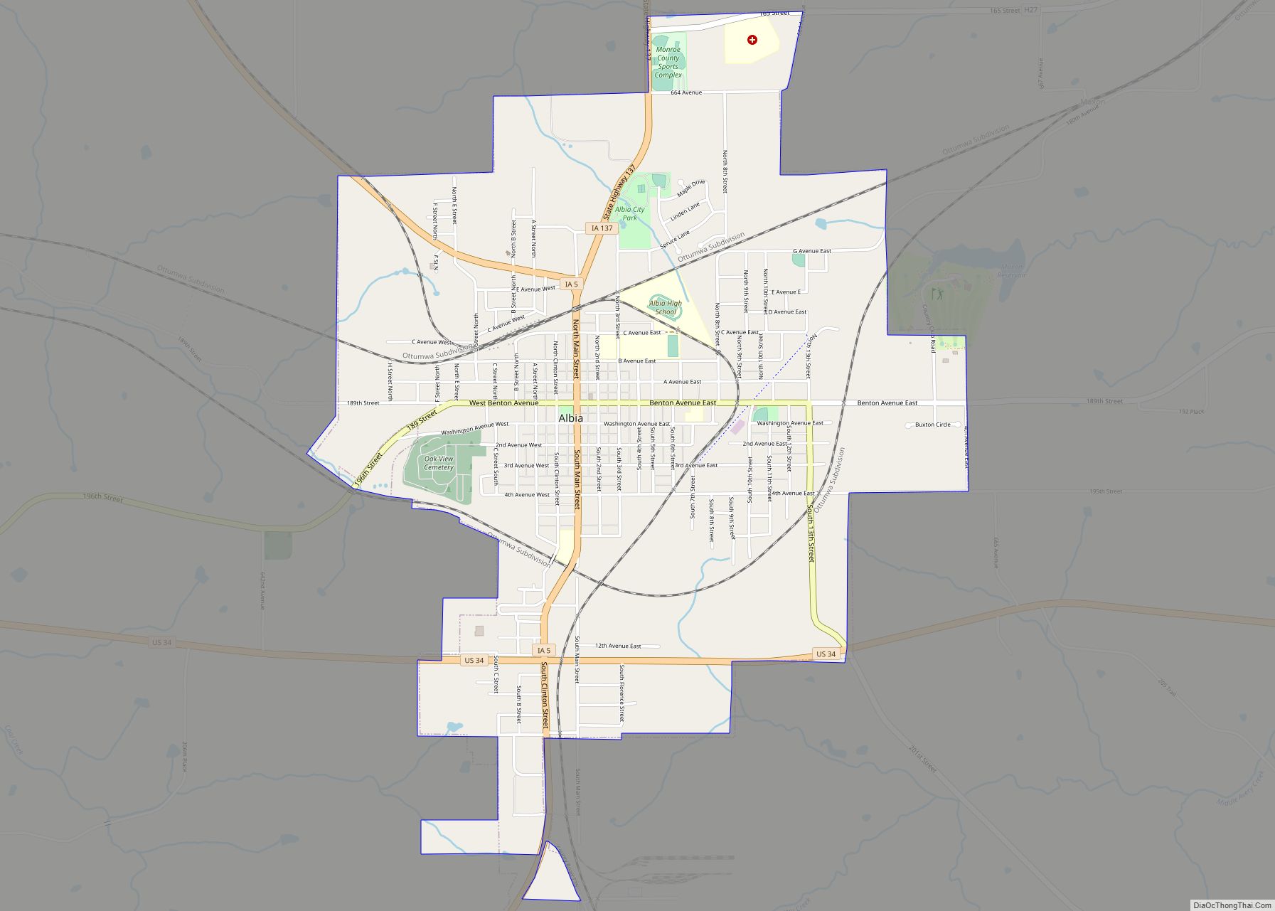
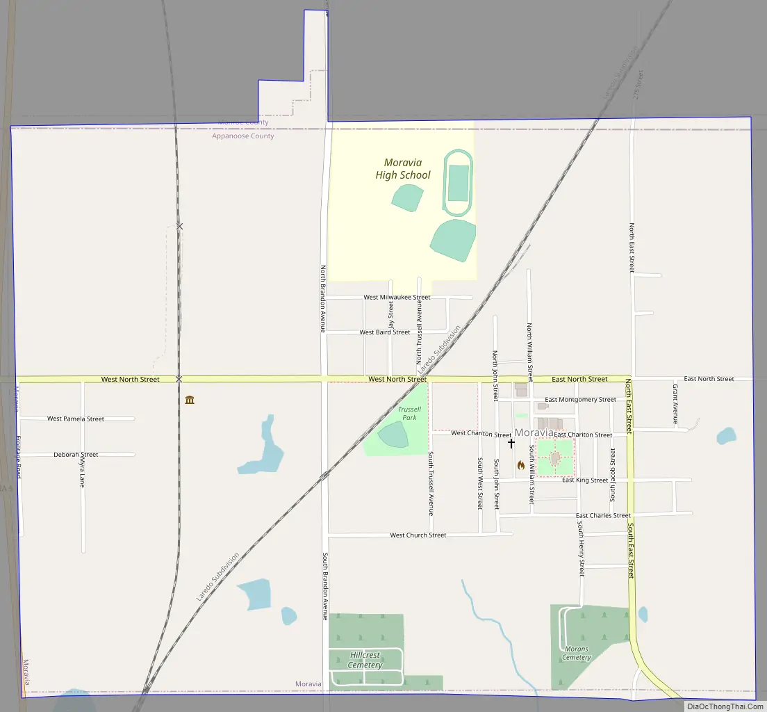
Moravia Road Map
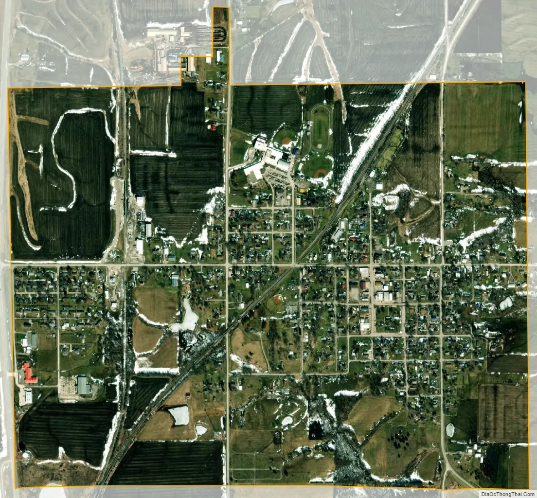
Moravia city Satellite Map
Geography
Moravia is located at 40°53′26″N 92°48′57″W / 40.89056°N 92.81583°W / 40.89056; -92.81583 (40.890621, -92.815831).
According to the United States Census Bureau, the city has a total area of 1.12 square miles (2.90 km), all land.
See also
Map of Iowa State and its subdivision:- Adair
- Adams
- Allamakee
- Appanoose
- Audubon
- Benton
- Black Hawk
- Boone
- Bremer
- Buchanan
- Buena Vista
- Butler
- Calhoun
- Carroll
- Cass
- Cedar
- Cerro Gordo
- Cherokee
- Chickasaw
- Clarke
- Clay
- Clayton
- Clinton
- Crawford
- Dallas
- Davis
- Decatur
- Delaware
- Des Moines
- Dickinson
- Dubuque
- Emmet
- Fayette
- Floyd
- Franklin
- Fremont
- Greene
- Grundy
- Guthrie
- Hamilton
- Hancock
- Hardin
- Harrison
- Henry
- Howard
- Humboldt
- Ida
- Iowa
- Jackson
- Jasper
- Jefferson
- Johnson
- Jones
- Keokuk
- Kossuth
- Lee
- Linn
- Louisa
- Lucas
- Lyon
- Madison
- Mahaska
- Marion
- Marshall
- Mills
- Mitchell
- Monona
- Monroe
- Montgomery
- Muscatine
- O'Brien
- Osceola
- Page
- Palo Alto
- Plymouth
- Pocahontas
- Polk
- Pottawattamie
- Poweshiek
- Ringgold
- Sac
- Scott
- Shelby
- Sioux
- Story
- Tama
- Taylor
- Union
- Van Buren
- Wapello
- Warren
- Washington
- Wayne
- Webster
- Winnebago
- Winneshiek
- Woodbury
- Worth
- Wright
- Alabama
- Alaska
- Arizona
- Arkansas
- California
- Colorado
- Connecticut
- Delaware
- District of Columbia
- Florida
- Georgia
- Hawaii
- Idaho
- Illinois
- Indiana
- Iowa
- Kansas
- Kentucky
- Louisiana
- Maine
- Maryland
- Massachusetts
- Michigan
- Minnesota
- Mississippi
- Missouri
- Montana
- Nebraska
- Nevada
- New Hampshire
- New Jersey
- New Mexico
- New York
- North Carolina
- North Dakota
- Ohio
- Oklahoma
- Oregon
- Pennsylvania
- Rhode Island
- South Carolina
- South Dakota
- Tennessee
- Texas
- Utah
- Vermont
- Virginia
- Washington
- West Virginia
- Wisconsin
- Wyoming