Norway is a city in Benton County, Iowa, United States. The population was 466 at the time of the 2020 census. The city is approximately 17 miles (27 km) southwest of downtown Cedar Rapids. It is part of the Cedar Rapids Metropolitan Statistical Area. Norway is the setting of the movie The Final Season.
| Name: | Norway city |
|---|---|
| LSAD Code: | 25 |
| LSAD Description: | city (suffix) |
| State: | Iowa |
| County: | Benton County |
| Founded: | 1863 |
| Elevation: | 810 ft (247 m) |
| Total Area: | 0.43 sq mi (1.12 km²) |
| Land Area: | 0.43 sq mi (1.12 km²) |
| Water Area: | 0.00 sq mi (0.00 km²) |
| Total Population: | 466 |
| Population Density: | 1,073.73/sq mi (414.44/km²) |
| ZIP code: | 52318 |
| Area code: | 319 |
| FIPS code: | 1957720 |
| GNISfeature ID: | 0459660 |
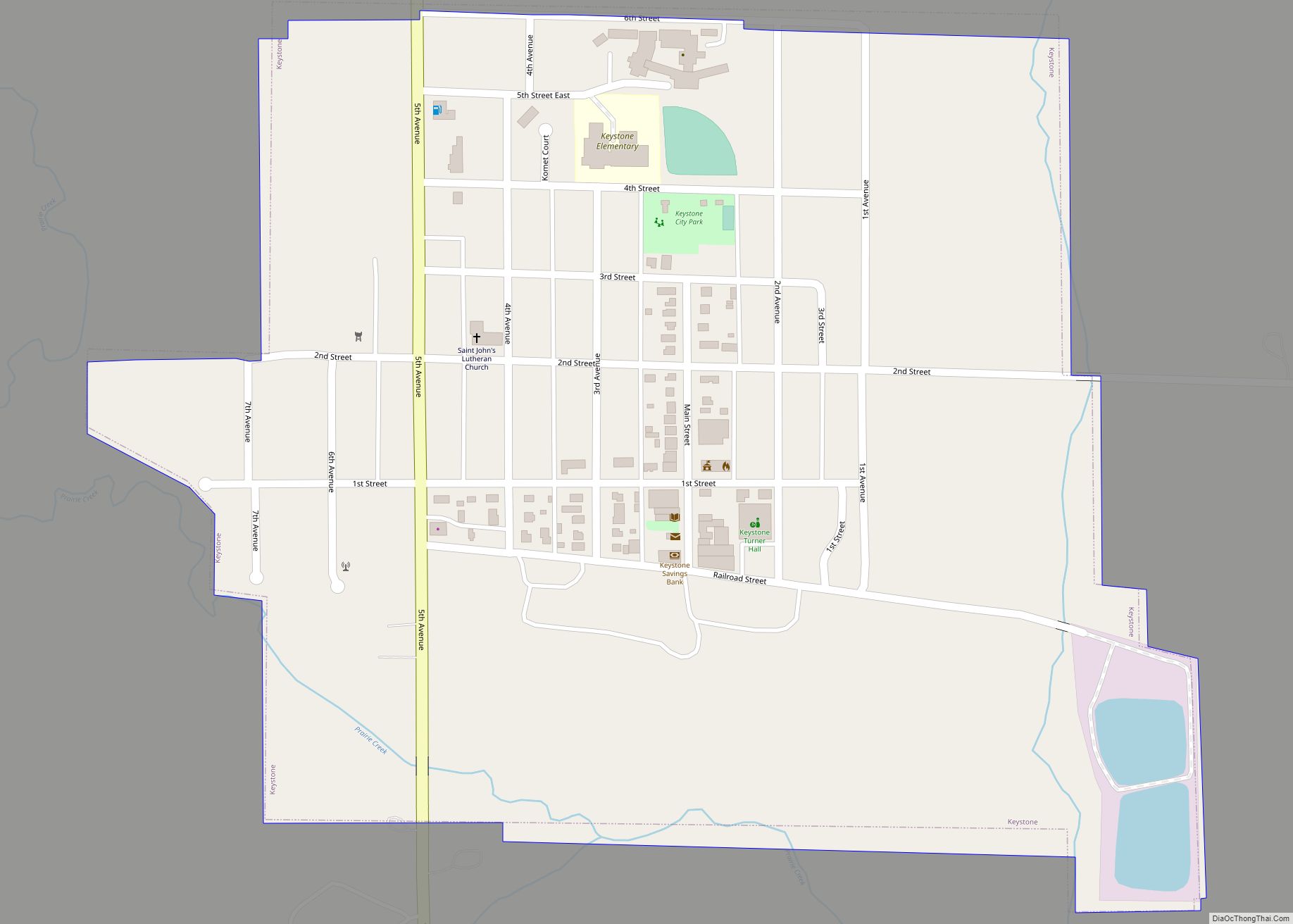
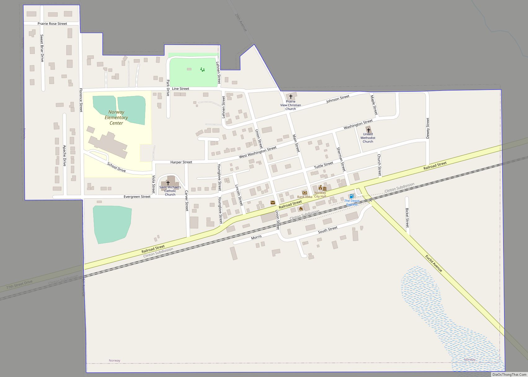
Online Interactive Map
Click on ![]() to view map in "full screen" mode.
to view map in "full screen" mode.
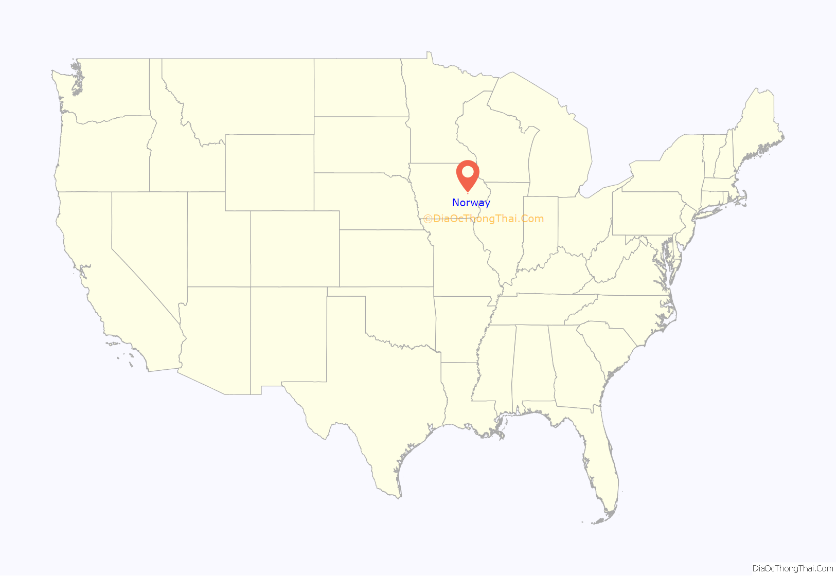
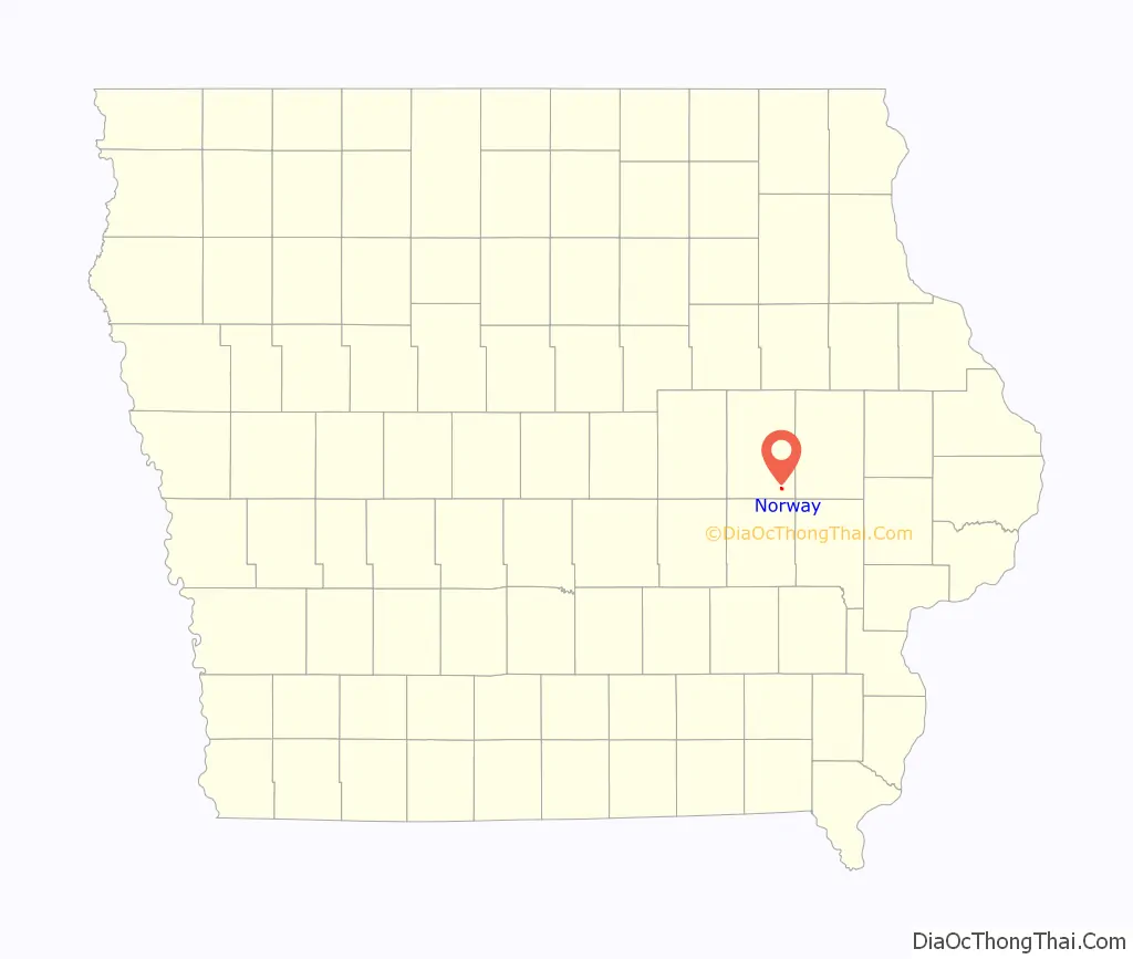
Norway location map. Where is Norway city?
History
Norway was platted in 1863 by Osman Tuttle (born Osmund Endreson Totland in Hjelmeland, Norway) two years after the Chicago and Northwestern Railway had reached this part of the county. Tuttle donated five acres of ground to the railway company with the condition that the new town should bear the name of his native country. During 1864, Tuttle laid out the town site north of the railway truck, which he had recorded as Norway.
Norway Road Map
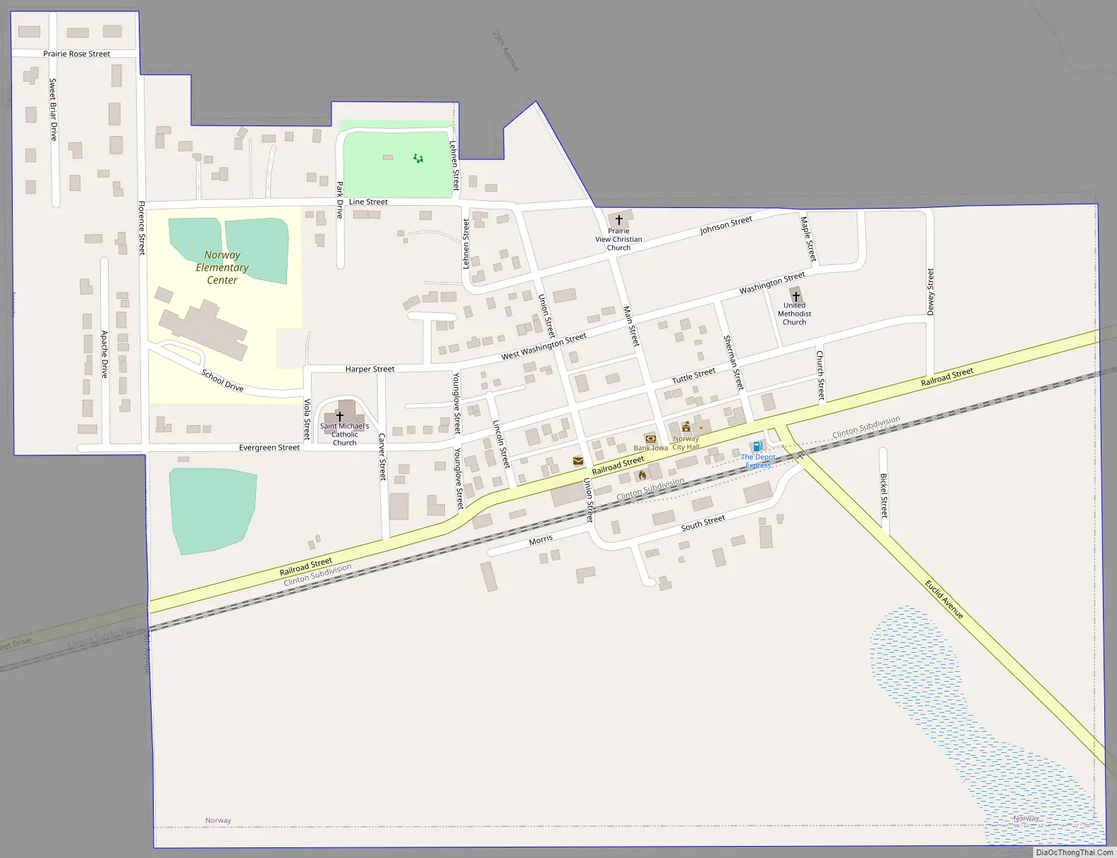
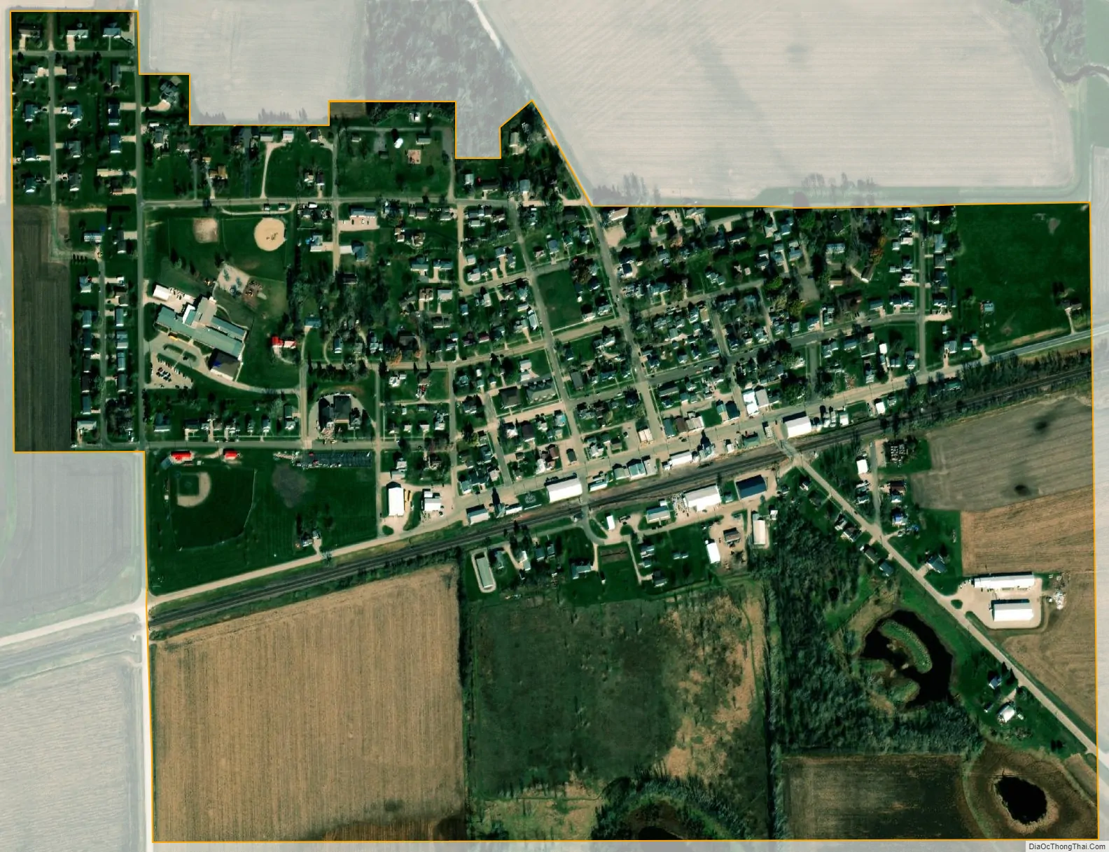
Norway city Satellite Map
Geography
According to the United States Census Bureau, the city has a total area of 0.45 square miles (1.17 km), all land.
See also
Map of Iowa State and its subdivision:- Adair
- Adams
- Allamakee
- Appanoose
- Audubon
- Benton
- Black Hawk
- Boone
- Bremer
- Buchanan
- Buena Vista
- Butler
- Calhoun
- Carroll
- Cass
- Cedar
- Cerro Gordo
- Cherokee
- Chickasaw
- Clarke
- Clay
- Clayton
- Clinton
- Crawford
- Dallas
- Davis
- Decatur
- Delaware
- Des Moines
- Dickinson
- Dubuque
- Emmet
- Fayette
- Floyd
- Franklin
- Fremont
- Greene
- Grundy
- Guthrie
- Hamilton
- Hancock
- Hardin
- Harrison
- Henry
- Howard
- Humboldt
- Ida
- Iowa
- Jackson
- Jasper
- Jefferson
- Johnson
- Jones
- Keokuk
- Kossuth
- Lee
- Linn
- Louisa
- Lucas
- Lyon
- Madison
- Mahaska
- Marion
- Marshall
- Mills
- Mitchell
- Monona
- Monroe
- Montgomery
- Muscatine
- O'Brien
- Osceola
- Page
- Palo Alto
- Plymouth
- Pocahontas
- Polk
- Pottawattamie
- Poweshiek
- Ringgold
- Sac
- Scott
- Shelby
- Sioux
- Story
- Tama
- Taylor
- Union
- Van Buren
- Wapello
- Warren
- Washington
- Wayne
- Webster
- Winnebago
- Winneshiek
- Woodbury
- Worth
- Wright
- Alabama
- Alaska
- Arizona
- Arkansas
- California
- Colorado
- Connecticut
- Delaware
- District of Columbia
- Florida
- Georgia
- Hawaii
- Idaho
- Illinois
- Indiana
- Iowa
- Kansas
- Kentucky
- Louisiana
- Maine
- Maryland
- Massachusetts
- Michigan
- Minnesota
- Mississippi
- Missouri
- Montana
- Nebraska
- Nevada
- New Hampshire
- New Jersey
- New Mexico
- New York
- North Carolina
- North Dakota
- Ohio
- Oklahoma
- Oregon
- Pennsylvania
- Rhode Island
- South Carolina
- South Dakota
- Tennessee
- Texas
- Utah
- Vermont
- Virginia
- Washington
- West Virginia
- Wisconsin
- Wyoming