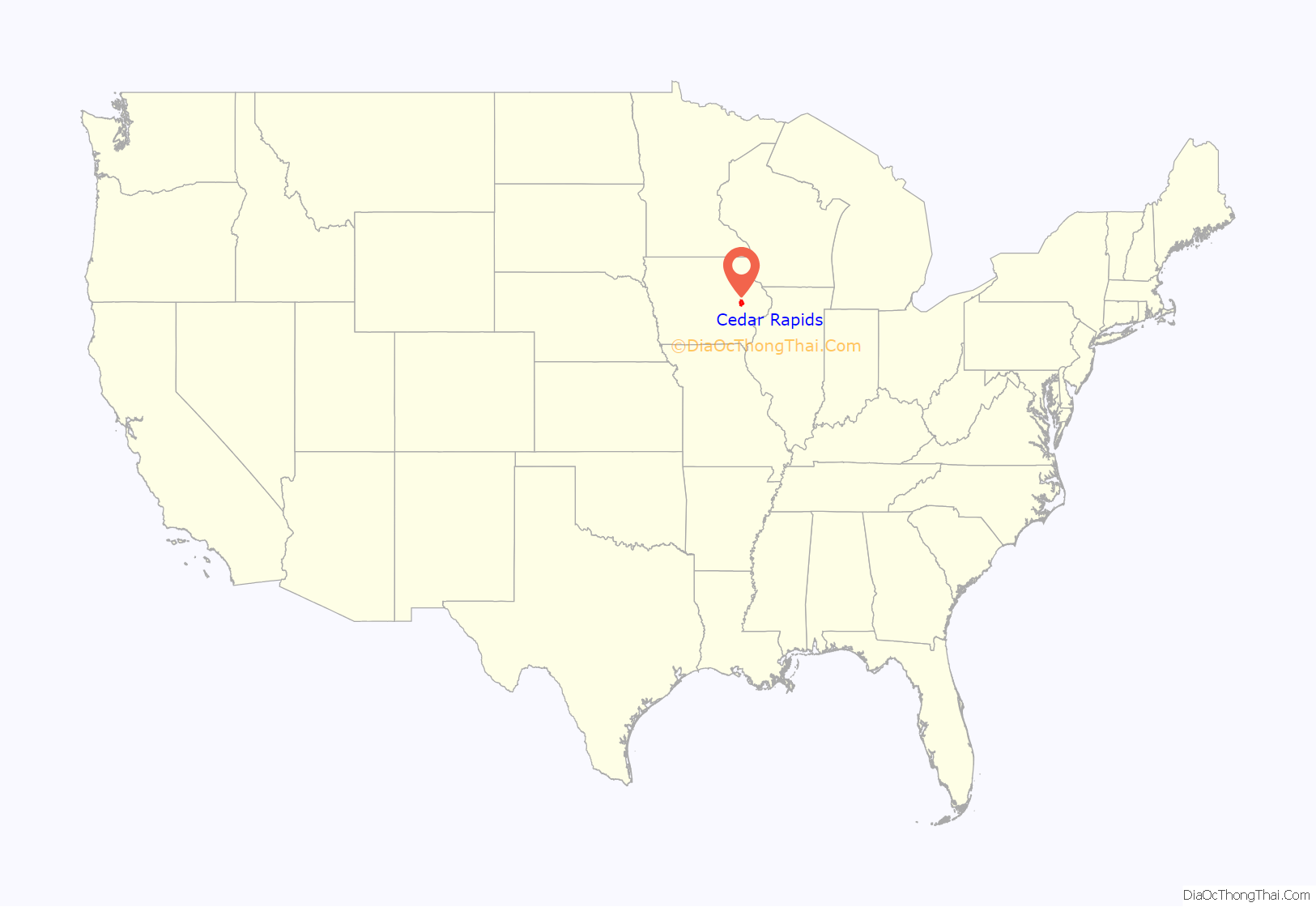
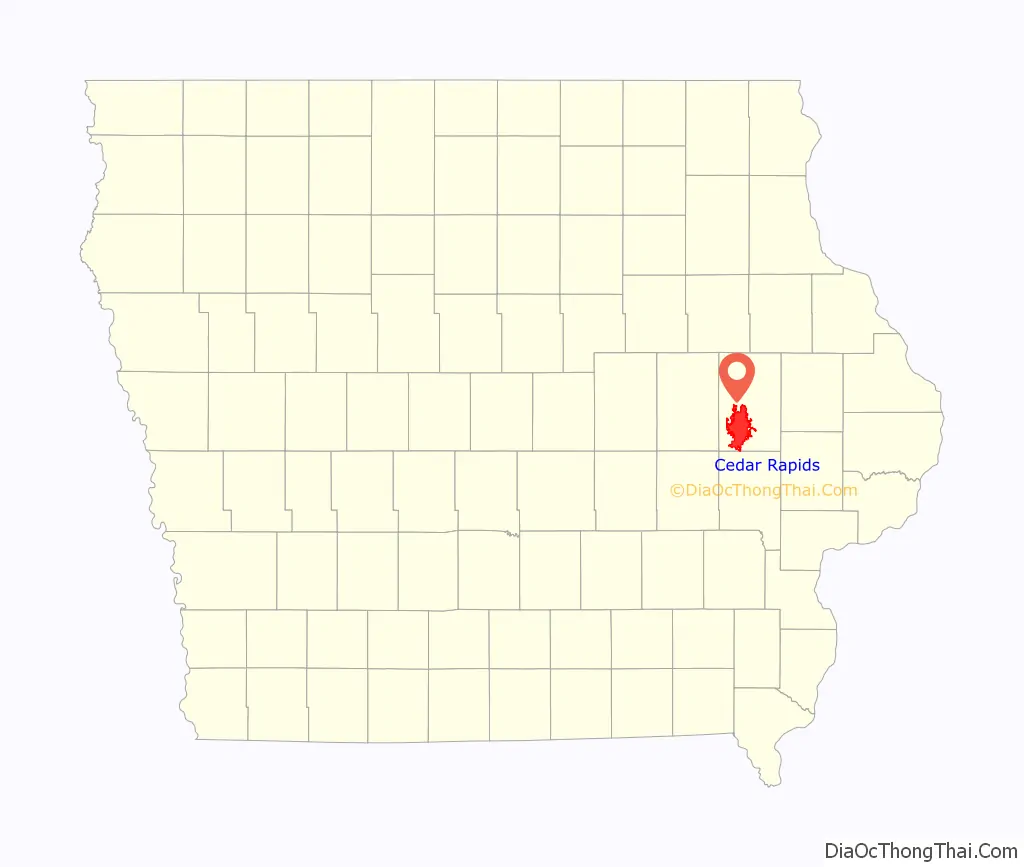
Cedar Rapids is the second-largest city in Iowa, United States and is the county seat of Linn County. The city lies on both banks of the Cedar River, 20 miles (32 km) north of Iowa City and 100 miles (160 km) northeast of Des Moines, the state’s capital and largest city. It is a part of the Cedar Rapids/Iowa City region of Eastern Iowa, which includes Linn, Benton, Cedar, Iowa, Jones, Johnson, and Washington counties.
As of the 2020 United States Census, the city population was 137,710. The estimated population of the three-county Metropolitan Statistical Area, which includes the nearby cities of Marion and Hiawatha, was 255,452 in 2008. Cedar Rapids is an economic hub of the state, located at the core of the Interstate 380 corridor. The Cedar Rapids Metropolitan Statistical Area (MSA) is also a part of a Combined Statistical Area (CSA) with the Iowa City MSA.
A flourishing center for arts and culture in Eastern Iowa, the city is home to the Cedar Rapids Museum of Art, the National Czech & Slovak Museum & Library, the Paramount Theatre, Orchestra Iowa, Theatre Cedar Rapids, the African American Museum of Iowa, and the Iowa Cultural Corridor Alliance. In the 1990s and 2000s, several Cedar Rapidians became well-known actors, including Ashton Kutcher, Elijah Wood, Terry Farrell, and Ron Livingston. The city is the setting for the musical The Pajama Game and the comedy film Cedar Rapids.
Cedar Rapids is nicknamed the “City of Five Seasons”, for the so-called “fifth season”, which is time to enjoy the other four. The symbol of the five seasons is the Tree of Five Seasons sculpture in downtown along the north river bank. The name “Five Seasons” and representations of the sculpture appear throughout the city in many forms.
| Name: | Cedar Rapids city |
|---|---|
| LSAD Code: | 25 |
| LSAD Description: | city (suffix) |
| State: | Iowa |
| County: | Linn County |
| Incorporated: | 1849 |
| Elevation: | 810 ft (247 m) |
| Land Area: | 73.03 sq mi (189.14 km²) |
| Water Area: | 1.23 sq mi (3.18 km²) |
| Population Density: | 1,885.72/sq mi (728.08/km²) |
| ZIP code: | 52227, 52228, 52233, 52324, 52338, 52401-11, 52497-99 |
| Area code: | 319 |
| FIPS code: | 1912000 |
| GNISfeature ID: | 0465941 |
| Website: | cedar-rapids.org |
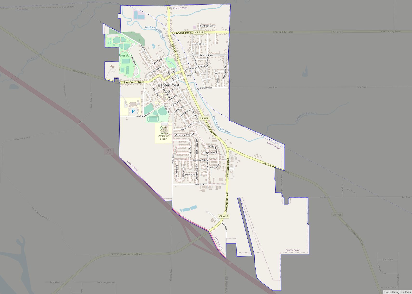
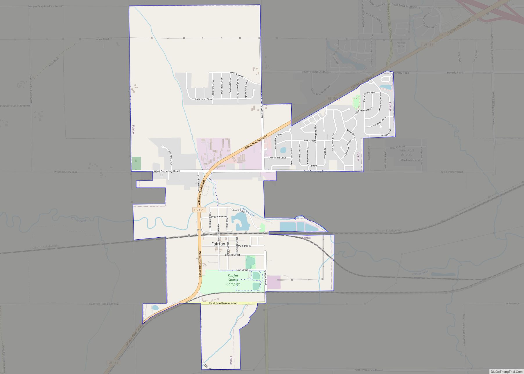
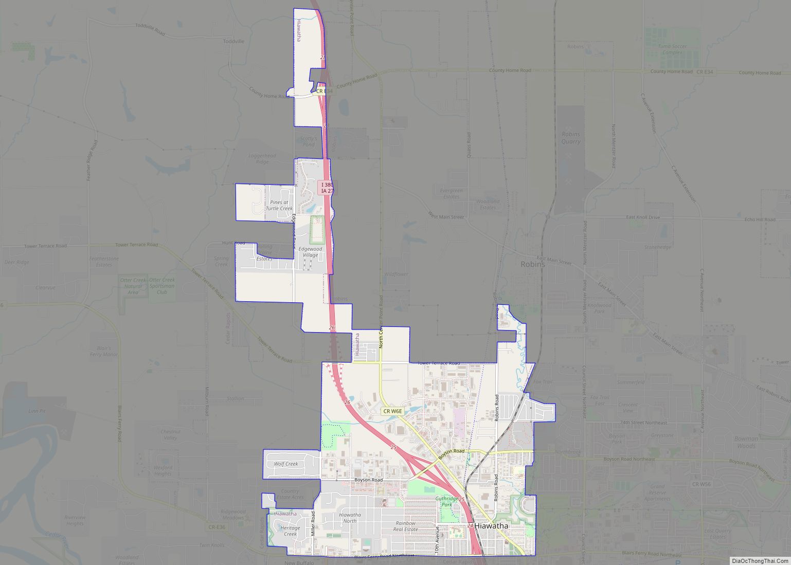
Online Interactive Map
Click on ![]() to view map in "full screen" mode.
to view map in "full screen" mode.
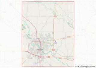
Cedar Rapids location map. Where is Cedar Rapids city?
History
Early history
The location of present-day Cedar Rapids was in the territory of the Fox and Sac tribes at the time of European American settlement.
The first white settler on the site of the future city was Osgood Shepherd, who built a log cabin (which he called a tavern) in 1837 or 1838 next to the Cedar River (then known as the Red Cedar) at what is now the corner of First Avenue and First Street Northeast. Shepherd was a squatter who claimed the land without legal title and also a reputed ne’er-do-well, who, if he was not a horse thief himself, definitely consorted with them. Early on, it appears that he “jumped the claim” of another squatter, Wilbert Stone, who had built a cabin and platted out a town, some distance south of Shepherd’s cabin, that he called Columbus. Shepherd drove Stone across the river, claiming that Stone had built his cabin on Shepherd’s land, then sold Stone’s cabin to a buyer named Hull. Shepherd later tried the same tactic with perhaps the first settler on the west side of the river, Robert Ellis, but Ellis happened to be chopping wood at the time and warned that someone would be dead if Shepherd did not retreat.
The true founders of the city were George Greene, Nicholas Brown, and a few others. Brown had experience as a miller and Greene had surveyed much of eastern Iowa, so both saw the value of the spot Shepherd had claimed. It was right next to the rapids—a prime spot to build a mill—the last set of rapids on the river before the Cedar fed into the Iowa River, meaning that goods milled on the spot could be carried by boat down river to the Mississippi. In 1841, they formed a partnership that bought out Shepherd’s claim and platted out a town they called Rapids City. Brown immediately constructed a primitive dam and then built the town’s first mill. His crude dam soon washed away, prompting Greene to induce Alexander Ely, an engineer from Michigan, to build a proper dam that would create a millrace capable of powering several mills.
At this time, the city was confined to the east side of the river. The west bank soon contained a village named Kingston for resident David King who early on operated a rope ferry across the river.
The town was formally incorporated by the Iowa State Legislature on January 15, 1849 as Cedar Rapids, named for the rapids in the Cedar River (the river itself was named for the large number of red cedar trees that grew along its banks). The population was less than 400.
During the 1850s Cedar Rapids grew in size, and it was during this decade that the Czech population became substantial; when the town was reincorporated in 1856, a quarter of its roughly 1,600 inhabitants were Czech immigrants. The availability of cheap land in the new state of Iowa happened to coincide with the Revolutions of 1848 in the Austrian Empire that caused a large number of Czechs to flee their homeland and emigrate to the U.S. In 1851 was founded the institution that would eventually become Coe College. The decade also witnessed attempts by local leaders to improve the city’s access to distant markets, first through purchase of a steamboat (aptly named Cedar Rapids) and ultimately through investment in a railroad. The first locomotive rolled into town on June 15, 1859.
Railroads were an important factor in the development of the state and the growth of cities along the rail lines. By the end of the 19th century, the 23rd largest state was the fifth largest in track mileage.
In this same decade, “Major” John May, an inventor and land speculator, purchased the island (now called “May’s Island”) situated between Cedar Rapids and Kingston with the intention of founding a town he called May Island. When that scheme proved impractical due to the island’s tendency to flood, he conceived the idea of making his island the center of a larger city that spanned the river and convinced the state legislature to officially name the land he had bought there, just south of Kingston, “West Cedar Rapids.”
Cedar Rapids annexed the community of Kingston in 1870 and constructed an iron bridge across the river along the line of the current Third Avenue bridge.
The economic growth of Cedar Rapids increased in 1871 upon the founding of the Sinclair meatpacking company. The plant allowed for year-round meatpacking because ice could be harvested from the Cedar River in winter to chill an icehouse, and within a few years it became one of the largest factories of its kind in the country, employing 400 people. In 1873, the oatmeal mill that would ultimately become the flagship operation of the Quaker Oats Company – and the largest cereal mill in the world, was built.
In 1909 the city acquired May’s Island for the purpose of making it the seat of government; then, as now, there were ill feelings between east- and west-siders in Cedar Rapids, and the city’s leaders hoped that putting City Hall in the “neutral territory” of the island would help ease tensions. In 1919, the residents of Linn County voted to move the county seat from Marion to Cedar Rapids, partially because Cedar Rapids had offered to donate the southern third of the island as a site for a new county courthouse and jail.
In 2010, the Census Bureau reported Cedar Rapids’ population as 87.98% white, and 5.58% black.
Flood of 2008
During the Iowa flood of 2008, the Cedar River reached a record high of 31.12 feet (9.49 m) on June 13 (the previous record was 20 feet (6.1 m)), surpassing the 500-year flood plain. 1,126 city blocks were flooded, or more than 10 square miles (26 km), and 561 city blocks were severely damaged, on both banks of the Cedar River, comprising 14% of the city’s total area. A total of 7,749 flooded properties had to be evacuated, including 5,900 homes and 310 city facilities, among them the City Hall, Central Fire Station, Main Public Library, Ground Transportation Center, Public Works building, and the Animal Control building. It is estimated that at least 1,300 properties in the Cedar Rapids area had to be demolished because of the flood, which caused several billions of dollars in damages. More than 4,000 members of the Iowa National Guard were activated to assist the city. The temporary levees became saturated not only with the flood waters but also with additional rainfall, causing them to fail.
Until the flood, the city’s government was headquartered in the Veterans Memorial Building, near the Linn County Courthouse and jail on Mays Island in the Cedar River, making Cedar Rapids one of a few cities in the world, along with Paris, France, with governmental offices on a municipal island.
Flood of 2016
During the flood of 2016, remnants of Hurricane Paine from the eastern Pacific Ocean via the Gulf of California caused the second highest recorded crest of the Cedar River in Cedar Rapids, reaching 22 feet (6.7 m) on September 27. The inundation of southern Minnesota, central and western Wisconsin, and northeastern Iowa by Hurricane Paine’s remnants began on September 21 and 22 and continued until the end of the month. The cresting in Cedar Rapids was below the initial estimate of 25 feet (7.6 m) and the revised estimate of 23 feet (7.0 m), but more than 10 feet (3.0 m) above the flood stage of 12 feet (3.7 m). The flood was above levels considered to have about a 1% chance of occurring in a given year. More than 5,000 homes were affected, causing over 5,000 people to evacuate. The Cedar Rapids Schools were closed for a week.
In 2015, Cedar Rapids approved a $625 million flood protection plan over 20 years for levee improvements. Although the improvement to the levee system in Cedar Rapids had not been completed due to over $80 million in funding not appropriated by the United States Congresses of 2014 and 2016 and the voting down by local residents of a temporary increase in the local sales tax to pay for the levee improvements, out of school students along with hundreds of thousands of volunteers and 412 Iowa National Guard troops filled more than a quarter of a million sandbags in a successful effort to prevent any major flooding of the city outside the evacuation zone. A 9.8-mile (15.8 km) system of Hesco barriers, earthen berms, and over 400,000 sandbags were used to plug the gaps in the levee system. The city of Cedar Rapids purchased additional Hesco barriers from Iowa City for $1.4 million. Numerous upstream cities that had been earlier affected by the September flooding and mandatory evacuations, including Charles City, Greene, Manchester, Clarksville, Shell Rock, Vinton, Janesville, Cedar Falls and Waterloo, sent hundreds of thousands of unused sandbags to support efforts in Cedar Rapids and nearby communities. The remnants of Hurricane Paine did not produce any rain to saturate the temporary earth berms and sandbags, which would have greatly increased the likelihood of breach in the temporary levee structures, causing a much greater flooded area; the river crested during very sunny weather. Additionally, beginning on September 25, 300 to 400 National Guard troops along with the Iowa State Patrol, other law enforcement agencies, and 60 duly sworn law enforcement officials enforced a nightly 8pm to 7am curfew.
August 10, 2020, Midwest derecho
On August 10, 2020, an intense derecho formed over the Midwest and moved eastward across Iowa, with Cedar Rapids being the hardest-hit city. Sustained winds of 60 to 80 miles per hour (97 to 129 km/h), frequent gusts of 110 miles per hour (180 km/h) or greater, and an estimated peak gust of 140 miles per hour (230 km/h) on the southwest side of the city damaged the majority of residential and commercial buildings in Cedar Rapids, as well as 20 schools, and resulted in the closure of most local businesses. Thousands of trees were downed throughout all 75 square miles of Cedar Rapids. Most of the city’s roads became mostly blocked or impassible due to downed trees and blown limbs, power poles along with their lines, and general debris, like large road signs, as well as damaged buildings, homes, and farms. 95% of the city was without power. Trash pickup stopped, cell phone service was very spotty for multiple days, and many gas leaks were reported. Interstate 380 was closed between Cedar Rapids and Iowa City.
Hospitals treated over 300 patients for storm related injuries. Professional estimates suggested that cleanup and removal of the city’s downed trees could take months. Arborists urged residents not to clear trees on their own, in order to avoid injury.
On Friday, August 14, Governor Kim Reynolds arrived in Cedar Rapids, accompanied by Adjutant General Benjamin Corell of the Iowa National Guard. Gen. Corell said he had not seen a comparable level of damage since Hurricane Katrina in 2005. Other city officials described the damage as being even worse than the Iowa flood of 2008.
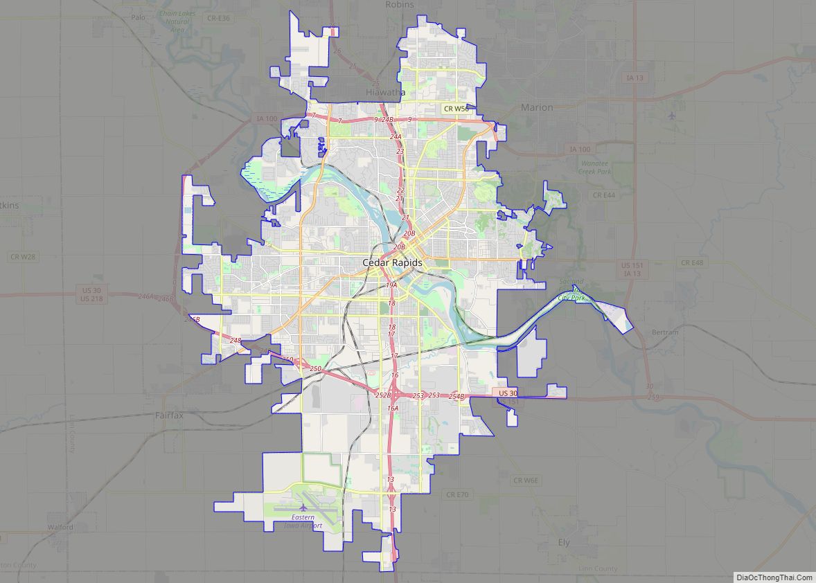
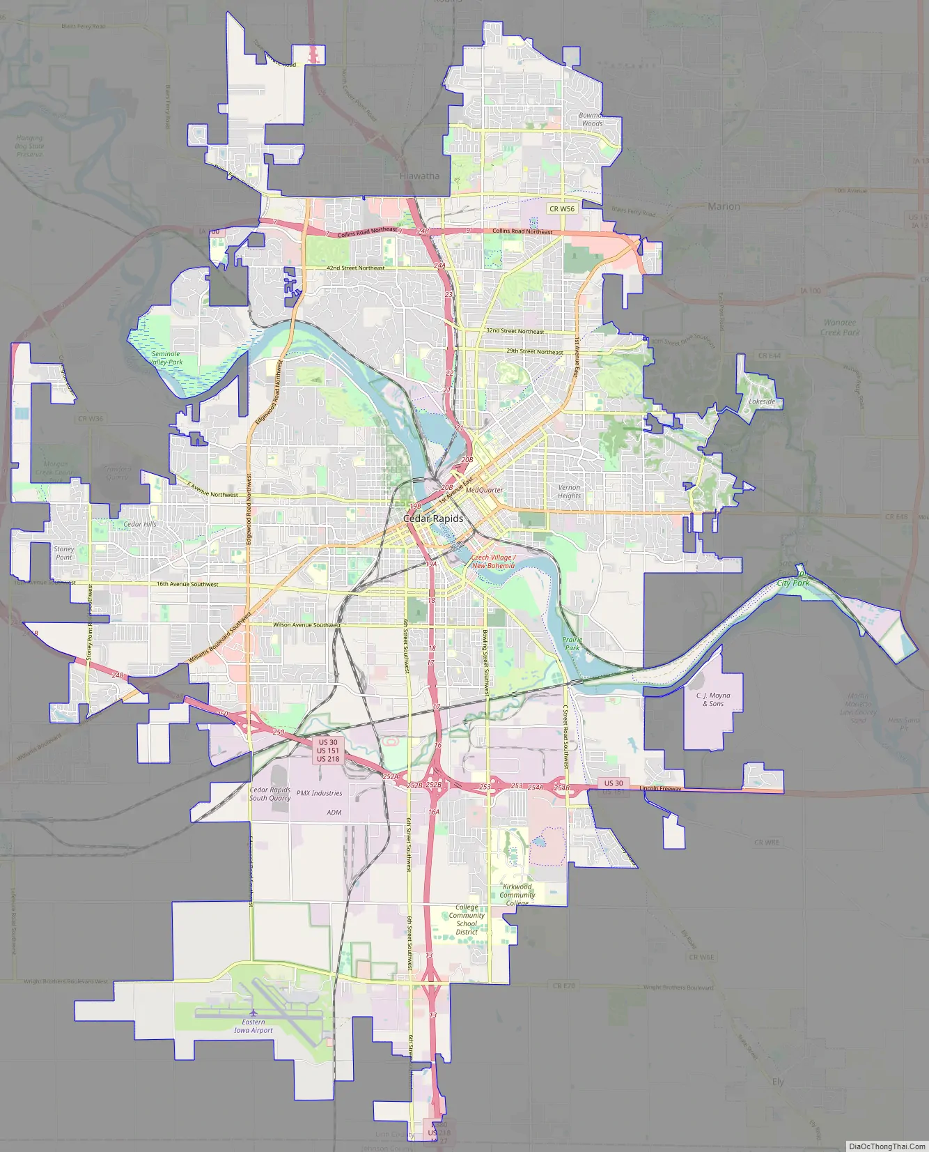
Cedar Rapids Road Map
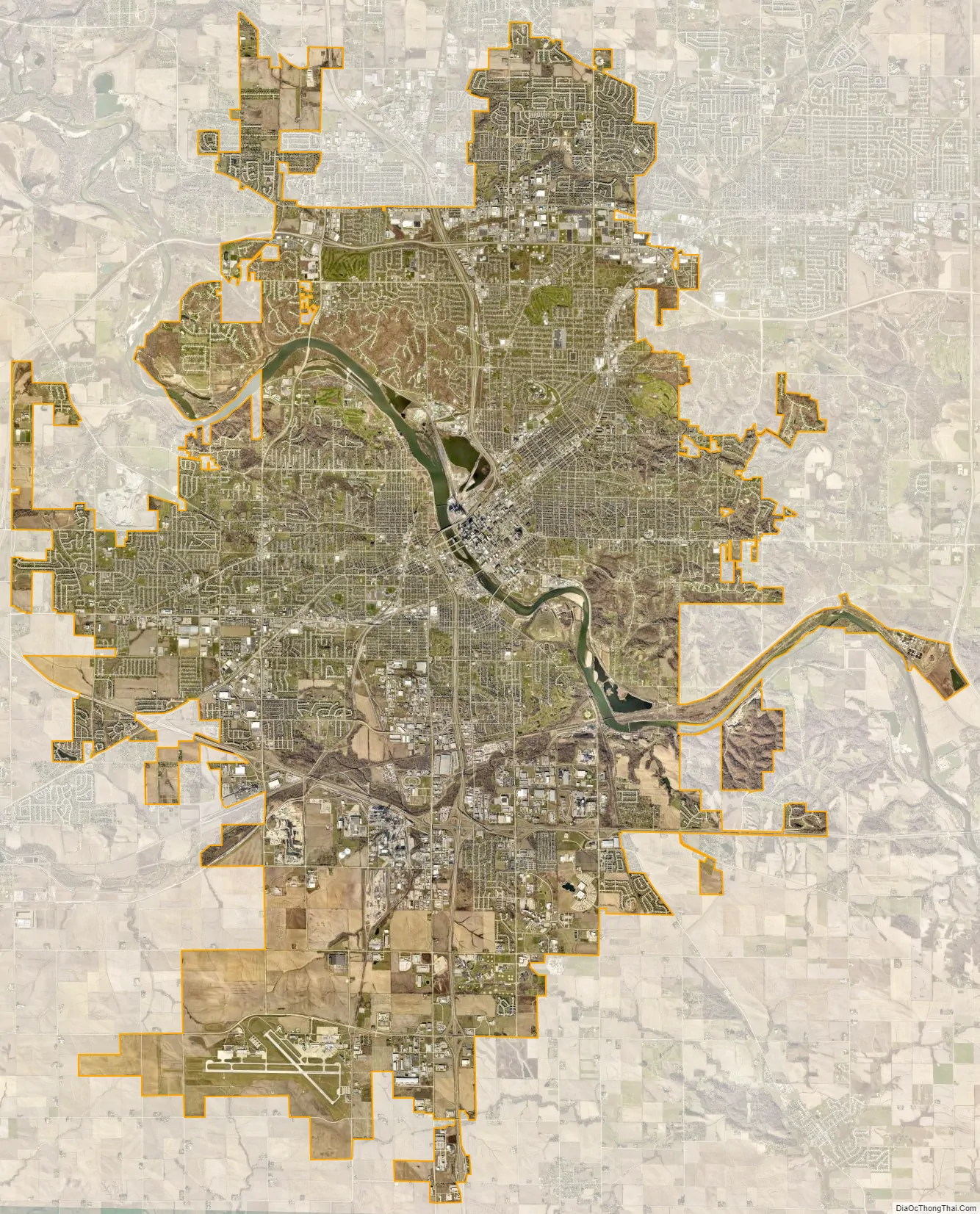
Cedar Rapids city Satellite Map
Geography
The city is divided into four quadrants, used in assigning street addresses. 1st Avenue (U.S. Route 151 Business) divides the north and south sides of the city, and the Cedar River divides east and west. Mays Island, in the middle of the river, is the only area of the city where addresses have no quadrant. Areas outside the city limits that have a Cedar Rapids mailing address do not use the quadrants either.
Except in the downtown area, 1st Avenue and the Cedar River tend to run diagonally instead of along the cardinal directions. Due to the curving of 1st Avenue, there are some areas in western Cedar Rapids where NW addresses are actually south of SW addresses.
Cedar Rapids is divided into 14 ZIP Codes. Mays Island and the downtown area are covered by 52401. The northeast quadrant is covered by 52402 and 52411. The southeast quadrant is covered by 52403. The southwest quadrant is covered by 52404. The northwest quadrant is covered by 52405. Post office boxes are covered by ZIP codes 52406, 52407, 52408, 52409, and 52410. Several other ZIP codes are for specific businesses (Aegon USA, Collins Aerospace, etc.).
According to the United States Census Bureau, the city has a total area of 72.07 square miles (186.66 km), of which 70.8 square miles (183.37 km) is land and 1.27 square miles (3.29 km) is water.
Neighborhoods
There are twelve active neighborhood associations in Cedar Rapids. The neighborhoods nearest downtown include Wellington Heights and Oakhill Jackson in the southeast quadrant and Moundview in the northeast quadrant. Also farther north in the northeast quadrant are Noelridge Park and Kenwood Park, which was independent until it was incorporated into the Cedar Rapids city limits. The boundaries of Kenwood are 32nd Street to Oakland Road to Old Marion Road to C Avenue to 40th Street then 1st Avenue between 40th street and 32nd Street.
In addition to the neighborhood associations in Cedar Rapids, there are many informal, unofficial neighborhoods, such as Bowman Woods, Vernon Heights, Stoney Point, Kingston Village, New Bohemia (NewBo) and Wilderness Estates.
Czech Village is located along 16th Avenue SW, south of the Cedar River. It is home to such Czech-themed businesses as The Czech Cottage, Sykora Bakery, and White Lion Treasures. The National Czech & Slovak Museum & Library is one of Cedar Rapids’ major tourist attractions. The museum’s main building was directly on the river and was badly damaged by the 2008 floods. After the flood the museum moved a few blocks to Inspiration Place SW. The Bohemian National Cemetery is located nearby.
The Cedar Rapids Czech Heritage Foundation is one of many local organizations working to promote and preserve Czech heritage in Cedar Rapids. It supports and sponsors many programs and events throughout the year, including the Miss Czech-Slovak Iowa pageant. Two Miss Czech-Slovak US queens can claim this community as home: Lisa Volesky and Stasia Krivanek.
Olga Drahozal was the famed band leader of the Czech Plus Polka Band, a performing group that frequents the Kosek Band Stand in Czech Village. She, Bessie Duggena, and Leona Poduška taught Czech School (Česká škola) at Wilson Middle School.
In 2003, the African-American Historical Museum and Cultural Center of Iowa opened its doors. Cedar Rapids is also home to the historic 26-acre (105,000 m) Brucemore Estate, on which sits a 21-room mansion, and the Masonic Library and Museum.
In 2009, Cedar Rapids was rated one of the “Top 10 cities to Grow Up In” in the United States, partly due to a low crime rate and a good public school system.
Climate
Cedar Rapids has a humid continental climate with long, cold, sometimes brutal winters with plenty of snow, while summers are hot and humid, with frequent severe thunderstorms.
The record low temperature in Cedar Rapids is −30 °F (−34 °C), set on January 31, 2019, while the record high temperature of 110 °F (43 °C) was set on July 6, 1911.
See also
Map of Iowa State and its subdivision:- Adair
- Adams
- Allamakee
- Appanoose
- Audubon
- Benton
- Black Hawk
- Boone
- Bremer
- Buchanan
- Buena Vista
- Butler
- Calhoun
- Carroll
- Cass
- Cedar
- Cerro Gordo
- Cherokee
- Chickasaw
- Clarke
- Clay
- Clayton
- Clinton
- Crawford
- Dallas
- Davis
- Decatur
- Delaware
- Des Moines
- Dickinson
- Dubuque
- Emmet
- Fayette
- Floyd
- Franklin
- Fremont
- Greene
- Grundy
- Guthrie
- Hamilton
- Hancock
- Hardin
- Harrison
- Henry
- Howard
- Humboldt
- Ida
- Iowa
- Jackson
- Jasper
- Jefferson
- Johnson
- Jones
- Keokuk
- Kossuth
- Lee
- Linn
- Louisa
- Lucas
- Lyon
- Madison
- Mahaska
- Marion
- Marshall
- Mills
- Mitchell
- Monona
- Monroe
- Montgomery
- Muscatine
- O'Brien
- Osceola
- Page
- Palo Alto
- Plymouth
- Pocahontas
- Polk
- Pottawattamie
- Poweshiek
- Ringgold
- Sac
- Scott
- Shelby
- Sioux
- Story
- Tama
- Taylor
- Union
- Van Buren
- Wapello
- Warren
- Washington
- Wayne
- Webster
- Winnebago
- Winneshiek
- Woodbury
- Worth
- Wright
- Alabama
- Alaska
- Arizona
- Arkansas
- California
- Colorado
- Connecticut
- Delaware
- District of Columbia
- Florida
- Georgia
- Hawaii
- Idaho
- Illinois
- Indiana
- Iowa
- Kansas
- Kentucky
- Louisiana
- Maine
- Maryland
- Massachusetts
- Michigan
- Minnesota
- Mississippi
- Missouri
- Montana
- Nebraska
- Nevada
- New Hampshire
- New Jersey
- New Mexico
- New York
- North Carolina
- North Dakota
- Ohio
- Oklahoma
- Oregon
- Pennsylvania
- Rhode Island
- South Carolina
- South Dakota
- Tennessee
- Texas
- Utah
- Vermont
- Virginia
- Washington
- West Virginia
- Wisconsin
- Wyoming