Numa is a city in Appanoose County, Iowa, United States. The population was 68 in the 2020 census, a decline from 109 in 2000.
| Name: | Numa city |
|---|---|
| LSAD Code: | 25 |
| LSAD Description: | city (suffix) |
| State: | Iowa |
| County: | Appanoose County |
| Incorporated: | November 9, 1909 |
| Elevation: | 1,027 ft (313 m) |
| Total Area: | 0.44 sq mi (1.14 km²) |
| Land Area: | 0.44 sq mi (1.14 km²) |
| Water Area: | 0.00 sq mi (0.00 km²) |
| Total Population: | 68 |
| Population Density: | 154.20/sq mi (59.53/km²) |
| ZIP code: | 52544 |
| Area code: | 641 |
| FIPS code: | 1957945 |
| GNISfeature ID: | 0459679 |
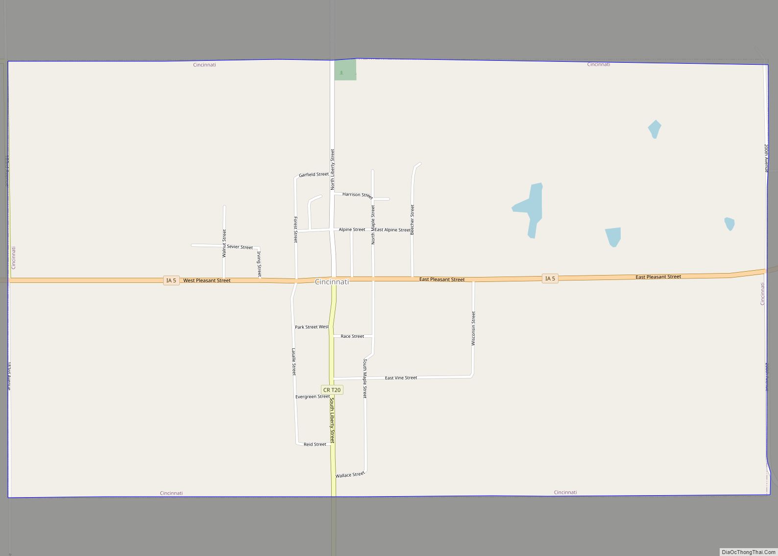
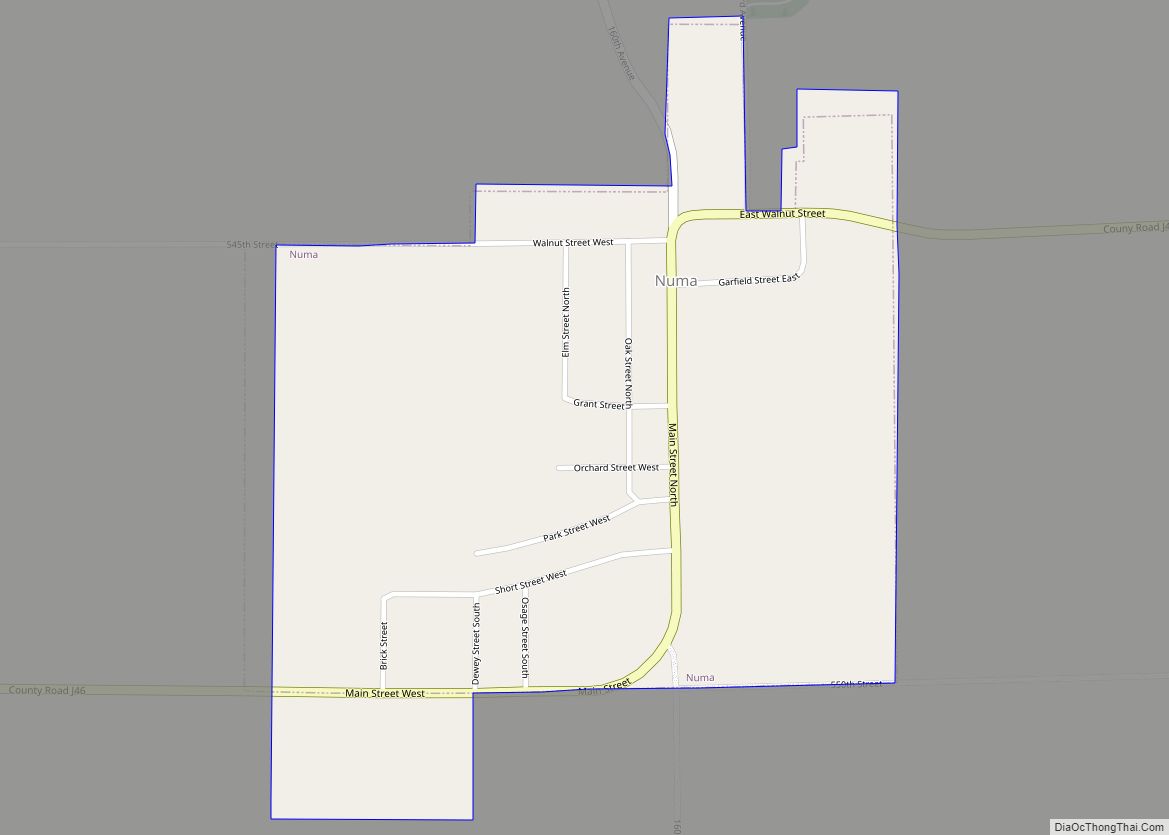
Online Interactive Map
Click on ![]() to view map in "full screen" mode.
to view map in "full screen" mode.
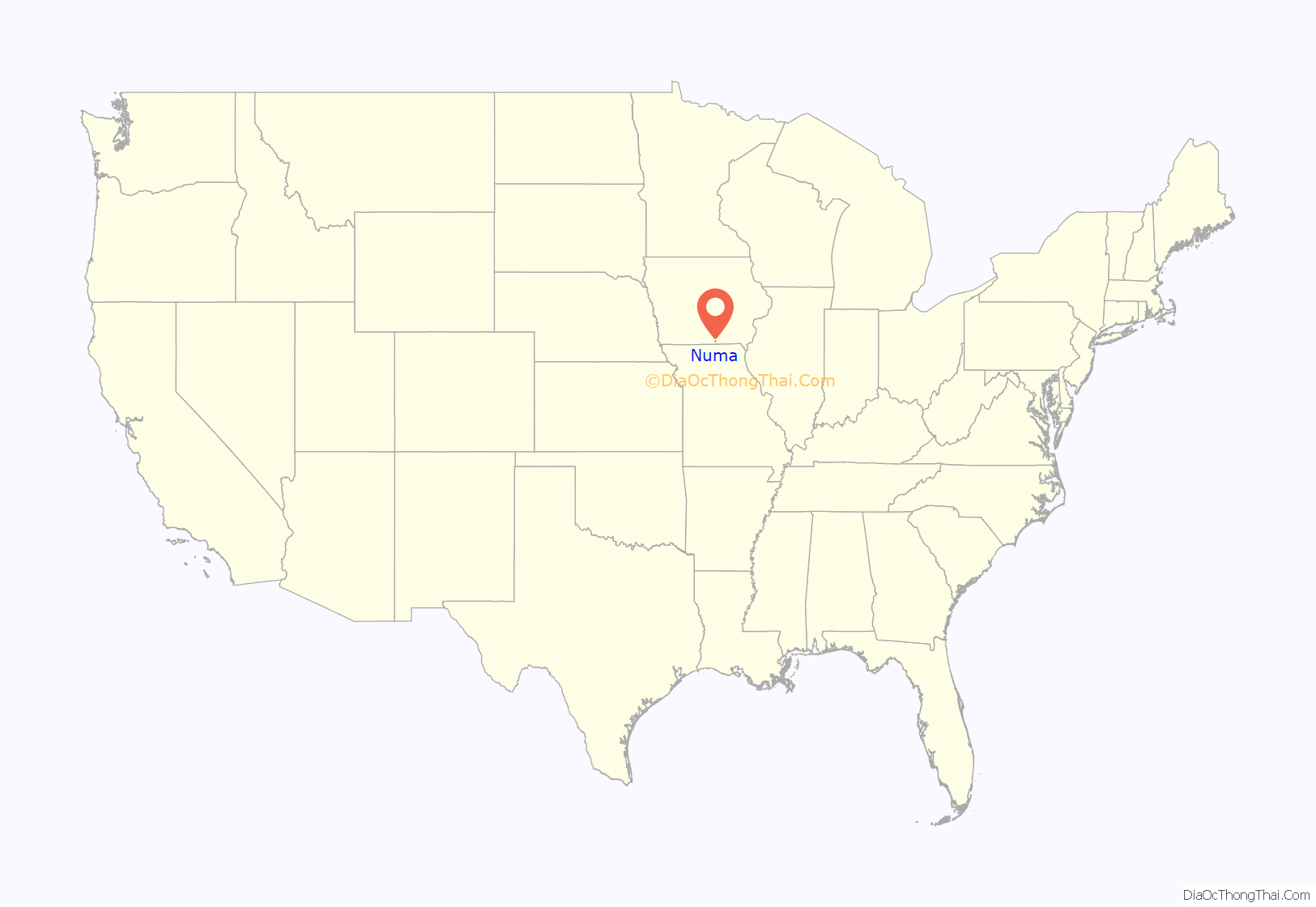
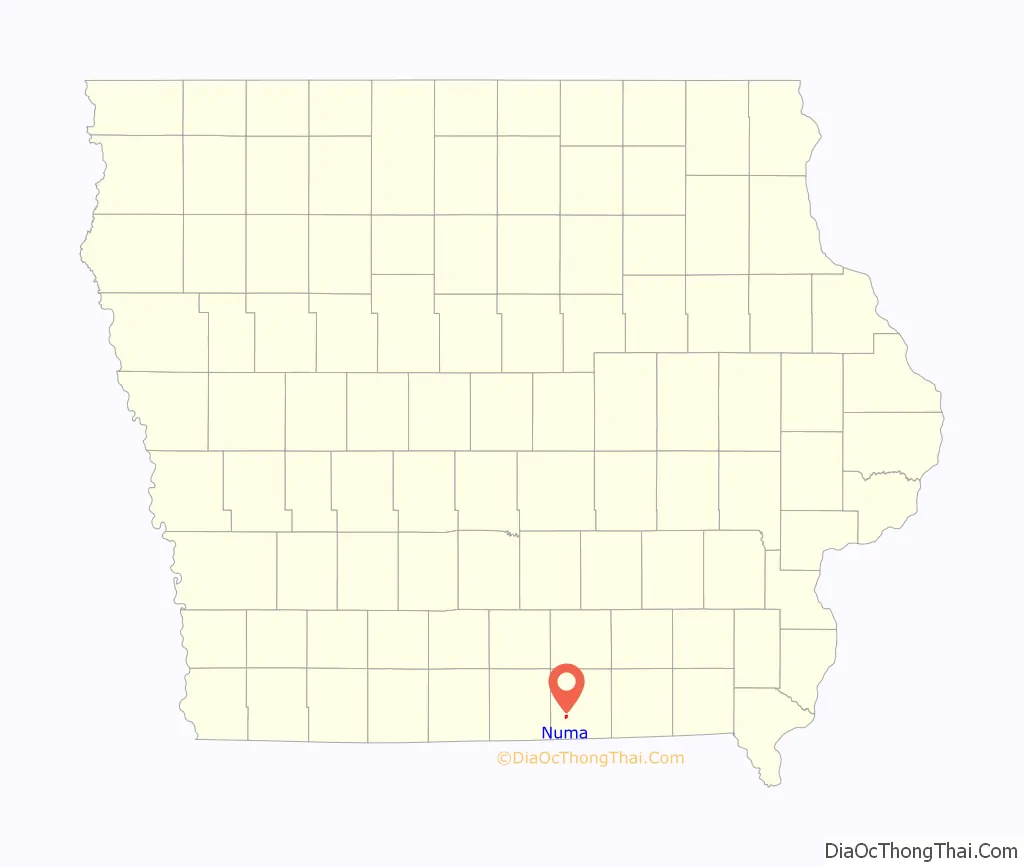
Numa location map. Where is Numa city?
History
Numa was laid out in 1871.
In 1907, fire destroyed the surface equipment of the Numa Block mine, then the most productive mine in the county. The Numa Block shaft was 150 feet (46 m) deep, giving access to a 30-inch (760 mm) coal seam. The Numa Block Coal Company also owned mines in Seymour, (about 8 miles (13 km) to the west). In 1912, Local 875 of the United Mine Workers, based in Numa, had 392 members.
The original Numa Block mine was closed in 1915, after having undermined 240 acres (0.97 km). In 1911, the Numa Block Coal Company started a new mine, about a mile east of Numa. When fully developed, this mine employed 155 men, hoisting 300 tons of coal daily to ship 175 carloads of coal monthly. A new company town, Martinstown, was platted around this mine in 1913. The approximately 40 houses in Martinstown were frequently known as Shantytown. The mine closed in 1937, after undermining 96 acres (390,000 m). Aside from the blackened remains of the Martinstown slag pile, little remains of this mine today. In 1914, the Numa Block Coal Company produced over 100,000 tons of coal, ranking among the top 24 coal producers in the state.
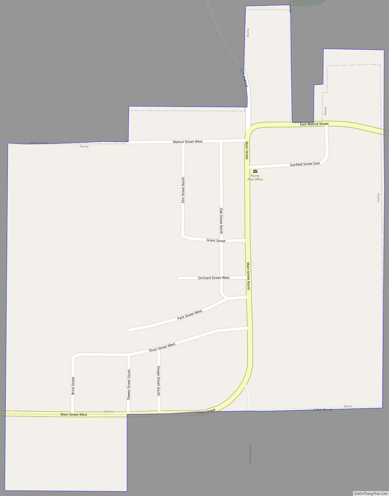
Numa Road Map
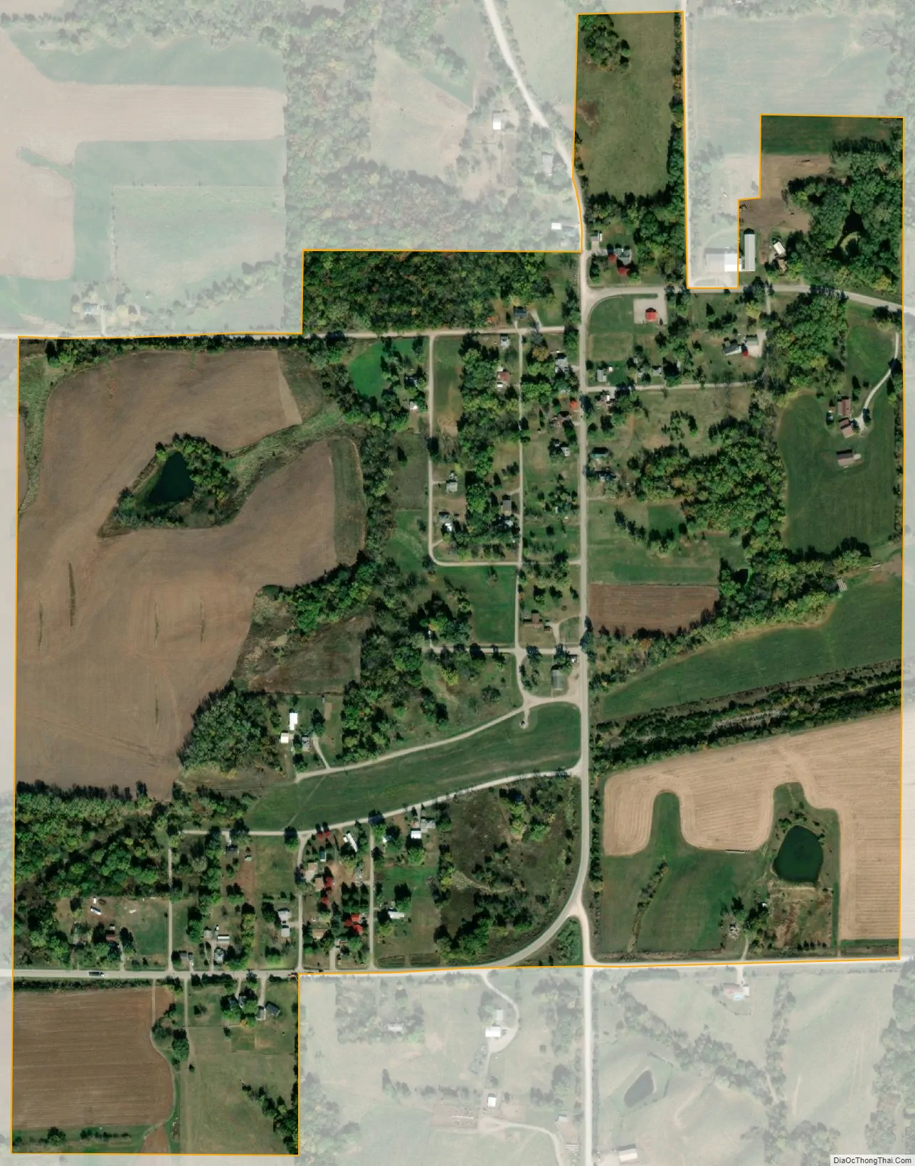
Numa city Satellite Map
Geography
Numa’s longitude and latitude coordinates in decimal form are 40.685566, −92.978596.
According to the United States Census Bureau, the city has a total area of 0.44 square miles (1.14 km), all land.
See also
Map of Iowa State and its subdivision:- Adair
- Adams
- Allamakee
- Appanoose
- Audubon
- Benton
- Black Hawk
- Boone
- Bremer
- Buchanan
- Buena Vista
- Butler
- Calhoun
- Carroll
- Cass
- Cedar
- Cerro Gordo
- Cherokee
- Chickasaw
- Clarke
- Clay
- Clayton
- Clinton
- Crawford
- Dallas
- Davis
- Decatur
- Delaware
- Des Moines
- Dickinson
- Dubuque
- Emmet
- Fayette
- Floyd
- Franklin
- Fremont
- Greene
- Grundy
- Guthrie
- Hamilton
- Hancock
- Hardin
- Harrison
- Henry
- Howard
- Humboldt
- Ida
- Iowa
- Jackson
- Jasper
- Jefferson
- Johnson
- Jones
- Keokuk
- Kossuth
- Lee
- Linn
- Louisa
- Lucas
- Lyon
- Madison
- Mahaska
- Marion
- Marshall
- Mills
- Mitchell
- Monona
- Monroe
- Montgomery
- Muscatine
- O'Brien
- Osceola
- Page
- Palo Alto
- Plymouth
- Pocahontas
- Polk
- Pottawattamie
- Poweshiek
- Ringgold
- Sac
- Scott
- Shelby
- Sioux
- Story
- Tama
- Taylor
- Union
- Van Buren
- Wapello
- Warren
- Washington
- Wayne
- Webster
- Winnebago
- Winneshiek
- Woodbury
- Worth
- Wright
- Alabama
- Alaska
- Arizona
- Arkansas
- California
- Colorado
- Connecticut
- Delaware
- District of Columbia
- Florida
- Georgia
- Hawaii
- Idaho
- Illinois
- Indiana
- Iowa
- Kansas
- Kentucky
- Louisiana
- Maine
- Maryland
- Massachusetts
- Michigan
- Minnesota
- Mississippi
- Missouri
- Montana
- Nebraska
- Nevada
- New Hampshire
- New Jersey
- New Mexico
- New York
- North Carolina
- North Dakota
- Ohio
- Oklahoma
- Oregon
- Pennsylvania
- Rhode Island
- South Carolina
- South Dakota
- Tennessee
- Texas
- Utah
- Vermont
- Virginia
- Washington
- West Virginia
- Wisconsin
- Wyoming