Pomeroy is a city in Calhoun County, Iowa, United States. The population was 526 at the time of the 2020 census.
| Name: | Pomeroy city |
|---|---|
| LSAD Code: | 25 |
| LSAD Description: | city (suffix) |
| State: | Iowa |
| County: | Calhoun County |
| Elevation: | 1,240 ft (378 m) |
| Total Area: | 2.05 sq mi (5.30 km²) |
| Land Area: | 2.05 sq mi (5.30 km²) |
| Water Area: | 0.00 sq mi (0.00 km²) |
| Total Population: | 526 |
| Population Density: | 256.84/sq mi (99.17/km²) |
| ZIP code: | 50575 |
| Area code: | 712 |
| FIPS code: | 1964065 |
| GNISfeature ID: | 0460354 |
Online Interactive Map
Click on ![]() to view map in "full screen" mode.
to view map in "full screen" mode.
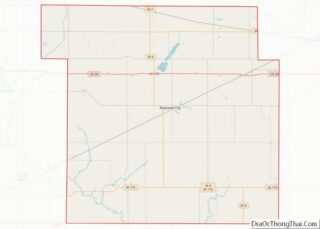
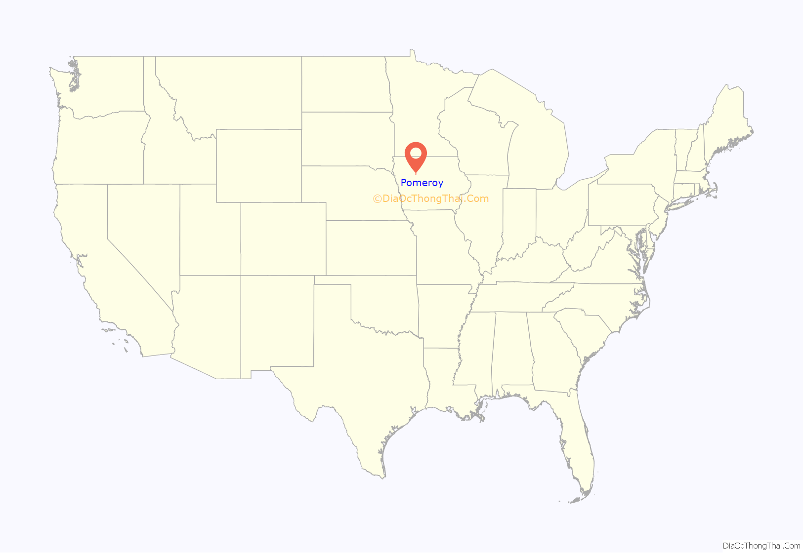
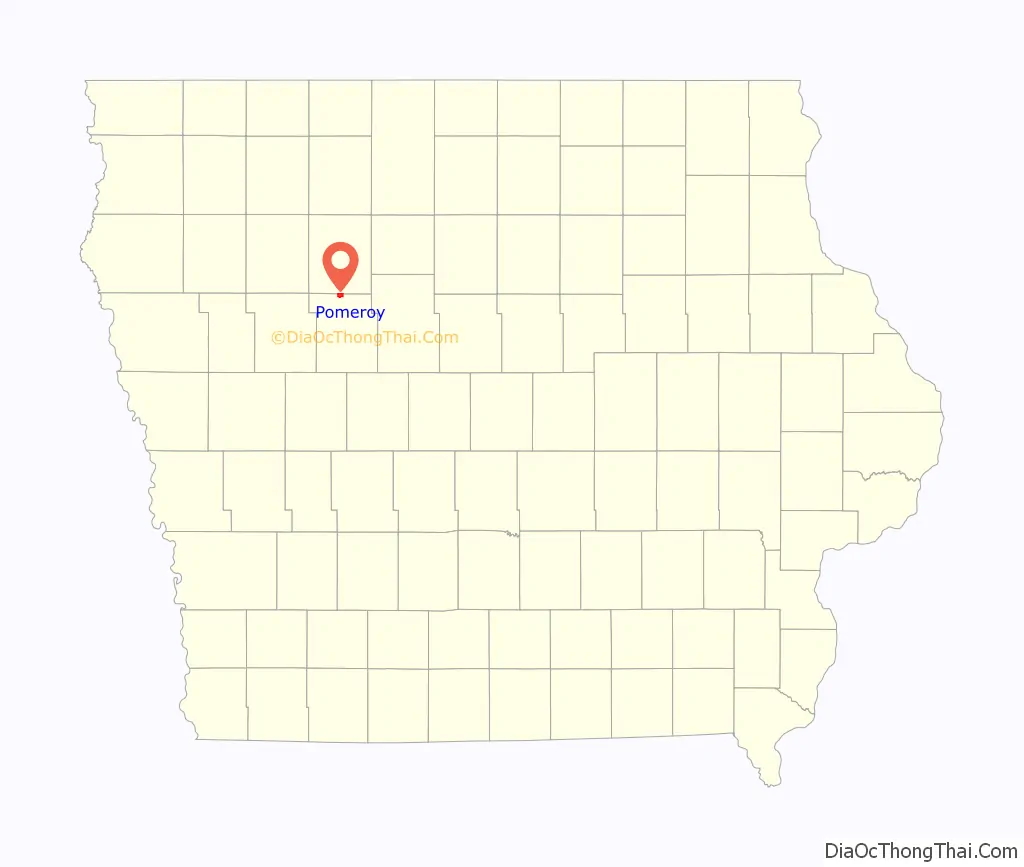
Pomeroy location map. Where is Pomeroy city?
History
Pomeroy was platted in 1870 in anticipation of the railroad being built through the settlement. It was named for Charles Pomeroy, an Iowa politician.
On July 6, 1893, Pomeroy was struck by a tornado that was later estimated to be F5 on the Fujita scale. With a damage path 500 yards (460 m) wide and 55 miles (89 km) long, the tornado destroyed about 80% of the homes in Pomeroy. The tornado killed 71 people and injured 200.
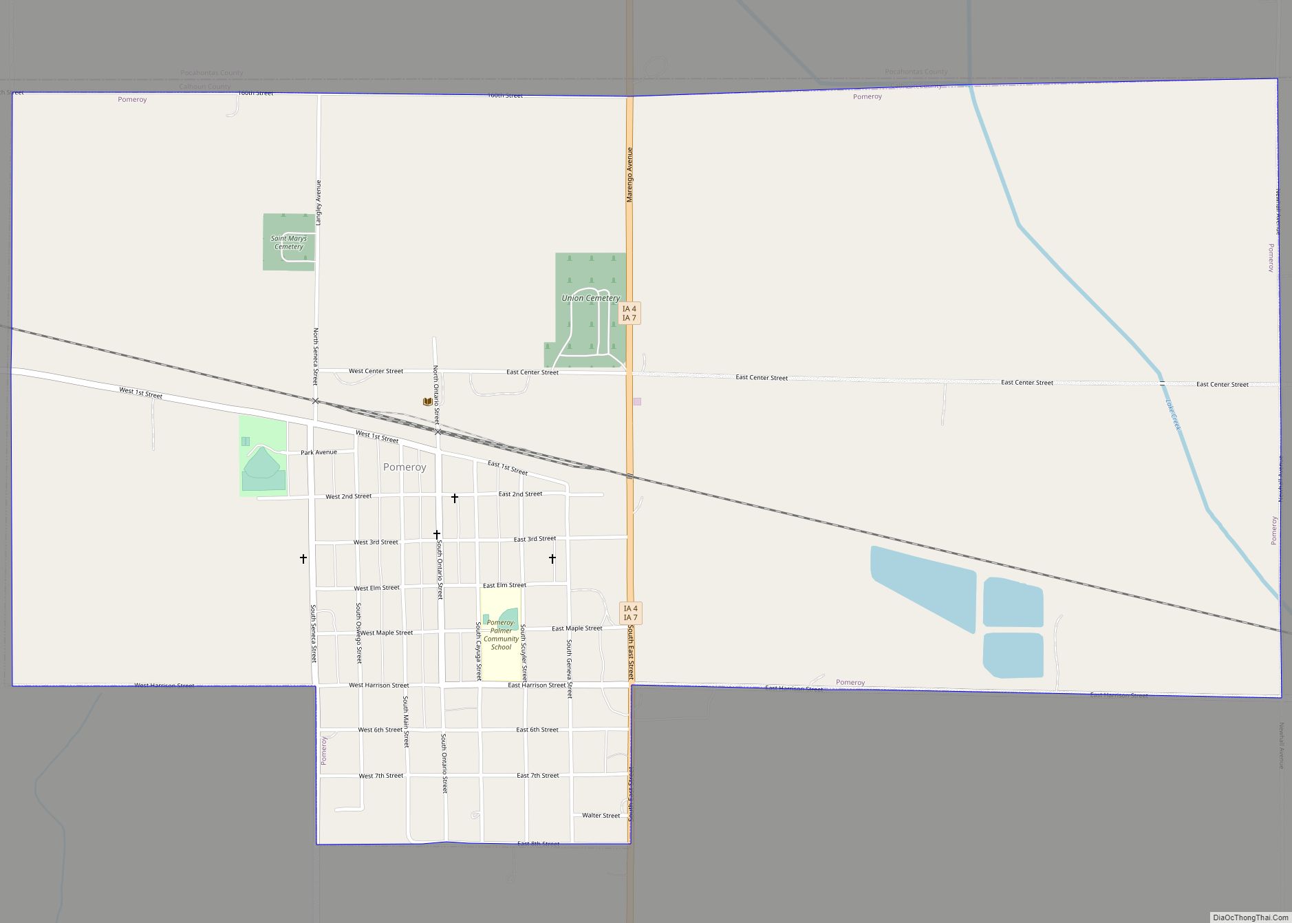
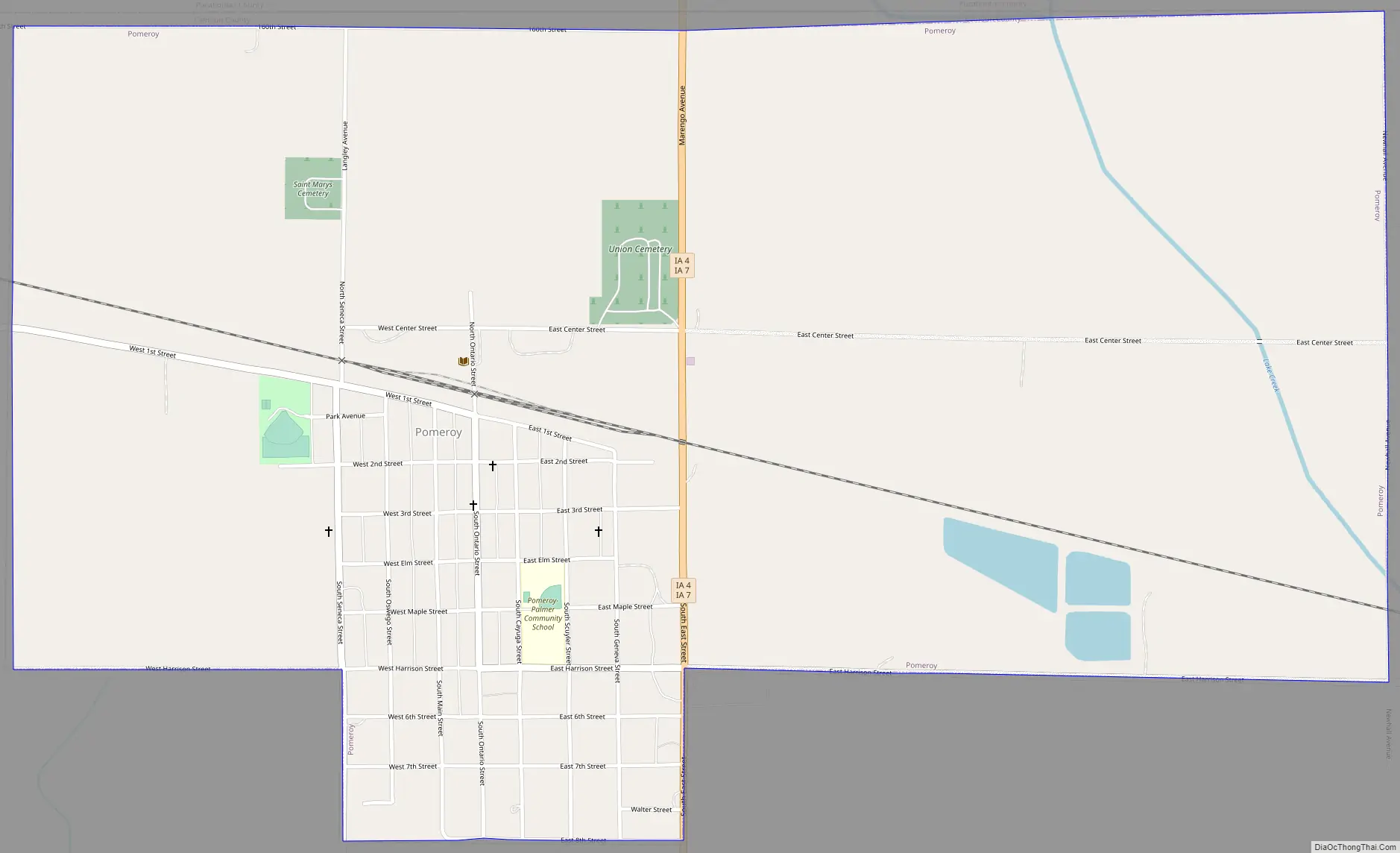
Pomeroy Road Map
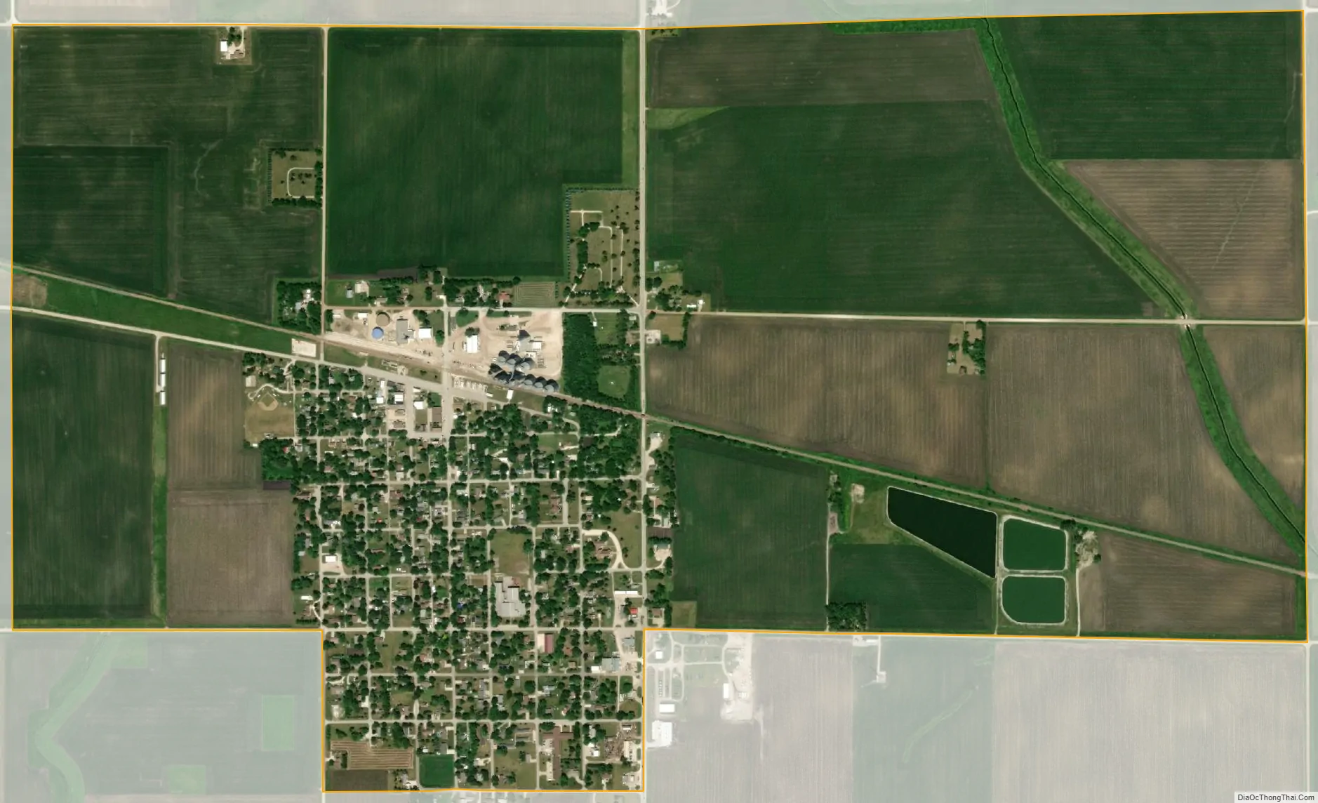
Pomeroy city Satellite Map
Geography
Pomeroy is located at 42°32′54″N 94°41′1″W / 42.54833°N 94.68361°W / 42.54833; -94.68361 (42.548395, -94.683541).
According to the United States Census Bureau, the city has a total area of 2.04 square miles (5.28 km), all land.
Pomeroy lies within the western side of Manson crater, an impact structure buried by glacial till and outwash.
See also
Map of Iowa State and its subdivision:- Adair
- Adams
- Allamakee
- Appanoose
- Audubon
- Benton
- Black Hawk
- Boone
- Bremer
- Buchanan
- Buena Vista
- Butler
- Calhoun
- Carroll
- Cass
- Cedar
- Cerro Gordo
- Cherokee
- Chickasaw
- Clarke
- Clay
- Clayton
- Clinton
- Crawford
- Dallas
- Davis
- Decatur
- Delaware
- Des Moines
- Dickinson
- Dubuque
- Emmet
- Fayette
- Floyd
- Franklin
- Fremont
- Greene
- Grundy
- Guthrie
- Hamilton
- Hancock
- Hardin
- Harrison
- Henry
- Howard
- Humboldt
- Ida
- Iowa
- Jackson
- Jasper
- Jefferson
- Johnson
- Jones
- Keokuk
- Kossuth
- Lee
- Linn
- Louisa
- Lucas
- Lyon
- Madison
- Mahaska
- Marion
- Marshall
- Mills
- Mitchell
- Monona
- Monroe
- Montgomery
- Muscatine
- O'Brien
- Osceola
- Page
- Palo Alto
- Plymouth
- Pocahontas
- Polk
- Pottawattamie
- Poweshiek
- Ringgold
- Sac
- Scott
- Shelby
- Sioux
- Story
- Tama
- Taylor
- Union
- Van Buren
- Wapello
- Warren
- Washington
- Wayne
- Webster
- Winnebago
- Winneshiek
- Woodbury
- Worth
- Wright
- Alabama
- Alaska
- Arizona
- Arkansas
- California
- Colorado
- Connecticut
- Delaware
- District of Columbia
- Florida
- Georgia
- Hawaii
- Idaho
- Illinois
- Indiana
- Iowa
- Kansas
- Kentucky
- Louisiana
- Maine
- Maryland
- Massachusetts
- Michigan
- Minnesota
- Mississippi
- Missouri
- Montana
- Nebraska
- Nevada
- New Hampshire
- New Jersey
- New Mexico
- New York
- North Carolina
- North Dakota
- Ohio
- Oklahoma
- Oregon
- Pennsylvania
- Rhode Island
- South Carolina
- South Dakota
- Tennessee
- Texas
- Utah
- Vermont
- Virginia
- Washington
- West Virginia
- Wisconsin
- Wyoming