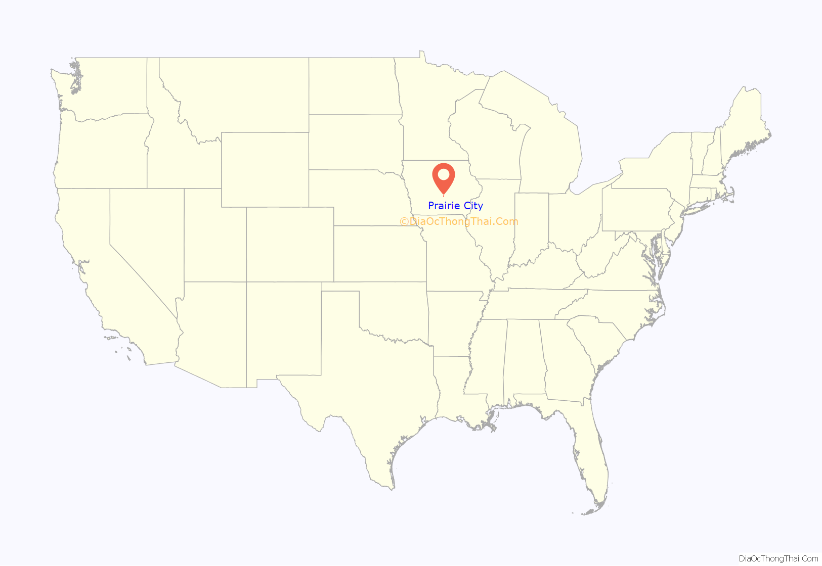
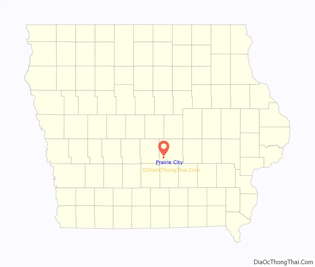
Prairie City is a city in Jasper County, Iowa, United States. The population was 1,700 at the time of the 2020 census. It is twenty-two miles east of Des Moines.
| Name: | Prairie City city |
|---|---|
| LSAD Code: | 25 |
| LSAD Description: | city (suffix) |
| State: | Iowa |
| County: | Jasper County |
| Elevation: | 928 ft (283 m) |
| Total Area: | 1.24 sq mi (3.22 km²) |
| Land Area: | 1.24 sq mi (3.22 km²) |
| Water Area: | 0.00 sq mi (0.00 km²) |
| Total Population: | 1,700 |
| Population Density: | 1,368.76/sq mi (528.67/km²) |
| ZIP code: | 50228 |
| Area code: | 515 |
| FIPS code: | 1964470 |
| GNISfeature ID: | 0460389 |
| Website: | www.prairiecityiowa.us |
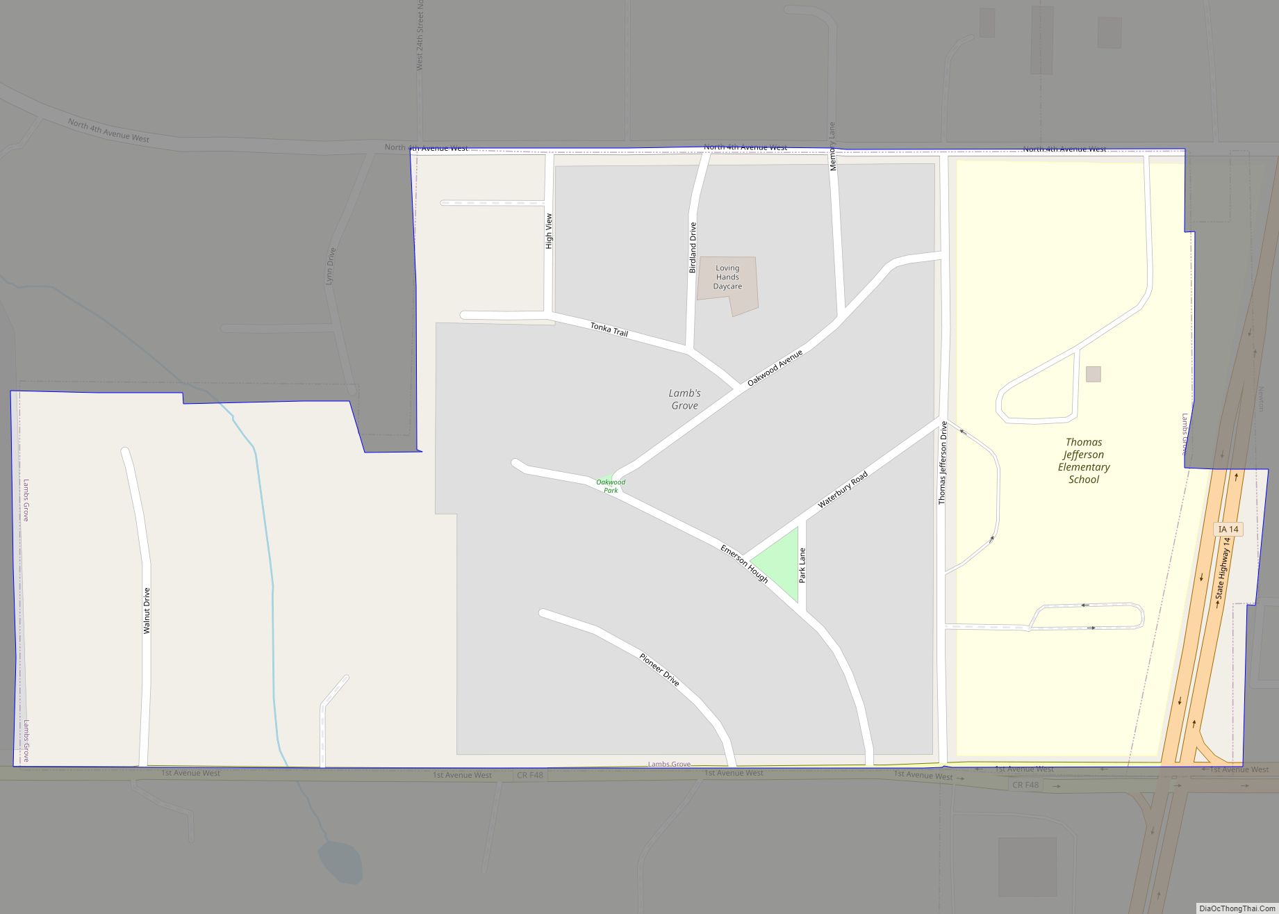
Online Interactive Map
Click on ![]() to view map in "full screen" mode.
to view map in "full screen" mode.
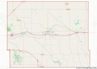
Prairie City location map. Where is Prairie City city?
History
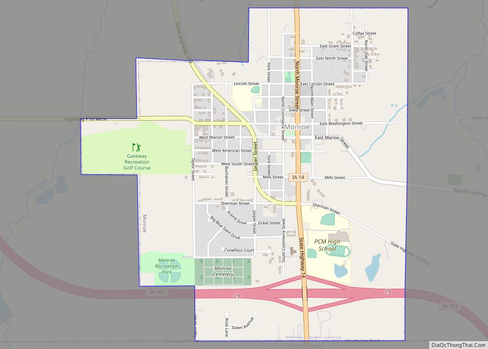
Prairie City was founded by James Elliott in 1856, for whom it was originally named; it was later changed because there was already a town named Elliott in the state. The first resident was William Means, who built a tavern 2 miles (3.2 km) west of Elliot’s cabin. The railroad first came through Prairie City in 1866. The first school in Prairie City was built on 1868(The Plainsmen) ; the city’s district remained independent until a merger with that of Monroe in 1990, brought about by the destruction by fire of Monroe’s high school. The new school district is called Prairie City-Monroe (“PCM”) Community School district, home of the PCM Mustangs.
Prairie City’s Historical Society was established in 1995. The Prairie City Historical Museum is located at 109 S. Main Street and open by appointment. Many artifacts from Prairie City’s history are housed in the museum including the Dowden Potato Digger, which was originally manufactured in Prairie City.
The city was the subject of Douglas Bauer’s popular reminiscence of change in small town Iowa from the 1950s through the 1970s, Prairie City, Iowa: Three Seasons at Home.
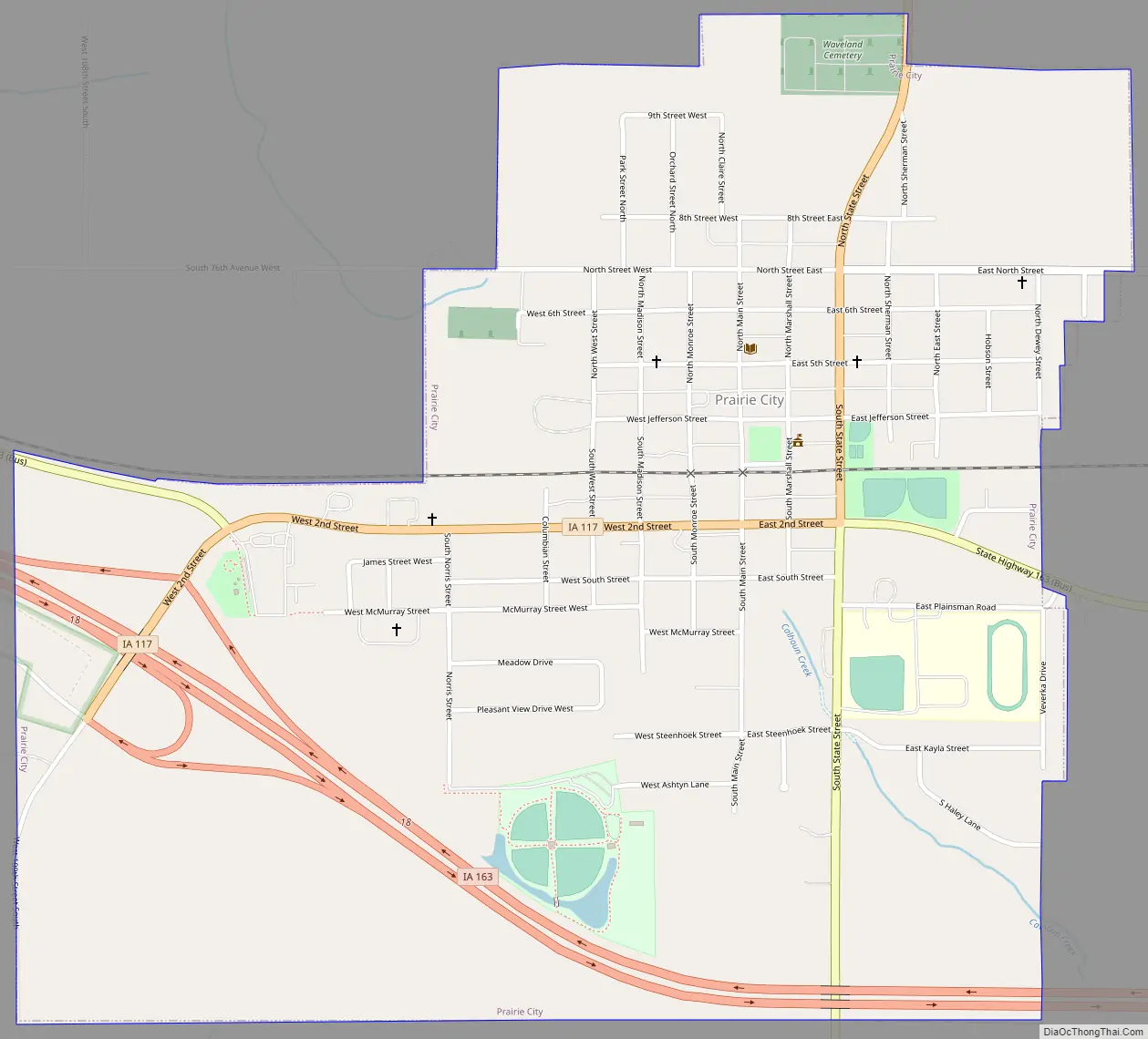
Prairie City Road Map
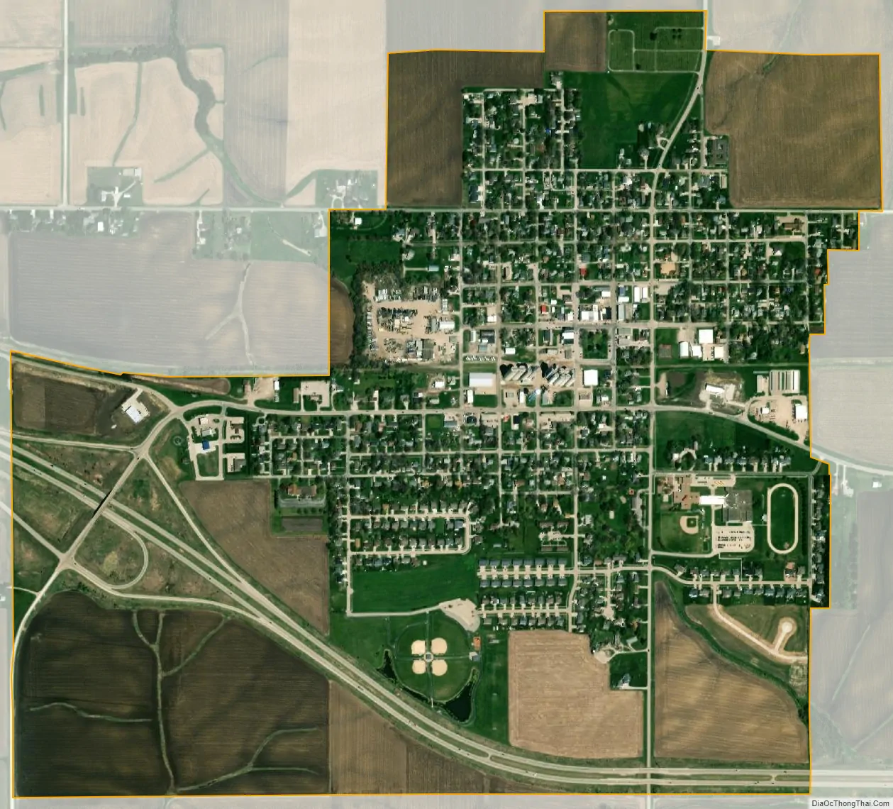
Prairie City city Satellite Map
Geography
Prairie City is located at 41°35′53″N 93°14′12″W / 41.59806°N 93.23667°W / 41.59806; -93.23667 (41.598042, -93.236726).
According to the United States Census Bureau, the city has a total area of 1.21 square miles (3.13 km), all land.
See also
Map of Iowa State and its subdivision:- Adair
- Adams
- Allamakee
- Appanoose
- Audubon
- Benton
- Black Hawk
- Boone
- Bremer
- Buchanan
- Buena Vista
- Butler
- Calhoun
- Carroll
- Cass
- Cedar
- Cerro Gordo
- Cherokee
- Chickasaw
- Clarke
- Clay
- Clayton
- Clinton
- Crawford
- Dallas
- Davis
- Decatur
- Delaware
- Des Moines
- Dickinson
- Dubuque
- Emmet
- Fayette
- Floyd
- Franklin
- Fremont
- Greene
- Grundy
- Guthrie
- Hamilton
- Hancock
- Hardin
- Harrison
- Henry
- Howard
- Humboldt
- Ida
- Iowa
- Jackson
- Jasper
- Jefferson
- Johnson
- Jones
- Keokuk
- Kossuth
- Lee
- Linn
- Louisa
- Lucas
- Lyon
- Madison
- Mahaska
- Marion
- Marshall
- Mills
- Mitchell
- Monona
- Monroe
- Montgomery
- Muscatine
- O'Brien
- Osceola
- Page
- Palo Alto
- Plymouth
- Pocahontas
- Polk
- Pottawattamie
- Poweshiek
- Ringgold
- Sac
- Scott
- Shelby
- Sioux
- Story
- Tama
- Taylor
- Union
- Van Buren
- Wapello
- Warren
- Washington
- Wayne
- Webster
- Winnebago
- Winneshiek
- Woodbury
- Worth
- Wright
- Alabama
- Alaska
- Arizona
- Arkansas
- California
- Colorado
- Connecticut
- Delaware
- District of Columbia
- Florida
- Georgia
- Hawaii
- Idaho
- Illinois
- Indiana
- Iowa
- Kansas
- Kentucky
- Louisiana
- Maine
- Maryland
- Massachusetts
- Michigan
- Minnesota
- Mississippi
- Missouri
- Montana
- Nebraska
- Nevada
- New Hampshire
- New Jersey
- New Mexico
- New York
- North Carolina
- North Dakota
- Ohio
- Oklahoma
- Oregon
- Pennsylvania
- Rhode Island
- South Carolina
- South Dakota
- Tennessee
- Texas
- Utah
- Vermont
- Virginia
- Washington
- West Virginia
- Wisconsin
- Wyoming