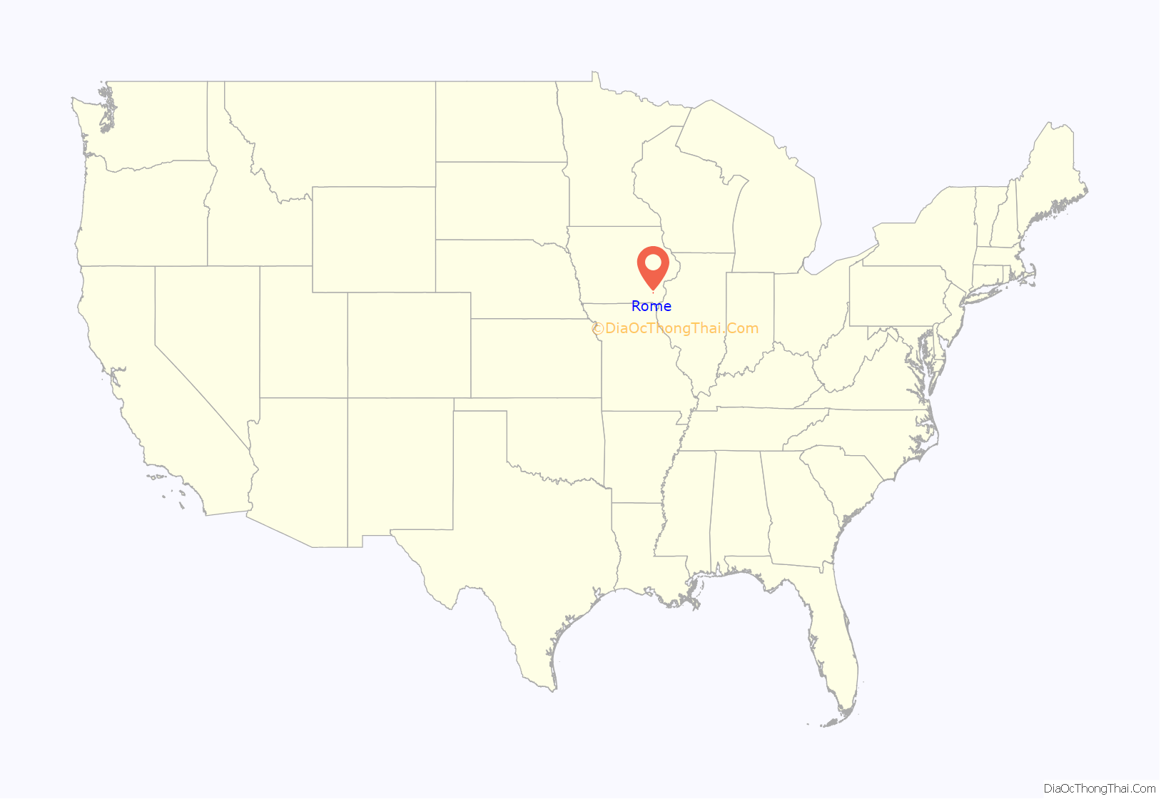
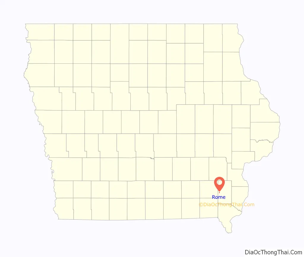
Rome is a village in Henry County, Iowa, United States. The population was 114 at the time of the 2020 census.
| Name: | Rome city |
|---|---|
| LSAD Code: | 25 |
| LSAD Description: | city (suffix) |
| State: | Iowa |
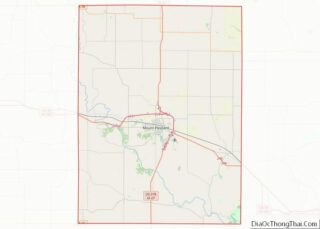
| County: | Henry County |
| Elevation: | 597 ft (182 m) |
| Total Area: | 0.13 sq mi (0.32 km²) |
| Land Area: | 0.12 sq mi (0.32 km²) |
| Water Area: | 0.00 sq mi (0.00 km²) |
| Total Population: | 114 |
| Population Density: | 919.35/sq mi (353.75/km²) |
| ZIP code: | 52642 |
| Area code: | 319 |
| FIPS code: | 1968565 |
| GNISfeature ID: | 0460771 |
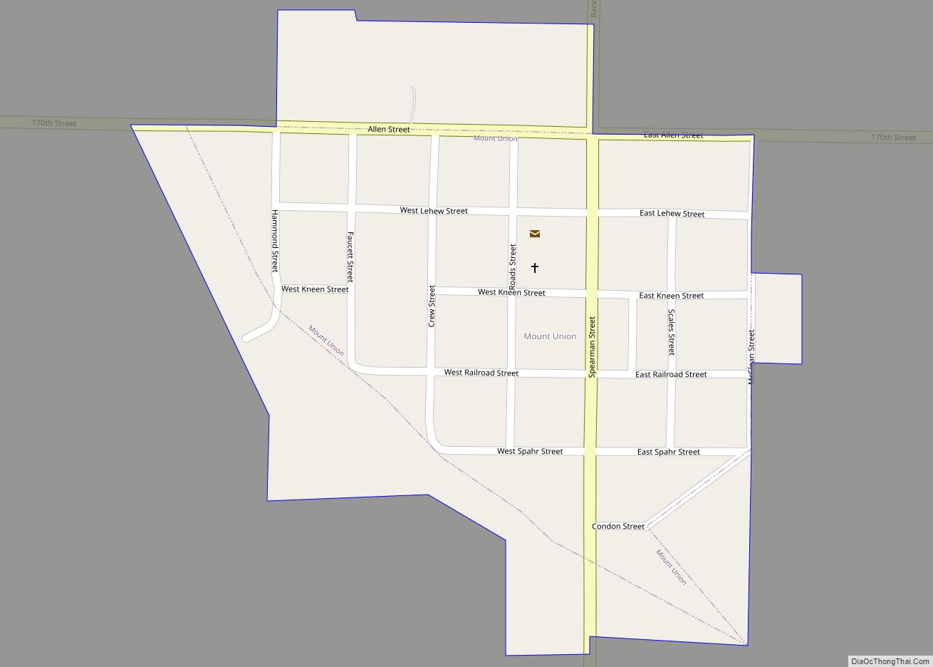
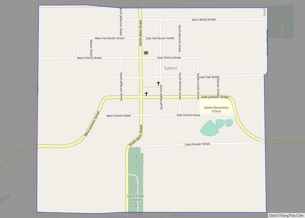
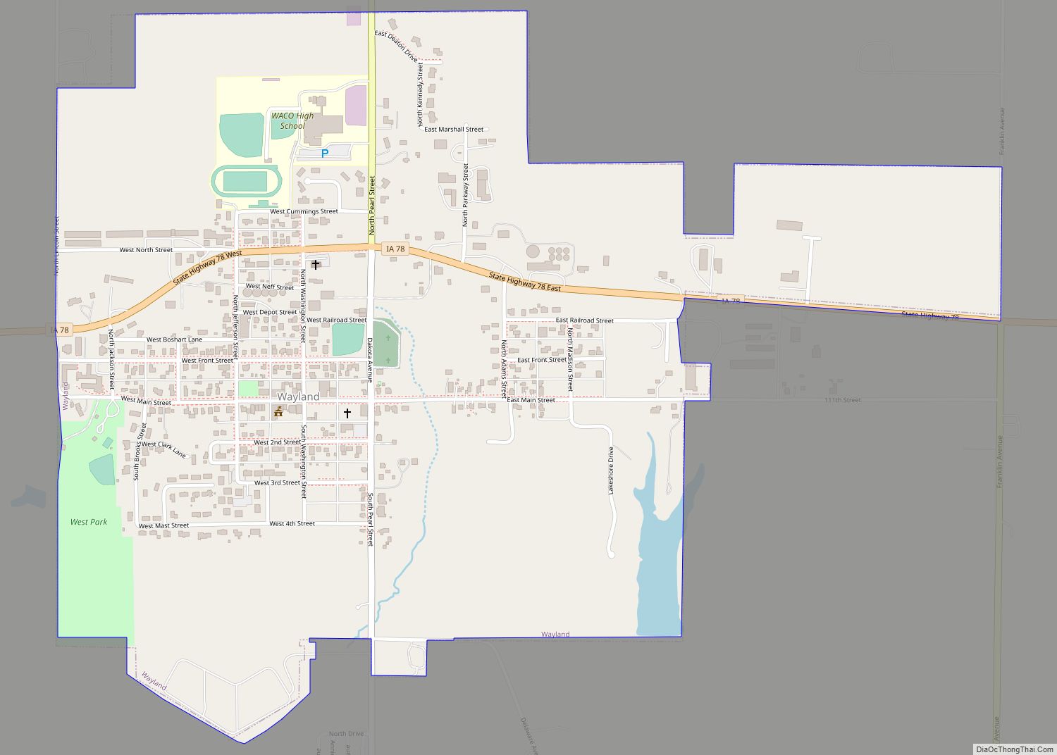
Online Interactive Map
Click on ![]() to view map in "full screen" mode.
to view map in "full screen" mode.
Rome location map. Where is Rome city?
History
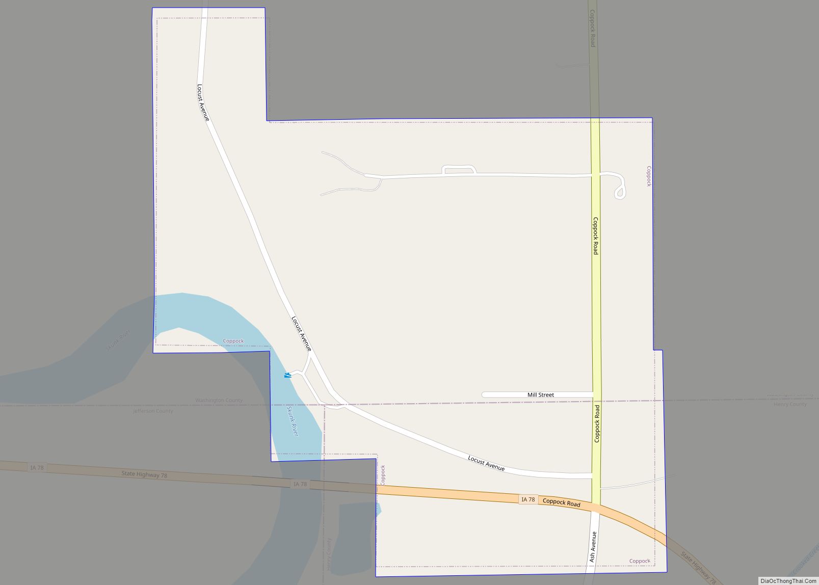
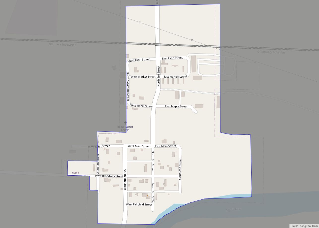
Rome was first laid out in 1846 by William Scott. In 1866, Rome annexed land across the Skunk River, in order to be connected to the Chicago, Burlington and Quincy Railroad.
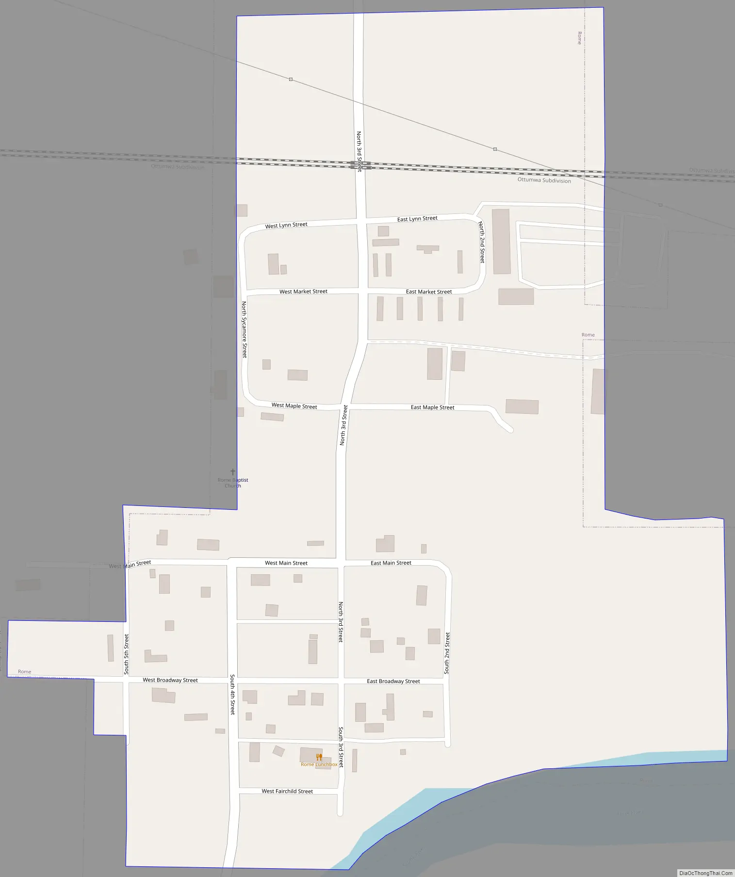
Rome Road Map
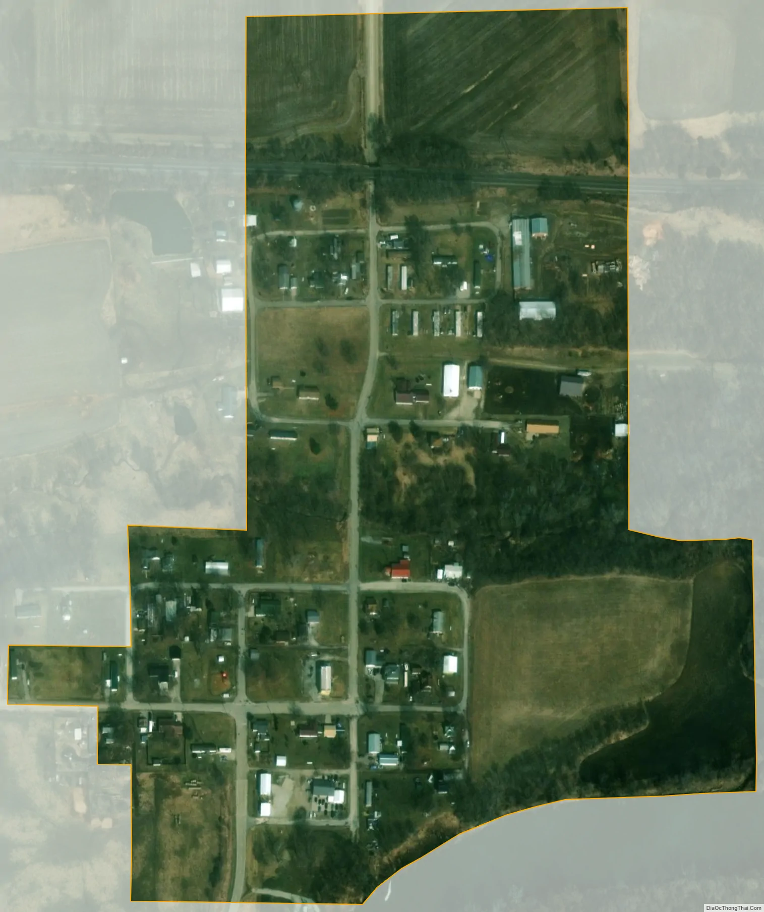
Rome city Satellite Map
Geography
Rome’s longitude and latitude coordinates in decimal form are 40.983047, -91.683033.
According to the United States Census Bureau, the village has a total area of 0.13 square miles (0.34 km), all land. The village is situated on the northwest bank of the Skunk River.
See also
Map of Iowa State and its subdivision:- Adair
- Adams
- Allamakee
- Appanoose
- Audubon
- Benton
- Black Hawk
- Boone
- Bremer
- Buchanan
- Buena Vista
- Butler
- Calhoun
- Carroll
- Cass
- Cedar
- Cerro Gordo
- Cherokee
- Chickasaw
- Clarke
- Clay
- Clayton
- Clinton
- Crawford
- Dallas
- Davis
- Decatur
- Delaware
- Des Moines
- Dickinson
- Dubuque
- Emmet
- Fayette
- Floyd
- Franklin
- Fremont
- Greene
- Grundy
- Guthrie
- Hamilton
- Hancock
- Hardin
- Harrison
- Henry
- Howard
- Humboldt
- Ida
- Iowa
- Jackson
- Jasper
- Jefferson
- Johnson
- Jones
- Keokuk
- Kossuth
- Lee
- Linn
- Louisa
- Lucas
- Lyon
- Madison
- Mahaska
- Marion
- Marshall
- Mills
- Mitchell
- Monona
- Monroe
- Montgomery
- Muscatine
- O'Brien
- Osceola
- Page
- Palo Alto
- Plymouth
- Pocahontas
- Polk
- Pottawattamie
- Poweshiek
- Ringgold
- Sac
- Scott
- Shelby
- Sioux
- Story
- Tama
- Taylor
- Union
- Van Buren
- Wapello
- Warren
- Washington
- Wayne
- Webster
- Winnebago
- Winneshiek
- Woodbury
- Worth
- Wright
- Alabama
- Alaska
- Arizona
- Arkansas
- California
- Colorado
- Connecticut
- Delaware
- District of Columbia
- Florida
- Georgia
- Hawaii
- Idaho
- Illinois
- Indiana
- Iowa
- Kansas
- Kentucky
- Louisiana
- Maine
- Maryland
- Massachusetts
- Michigan
- Minnesota
- Mississippi
- Missouri
- Montana
- Nebraska
- Nevada
- New Hampshire
- New Jersey
- New Mexico
- New York
- North Carolina
- North Dakota
- Ohio
- Oklahoma
- Oregon
- Pennsylvania
- Rhode Island
- South Carolina
- South Dakota
- Tennessee
- Texas
- Utah
- Vermont
- Virginia
- Washington
- West Virginia
- Wisconsin
- Wyoming