Sac City is a city in and the county seat of Sac County, Iowa, United States, located just southwest of the eastern intersection of U.S. Routes 20 and 71 in the rolling hills along the valley of the North Raccoon River. The city is one of 45 designated Main Street Iowa communities through the Main Street Iowa development program. The population was 2,063 in the 2020 census, a decline from the 2,368 population in 2000.
| Name: | Sac City city |
|---|---|
| LSAD Code: | 25 |
| LSAD Description: | city (suffix) |
| State: | Iowa |
| County: | Sac County |
| Elevation: | 1,217 ft (371 m) |
| Total Area: | 4.96 sq mi (12.86 km²) |
| Land Area: | 4.90 sq mi (12.68 km²) |
| Water Area: | 0.07 sq mi (0.17 km²) |
| Total Population: | 2,063 |
| Population Density: | 421.36/sq mi (162.67/km²) |
| ZIP code: | 50583 |
| Area code: | 712 |
| FIPS code: | 1969645 |
| GNISfeature ID: | 0460882 |
| Website: | saccity.city |
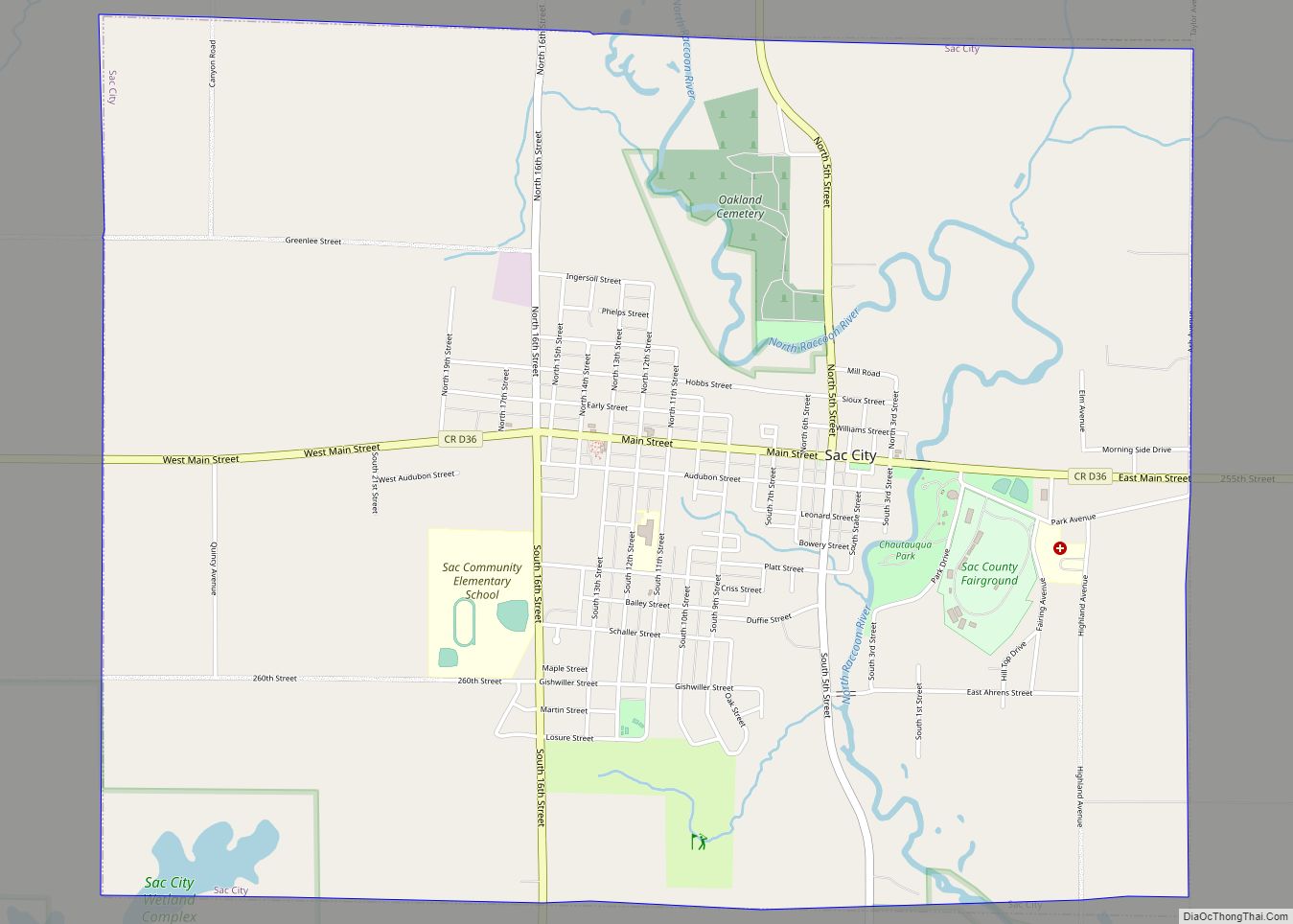
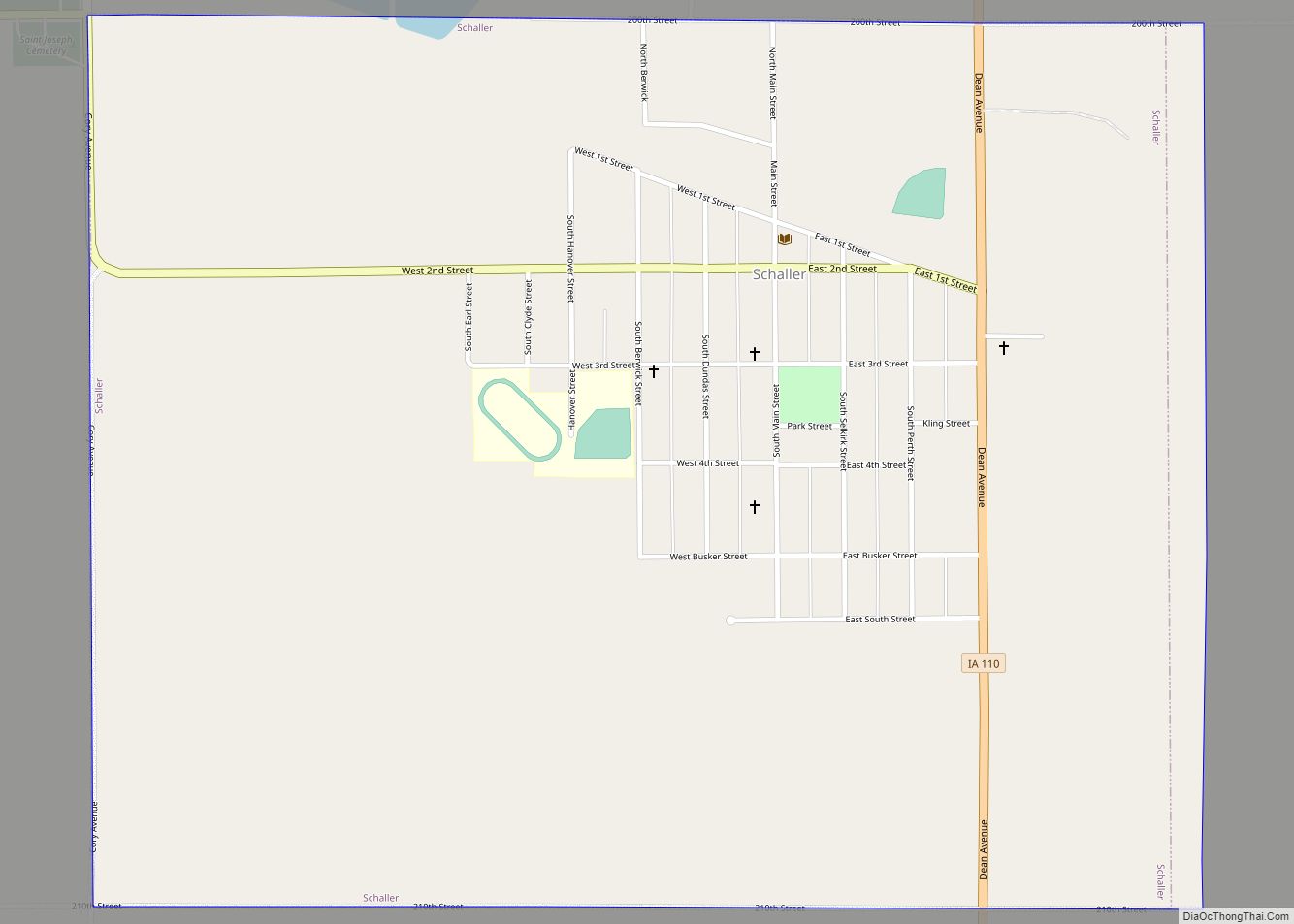
Online Interactive Map
Click on ![]() to view map in "full screen" mode.
to view map in "full screen" mode.
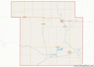
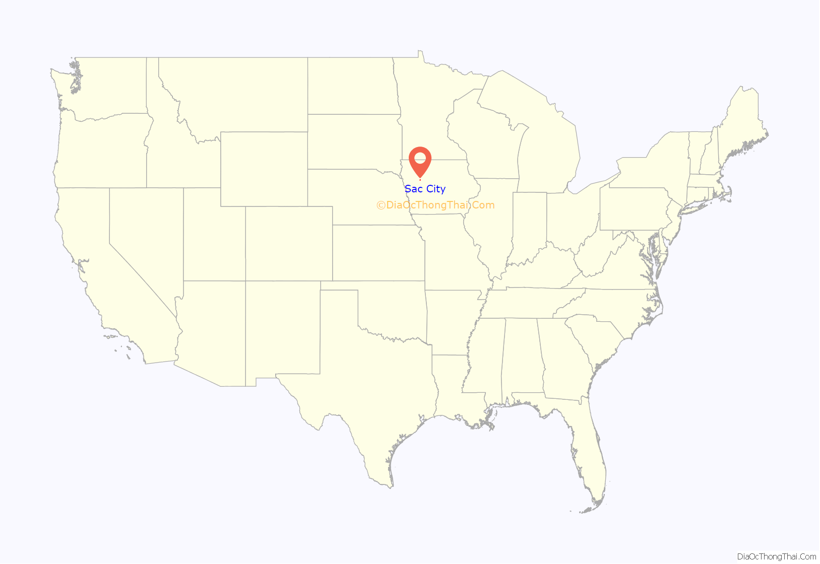
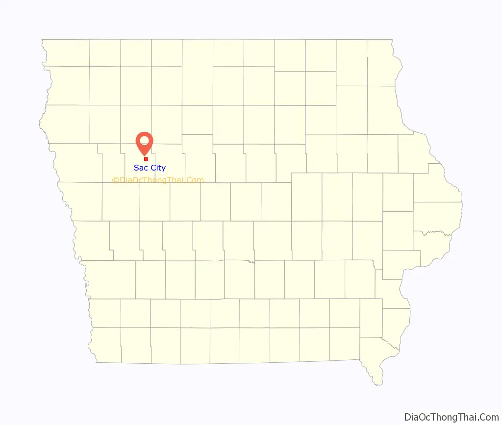
Sac City location map. Where is Sac City city?
History
Sac City was first platted in 1855 by Joshua Keith Powell of Fort Dodge, Iowa. The town was so named because the Sac and Fox Indians were in possession of the land at the time of the Louisiana Purchase. The City of Sac City was incorporated 19 years later, in 1874.
Judge Eugene Criss, credited with being the father of Sac City, left Wisconsin and crossed the Mississippi River in the early months of 1855 by covered wagon. He was in search of waterpower and had the desire to establish a settlement in a new and untried country. Deciding upon the North Raccoon River to begin his settlement, Judge Criss proceeded to erect the first log cabin in Sac City, establish himself in the hotel business, as well as keep a stage station and general store for nearby settlers.
As early as 1859, there was talk of building a railroad through Sac County, but the first railroad did not come through Sac City until 1879. The railroad companies refused to lay tracks through undeveloped or mildly developed areas, and Sac City did not meet the requirements. The railroad companies demanded communities be far enough advanced to provide a quick return to capital before they would construct a steam and iron highway through the area. When it came, the railroad benefited Sac City incredibly. The Chicago and North Western Transportation Company connected Sac City, Wall Lake, Auburn, Odebolt, Lake View, Early, and Schaller as well as the cities where crops were sold.
The first Sac County Fair was held in 1871 on 10 acres (40,000 m) of ground east of Sac City that had been purchased by the Sac County Agricultural Society the same year. The fair was one of the biggest events of the year and brought people in wagons and buggies from miles around to see the harness races, livestock exhibits, produce, needlework, and art goods.
The Sac City Chautauqua Association was organized in December 1904 with 120 members. The Association brought many fine programs to the community, and because transportation was still slow and laborious, many families stayed in tents on the grounds for the entire Chautauqua session, about eight or nine days. At first the meetings were held in a tent, but by 1908, the citizens of Sac City built a Chautauqua Building in which to hold their meetings, and which is now the only one left of its kind in the state of Iowa.
Modern-day
In May 2017 lifelong Sac City resident and businessman John Criss donated US$5.7 million of his estate to the city for beautification projects.
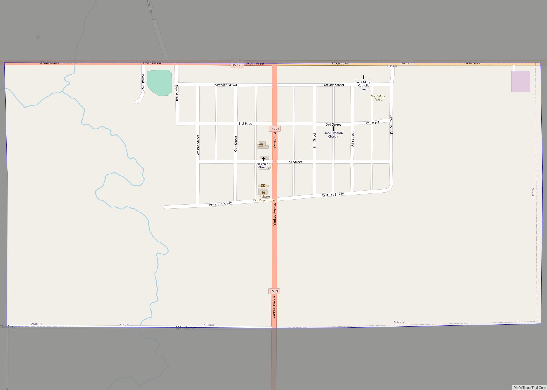
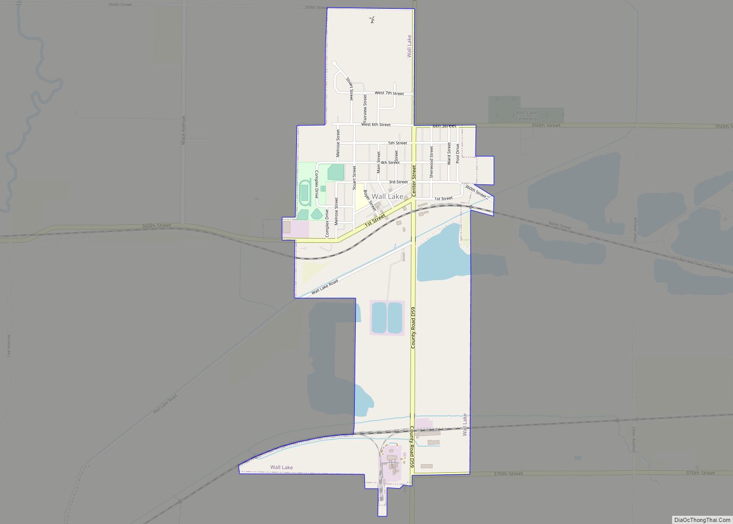
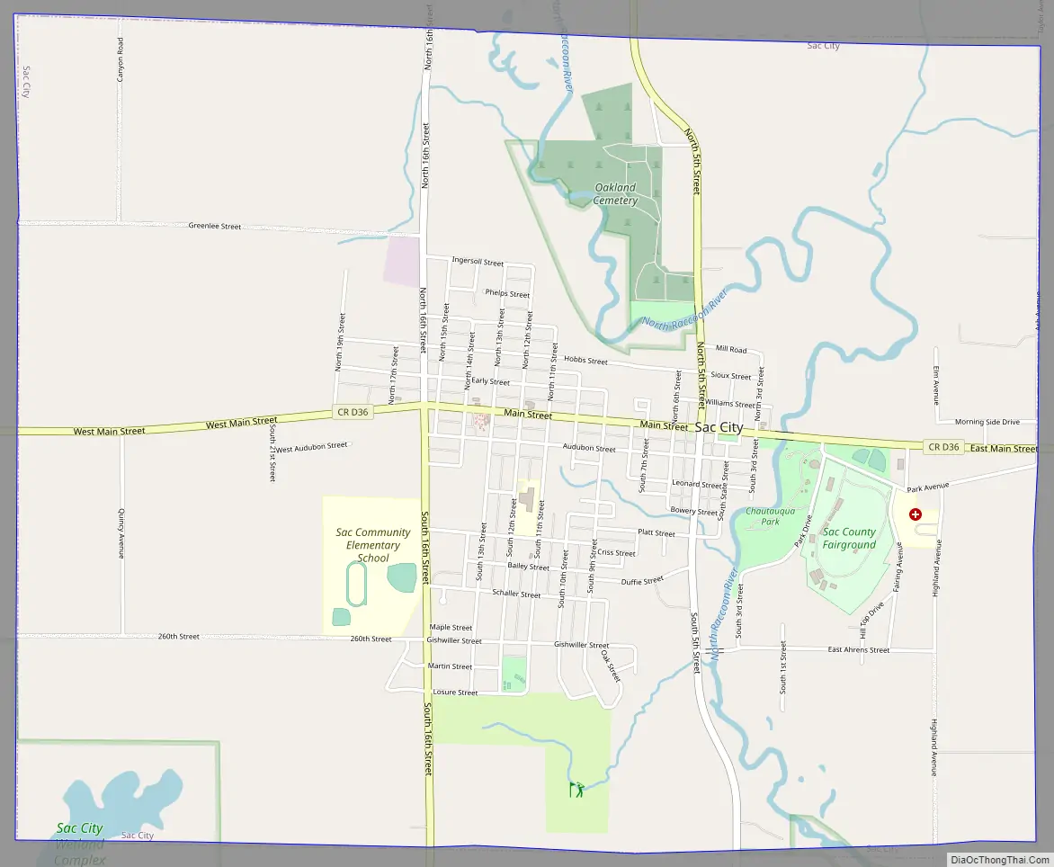
Sac City Road Map
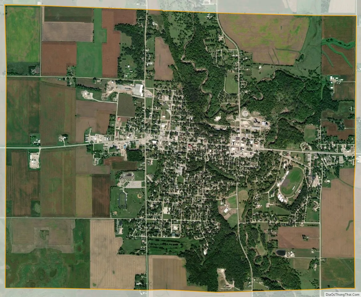
Sac City city Satellite Map
Geography
Sac City’s longitude and latitude coordinates in decimal form are 42.421154, -94.995083.
According to the United States Census Bureau, the city has a total area of 4.93 square miles (12.77 km), of which 4.86 square miles (12.59 km) is land and 0.07 square miles (0.18 km) is water.
Climate
Humid continental climate is a climatic region typified by large seasonal temperature differences, with warm to hot (and often humid) summers and cold (sometimes severely cold) winters. Precipitation is relatively well distributed year-round in many areas with this climate. The Köppen Climate Classification subtype for this climate is “Dfa” (Hot Summer Continental Climate).
See also
Map of Iowa State and its subdivision:- Adair
- Adams
- Allamakee
- Appanoose
- Audubon
- Benton
- Black Hawk
- Boone
- Bremer
- Buchanan
- Buena Vista
- Butler
- Calhoun
- Carroll
- Cass
- Cedar
- Cerro Gordo
- Cherokee
- Chickasaw
- Clarke
- Clay
- Clayton
- Clinton
- Crawford
- Dallas
- Davis
- Decatur
- Delaware
- Des Moines
- Dickinson
- Dubuque
- Emmet
- Fayette
- Floyd
- Franklin
- Fremont
- Greene
- Grundy
- Guthrie
- Hamilton
- Hancock
- Hardin
- Harrison
- Henry
- Howard
- Humboldt
- Ida
- Iowa
- Jackson
- Jasper
- Jefferson
- Johnson
- Jones
- Keokuk
- Kossuth
- Lee
- Linn
- Louisa
- Lucas
- Lyon
- Madison
- Mahaska
- Marion
- Marshall
- Mills
- Mitchell
- Monona
- Monroe
- Montgomery
- Muscatine
- O'Brien
- Osceola
- Page
- Palo Alto
- Plymouth
- Pocahontas
- Polk
- Pottawattamie
- Poweshiek
- Ringgold
- Sac
- Scott
- Shelby
- Sioux
- Story
- Tama
- Taylor
- Union
- Van Buren
- Wapello
- Warren
- Washington
- Wayne
- Webster
- Winnebago
- Winneshiek
- Woodbury
- Worth
- Wright
- Alabama
- Alaska
- Arizona
- Arkansas
- California
- Colorado
- Connecticut
- Delaware
- District of Columbia
- Florida
- Georgia
- Hawaii
- Idaho
- Illinois
- Indiana
- Iowa
- Kansas
- Kentucky
- Louisiana
- Maine
- Maryland
- Massachusetts
- Michigan
- Minnesota
- Mississippi
- Missouri
- Montana
- Nebraska
- Nevada
- New Hampshire
- New Jersey
- New Mexico
- New York
- North Carolina
- North Dakota
- Ohio
- Oklahoma
- Oregon
- Pennsylvania
- Rhode Island
- South Carolina
- South Dakota
- Tennessee
- Texas
- Utah
- Vermont
- Virginia
- Washington
- West Virginia
- Wisconsin
- Wyoming