Scranton is a city in Greene County, Iowa, United States. The population was 511 at the time of the 2020 census. It was named after Scranton, Pennsylvania.
| Name: | Scranton city |
|---|---|
| LSAD Code: | 25 |
| LSAD Description: | city (suffix) |
| State: | Iowa |
| County: | Greene County |
| Elevation: | 1,178 ft (359 m) |
| Total Area: | 1.86 sq mi (4.82 km²) |
| Land Area: | 1.86 sq mi (4.82 km²) |
| Water Area: | 0.00 sq mi (0.00 km²) |
| Total Population: | 511 |
| Population Density: | 274.58/sq mi (106.00/km²) |
| ZIP code: | 51462 |
| Area code: | 712 |
| FIPS code: | 1971310 |
| GNISfeature ID: | 0461492 |
| Website: | www.scrantoniowa.com |
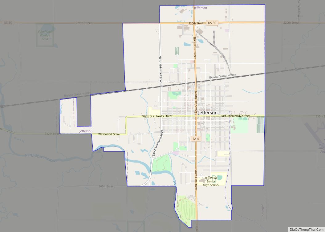
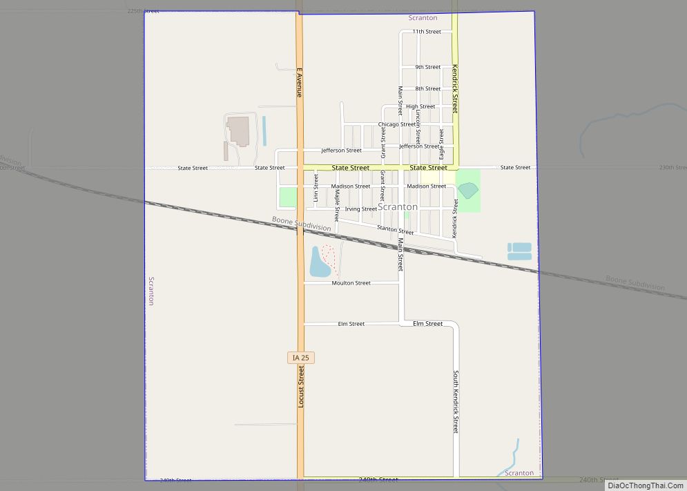
Online Interactive Map
Click on ![]() to view map in "full screen" mode.
to view map in "full screen" mode.
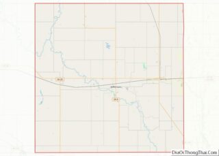
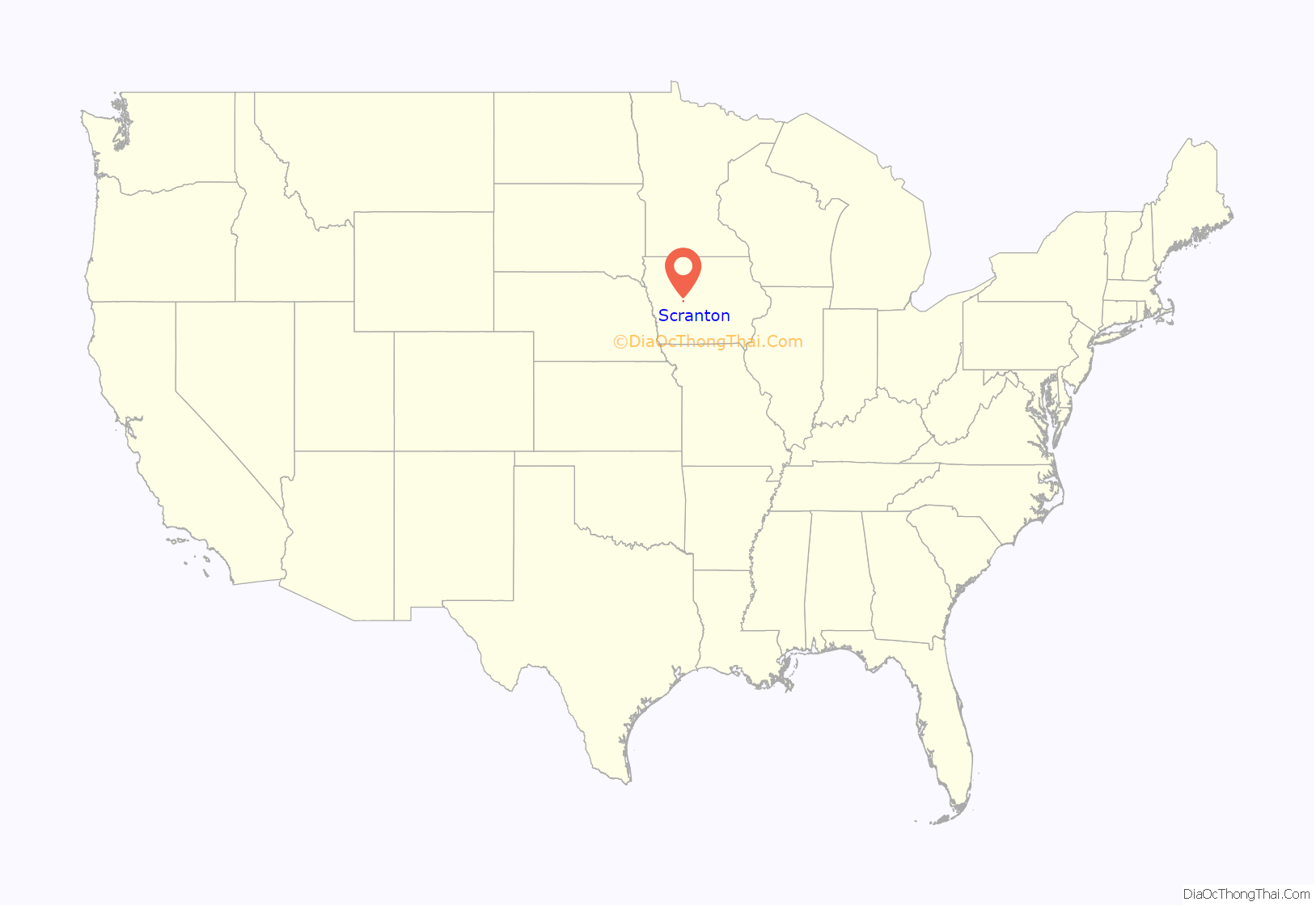
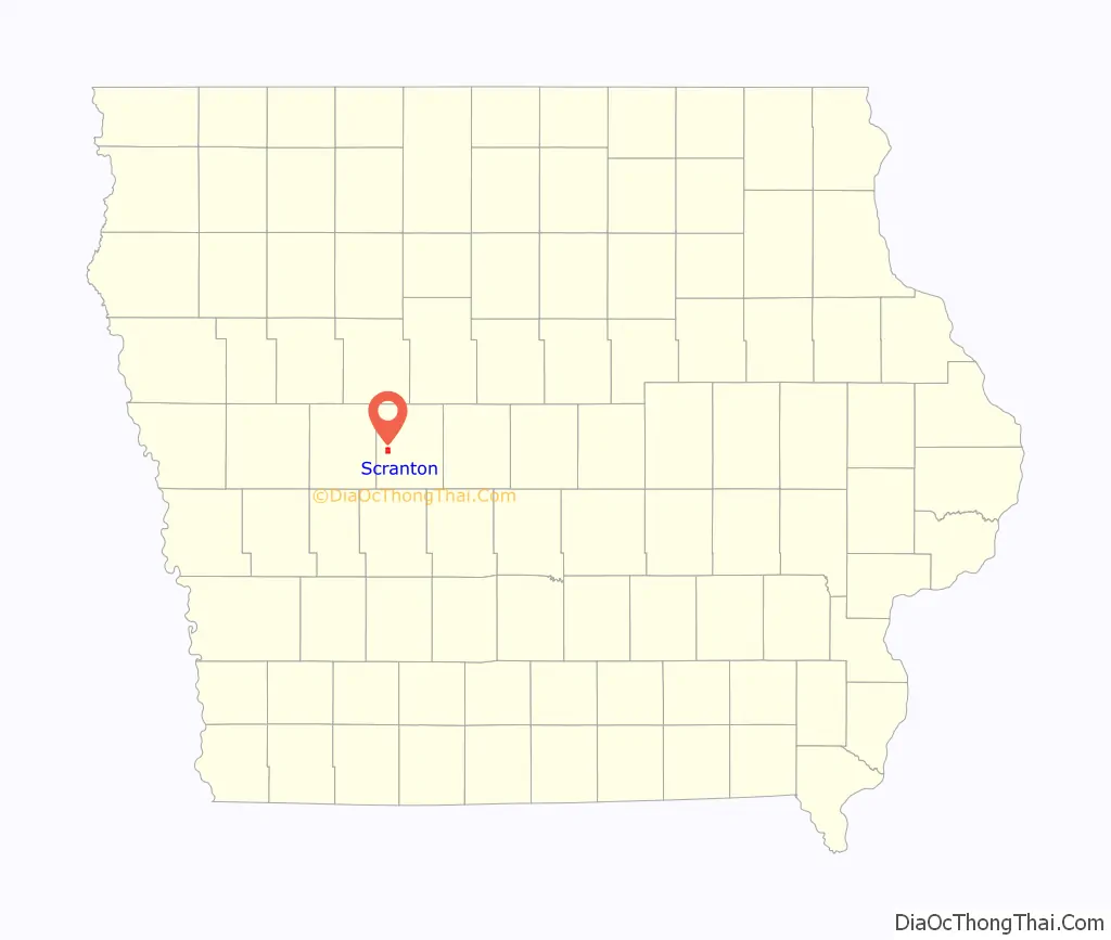
Scranton location map. Where is Scranton city?
History
Scranton was platted in 1869, shortly after the Cedar Rapids & Missouri River Railroad was built through that territory. It was named for Joseph H. Scranton of Scranton, Pennsylvania, who supplied most of the iron rails in the construction of the railroad. Scranton was incorporated in 1880.
Scranton’s water tower, built in 1897, is the oldest working water tower in Iowa and ninth oldest in the United States. A fire occurred at the tower in 1907, initially started to melt ice that had caused the town to be without water. Three men were injured attempting to put the fire out, although the tower itself did not suffer any major damage.
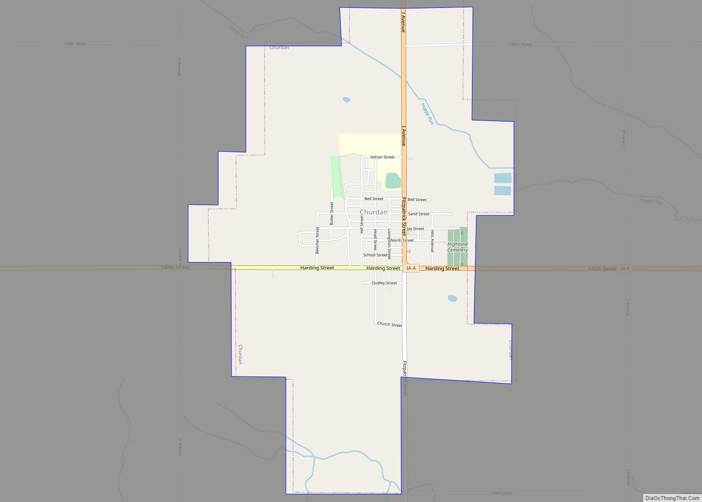
Scranton Road Map
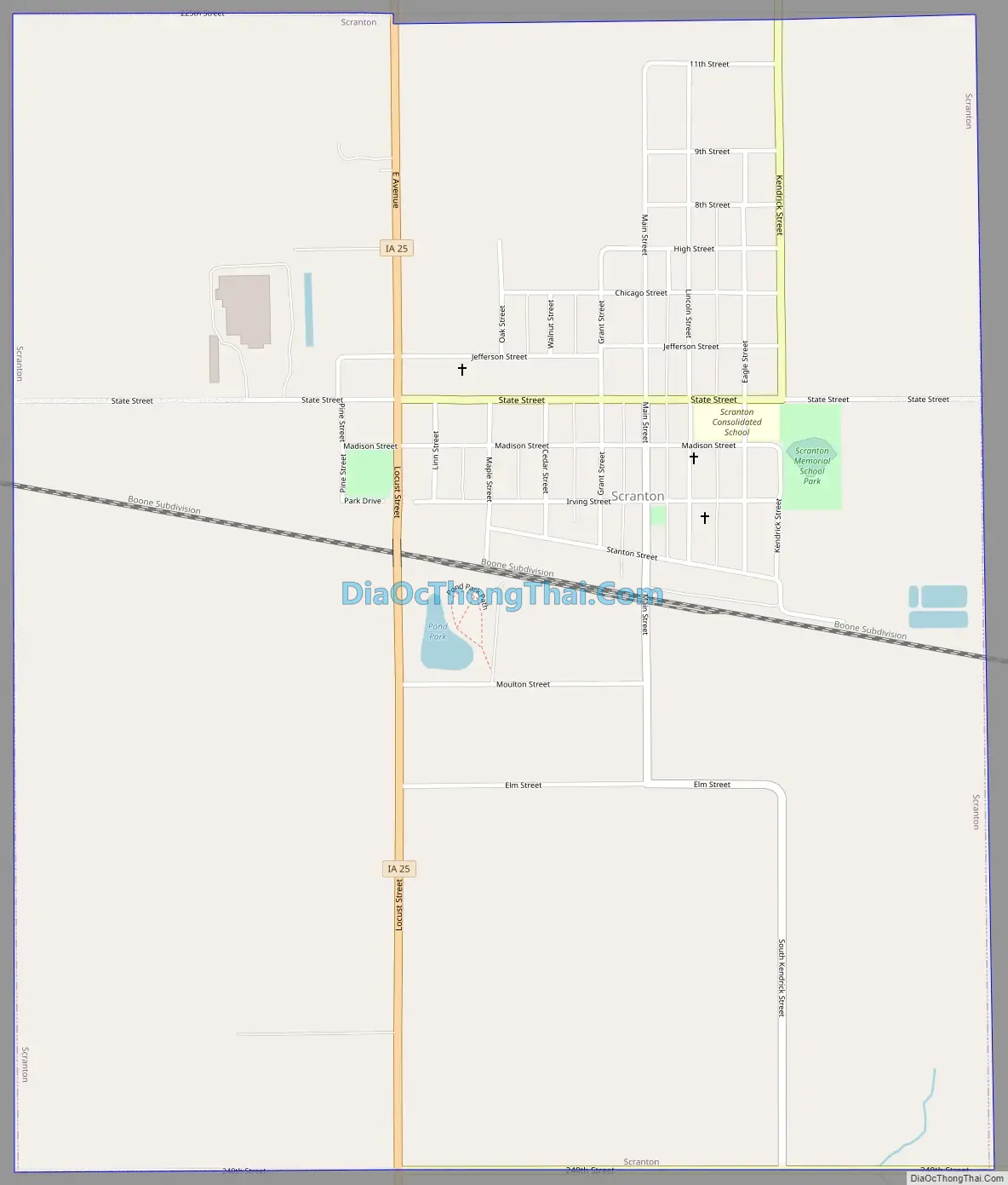
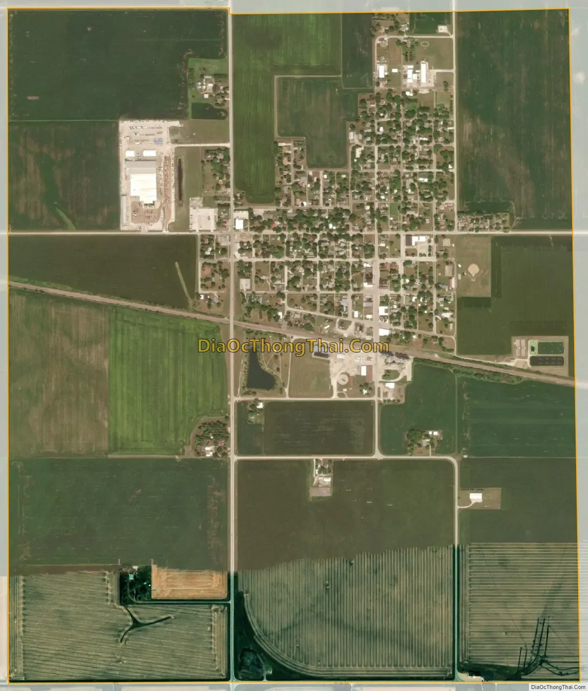
Scranton city Satellite Map
Geography
Scranton is located along U.S. Route 30 at 42°1′20″N 94°32′46″W / 42.02222°N 94.54611°W / 42.02222; -94.54611 (42.022197, -94.546047), in the valley of the North Raccoon River.
According to the United States Census Bureau, the city has a total area of 1.88 square miles (4.87 km), all land.
See also
Map of Iowa State and its subdivision:- Adair
- Adams
- Allamakee
- Appanoose
- Audubon
- Benton
- Black Hawk
- Boone
- Bremer
- Buchanan
- Buena Vista
- Butler
- Calhoun
- Carroll
- Cass
- Cedar
- Cerro Gordo
- Cherokee
- Chickasaw
- Clarke
- Clay
- Clayton
- Clinton
- Crawford
- Dallas
- Davis
- Decatur
- Delaware
- Des Moines
- Dickinson
- Dubuque
- Emmet
- Fayette
- Floyd
- Franklin
- Fremont
- Greene
- Grundy
- Guthrie
- Hamilton
- Hancock
- Hardin
- Harrison
- Henry
- Howard
- Humboldt
- Ida
- Iowa
- Jackson
- Jasper
- Jefferson
- Johnson
- Jones
- Keokuk
- Kossuth
- Lee
- Linn
- Louisa
- Lucas
- Lyon
- Madison
- Mahaska
- Marion
- Marshall
- Mills
- Mitchell
- Monona
- Monroe
- Montgomery
- Muscatine
- O'Brien
- Osceola
- Page
- Palo Alto
- Plymouth
- Pocahontas
- Polk
- Pottawattamie
- Poweshiek
- Ringgold
- Sac
- Scott
- Shelby
- Sioux
- Story
- Tama
- Taylor
- Union
- Van Buren
- Wapello
- Warren
- Washington
- Wayne
- Webster
- Winnebago
- Winneshiek
- Woodbury
- Worth
- Wright
- Alabama
- Alaska
- Arizona
- Arkansas
- California
- Colorado
- Connecticut
- Delaware
- District of Columbia
- Florida
- Georgia
- Hawaii
- Idaho
- Illinois
- Indiana
- Iowa
- Kansas
- Kentucky
- Louisiana
- Maine
- Maryland
- Massachusetts
- Michigan
- Minnesota
- Mississippi
- Missouri
- Montana
- Nebraska
- Nevada
- New Hampshire
- New Jersey
- New Mexico
- New York
- North Carolina
- North Dakota
- Ohio
- Oklahoma
- Oregon
- Pennsylvania
- Rhode Island
- South Carolina
- South Dakota
- Tennessee
- Texas
- Utah
- Vermont
- Virginia
- Washington
- West Virginia
- Wisconsin
- Wyoming