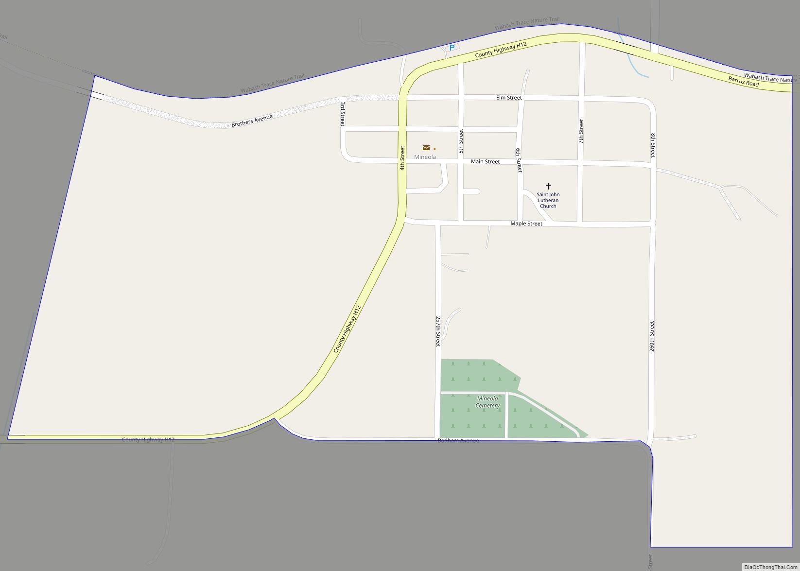
Silver City is a city in Mills County, Iowa, United States. The population was 245 at the 2020 census. The Wabash Trace—a railroad converted to a bicycle trail—passes through here. At trailside, there is a small park with a gazebo, and across from it, a small cafe.
| Name: | Silver City city |
|---|---|
| LSAD Code: | 25 |
| LSAD Description: | city (suffix) |
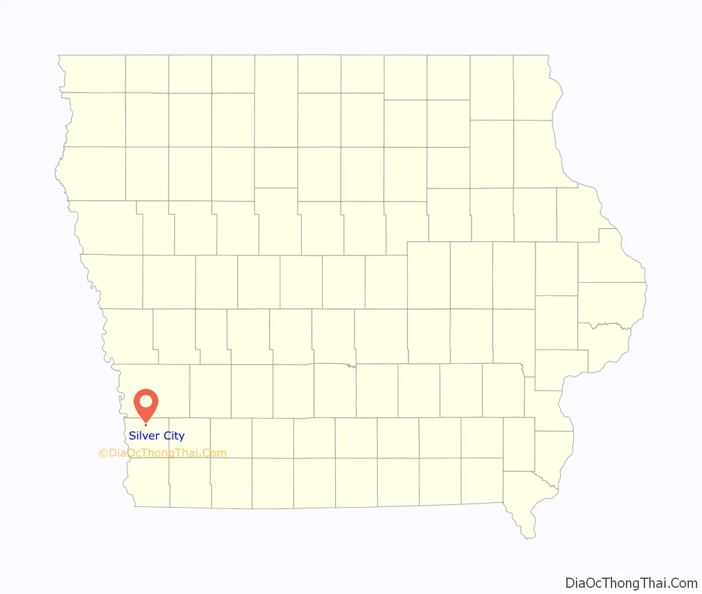
| State: | Iowa |
| County: | Mills County |
| Elevation: | 1,047 ft (319 m) |
| Total Area: | 0.21 sq mi (0.54 km²) |
| Land Area: | 0.21 sq mi (0.54 km²) |
| Water Area: | 0.00 sq mi (0.00 km²) |
| Total Population: | 245 |
| Population Density: | 1,172.25/sq mi (452.03/km²) |
| ZIP code: | 51571 |
| Area code: | 712 |
| FIPS code: | 1973155 |
| GNISfeature ID: | 0461609 |
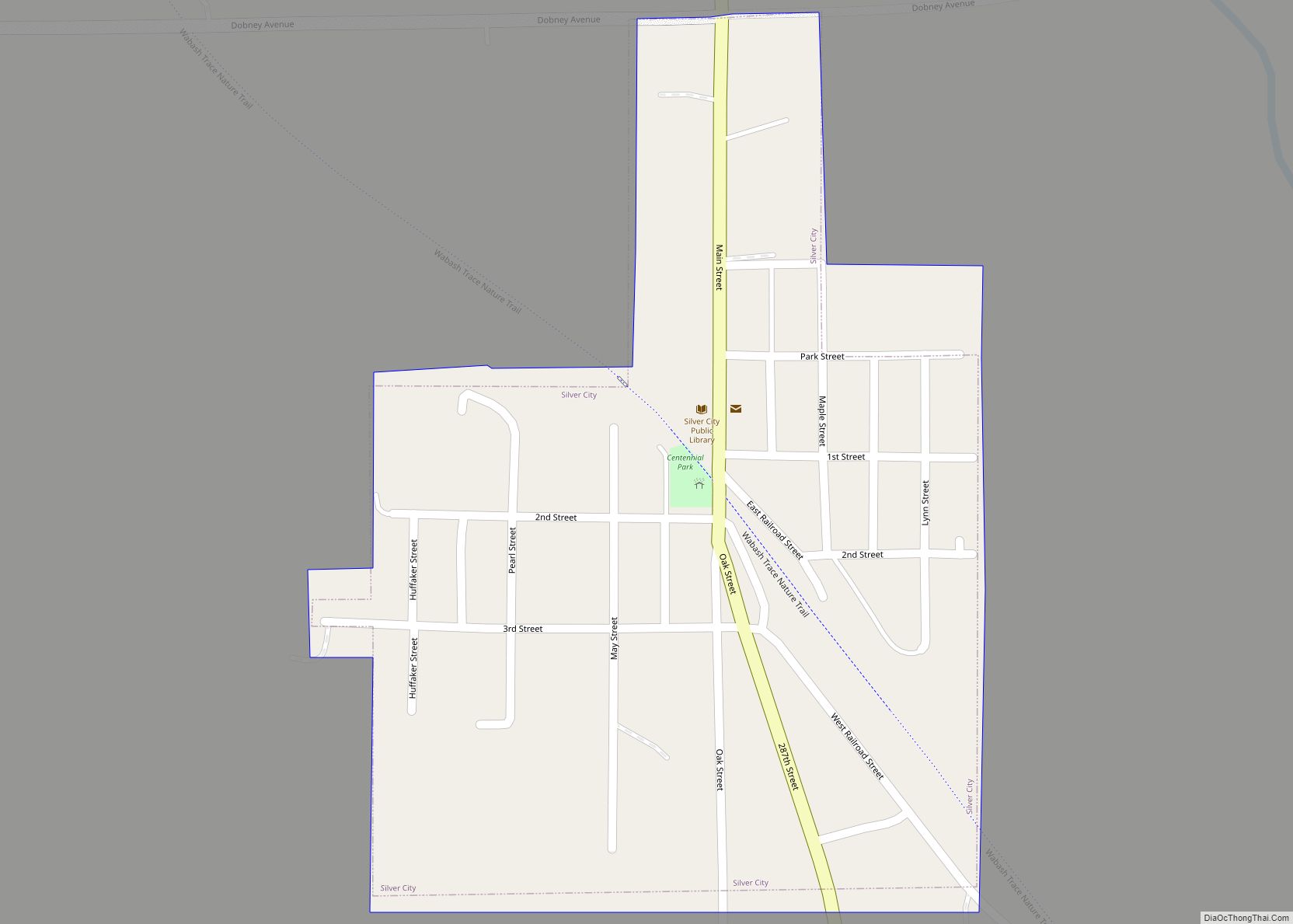
Online Interactive Map
Click on ![]() to view map in "full screen" mode.
to view map in "full screen" mode.
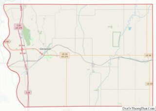
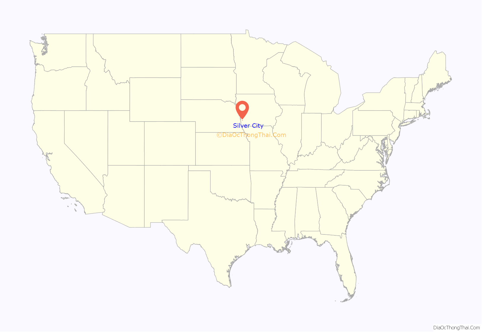
Silver City location map. Where is Silver City city?
History
Silver City had its start in the year 1879 by the building of the Wabash, St. Louis and Pacific Railway through that territory.
In its busiest time, Silver City was home to a lumber yard, grocery store, horse racing track, jewelry store, pharmacy and other businesses. An annual carnival would visit as well.
Silver City is currently home to the Loyal Lassies/Ingraham Straight Shooters 4-H club as well as the Silver City Library and historical society. Silver City Volunteer Fire & Rescue services the town and immediate area. Mills County Sheriffs Department provides emergency response and patrol services.
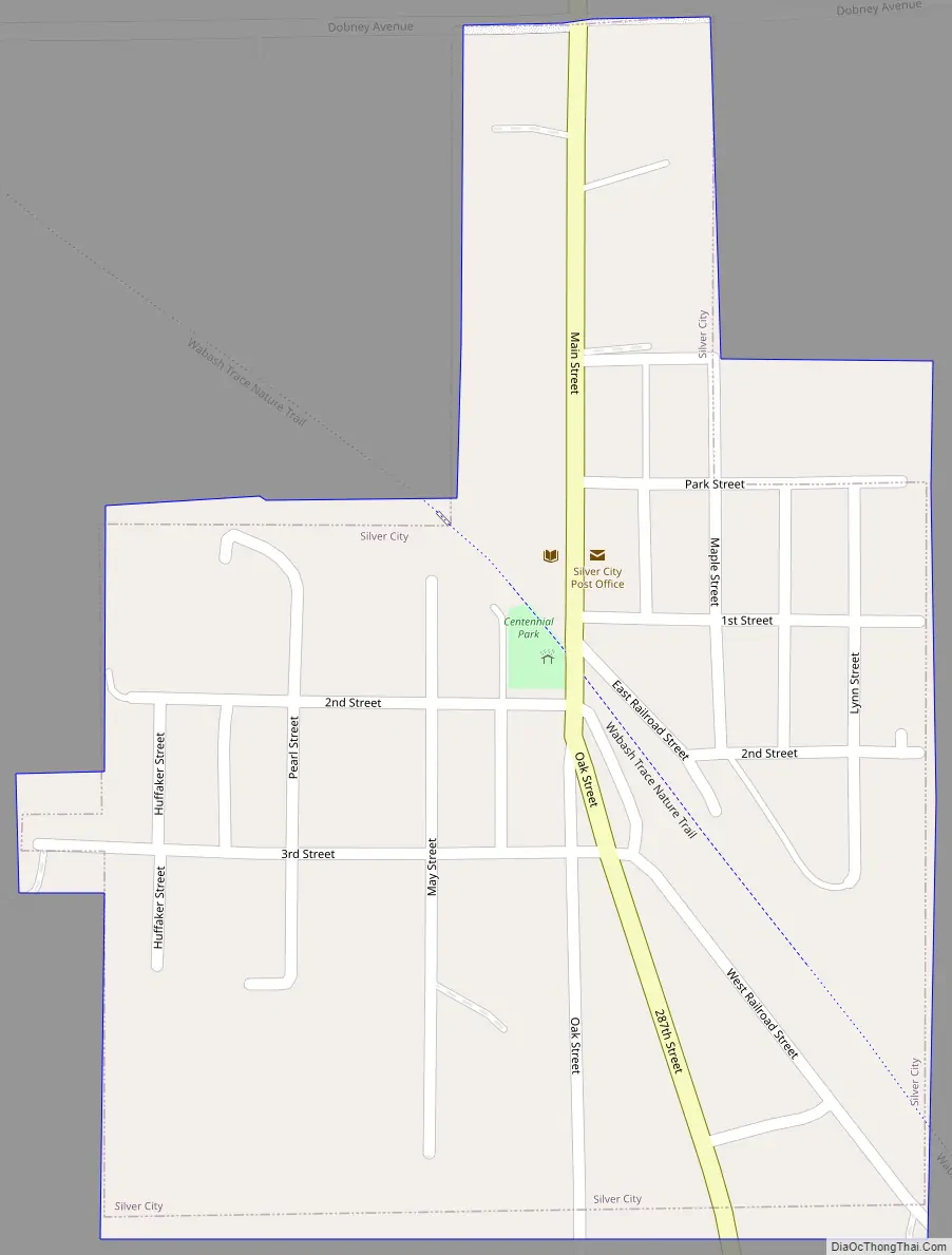
Silver City Road Map
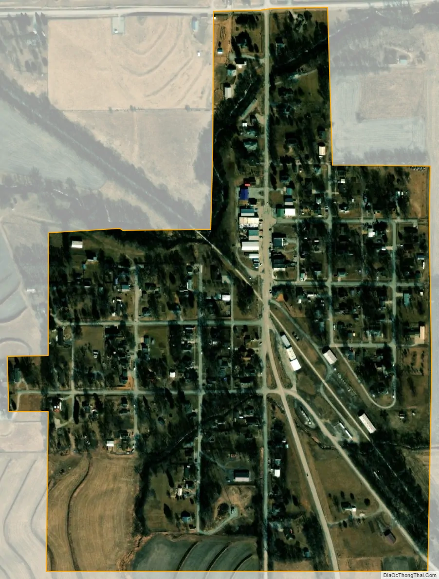
Silver City city Satellite Map
Geography
Silver City is located at 41°6′43″N 95°38′17″W / 41.11194°N 95.63806°W / 41.11194; -95.63806 (41.112051, -95.638057). Silver Creek, the town’s namesake and a tributary of the West Nishnabotna River, parallels the eastern city limits. The Wabash Trace Nature Trail, a former rail line, enters the town from the west and runs southeasterly through town, making a southerly turn before meeting Silver Creek.
According to the United States Census Bureau, the city has a total area of 0.22 square miles (0.57 km), all land.
See also
Map of Iowa State and its subdivision:- Adair
- Adams
- Allamakee
- Appanoose
- Audubon
- Benton
- Black Hawk
- Boone
- Bremer
- Buchanan
- Buena Vista
- Butler
- Calhoun
- Carroll
- Cass
- Cedar
- Cerro Gordo
- Cherokee
- Chickasaw
- Clarke
- Clay
- Clayton
- Clinton
- Crawford
- Dallas
- Davis
- Decatur
- Delaware
- Des Moines
- Dickinson
- Dubuque
- Emmet
- Fayette
- Floyd
- Franklin
- Fremont
- Greene
- Grundy
- Guthrie
- Hamilton
- Hancock
- Hardin
- Harrison
- Henry
- Howard
- Humboldt
- Ida
- Iowa
- Jackson
- Jasper
- Jefferson
- Johnson
- Jones
- Keokuk
- Kossuth
- Lee
- Linn
- Louisa
- Lucas
- Lyon
- Madison
- Mahaska
- Marion
- Marshall
- Mills
- Mitchell
- Monona
- Monroe
- Montgomery
- Muscatine
- O'Brien
- Osceola
- Page
- Palo Alto
- Plymouth
- Pocahontas
- Polk
- Pottawattamie
- Poweshiek
- Ringgold
- Sac
- Scott
- Shelby
- Sioux
- Story
- Tama
- Taylor
- Union
- Van Buren
- Wapello
- Warren
- Washington
- Wayne
- Webster
- Winnebago
- Winneshiek
- Woodbury
- Worth
- Wright
- Alabama
- Alaska
- Arizona
- Arkansas
- California
- Colorado
- Connecticut
- Delaware
- District of Columbia
- Florida
- Georgia
- Hawaii
- Idaho
- Illinois
- Indiana
- Iowa
- Kansas
- Kentucky
- Louisiana
- Maine
- Maryland
- Massachusetts
- Michigan
- Minnesota
- Mississippi
- Missouri
- Montana
- Nebraska
- Nevada
- New Hampshire
- New Jersey
- New Mexico
- New York
- North Carolina
- North Dakota
- Ohio
- Oklahoma
- Oregon
- Pennsylvania
- Rhode Island
- South Carolina
- South Dakota
- Tennessee
- Texas
- Utah
- Vermont
- Virginia
- Washington
- West Virginia
- Wisconsin
- Wyoming