Wheatland is a city in Clinton County, Iowa, United States. The population was 775 at the time of the 2020 census.
| Name: | Wheatland city |
|---|---|
| LSAD Code: | 25 |
| LSAD Description: | city (suffix) |
| State: | Iowa |
| County: | Clinton County |
| Elevation: | 689 ft (210 m) |
| Total Area: | 0.57 sq mi (1.49 km²) |
| Land Area: | 0.57 sq mi (1.49 km²) |
| Water Area: | 0.00 sq mi (0.00 km²) |
| Total Population: | 775 |
| Population Density: | 1,350.17/sq mi (521.63/km²) |
| ZIP code: | 52777 |
| Area code: | 563 |
| FIPS code: | 1984945 |
| Website: | www.cityofwheatland.org |
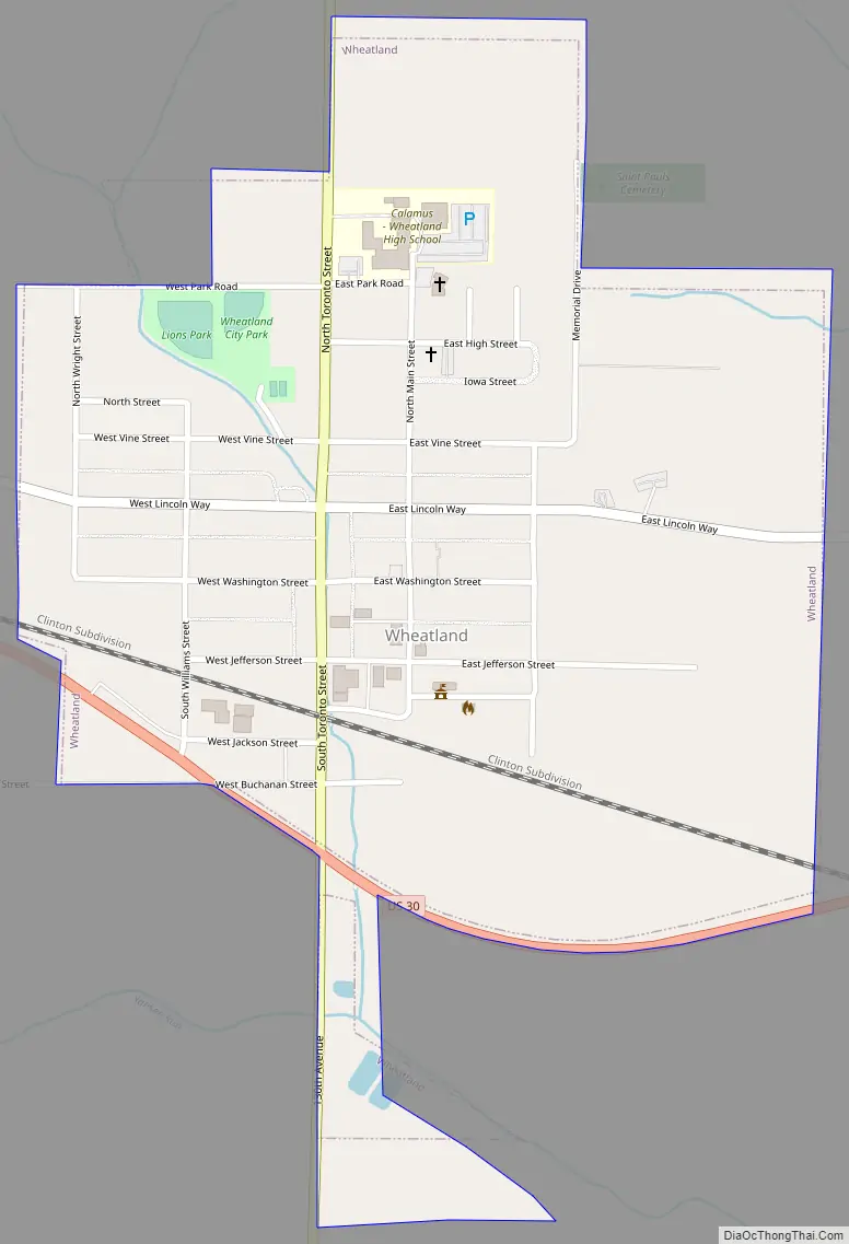
Online Interactive Map
Click on ![]() to view map in "full screen" mode.
to view map in "full screen" mode.
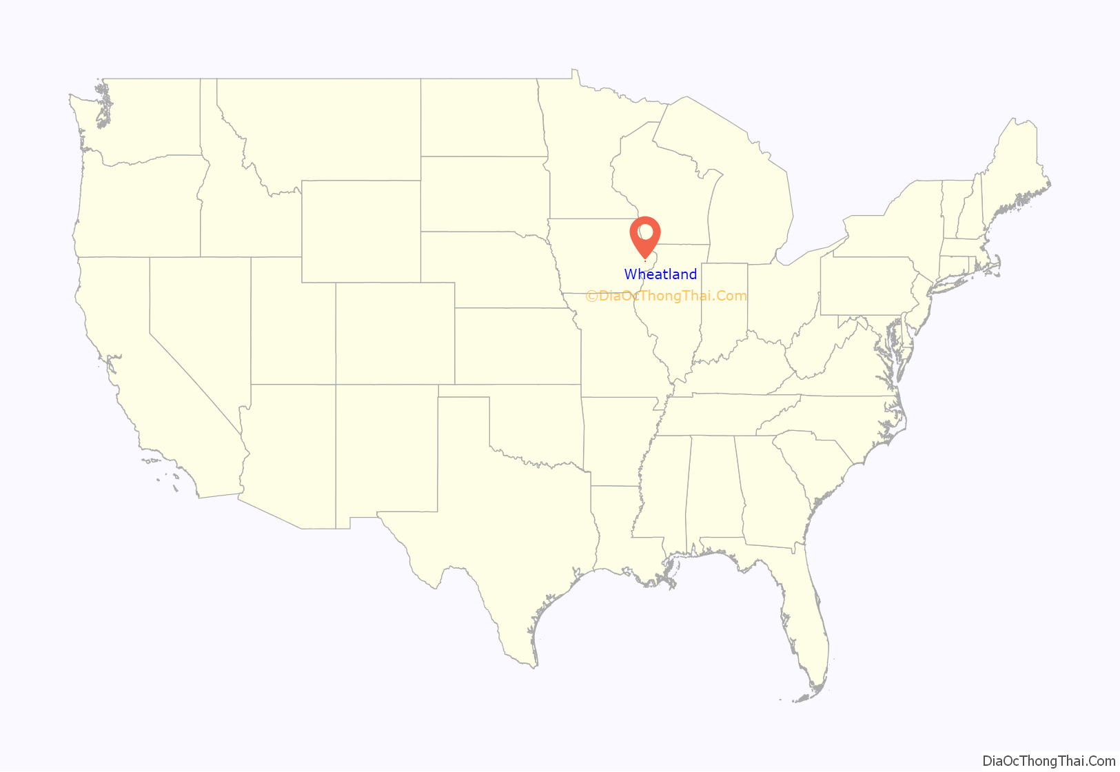
Wheatland location map. Where is Wheatland city?
History
Wheatland was platted in 1858 under the leadership of John Bennett. The town was named for President James Buchanan’s estate Wheatland in Lancaster, Pennsylvania. The entire township (Spring Rock) had a white population of only 101 in 1850, but that number rose to 756 in 1860. A significant body of early settlers all came from the village of Wunderthausen in central Germany. The Germans founded the first church in town in 1857 with a Presbyterian affiliation. This relationship was dissolved in 1861 with the incorporation of St. Paul’s German Reformed Church (now St. Paul’s United Church of Christ). The First Presbyterian Church was organized in 1858, though no longer functions. Wheatland was legally incorporated on July 13, 1869.
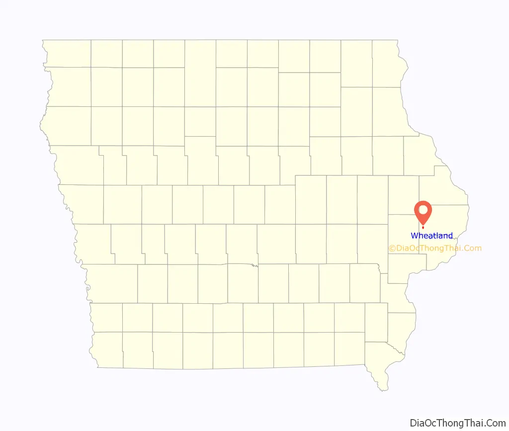
Wheatland Road Map
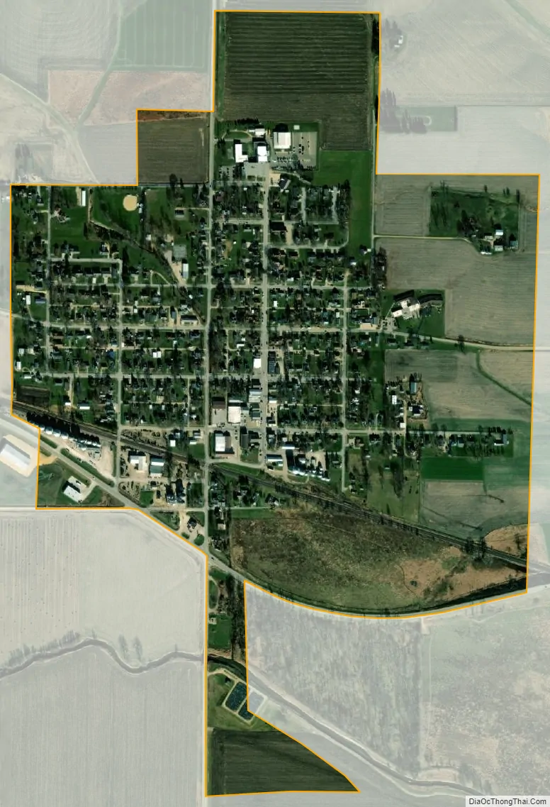
Wheatland city Satellite Map
Geography
Wheatland is located at 41°49′58″N 90°50′22″W / 41.83278°N 90.83944°W / 41.83278; -90.83944 (41.832891, -90.839490).
According to the United States Census Bureau, the city has a total area of 0.61 square miles (1.58 km), all land.
See also
Map of Iowa State and its subdivision:- Adair
- Adams
- Allamakee
- Appanoose
- Audubon
- Benton
- Black Hawk
- Boone
- Bremer
- Buchanan
- Buena Vista
- Butler
- Calhoun
- Carroll
- Cass
- Cedar
- Cerro Gordo
- Cherokee
- Chickasaw
- Clarke
- Clay
- Clayton
- Clinton
- Crawford
- Dallas
- Davis
- Decatur
- Delaware
- Des Moines
- Dickinson
- Dubuque
- Emmet
- Fayette
- Floyd
- Franklin
- Fremont
- Greene
- Grundy
- Guthrie
- Hamilton
- Hancock
- Hardin
- Harrison
- Henry
- Howard
- Humboldt
- Ida
- Iowa
- Jackson
- Jasper
- Jefferson
- Johnson
- Jones
- Keokuk
- Kossuth
- Lee
- Linn
- Louisa
- Lucas
- Lyon
- Madison
- Mahaska
- Marion
- Marshall
- Mills
- Mitchell
- Monona
- Monroe
- Montgomery
- Muscatine
- O'Brien
- Osceola
- Page
- Palo Alto
- Plymouth
- Pocahontas
- Polk
- Pottawattamie
- Poweshiek
- Ringgold
- Sac
- Scott
- Shelby
- Sioux
- Story
- Tama
- Taylor
- Union
- Van Buren
- Wapello
- Warren
- Washington
- Wayne
- Webster
- Winnebago
- Winneshiek
- Woodbury
- Worth
- Wright
- Alabama
- Alaska
- Arizona
- Arkansas
- California
- Colorado
- Connecticut
- Delaware
- District of Columbia
- Florida
- Georgia
- Hawaii
- Idaho
- Illinois
- Indiana
- Iowa
- Kansas
- Kentucky
- Louisiana
- Maine
- Maryland
- Massachusetts
- Michigan
- Minnesota
- Mississippi
- Missouri
- Montana
- Nebraska
- Nevada
- New Hampshire
- New Jersey
- New Mexico
- New York
- North Carolina
- North Dakota
- Ohio
- Oklahoma
- Oregon
- Pennsylvania
- Rhode Island
- South Carolina
- South Dakota
- Tennessee
- Texas
- Utah
- Vermont
- Virginia
- Washington
- West Virginia
- Wisconsin
- Wyoming


