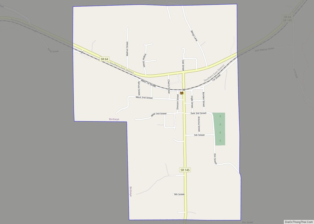
Huntingburg is a city in Patoka Township, Dubois County, in the U.S. state of Indiana. The population was 6,362 at the 2020 census.
Located in southwestern Indiana, the city is known for its downtown with numerous antique shops. It is part of the Jasper Micropolitan Statistical Area. The city is also known as the “Hollywood of the Midwest.” The movies A League of Their Own (1992), Hard Rain (1998), and the HBO film Soul of the Game (1996) were filmed in Huntingburg. Columbia Pictures renovated the grandstand at League Stadium that was to become part of the set for A League of Their Own.
| Name: | Huntingburg city |
|---|---|
| LSAD Code: | 25 |
| LSAD Description: | city (suffix) |
| State: | Indiana |
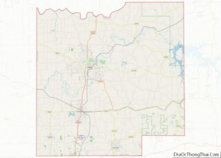
| County: | Dubois County |
| Elevation: | 495 ft (151 m) |
| Total Area: | 5.27 sq mi (13.64 km²) |
| Land Area: | 5.05 sq mi (13.09 km²) |
| Water Area: | 0.21 sq mi (0.55 km²) |
| Total Population: | 6,362 |
| Population Density: | 1,258.80/sq mi (486.05/km²) |
| ZIP code: | 47542 |
| Area code: | 812, 930 |
| FIPS code: | 1835284 |
| GNISfeature ID: | 2394451 |
| Website: | http://www.huntingburg-in.gov/ |
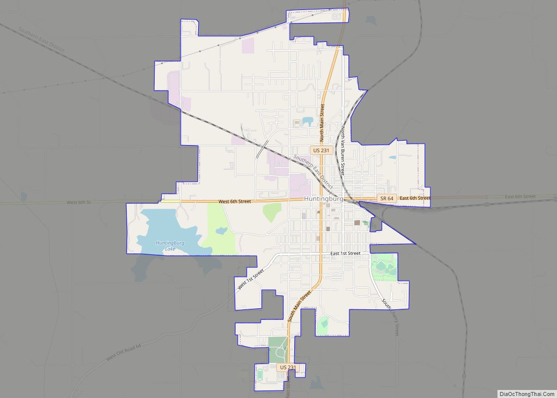
Online Interactive Map
Click on ![]() to view map in "full screen" mode.
to view map in "full screen" mode.
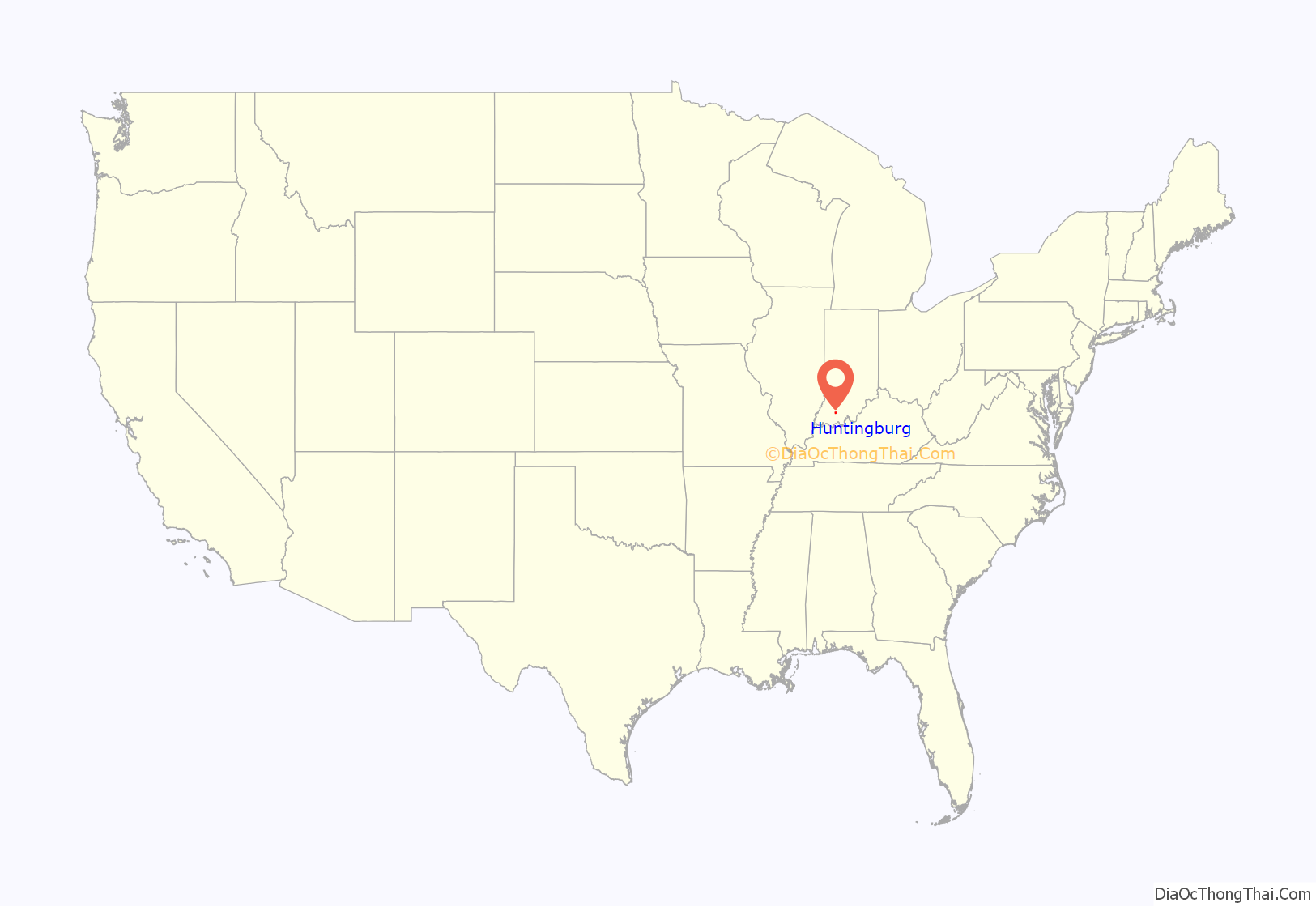
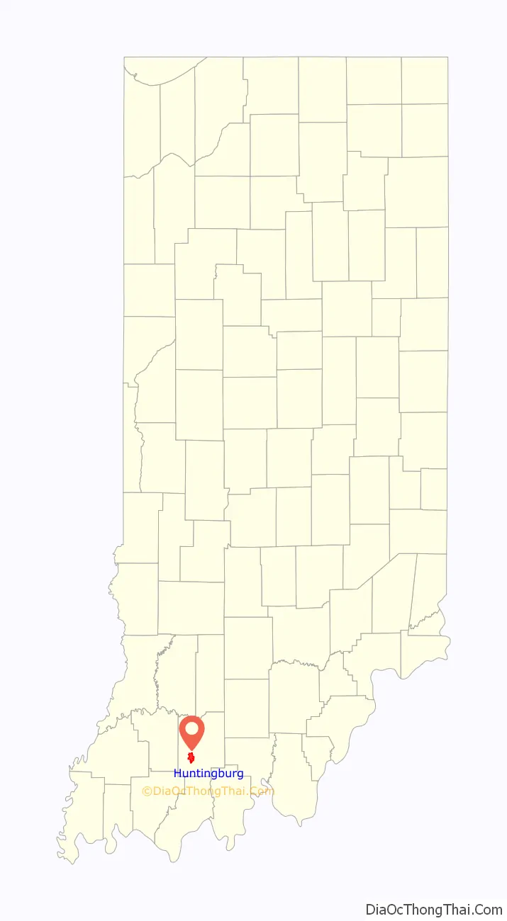
Huntingburg location map. Where is Huntingburg city?
History
Huntingburg was platted in 1837 by Colonel Jacob Geiger who purchased 1,920 acres (7.8 km) of land and became one of the city’s first permanent settlers. It was likely so named because the site had been a popular hunting ground. Huntingburg was incorporated as a town in 1866.
The Huntingburg Commercial Historic District and Huntingburg Town Hall and Fire Engine House are listed on the National Register of Historic Places.
The Huntingburg post office has been in operation since 1842.
As part of Dubois County, Huntingburg re-entered the Eastern Time Zone on November 4, 2007, after 15 months on the Central Time Zone.
On May 14, 2020, during the 2019-20 coronavirus pandemic, the city’s local meat processing plant run by Farbest Foods reported 42 cases of COVID-19 among the employees, resulting in an 2-day closure beginning on May 18.
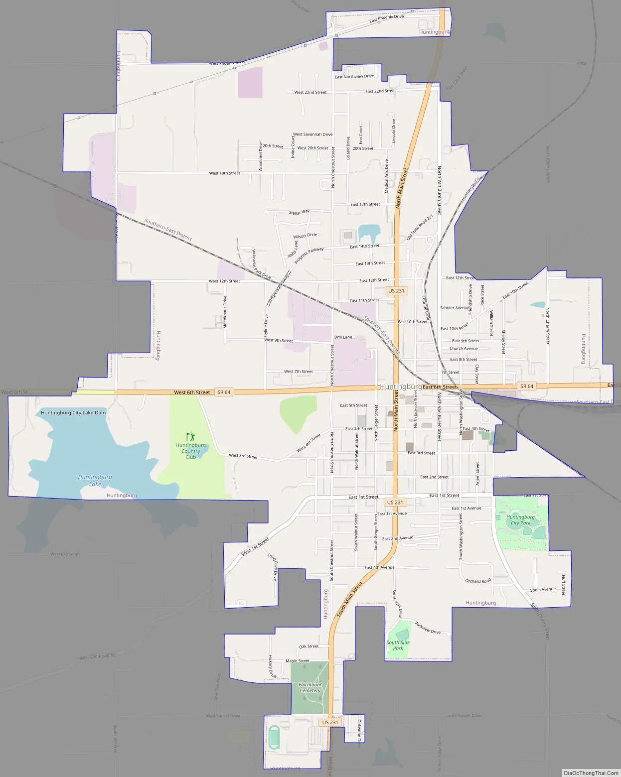
Huntingburg Road Map
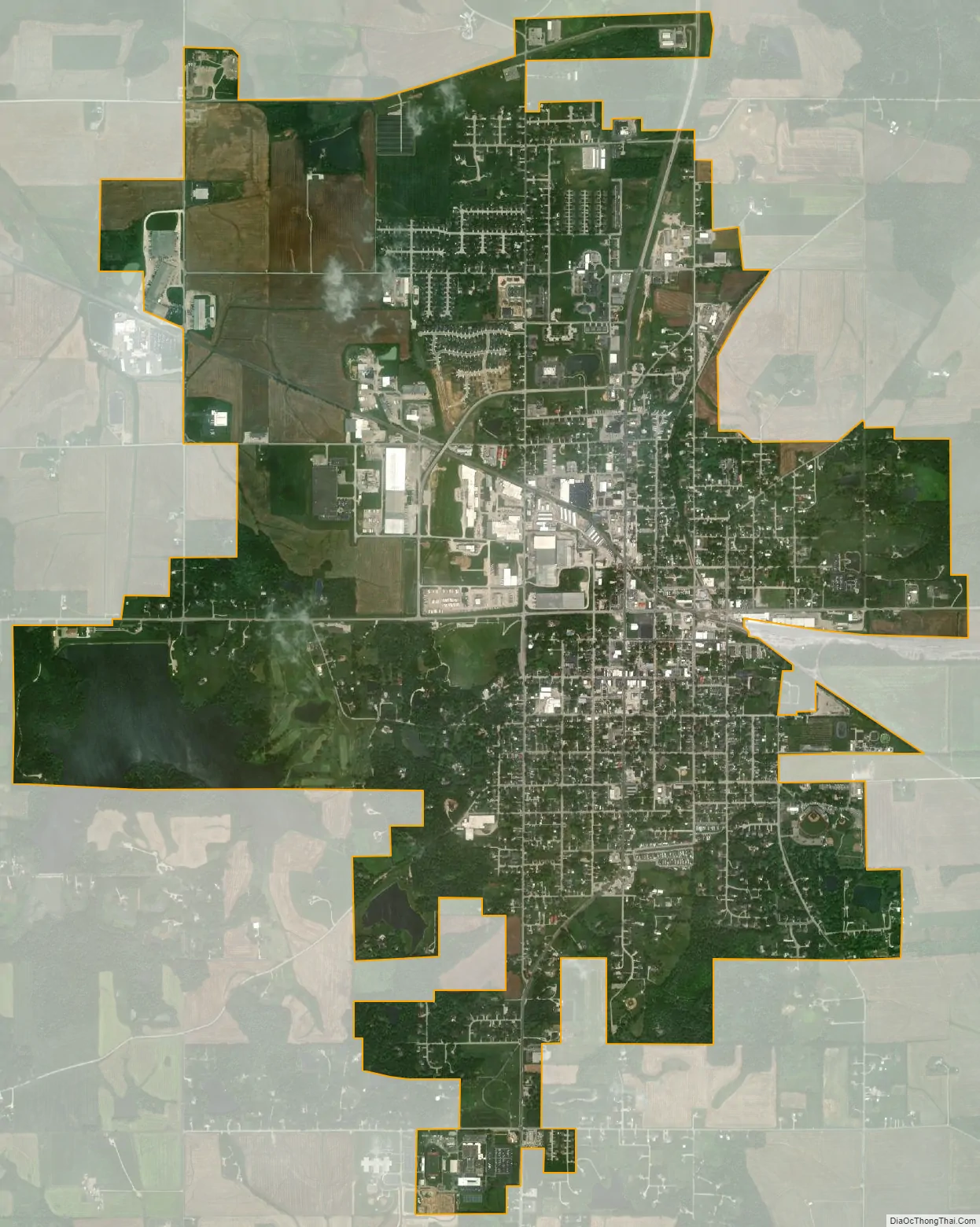
Huntingburg city Satellite Map
Geography
According to the 2010 census, Huntingburg has a total area of 5.273 square miles (13.66 km), of which 5.06 square miles (13.11 km) (or 95.96%) is land and 0.213 square miles (0.55 km) (or 4.04%) is water.
Climate
The climate in this area is characterized by hot, humid summers and generally cool winters. According to the Köppen Climate Classification system, Huntingburg, IN has a humid subtropical climate, abbreviated “Cfa” on climate maps.
See also
Map of Indiana State and its subdivision:- Adams
- Allen
- Bartholomew
- Benton
- Blackford
- Boone
- Brown
- Carroll
- Cass
- Clark
- Clay
- Clinton
- Crawford
- Daviess
- De Kalb
- Dearborn
- Decatur
- Delaware
- Dubois
- Elkhart
- Fayette
- Floyd
- Fountain
- Franklin
- Fulton
- Gibson
- Grant
- Greene
- Hamilton
- Hancock
- Harrison
- Hendricks
- Henry
- Howard
- Huntington
- Jackson
- Jasper
- Jay
- Jefferson
- Jennings
- Johnson
- Knox
- Kosciusko
- LaGrange
- Lake
- Lake Michigan
- LaPorte
- Lawrence
- Madison
- Marion
- Marshall
- Martin
- Miami
- Monroe
- Montgomery
- Morgan
- Newton
- Noble
- Ohio
- Orange
- Owen
- Parke
- Perry
- Pike
- Porter
- Posey
- Pulaski
- Putnam
- Randolph
- Ripley
- Rush
- Saint Joseph
- Scott
- Shelby
- Spencer
- Starke
- Steuben
- Sullivan
- Switzerland
- Tippecanoe
- Tipton
- Union
- Vanderburgh
- Vermillion
- Vigo
- Wabash
- Warren
- Warrick
- Washington
- Wayne
- Wells
- White
- Whitley
- Alabama
- Alaska
- Arizona
- Arkansas
- California
- Colorado
- Connecticut
- Delaware
- District of Columbia
- Florida
- Georgia
- Hawaii
- Idaho
- Illinois
- Indiana
- Iowa
- Kansas
- Kentucky
- Louisiana
- Maine
- Maryland
- Massachusetts
- Michigan
- Minnesota
- Mississippi
- Missouri
- Montana
- Nebraska
- Nevada
- New Hampshire
- New Jersey
- New Mexico
- New York
- North Carolina
- North Dakota
- Ohio
- Oklahoma
- Oregon
- Pennsylvania
- Rhode Island
- South Carolina
- South Dakota
- Tennessee
- Texas
- Utah
- Vermont
- Virginia
- Washington
- West Virginia
- Wisconsin
- Wyoming