Bentley is a city in Sedgwick County, Kansas, United States. As of the 2020 census, the population of the city was 560. It is located northwest of Wichita, approximately 4 miles north of K-96 highway at the intersection of 151st W & 109th N.
| Name: | Bentley city |
|---|---|
| LSAD Code: | 25 |
| LSAD Description: | city (suffix) |
| State: | Kansas |
| County: | Sedgwick County |
| Founded: | 1888 |
| Incorporated: | 1959 |
| Elevation: | 1,388 ft (423 m) |
| Total Area: | 0.30 sq mi (0.79 km²) |
| Land Area: | 0.30 sq mi (0.79 km²) |
| Water Area: | 0.00 sq mi (0.00 km²) |
| Total Population: | 560 |
| Population Density: | 1,900/sq mi (710/km²) |
| ZIP code: | 67016 |
| Area code: | 316 |
| FIPS code: | 2006125 |
| Website: | bentleyks.gov |
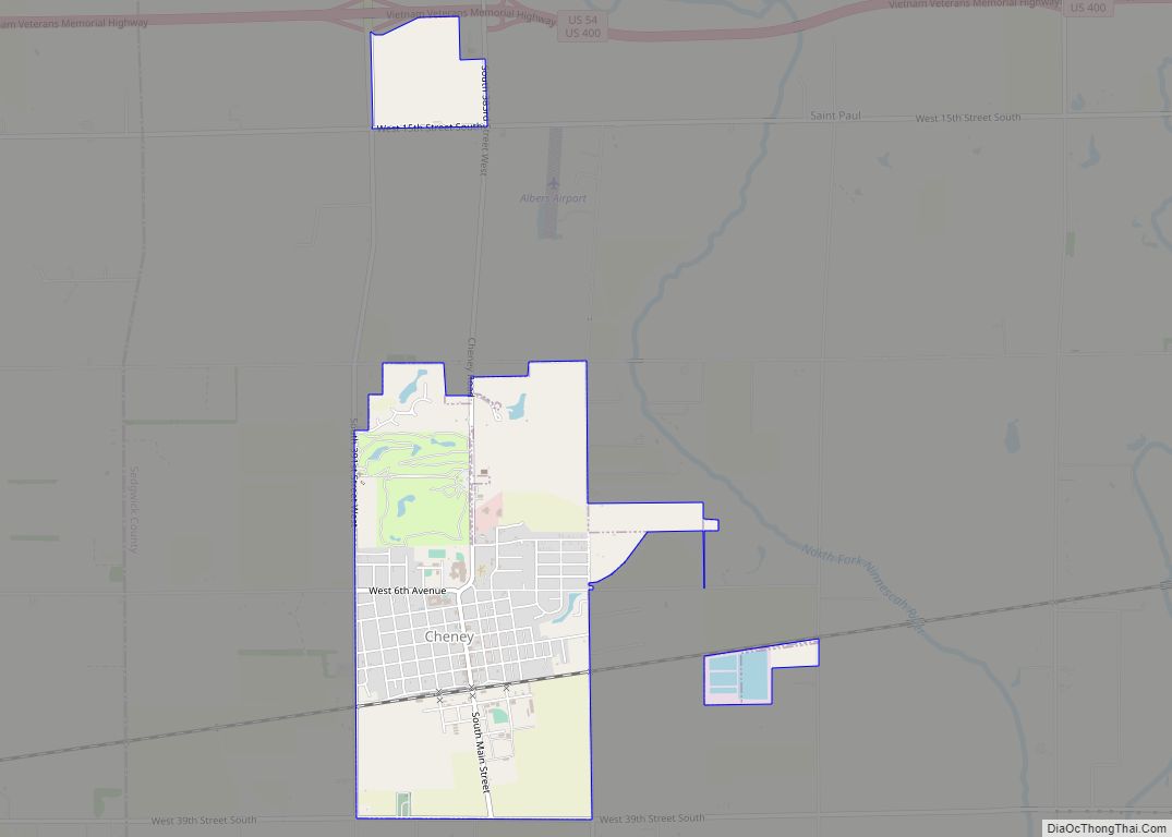
Online Interactive Map
Click on ![]() to view map in "full screen" mode.
to view map in "full screen" mode.
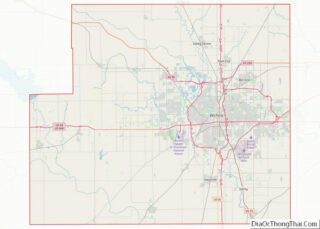
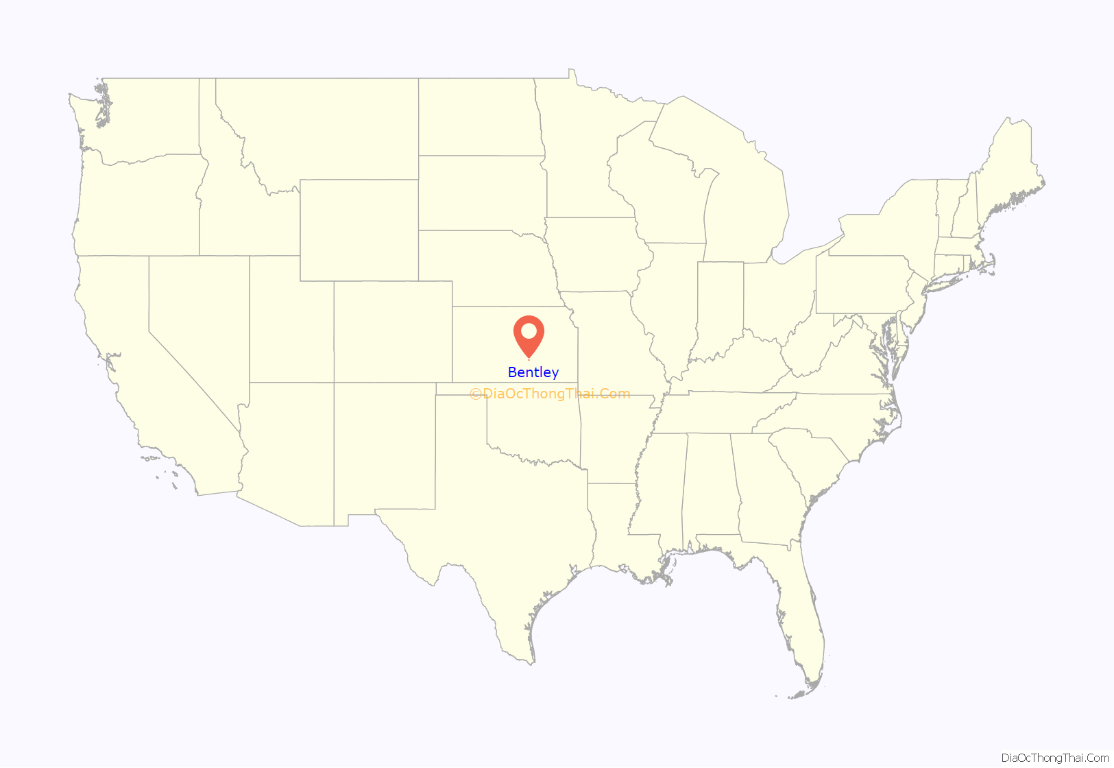
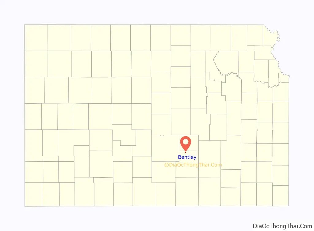
Bentley location map. Where is Bentley city?
History
In 1887, the Kansas Midland Railway was built from Wichita to Ellsworth, a distance of 107 miles, and the building of this line bisected Eagle township and established a depot and town on section 11, Eagle township. The town was named in honor of Orr. H. Bentley, of Wichita. The local railway company was composed of Wichita men; the directors were ex-Governor W. E. Stanley, J. Oak Davidson, Robert E. Lawrence, Charles R. Miller, Orsemus H. Bentley and H. G. Lee. When organized this railway company was officered by C. R. Miller, president; J. Oak Davidson, treasurer, and O. H. Bentley, secretary. It was constructed by the Kansas Construction and Improvement Company, an aggregation of Hartford and the eastern capital. The line was purchased outright by The Frisco on October 1, 1900. The Frisco was merged into the Burlington Northern Railroad in 1980, and the Burlington Northern abandoned the line in 1994.
Bentley was laid out in 1888. It is named in honor of the city’s founder Orsemus Hills Bentley, a railroad official.
The first post office in Bentley was established in March 1888.
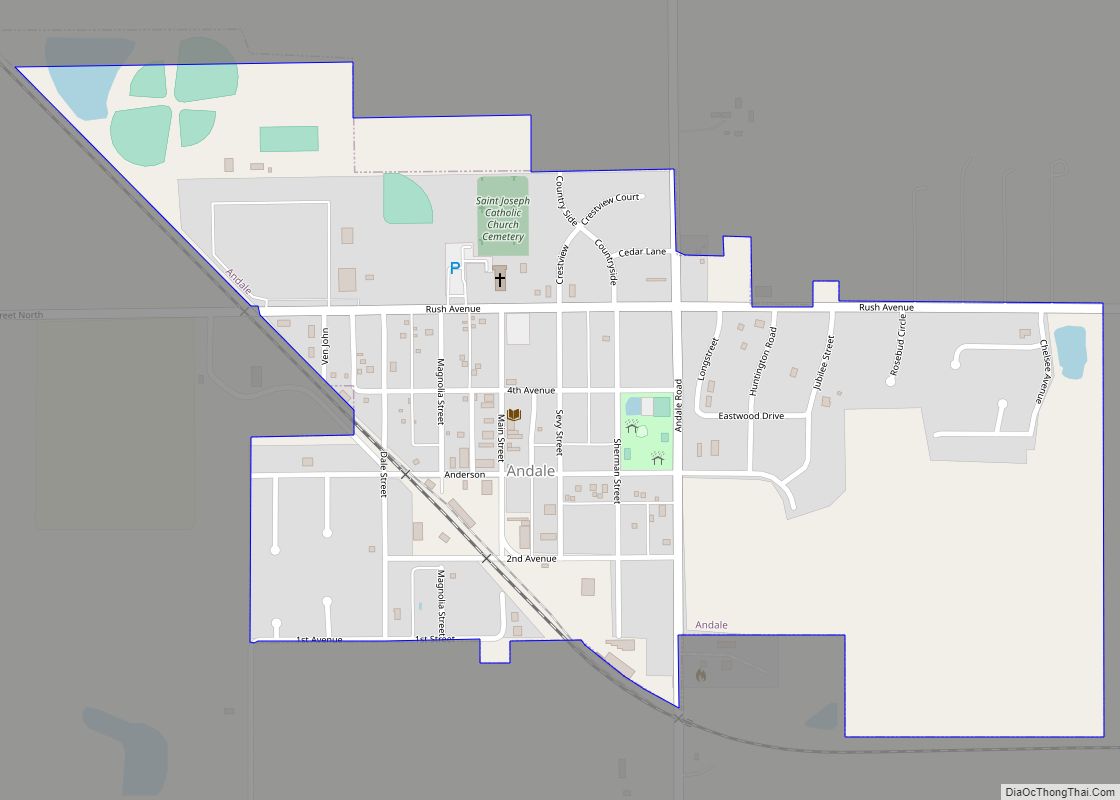
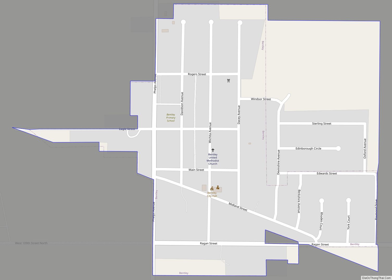
Bentley Road Map
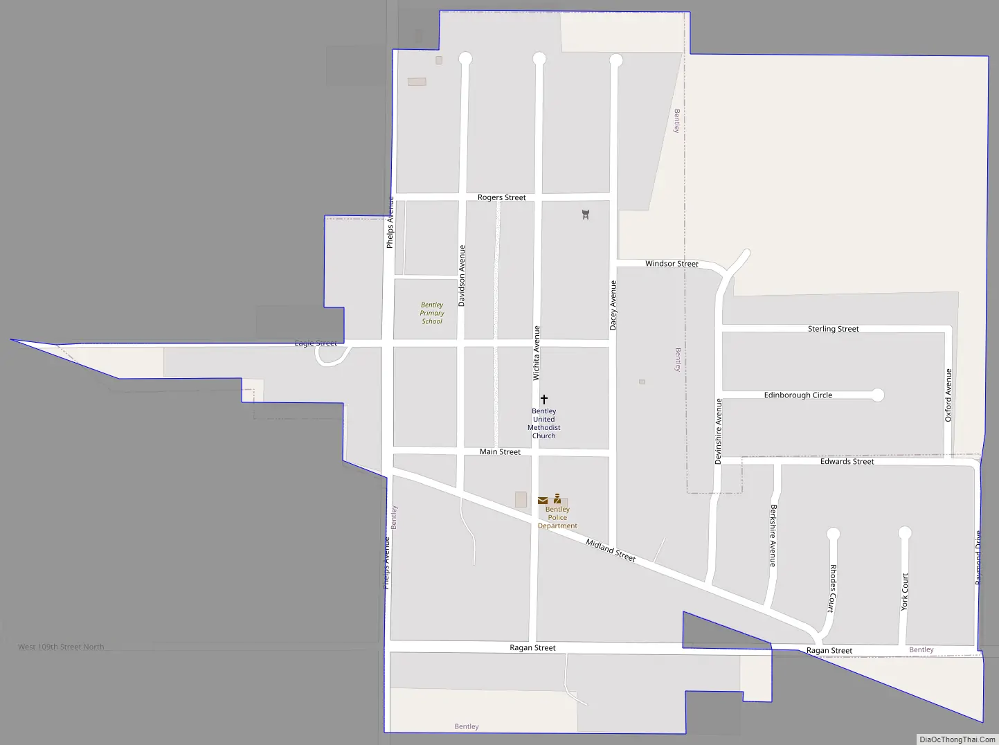
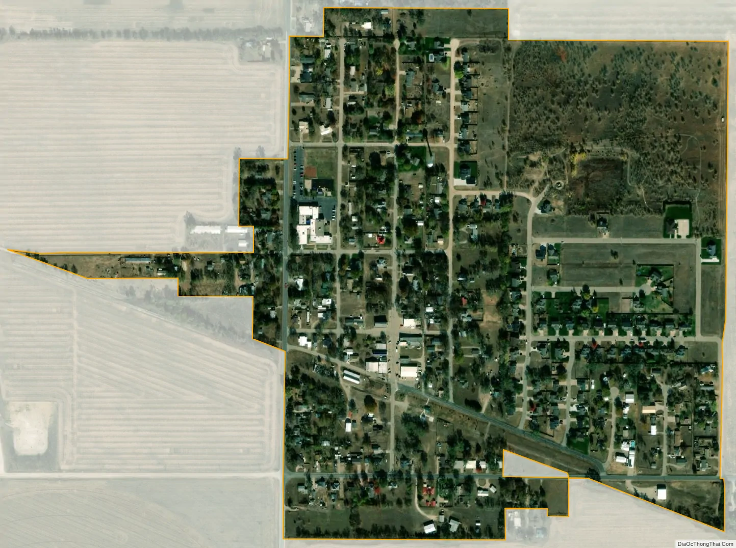
Bentley city Satellite Map
Geography
Bentley is located at 37°53′11″N 97°31′2″W / 37.88639°N 97.51722°W / 37.88639; -97.51722 (37.886437, -97.517133). According to the United States Census Bureau, the city has a total area of 0.30 square miles (0.78 km), all of it land.
See also
Map of Kansas State and its subdivision:- Allen
- Anderson
- Atchison
- Barber
- Barton
- Bourbon
- Brown
- Butler
- Chase
- Chautauqua
- Cherokee
- Cheyenne
- Clark
- Clay
- Cloud
- Coffey
- Comanche
- Cowley
- Crawford
- Decatur
- Dickinson
- Doniphan
- Douglas
- Edwards
- Elk
- Ellis
- Ellsworth
- Finney
- Ford
- Franklin
- Geary
- Gove
- Graham
- Grant
- Gray
- Greeley
- Greenwood
- Hamilton
- Harper
- Harvey
- Haskell
- Hodgeman
- Jackson
- Jefferson
- Jewell
- Johnson
- Kearny
- Kingman
- Kiowa
- Labette
- Lane
- Leavenworth
- Lincoln
- Linn
- Logan
- Lyon
- Marion
- Marshall
- McPherson
- Meade
- Miami
- Mitchell
- Montgomery
- Morris
- Morton
- Nemaha
- Neosho
- Ness
- Norton
- Osage
- Osborne
- Ottawa
- Pawnee
- Phillips
- Pottawatomie
- Pratt
- Rawlins
- Reno
- Republic
- Rice
- Riley
- Rooks
- Rush
- Russell
- Saline
- Scott
- Sedgwick
- Seward
- Shawnee
- Sheridan
- Sherman
- Smith
- Stafford
- Stanton
- Stevens
- Sumner
- Thomas
- Trego
- Wabaunsee
- Wallace
- Washington
- Wichita
- Wilson
- Woodson
- Wyandotte
- Alabama
- Alaska
- Arizona
- Arkansas
- California
- Colorado
- Connecticut
- Delaware
- District of Columbia
- Florida
- Georgia
- Hawaii
- Idaho
- Illinois
- Indiana
- Iowa
- Kansas
- Kentucky
- Louisiana
- Maine
- Maryland
- Massachusetts
- Michigan
- Minnesota
- Mississippi
- Missouri
- Montana
- Nebraska
- Nevada
- New Hampshire
- New Jersey
- New Mexico
- New York
- North Carolina
- North Dakota
- Ohio
- Oklahoma
- Oregon
- Pennsylvania
- Rhode Island
- South Carolina
- South Dakota
- Tennessee
- Texas
- Utah
- Vermont
- Virginia
- Washington
- West Virginia
- Wisconsin
- Wyoming