Eastborough is a city in Sedgwick County, Kansas, United States, and an enclave of the city of Wichita. As of the 2020 census, the population of the city was 756.
| Name: | Eastborough city |
|---|---|
| LSAD Code: | 25 |
| LSAD Description: | city (suffix) |
| State: | Kansas |
| County: | Sedgwick County |
| Founded: | 1929 |
| Incorporated: | 1937 |
| Elevation: | 1,371 ft (418 m) |
| Total Area: | 0.39 sq mi (1.00 km²) |
| Land Area: | 0.39 sq mi (1.00 km²) |
| Water Area: | 0.00 sq mi (0.00 km²) |
| Total Population: | 756 |
| Population Density: | 1,900/sq mi (760/km²) |
| Area code: | 316 |
| FIPS code: | 2019300 |
| Website: | eastborough-ks.gov |
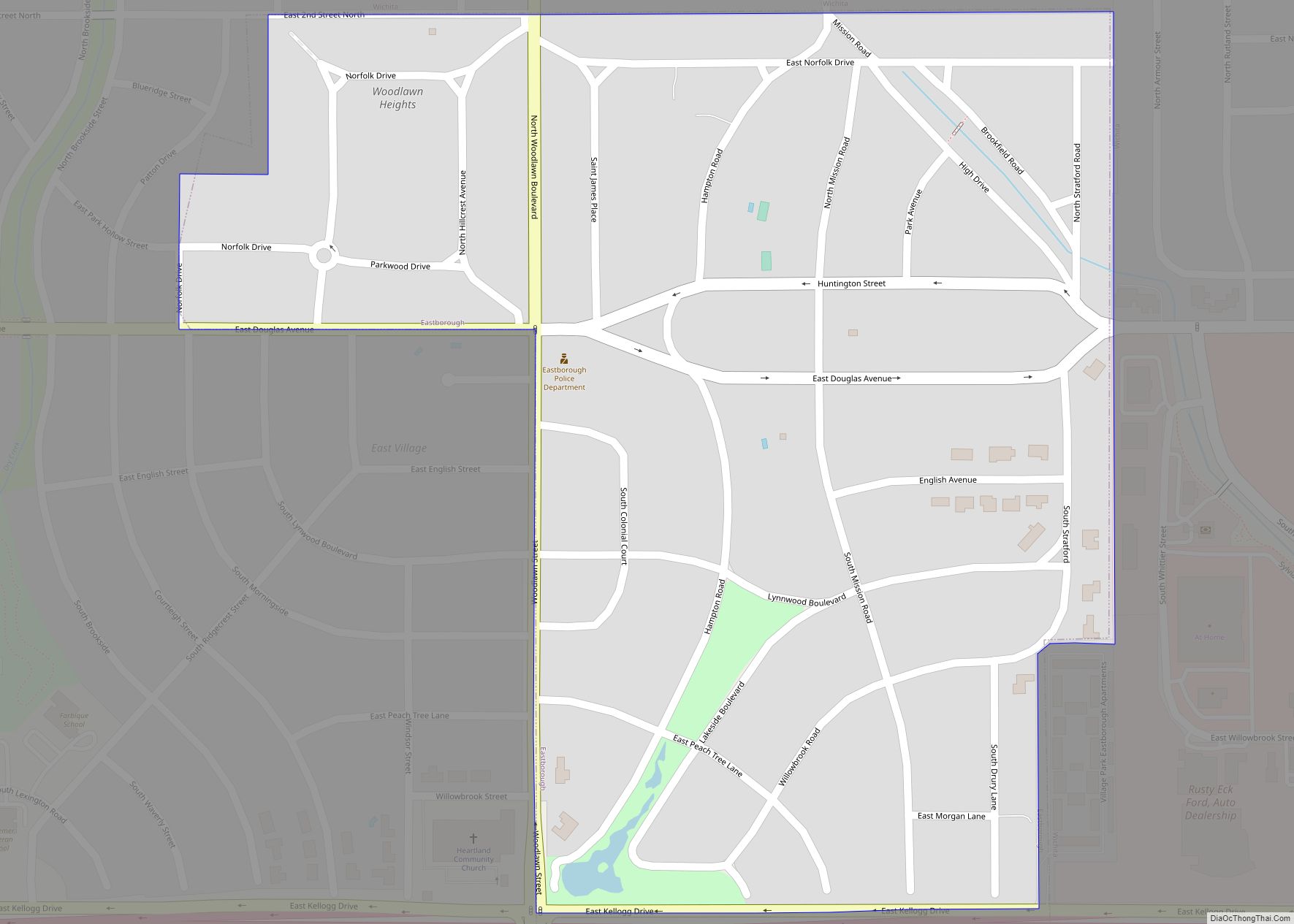
Online Interactive Map
Click on ![]() to view map in "full screen" mode.
to view map in "full screen" mode.
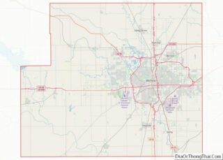
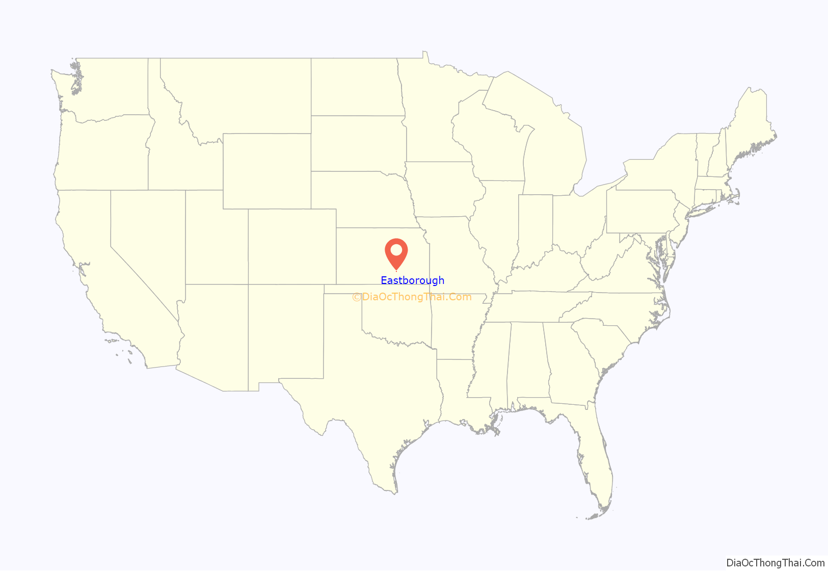
Eastborough location map. Where is Eastborough city?

History
Eastborough was originally envisioned by Burdon Hunter, a British architect. The first development in the Eastborough area began in 1929, but the discovery of oil in the area postponed its establishment until the middle of the 1930s. Sale of Eastborough Village started April 10, 1929. It was planned to incorporate when the first thirty homes were completed, but Eastborough found itself in disputes with the neighboring Woodlawn subdivision, i. e. they could not agree upon a name for the street between them. The disputes were resolved after the two agreed to apply together for incorporation, and Eastborough and Woodlawn were incorporated as the city of Eastborough on June 1, 1937.
Eastborough became known as a “speed trap”, because it has a lower speed limit than Wichita, which surrounds it. The speed limit of Douglas Avenue on both sides in Wichita is 30 miles per hour, where as 20 miles per hour in Eastborough, a reduction of 33%. Eastborough has many residents who regularly walk in the streets of the city. There are no sidewalks in Eastborough which is why the city has a lower speed limit. This issue became well known after Towne East Square shopping center was built east of Eastborough in 1975, because Wichita residents would commonly travel through Eastborough to get to Towne East since nearby Kellogg had traffic congestion problems. After Wichita completed an overhaul of nearby east Kellogg in 2009, Douglas Avenue was no longer the best route to Towne East.
The city gave up some land to the expansion of Kellogg/U.S. Route 54 on its southern boundary in 2002 and a wall was constructed along the southern boundary. As part of this construction, a new pond and playground was constructed and opened in 2003.
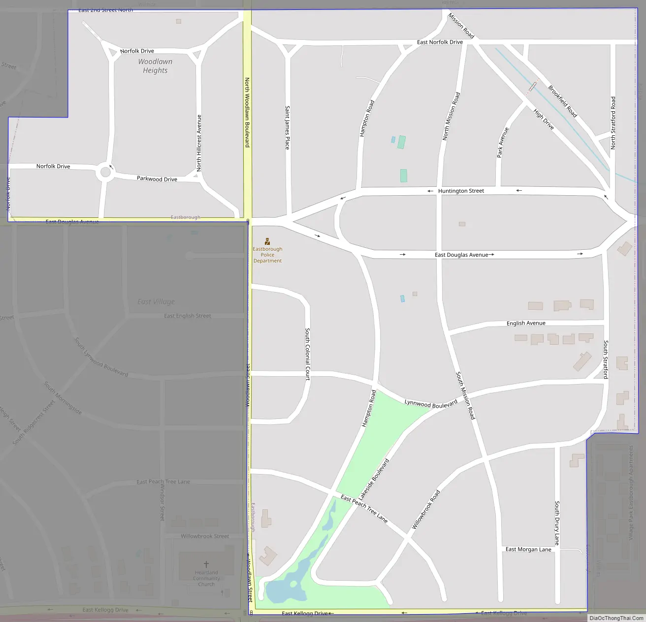
Eastborough Road Map
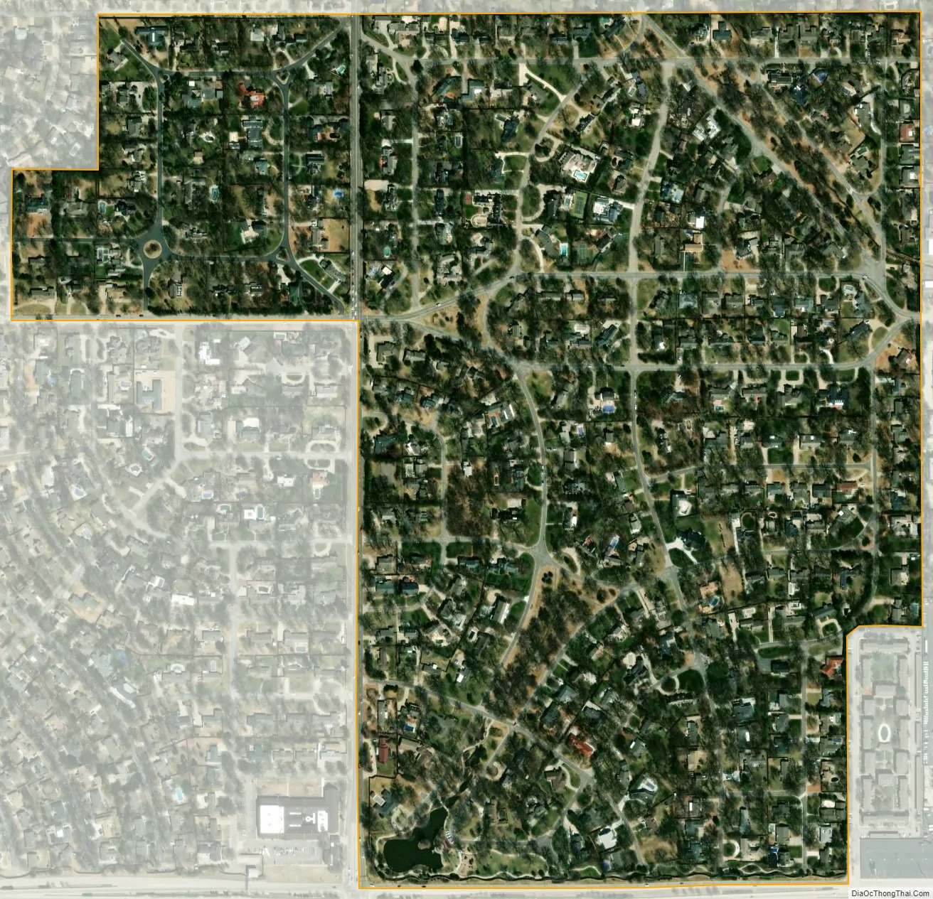
Eastborough city Satellite Map
Geography
Eastborough is located at 37°41′11″N 97°15′32″W / 37.68639°N 97.25889°W / 37.68639; -97.25889 (37.6864752, -97.2588378). According to the United States Census Bureau, the city has a total area of 0.40 square miles (1.04 km), all of it land.
Its southern boundary is Kellogg/U.S. Route 54, and northern boundary is 2nd Street.
See also
Map of Kansas State and its subdivision:- Allen
- Anderson
- Atchison
- Barber
- Barton
- Bourbon
- Brown
- Butler
- Chase
- Chautauqua
- Cherokee
- Cheyenne
- Clark
- Clay
- Cloud
- Coffey
- Comanche
- Cowley
- Crawford
- Decatur
- Dickinson
- Doniphan
- Douglas
- Edwards
- Elk
- Ellis
- Ellsworth
- Finney
- Ford
- Franklin
- Geary
- Gove
- Graham
- Grant
- Gray
- Greeley
- Greenwood
- Hamilton
- Harper
- Harvey
- Haskell
- Hodgeman
- Jackson
- Jefferson
- Jewell
- Johnson
- Kearny
- Kingman
- Kiowa
- Labette
- Lane
- Leavenworth
- Lincoln
- Linn
- Logan
- Lyon
- Marion
- Marshall
- McPherson
- Meade
- Miami
- Mitchell
- Montgomery
- Morris
- Morton
- Nemaha
- Neosho
- Ness
- Norton
- Osage
- Osborne
- Ottawa
- Pawnee
- Phillips
- Pottawatomie
- Pratt
- Rawlins
- Reno
- Republic
- Rice
- Riley
- Rooks
- Rush
- Russell
- Saline
- Scott
- Sedgwick
- Seward
- Shawnee
- Sheridan
- Sherman
- Smith
- Stafford
- Stanton
- Stevens
- Sumner
- Thomas
- Trego
- Wabaunsee
- Wallace
- Washington
- Wichita
- Wilson
- Woodson
- Wyandotte
- Alabama
- Alaska
- Arizona
- Arkansas
- California
- Colorado
- Connecticut
- Delaware
- District of Columbia
- Florida
- Georgia
- Hawaii
- Idaho
- Illinois
- Indiana
- Iowa
- Kansas
- Kentucky
- Louisiana
- Maine
- Maryland
- Massachusetts
- Michigan
- Minnesota
- Mississippi
- Missouri
- Montana
- Nebraska
- Nevada
- New Hampshire
- New Jersey
- New Mexico
- New York
- North Carolina
- North Dakota
- Ohio
- Oklahoma
- Oregon
- Pennsylvania
- Rhode Island
- South Carolina
- South Dakota
- Tennessee
- Texas
- Utah
- Vermont
- Virginia
- Washington
- West Virginia
- Wisconsin
- Wyoming