Clearwater is a city in Sedgwick County, Kansas, United States. As of the 2020 census, the population of the city was 2,653.
| Name: | Clearwater city |
|---|---|
| LSAD Code: | 25 |
| LSAD Description: | city (suffix) |
| State: | Kansas |
| County: | Sedgwick County |
| Founded: | 1870 |
| Incorporated: | 1885 |
| Elevation: | 1,286 ft (392 m) |
| Total Area: | 1.94 sq mi (5.02 km²) |
| Land Area: | 1.94 sq mi (5.02 km²) |
| Water Area: | 0.00 sq mi (0.00 km²) |
| Total Population: | 2,653 |
| Population Density: | 1,400/sq mi (530/km²) |
| ZIP code: | 67026 |
| Area code: | 620 |
| FIPS code: | 2013925 |
| Website: | clearwaterks.org |
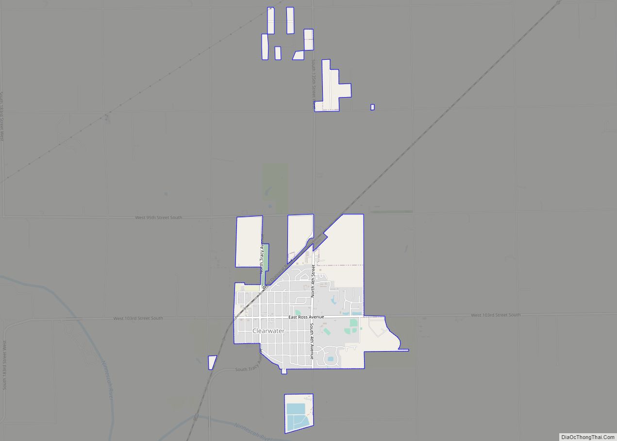
Online Interactive Map
Click on ![]() to view map in "full screen" mode.
to view map in "full screen" mode.
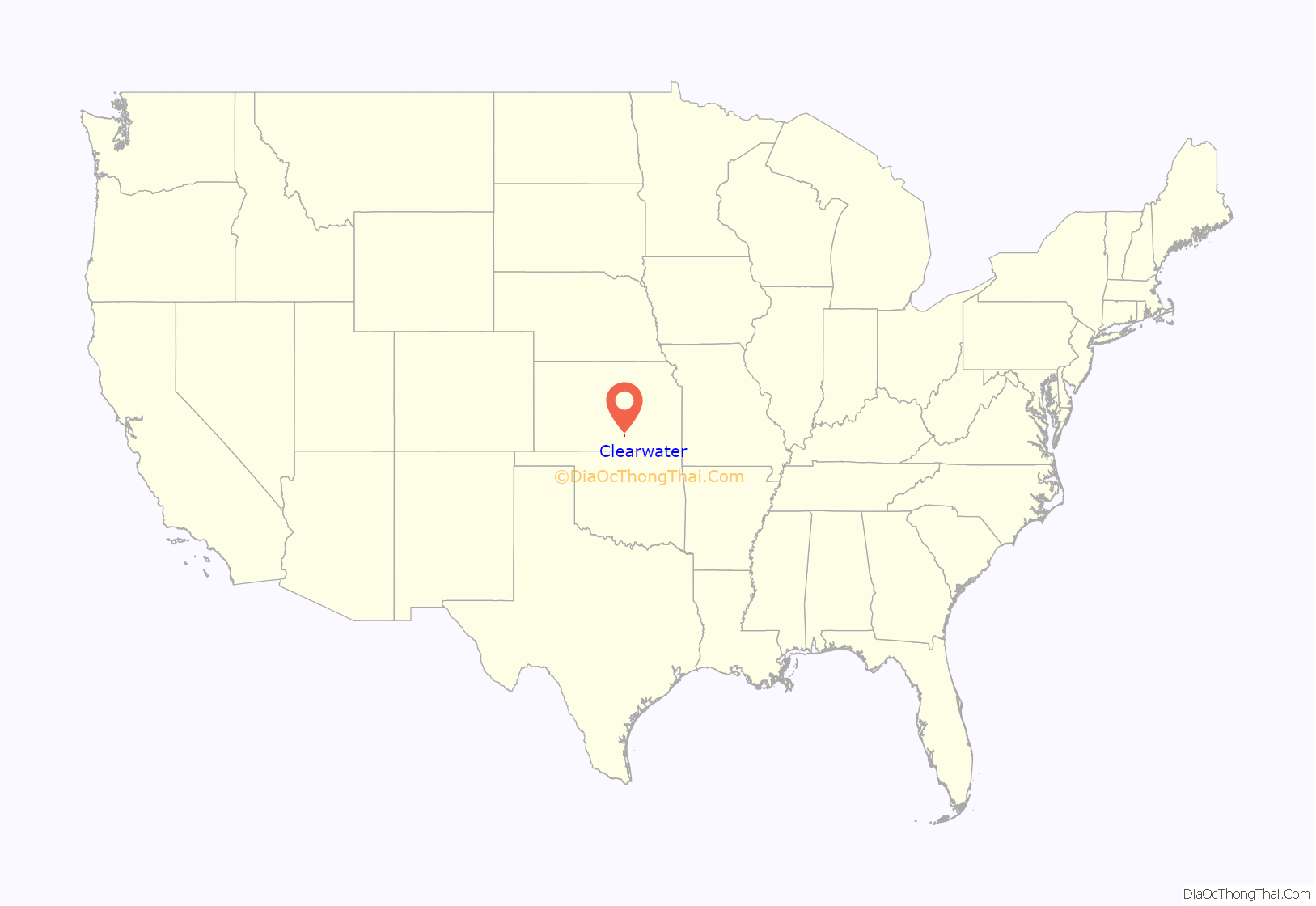
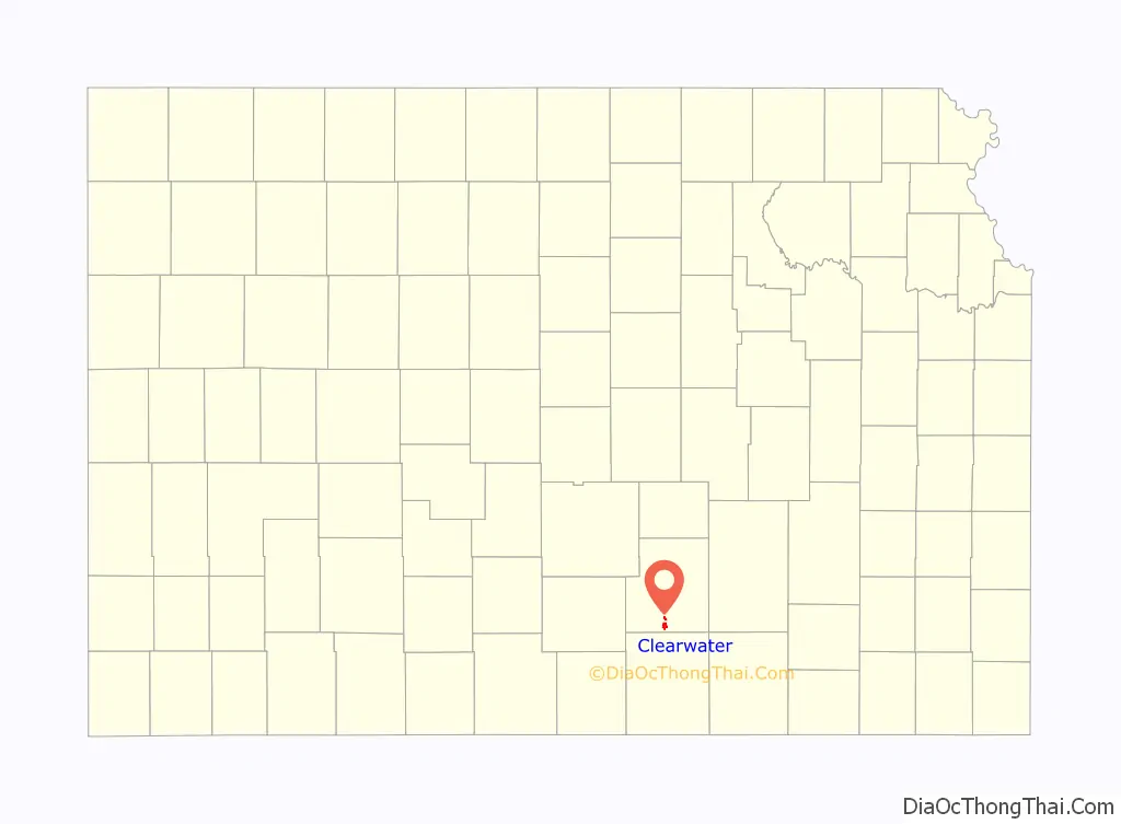
Clearwater location map. Where is Clearwater city?
History
Clearwater was first settled in 1870, then platted as a city in 1872. It was named from the clear water of the river upon which it is situated. The first post office in Clearwater was established in 1871, and the name of the post office was officially spelled out Clear Water until 1894. The Chisholm Trail ran along the east side of the community from 1867 to 1871.
Clearwater Road Map
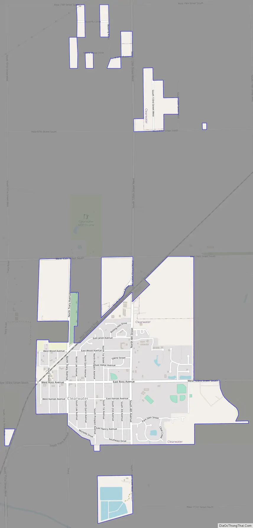
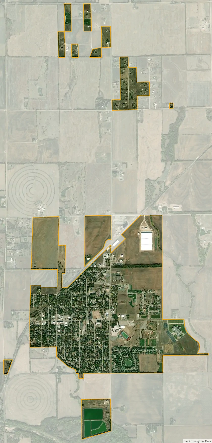
Clearwater city Satellite Map
Geography
Clearwater is located just southwest of Wichita, Kansas at 37°30′20″N 97°30′5″W / 37.50556°N 97.50139°W / 37.50556; -97.50139 (37.505646, -97.501516). According to the United States Census Bureau, the city has a total area of 1.87 square miles (4.84 km), all of it land.
See also
Map of Kansas State and its subdivision:- Allen
- Anderson
- Atchison
- Barber
- Barton
- Bourbon
- Brown
- Butler
- Chase
- Chautauqua
- Cherokee
- Cheyenne
- Clark
- Clay
- Cloud
- Coffey
- Comanche
- Cowley
- Crawford
- Decatur
- Dickinson
- Doniphan
- Douglas
- Edwards
- Elk
- Ellis
- Ellsworth
- Finney
- Ford
- Franklin
- Geary
- Gove
- Graham
- Grant
- Gray
- Greeley
- Greenwood
- Hamilton
- Harper
- Harvey
- Haskell
- Hodgeman
- Jackson
- Jefferson
- Jewell
- Johnson
- Kearny
- Kingman
- Kiowa
- Labette
- Lane
- Leavenworth
- Lincoln
- Linn
- Logan
- Lyon
- Marion
- Marshall
- McPherson
- Meade
- Miami
- Mitchell
- Montgomery
- Morris
- Morton
- Nemaha
- Neosho
- Ness
- Norton
- Osage
- Osborne
- Ottawa
- Pawnee
- Phillips
- Pottawatomie
- Pratt
- Rawlins
- Reno
- Republic
- Rice
- Riley
- Rooks
- Rush
- Russell
- Saline
- Scott
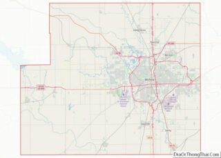
- Sedgwick
- Seward
- Shawnee
- Sheridan
- Sherman
- Smith
- Stafford
- Stanton
- Stevens
- Sumner
- Thomas
- Trego
- Wabaunsee
- Wallace
- Washington
- Wichita
- Wilson
- Woodson
- Wyandotte
- Alabama
- Alaska
- Arizona
- Arkansas
- California
- Colorado
- Connecticut
- Delaware
- District of Columbia
- Florida
- Georgia
- Hawaii
- Idaho
- Illinois
- Indiana
- Iowa
- Kansas
- Kentucky
- Louisiana
- Maine
- Maryland
- Massachusetts
- Michigan
- Minnesota
- Mississippi
- Missouri
- Montana
- Nebraska
- Nevada
- New Hampshire
- New Jersey
- New Mexico
- New York
- North Carolina
- North Dakota
- Ohio
- Oklahoma
- Oregon
- Pennsylvania
- Rhode Island
- South Carolina
- South Dakota
- Tennessee
- Texas
- Utah
- Vermont
- Virginia
- Washington
- West Virginia
- Wisconsin
- Wyoming