Albertville is a city in Wright County, Minnesota, United States. The City is a Northwest suburb of the Minneapolis- St Paul “Twin Cities” metropolitan area. The population was 7,896 at the 2020 census.
| Name: | Albertville city |
|---|---|
| LSAD Code: | 25 |
| LSAD Description: | city (suffix) |
| State: | Minnesota |
| County: | Wright County |
| Elevation: | 961 ft (293 m) |
| Total Area: | 4.70 sq mi (12.17 km²) |
| Land Area: | 4.42 sq mi (11.45 km²) |
| Water Area: | 0.28 sq mi (0.72 km²) |
| Total Population: | 7,896 |
| Population Density: | 1,786.43/sq mi (689.75/km²) |
| ZIP code: | 55301 |
| Area code: | 763 |
| FIPS code: | 2700730 |
| GNISfeature ID: | 0639253 |
| Website: | ci.albertville.mn.us |
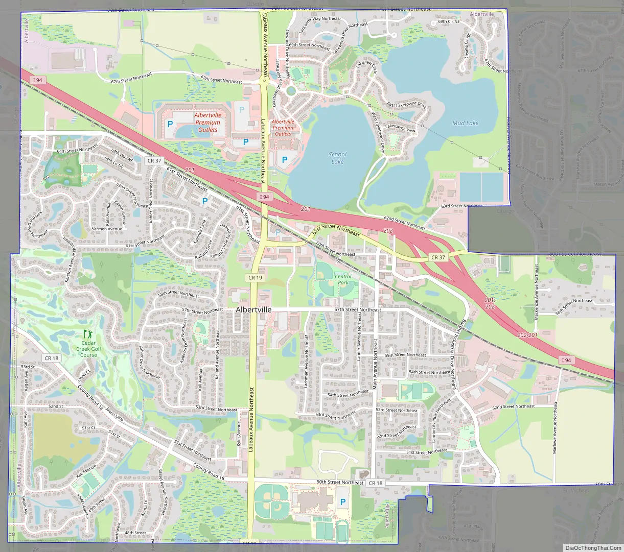
Online Interactive Map
Click on ![]() to view map in "full screen" mode.
to view map in "full screen" mode.
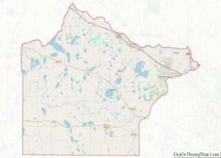
Albertville location map. Where is Albertville city?


History
The area that is known as Albertville was first a town site called “Hamburg” by Joseph Vetsch. Later that same year in August, the Minneapolis and Northwestern Railroad Company bought land for a railroad through the area (now the BNSF rail in downtown Albertville). After 30 years of contributions to the area, including Albert Zachman, who donated land for the current historic church by Central Park (also recognized as Lions Park) J.P. Eull and Theodore Aydt proposed a petition to incorporate the township as Saint Michael Station with a population of 190. The first election held, to construct a village hall, happened in 1903. It passed on a vote of 20-18 with a cost of $531.95 ($4,035.03 today). In the next few years, the town started to raise funds for a Catholic Church, completed in 1902, was named the Church of St. Albert, in honor of Albert Zachman’s contributions to the town. In 1909, Father Duhr proposed to change the name to Albertville in 1909, again in honor of Albert Zachman. The town approved, but was not official until September 1919, making the name change official.
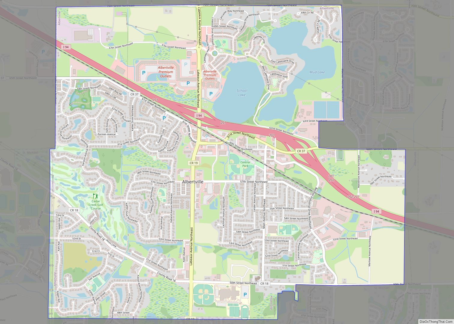
Albertville Road Map
Albertville city Satellite Map

Geography
According to the United States Census Bureau, the city has a total area of 4.64 square miles (12.02 km); 4.37 square miles (11.32 km) is land and 0.27 square miles (0.70 km) is water. Albertville is generally considered the halfway point between Minneapolis and Saint Cloud.
Albertville is home to the Albertville Premium Outlets, One of 2 outlet centers in the Twin Cities, the other being located in Eagan Minnesota.
The city contains the Church of St Albert, constructed in 1902.
See also
Map of Minnesota State and its subdivision:- Aitkin
- Anoka
- Becker
- Beltrami
- Benton
- Big Stone
- Blue Earth
- Brown
- Carlton
- Carver
- Cass
- Chippewa
- Chisago
- Clay
- Clearwater
- Cook
- Cottonwood
- Crow Wing
- Dakota
- Dodge
- Douglas
- Faribault
- Fillmore
- Freeborn
- Goodhue
- Grant
- Hennepin
- Houston
- Hubbard
- Isanti
- Itasca
- Jackson
- Kanabec
- Kandiyohi
- Kittson
- Koochiching
- Lac qui Parle
- Lake
- Lake of the Woods
- Lake Superior
- Le Sueur
- Lincoln
- Lyon
- Mahnomen
- Marshall
- Martin
- McLeod
- Meeker
- Mille Lacs
- Morrison
- Mower
- Murray
- Nicollet
- Nobles
- Norman
- Olmsted
- Otter Tail
- Pennington
- Pine
- Pipestone
- Polk
- Pope
- Ramsey
- Red Lake
- Redwood
- Renville
- Rice
- Rock
- Roseau
- Saint Louis
- Scott
- Sherburne
- Sibley
- Stearns
- Steele
- Stevens
- Swift
- Todd
- Traverse
- Wabasha
- Wadena
- Waseca
- Washington
- Watonwan
- Wilkin
- Winona
- Wright
- Yellow Medicine
- Alabama
- Alaska
- Arizona
- Arkansas
- California
- Colorado
- Connecticut
- Delaware
- District of Columbia
- Florida
- Georgia
- Hawaii
- Idaho
- Illinois
- Indiana
- Iowa
- Kansas
- Kentucky
- Louisiana
- Maine
- Maryland
- Massachusetts
- Michigan
- Minnesota
- Mississippi
- Missouri
- Montana
- Nebraska
- Nevada
- New Hampshire
- New Jersey
- New Mexico
- New York
- North Carolina
- North Dakota
- Ohio
- Oklahoma
- Oregon
- Pennsylvania
- Rhode Island
- South Carolina
- South Dakota
- Tennessee
- Texas
- Utah
- Vermont
- Virginia
- Washington
- West Virginia
- Wisconsin
- Wyoming