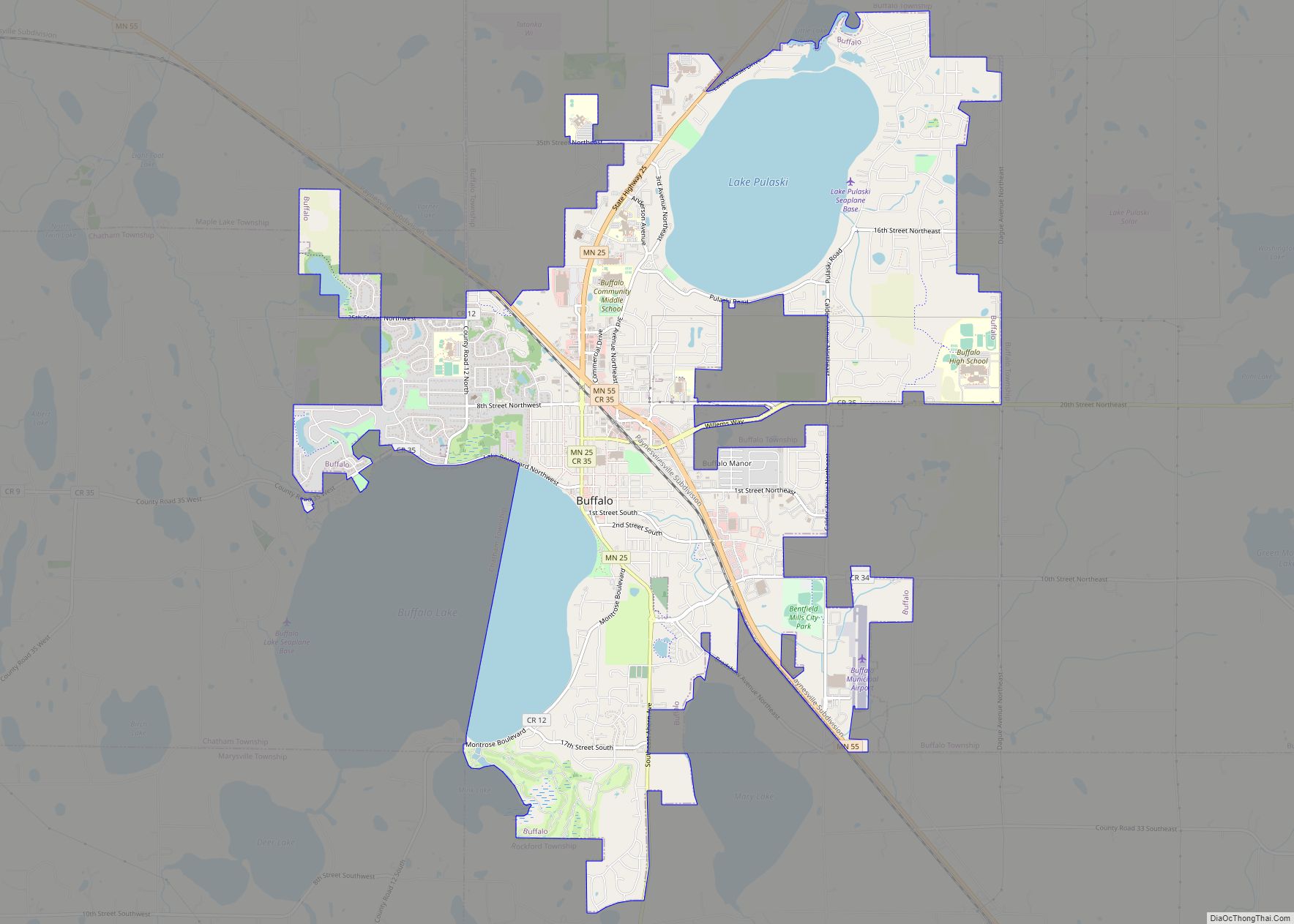
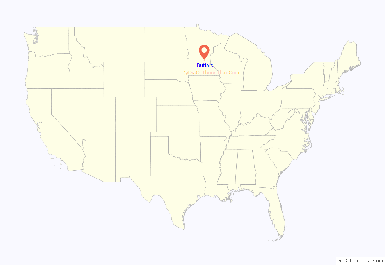
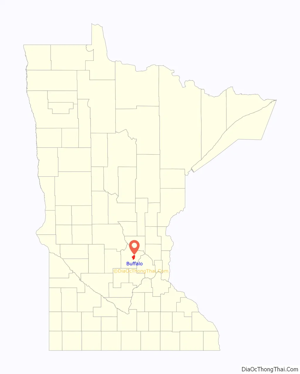
Buffalo is a city in the U.S. state of Minnesota and the county seat of Wright County. It is within the Minneapolis–Saint Paul metropolitan area, located about 42 miles northwest of Minneapolis on Buffalo Lake. The population of Buffalo was 15,453 at the 2010 census. The 2020 census revealed Buffalo had a population of 18,168.
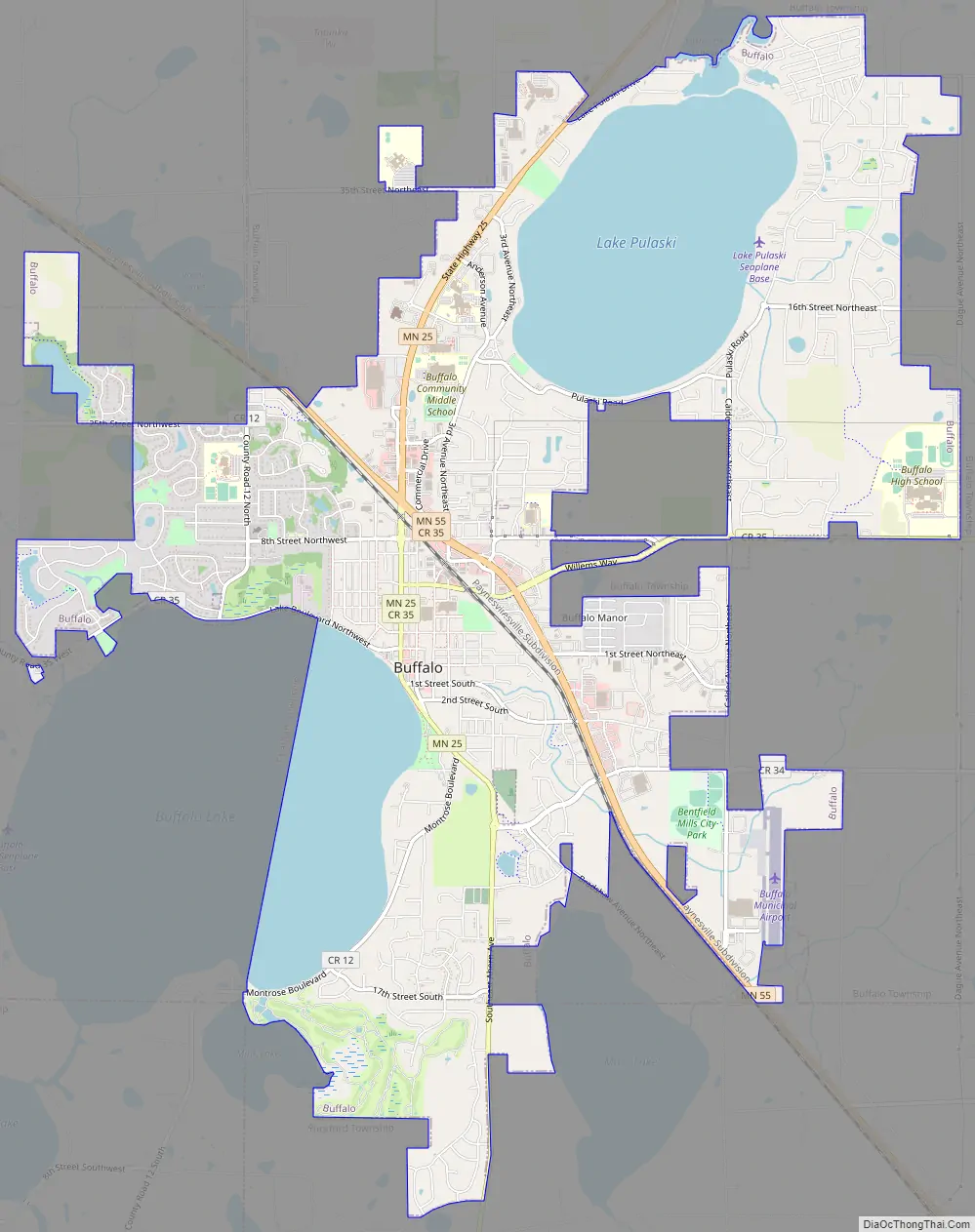
Minnesota State Highways 25 and 55 are two of the main routes into the city.
| Name: | Buffalo city |
|---|---|
| LSAD Code: | 25 |
| LSAD Description: | city (suffix) |
| State: | Minnesota |
| County: | Wright County |
| Elevation: | 928 ft (283 m) |
| Total Area: | 9.90 sq mi (25.63 km²) |
| Land Area: | 7.76 sq mi (20.10 km²) |
| Water Area: | 2.14 sq mi (5.53 km²) 25.62% |
| Total Population: | 18,168 |
| Population Density: | 2,083.24/sq mi (804.39/km²) |
| ZIP code: | 55313 |
| Area code: | 763 |
| FIPS code: | 2708452 |
| GNISfeature ID: | 0640603 |
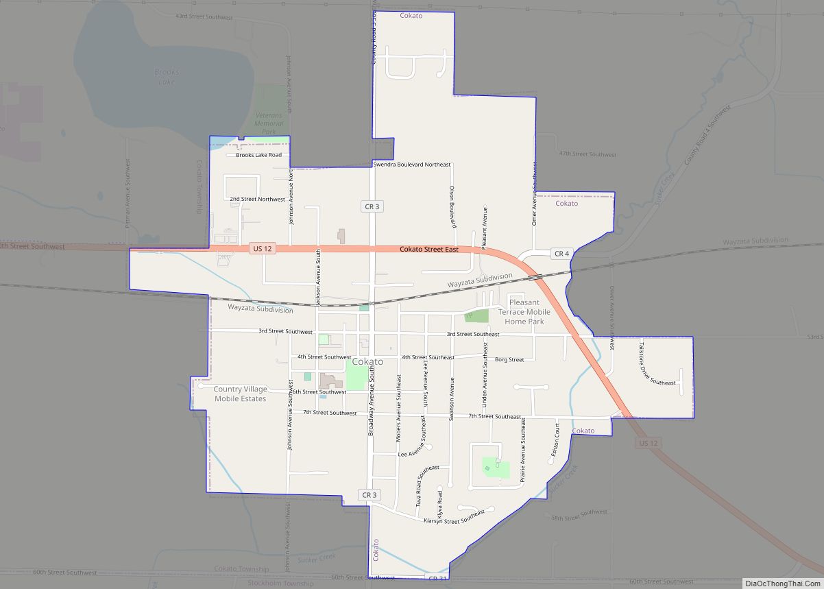
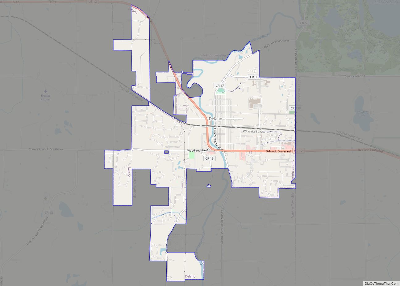
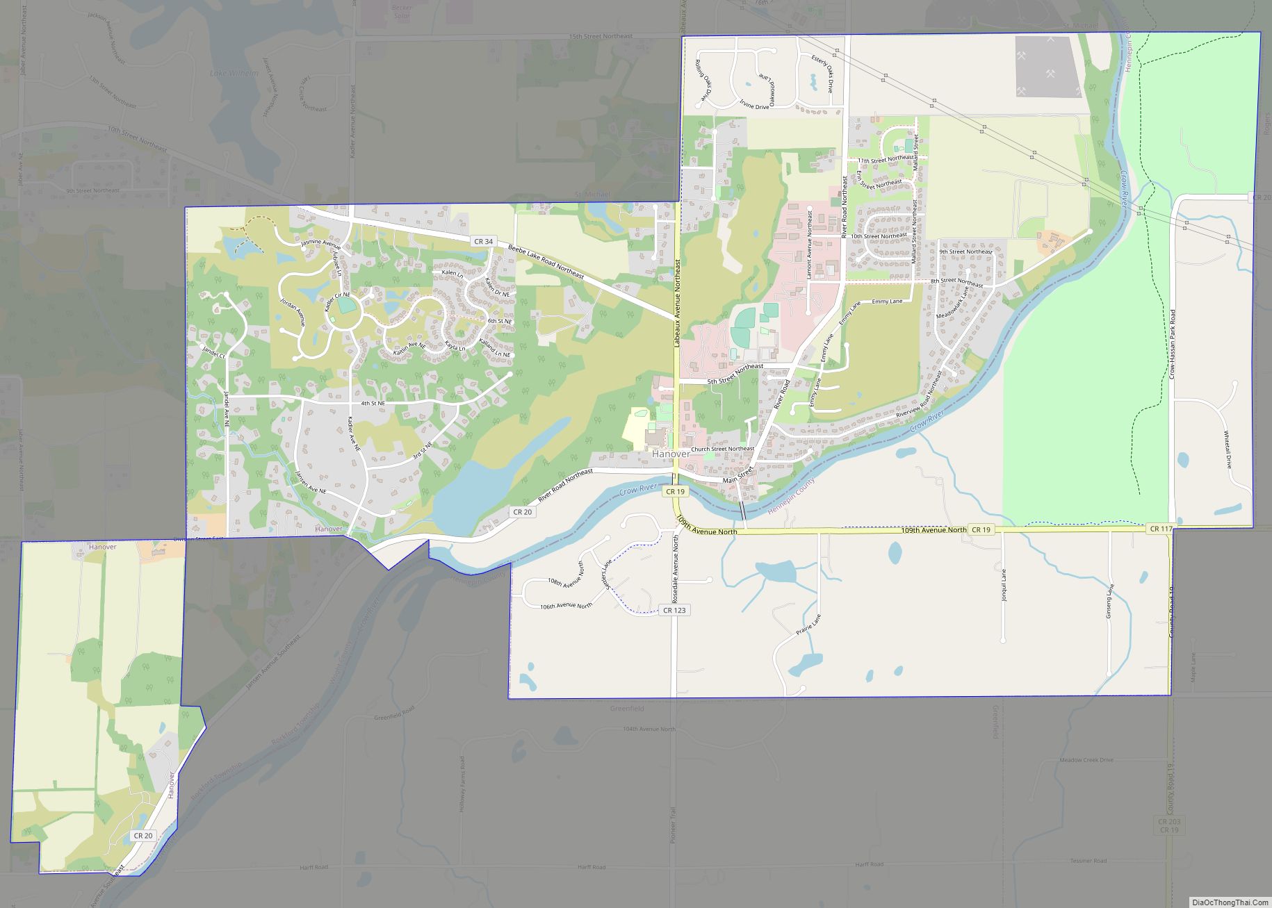
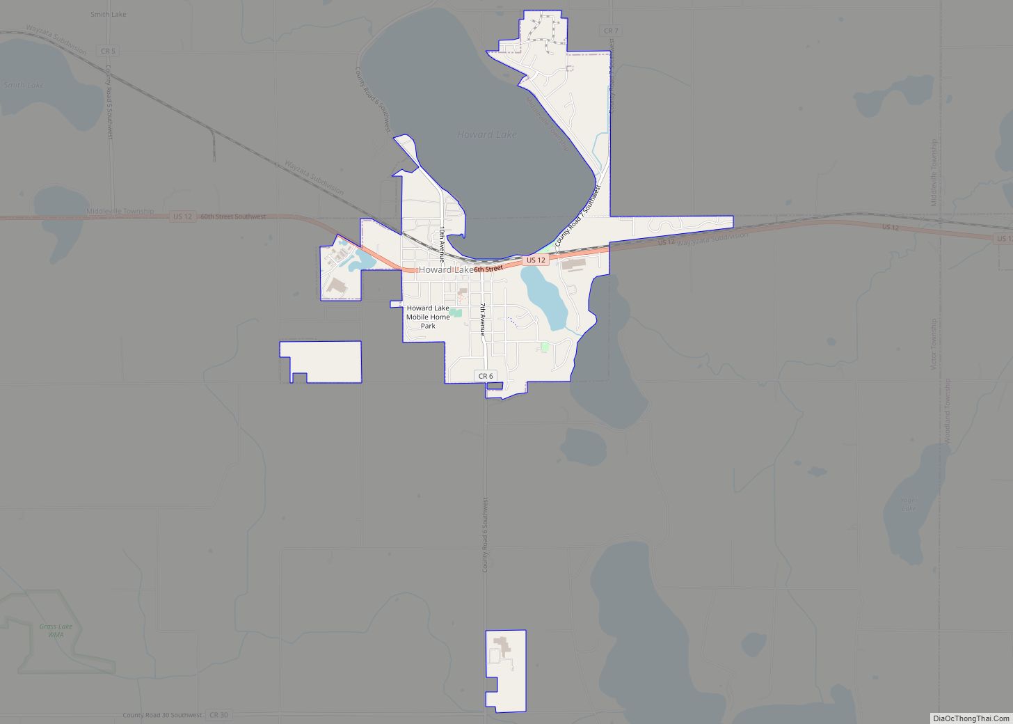
Online Interactive Map
Click on ![]() to view map in "full screen" mode.
to view map in "full screen" mode.
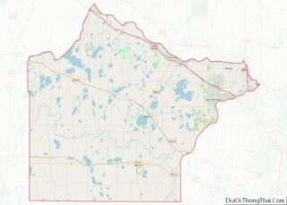
Buffalo location map. Where is Buffalo city?
History
Buffalo was platted in 1856 and named after nearby Buffalo Lake. A post office has been in operation in Buffalo since 1856.
A mass shooting and bombing occurred at Allina Health’s Buffalo Crossroads medical clinic on February 9, 2021. Five people were shot and one woman died.
Buffalo Road Map
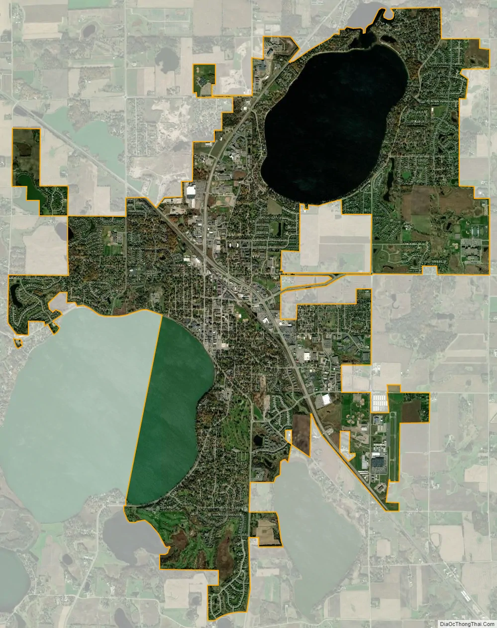
Buffalo city Satellite Map
Geography
According to the United States Census Bureau, the city has a total area of 9.64 square miles (24.97 km); 7.17 square miles (18.57 km) is land and 2.47 square miles (6.40 km) is water. The city is home to many lakes, namely Buffalo Lake and Lake Pulaski.
Climate
The summers are long and warm, while the winters are windy and freezing. Over the entire year, temperature varies from 7°F – 82°F. Don’t expect temperatures below -15°F or above 90°F. The windiest parts of the year last around 8.3 months, starting in September, with an average of 10.3 miles per hour.
See also
Map of Minnesota State and its subdivision:- Aitkin
- Anoka
- Becker
- Beltrami
- Benton
- Big Stone
- Blue Earth
- Brown
- Carlton
- Carver
- Cass
- Chippewa
- Chisago
- Clay
- Clearwater
- Cook
- Cottonwood
- Crow Wing
- Dakota
- Dodge
- Douglas
- Faribault
- Fillmore
- Freeborn
- Goodhue
- Grant
- Hennepin
- Houston
- Hubbard
- Isanti
- Itasca
- Jackson
- Kanabec
- Kandiyohi
- Kittson
- Koochiching
- Lac qui Parle
- Lake
- Lake of the Woods
- Lake Superior
- Le Sueur
- Lincoln
- Lyon
- Mahnomen
- Marshall
- Martin
- McLeod
- Meeker
- Mille Lacs
- Morrison
- Mower
- Murray
- Nicollet
- Nobles
- Norman
- Olmsted
- Otter Tail
- Pennington
- Pine
- Pipestone
- Polk
- Pope
- Ramsey
- Red Lake
- Redwood
- Renville
- Rice
- Rock
- Roseau
- Saint Louis
- Scott
- Sherburne
- Sibley
- Stearns
- Steele
- Stevens
- Swift
- Todd
- Traverse
- Wabasha
- Wadena
- Waseca
- Washington
- Watonwan
- Wilkin
- Winona
- Wright
- Yellow Medicine
- Alabama
- Alaska
- Arizona
- Arkansas
- California
- Colorado
- Connecticut
- Delaware
- District of Columbia
- Florida
- Georgia
- Hawaii
- Idaho
- Illinois
- Indiana
- Iowa
- Kansas
- Kentucky
- Louisiana
- Maine
- Maryland
- Massachusetts
- Michigan
- Minnesota
- Mississippi
- Missouri
- Montana
- Nebraska
- Nevada
- New Hampshire
- New Jersey
- New Mexico
- New York
- North Carolina
- North Dakota
- Ohio
- Oklahoma
- Oregon
- Pennsylvania
- Rhode Island
- South Carolina
- South Dakota
- Tennessee
- Texas
- Utah
- Vermont
- Virginia
- Washington
- West Virginia
- Wisconsin
- Wyoming