Argyle (pronounced are – guy – al) is a city in Marshall County, Minnesota, United States, along the Middle River. The population was 544 at the 2020 census. Old Mill State Park is nearby.
| Name: | Argyle city |
|---|---|
| LSAD Code: | 25 |
| LSAD Description: | city (suffix) |
| State: | Minnesota |
| County: | Marshall County |
| Incorporated: | 1883 |
| Elevation: | 846 ft (258 m) |
| Total Area: | 1.51 sq mi (3.91 km²) |
| Land Area: | 1.51 sq mi (3.91 km²) |
| Water Area: | 0.00 sq mi (0.00 km²) |
| Total Population: | 544 |
| Population Density: | 360.74/sq mi (139.25/km²) |
| ZIP code: | 56713 |
| Area code: | 218 |
| FIPS code: | 2702134 |
| GNISfeature ID: | 0639435 |
| Website: | ci.argyle.mn.us |
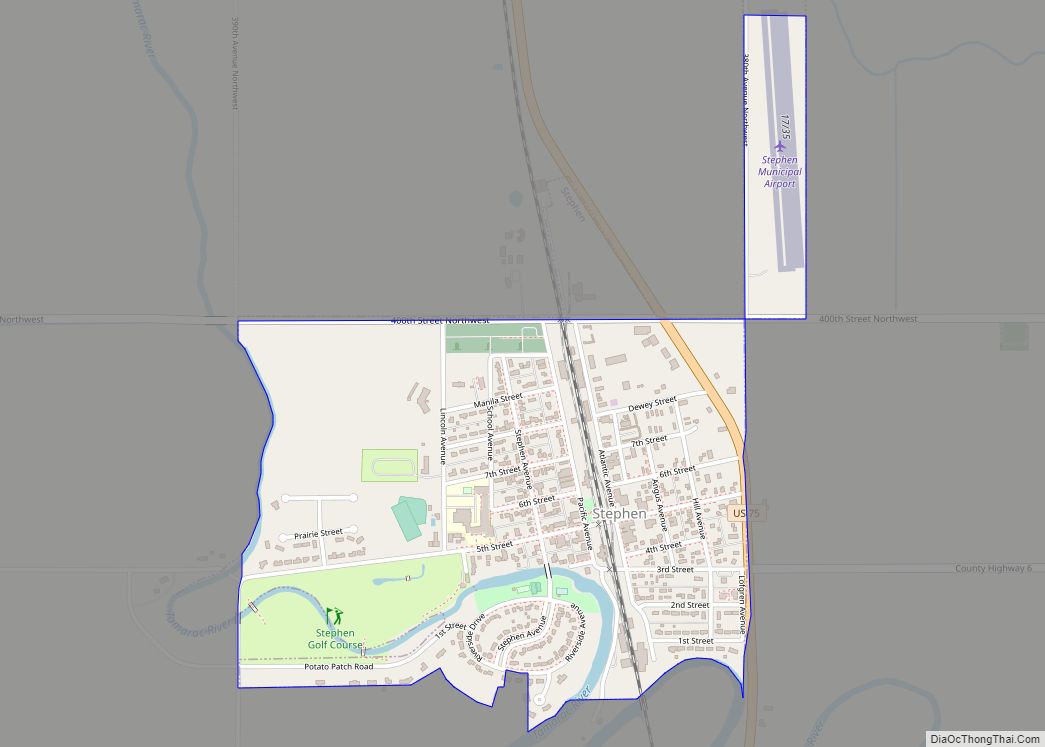
Online Interactive Map
Click on ![]() to view map in "full screen" mode.
to view map in "full screen" mode.
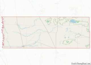
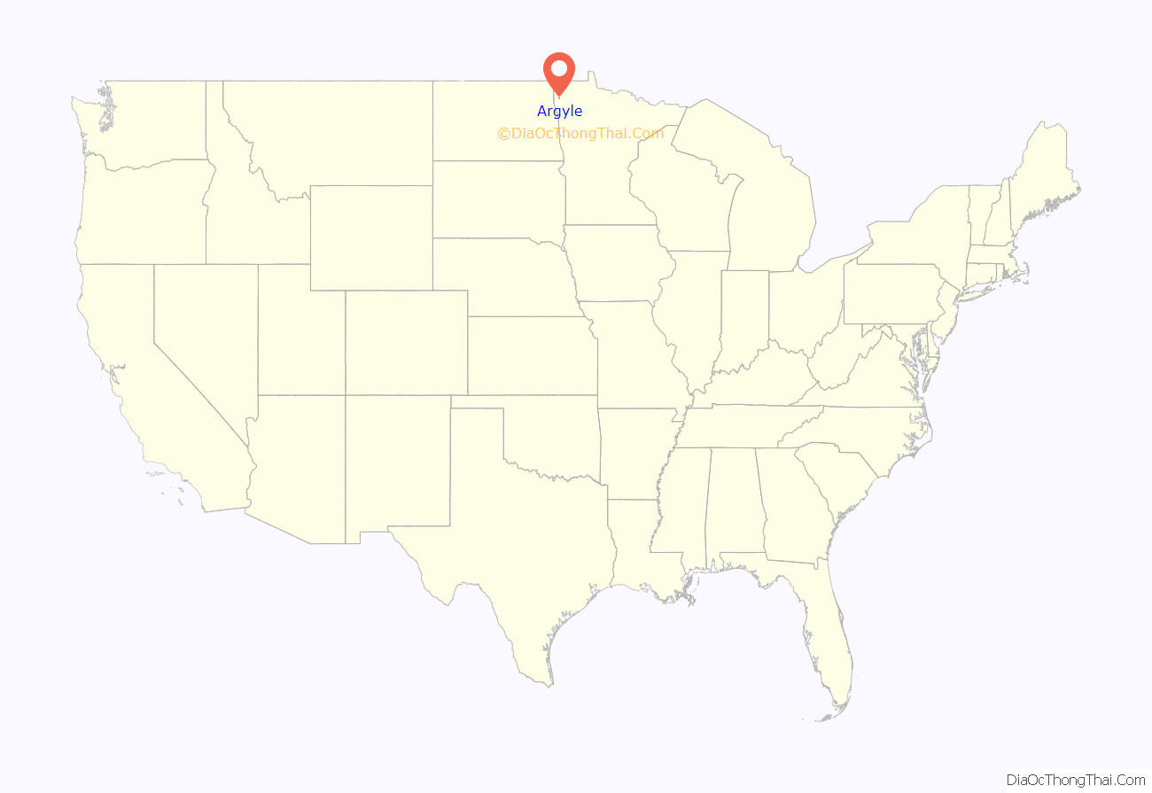
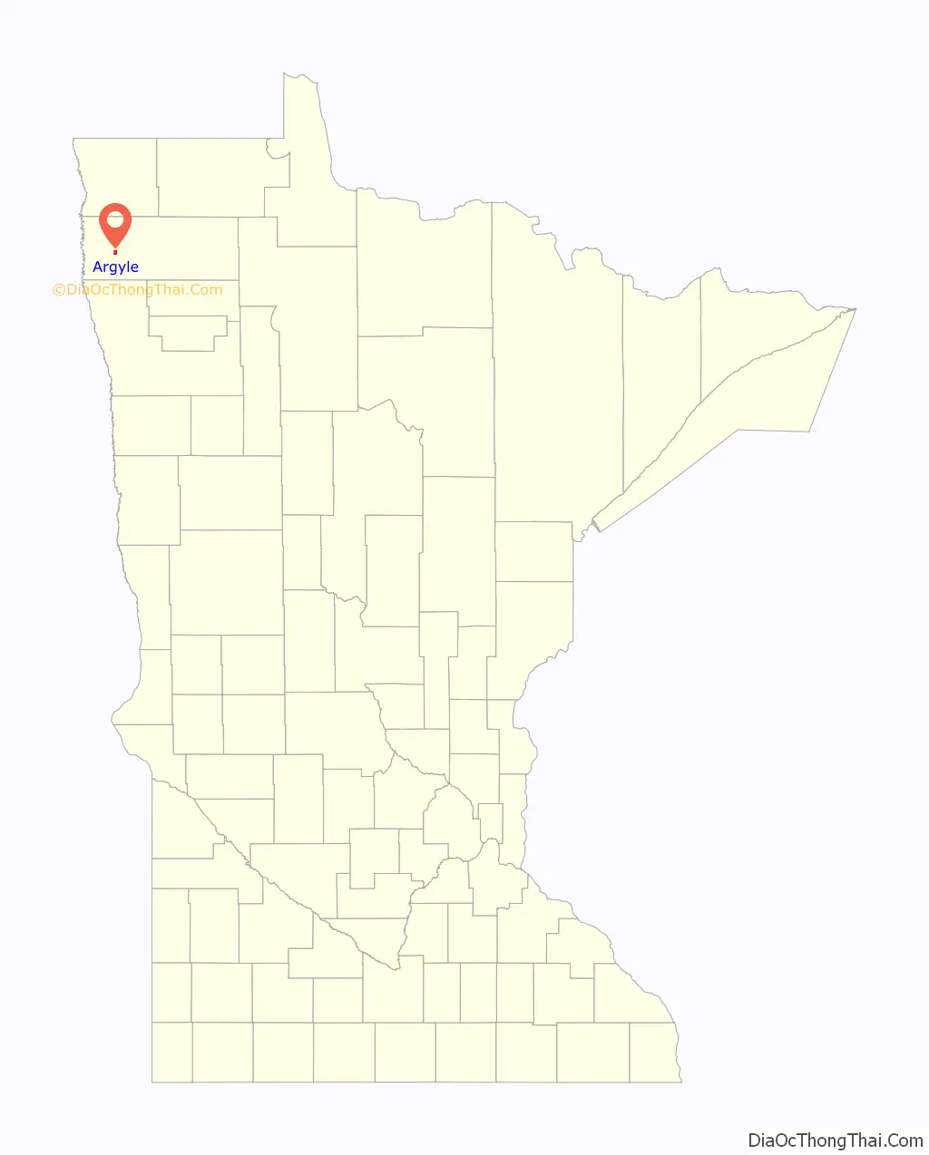
Argyle location map. Where is Argyle city?
History
Before James J. Hill bought the Great Northern Railway in 1879 and accepted the task of completing the line from Crookston to the Canada–US border, a French-Canadian man founded a town named Louisa, after the French king, in the path of the railroad. However, Hill’s company located the new railroad town just south of the Louisa property line and named it Argyle. The early settlement included many French-Canadians. Other settlers included immigrants from England, Norway, Poland, Sweden, Scotland, and Germany. The early townspeople and businessmen were always anxious to make Argyle an attractive community to the region. Today the community still boasts of several businesses, which draw customers from the regional area. Because of threats of flooding, a dike was built on the Middle River which is a branch of the Red River in 1988.
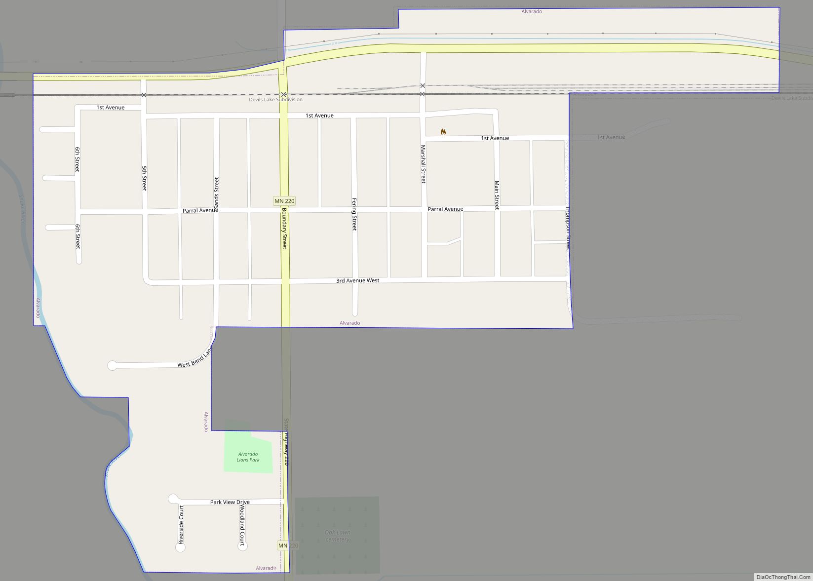
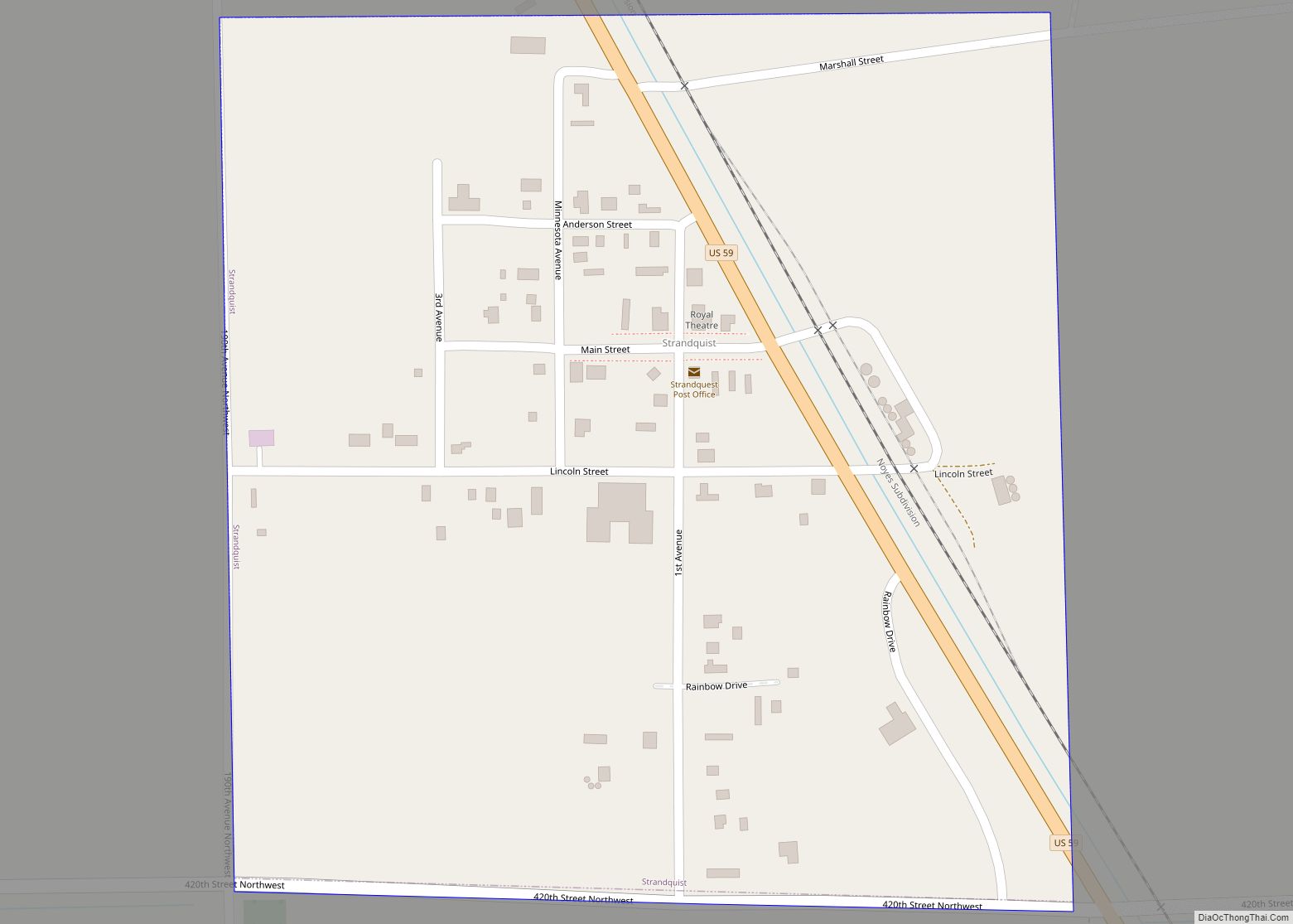
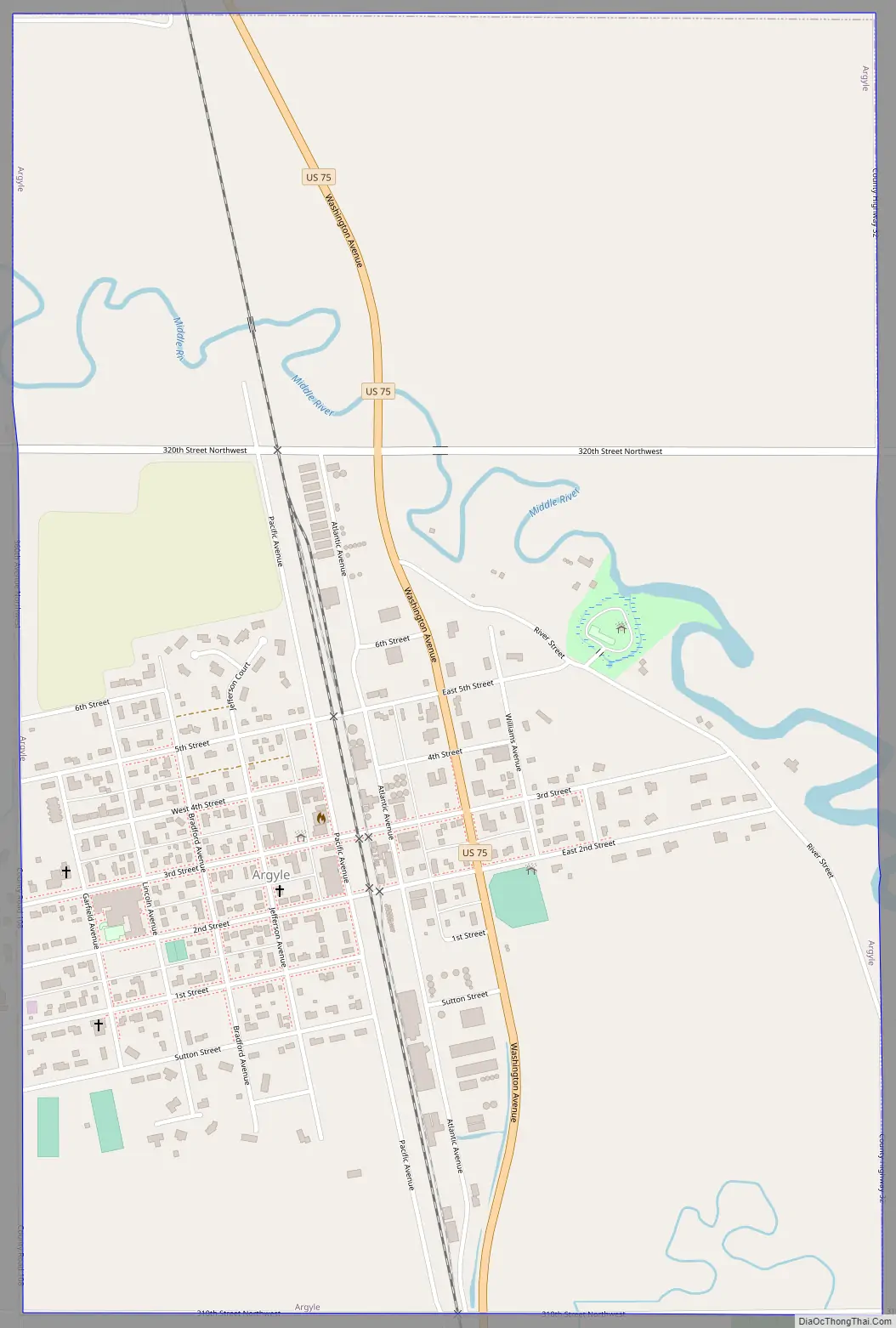
Argyle Road Map
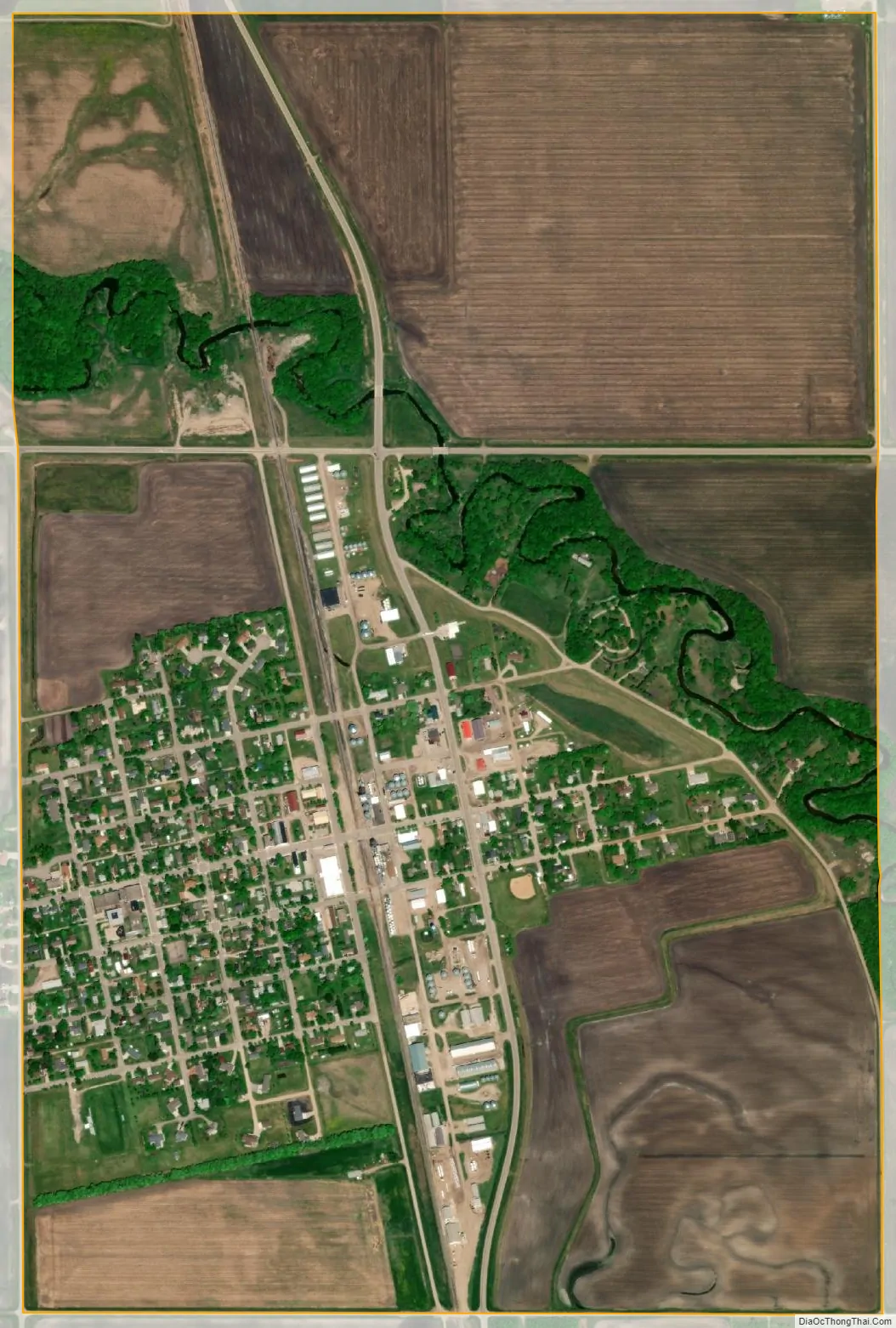
Argyle city Satellite Map
Geography
According to the United States Census Bureau, the city has a total area of 1.00 square mile (2.59 km), all land. The city is located 40 miles from both Grand Forks, North Dakota and Thief River Falls. Argyle is also located 130 miles from Winnipeg, Manitoba and 360 miles from Minneapolis. The relatively flat area around Argyle is good for farming.
Climate
See also
Map of Minnesota State and its subdivision:- Aitkin
- Anoka
- Becker
- Beltrami
- Benton
- Big Stone
- Blue Earth
- Brown
- Carlton
- Carver
- Cass
- Chippewa
- Chisago
- Clay
- Clearwater
- Cook
- Cottonwood
- Crow Wing
- Dakota
- Dodge
- Douglas
- Faribault
- Fillmore
- Freeborn
- Goodhue
- Grant
- Hennepin
- Houston
- Hubbard
- Isanti
- Itasca
- Jackson
- Kanabec
- Kandiyohi
- Kittson
- Koochiching
- Lac qui Parle
- Lake
- Lake of the Woods
- Lake Superior
- Le Sueur
- Lincoln
- Lyon
- Mahnomen
- Marshall
- Martin
- McLeod
- Meeker
- Mille Lacs
- Morrison
- Mower
- Murray
- Nicollet
- Nobles
- Norman
- Olmsted
- Otter Tail
- Pennington
- Pine
- Pipestone
- Polk
- Pope
- Ramsey
- Red Lake
- Redwood
- Renville
- Rice
- Rock
- Roseau
- Saint Louis
- Scott
- Sherburne
- Sibley
- Stearns
- Steele
- Stevens
- Swift
- Todd
- Traverse
- Wabasha
- Wadena
- Waseca
- Washington
- Watonwan
- Wilkin
- Winona
- Wright
- Yellow Medicine
- Alabama
- Alaska
- Arizona
- Arkansas
- California
- Colorado
- Connecticut
- Delaware
- District of Columbia
- Florida
- Georgia
- Hawaii
- Idaho
- Illinois
- Indiana
- Iowa
- Kansas
- Kentucky
- Louisiana
- Maine
- Maryland
- Massachusetts
- Michigan
- Minnesota
- Mississippi
- Missouri
- Montana
- Nebraska
- Nevada
- New Hampshire
- New Jersey
- New Mexico
- New York
- North Carolina
- North Dakota
- Ohio
- Oklahoma
- Oregon
- Pennsylvania
- Rhode Island
- South Carolina
- South Dakota
- Tennessee
- Texas
- Utah
- Vermont
- Virginia
- Washington
- West Virginia
- Wisconsin
- Wyoming