Fisher is a town in Polk County, Minnesota, United States. It is part of the Grand Forks–ND–MN Metropolitan Statistical Area. The population was 422 at the 2020 census. Fisher has become a bedroom community for the nearby Greater Grand Forks Metropolitan Area.
| Name: | Fisher city |
|---|---|
| LSAD Code: | 25 |
| LSAD Description: | city (suffix) |
| State: | Minnesota |
| County: | Polk County |
| Elevation: | 846 ft (258 m) |
| Total Area: | 0.43 sq mi (1.10 km²) |
| Land Area: | 0.43 sq mi (1.10 km²) |
| Water Area: | 0.00 sq mi (0.00 km²) |
| Total Population: | 422 |
| Population Density: | 990.61/sq mi (382.49/km²) |
| ZIP code: | 56723 |
| Area code: | 218 |
| FIPS code: | 2721158 |
| GNISfeature ID: | 0643704 |
| Website: | cityoffishermn.com |
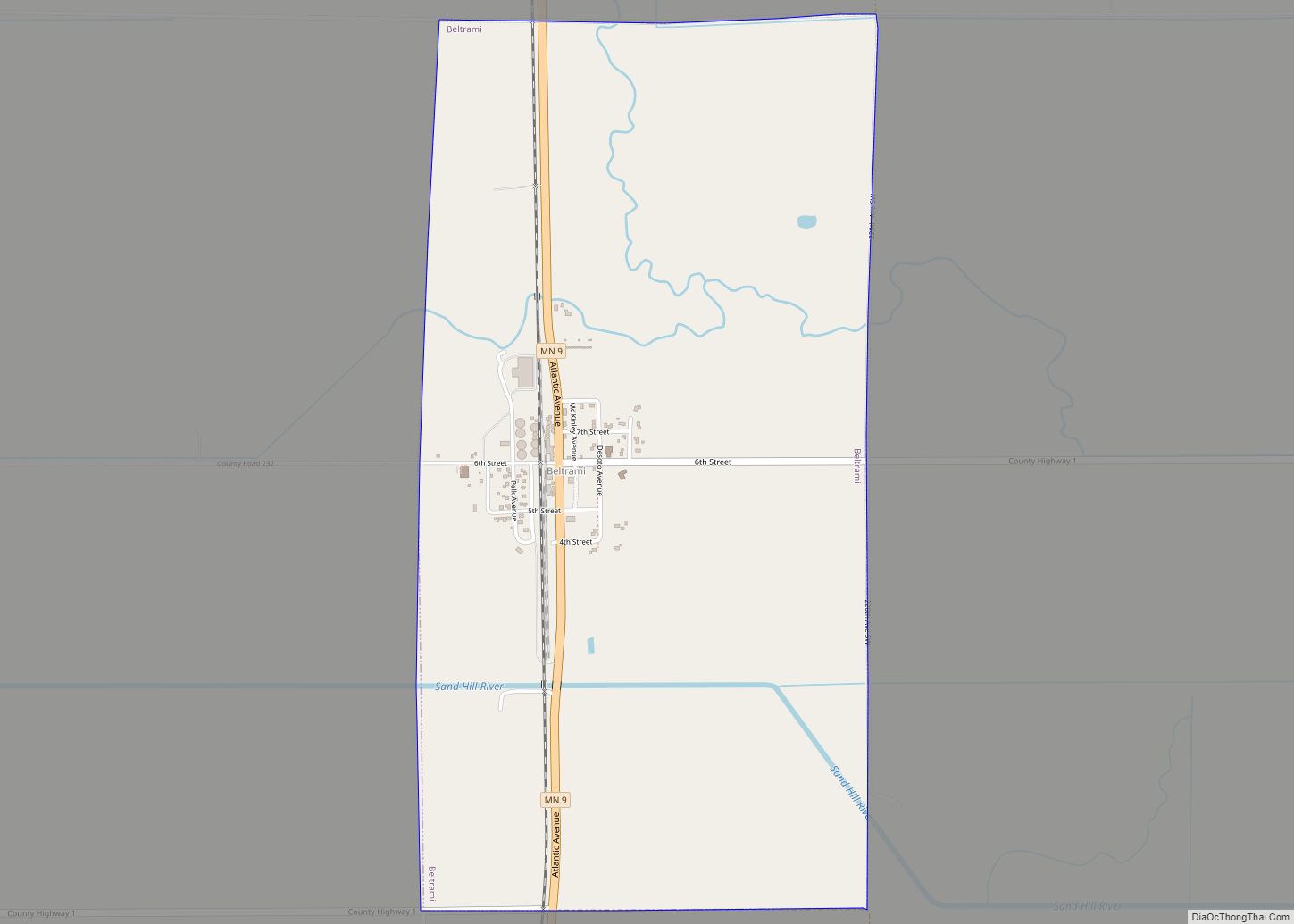
Online Interactive Map
Click on ![]() to view map in "full screen" mode.
to view map in "full screen" mode.
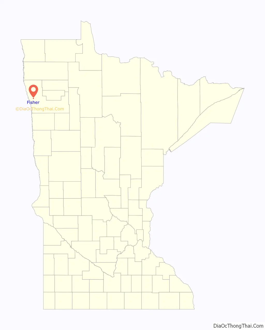
Fisher location map. Where is Fisher city?

History
Fisher is one of the oldest settlements in Polk County. It was originally named “Shirt-Tail Bend” because a shirt had once been tied to a stick to warn steamboats of a bend in the river. It was renamed ‘Fisher’s Landing’, and later shortened to Fisher. These names were adopted in honor of William H. Fisher, who was born in Hunterdon county, N. J., December 24, 1844; engaged in railroad business after 1864; settled in St. Paul in 1873, as attorney for the receiver of the St. Paul and Pacific railroad, and as its assistant manager and superintendent ; later was president and manager of the St. Paul and Duluth railroad company, 1883-99; was vice president and general manager of the Duluth and Winnipeg railroad company, 1888-93.
Fisher Road Map

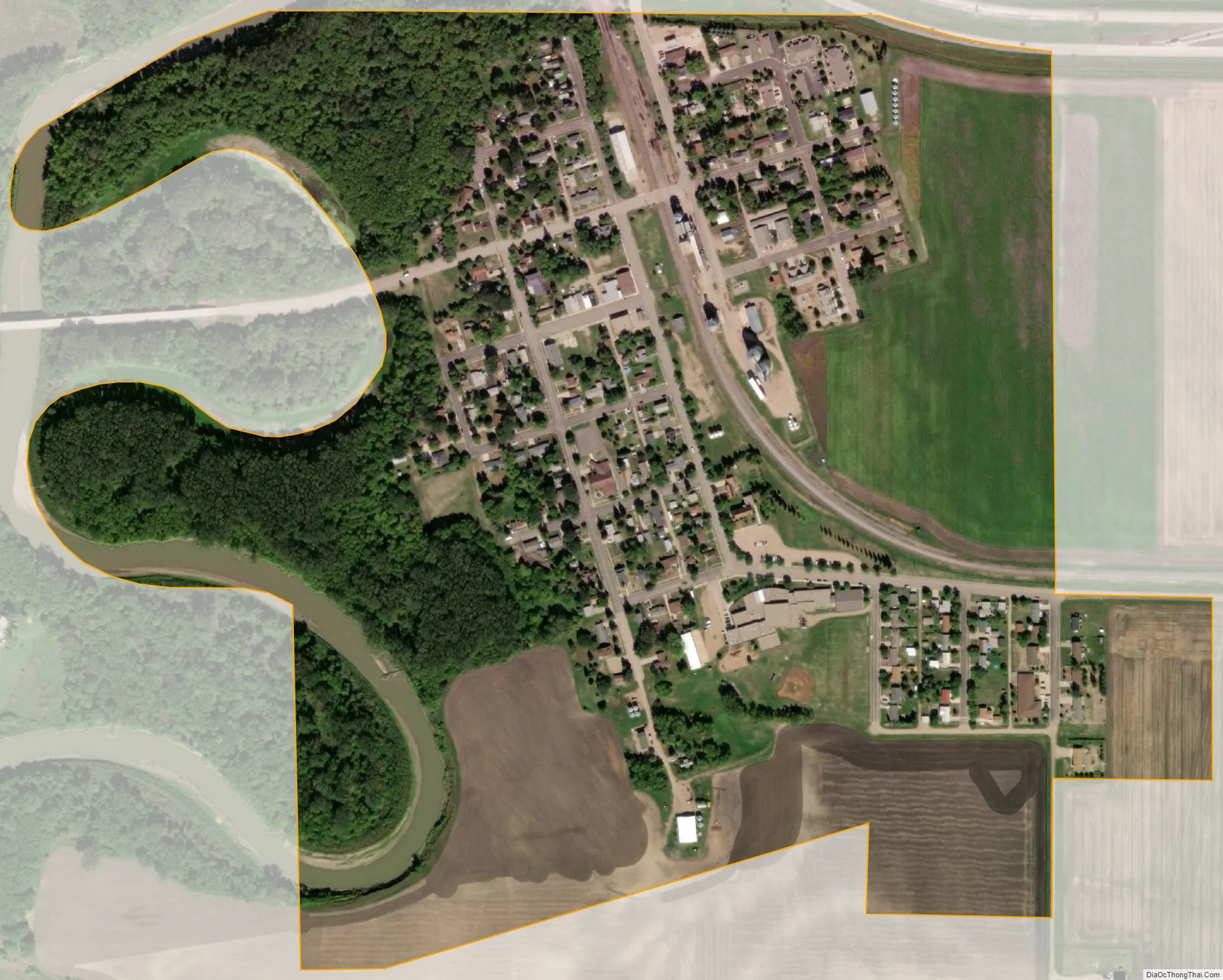
Fisher city Satellite Map
Geography
According to the United States Census Bureau, the city has a total area of 0.43 square miles (1.11 km), all land.
See also
Map of Minnesota State and its subdivision:- Aitkin
- Anoka
- Becker
- Beltrami
- Benton
- Big Stone
- Blue Earth
- Brown
- Carlton
- Carver
- Cass
- Chippewa
- Chisago
- Clay
- Clearwater
- Cook
- Cottonwood
- Crow Wing
- Dakota
- Dodge
- Douglas
- Faribault
- Fillmore
- Freeborn
- Goodhue
- Grant
- Hennepin
- Houston
- Hubbard
- Isanti
- Itasca
- Jackson
- Kanabec
- Kandiyohi
- Kittson
- Koochiching
- Lac qui Parle
- Lake
- Lake of the Woods
- Lake Superior
- Le Sueur
- Lincoln
- Lyon
- Mahnomen
- Marshall
- Martin
- McLeod
- Meeker
- Mille Lacs
- Morrison
- Mower
- Murray
- Nicollet
- Nobles
- Norman
- Olmsted
- Otter Tail
- Pennington
- Pine
- Pipestone
- Polk
- Pope
- Ramsey
- Red Lake
- Redwood
- Renville
- Rice
- Rock
- Roseau
- Saint Louis
- Scott
- Sherburne
- Sibley
- Stearns
- Steele
- Stevens
- Swift
- Todd
- Traverse
- Wabasha
- Wadena
- Waseca
- Washington
- Watonwan
- Wilkin
- Winona
- Wright
- Yellow Medicine
- Alabama
- Alaska
- Arizona
- Arkansas
- California
- Colorado
- Connecticut
- Delaware
- District of Columbia
- Florida
- Georgia
- Hawaii
- Idaho
- Illinois
- Indiana
- Iowa
- Kansas
- Kentucky
- Louisiana
- Maine
- Maryland
- Massachusetts
- Michigan
- Minnesota
- Mississippi
- Missouri
- Montana
- Nebraska
- Nevada
- New Hampshire
- New Jersey
- New Mexico
- New York
- North Carolina
- North Dakota
- Ohio
- Oklahoma
- Oregon
- Pennsylvania
- Rhode Island
- South Carolina
- South Dakota
- Tennessee
- Texas
- Utah
- Vermont
- Virginia
- Washington
- West Virginia
- Wisconsin
- Wyoming