Excelsior (/ɛkˈsɛlsiər/ ek-SEL-see-ər) is a city in Hennepin County, Minnesota, United States. Excelsior’s historic commercial district along Water Street is listed on the National Register of Historic Places, and the town has many Victorian-era houses. On Lake Minnetonka’s southern shore, the community serves as a local tourism destination for shoppers, boaters, and restaurant-goers.
Considered a western suburb of the Twin Cities, Excelsior is about 15 miles (24 km) southwest of downtown Minneapolis. Its population was 2,414 as of the 2020 census. Excelsior’s major roadway is Minnesota State Highway 7.
| Name: | Excelsior city |
|---|---|
| LSAD Code: | 25 |
| LSAD Description: | city (suffix) |
| State: | Minnesota |
| County: | Hennepin County |
| Founded: | 1853 |
| Incorporated: | 1878 |
| Elevation: | 945 ft (288 m) |
| Total Area: | 0.88 sq mi (2.27 km²) |
| Land Area: | 0.63 sq mi (1.63 km²) |
| Water Area: | 0.25 sq mi (0.64 km²) |
| Total Population: | 2,355 |
| Population Density: | 3,738.10/sq mi (1,444.23/km²) |
| ZIP code: | 55331 |
| Area code: | 952 |
| FIPS code: | 2720078 |
| GNISfeature ID: | 643477 |
| Website: | www.ci.excelsior.mn.us |
Online Interactive Map
Click on ![]() to view map in "full screen" mode.
to view map in "full screen" mode.
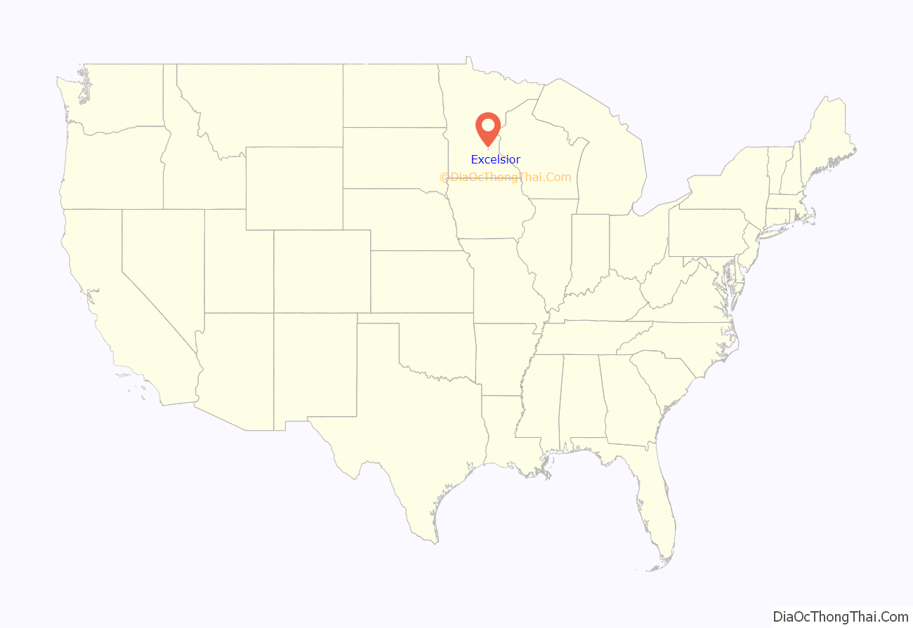
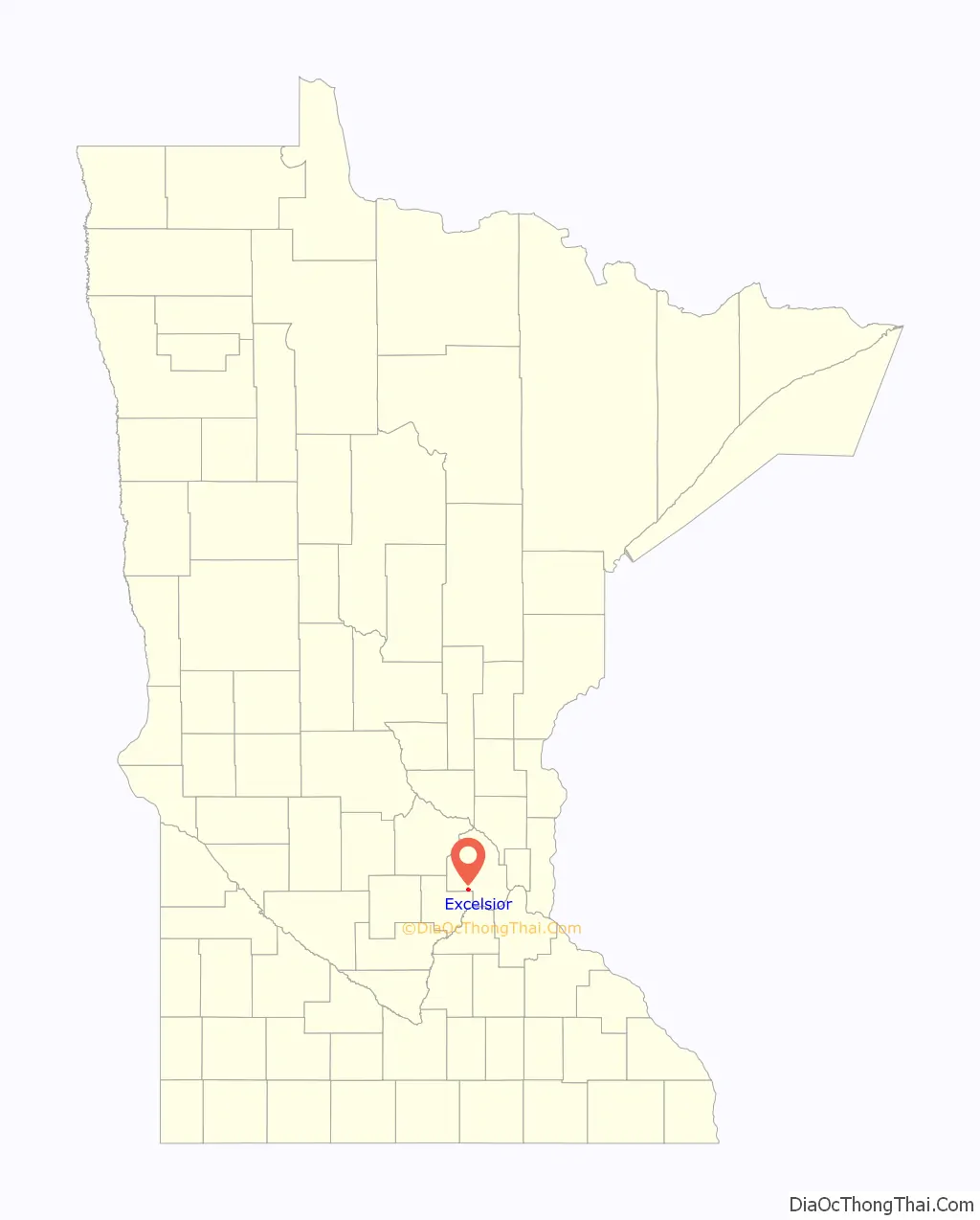
Excelsior location map. Where is Excelsior city?
History
The first Euro-Americans known to have visited Lake Minnetonka were two teenage boys, Joe Brown and Will Snelling, who canoed up Minnehaha Creek from Fort Saint Anthony in 1822.
Minnesota’s territorial governor Alexander Ramsey officially named Lake Minnetonka in 1852. He had been informed that the Dakota called the lake Mní iá Tháŋka (“the-water-they-speak-of-is-large”). The next year, a group of settlers from New York established Excelsior, the lake’s first white settlement.
During the late 19th century, the Excelsior and Lake Minnetonka area was home to several popular summer lake resorts.
Streetcars were used in Excelsior as a part of the Twin City Rapid Transit Company system until 1932, when the line was cut back to Hopkins.
20th century
A large ballroom called “Danceland” (later “Big Reggie’s Danceland”) stood across the street from Excelsior Amusement Park from the mid-1920s to 1973. Operated by Ray Colihan, it hosted performances by Lawrence Welk, Fred Waring, and the Andrews Sisters in the 1930s. On May 3, 1963, the Beach Boys performed at Danceland. Beach Boys singer Mike Love remembered the performance as a significant moment for the band in a 2019 interview. According to Love, people “were breaking the windows to get into [Danceland] because it was sold out… I said to one of my bandmates: ‘This must be like when Elvis was starting out.'” On June 12, 1964, The Rolling Stones played Danceland for an audience of 283. It has been speculated that Excelsior resident Jimmy Hutmaker inspired Mick Jagger to write the 1969 song “You Can’t Always Get What You Want” after a chance encounter at a local drugstore earlier that day, but this claim has long been disputed.
In 1974 President Gerald Ford purchased a golden retriever named Liberty from Excelsior resident Avis Friberg.
21st century
Over the years, Excelsior’s downtown historic district has been home to many businesses, including hotels, restaurants, and merchants. Since 2010, restaurants and eateries have come to dominate the town’s commercial landscape. Excelsior is known for maintaining its historical identity. Beyond the downtown district, it also retains much of its Victorian-era housing stock. Strict building codes are enforced in order to preserve this identity.
The Excelsior Commons and Lake Minnetonka are central amenities to the community and major draws for tourists. The Minnesota Streetcar Museum, a local transportation museum, maintains a heritage streetcar line in Excelsior and operates three restored streetcars on the line: Twin City Lines No. 1239, Winona Power & Light Co. #10, and Duluth Street Railway No. 78.
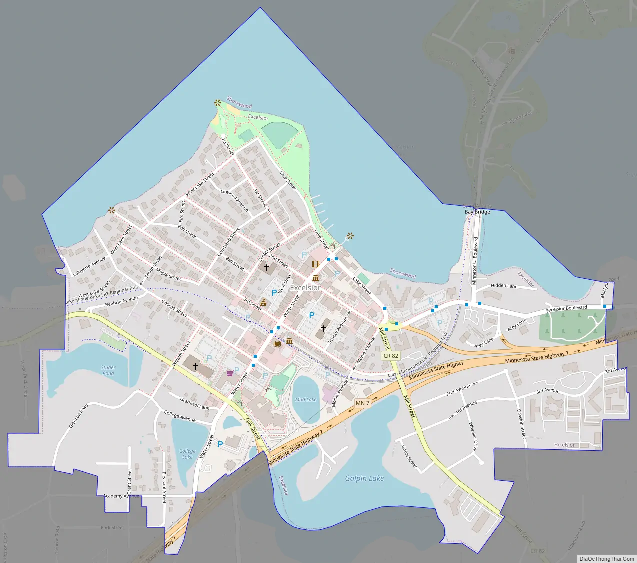
Excelsior Road Map
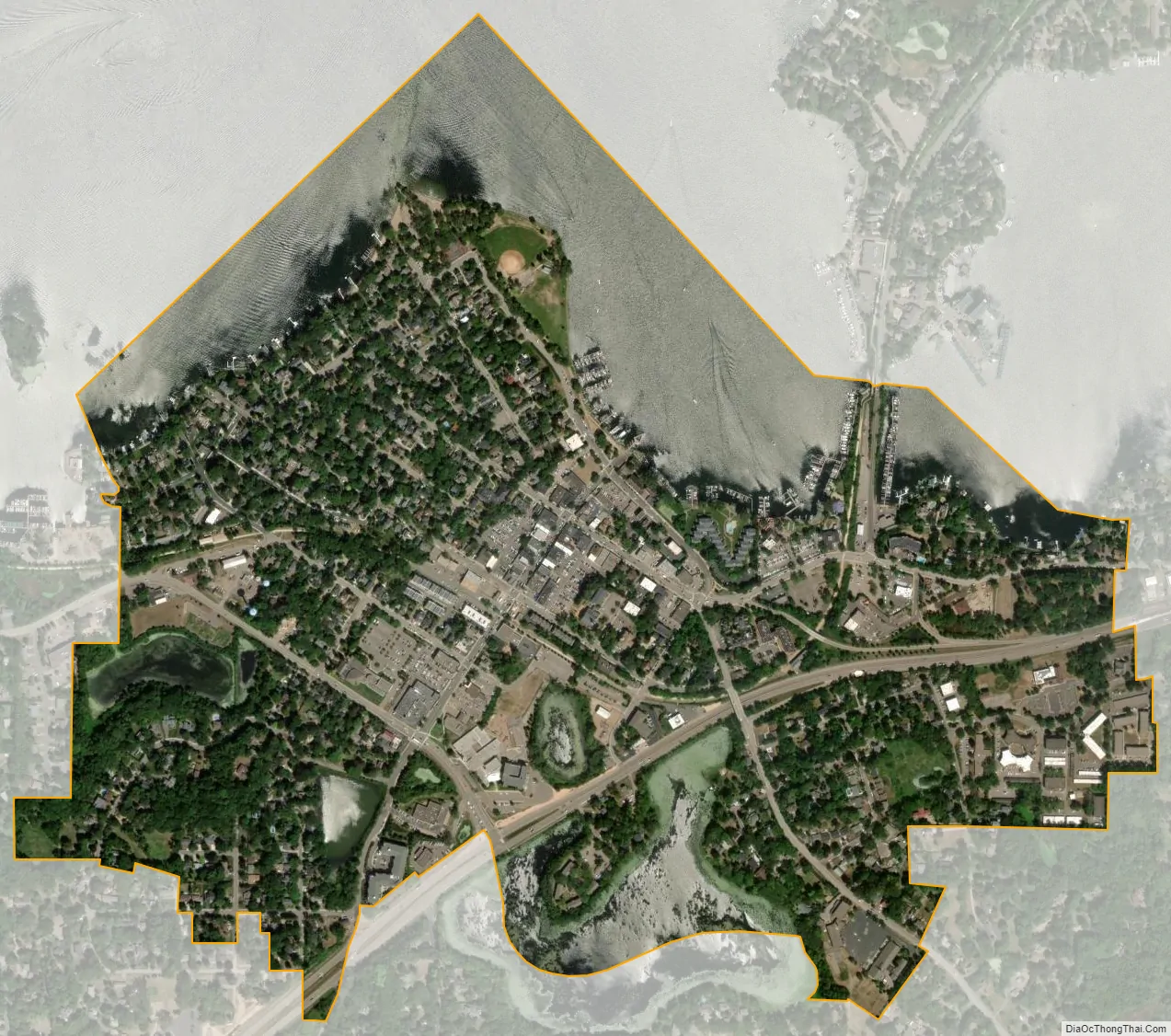
Excelsior city Satellite Map
Geography
Excelsior is in Hennepin County, Minnesota, on Lake Minnetonka’s south shore. It is approximately 15 miles (24 km) southwest of Minneapolis and bordered by Shorewood and Greenwood. According to the United States Census Bureau, Excelsior has an area of 0.69 square miles (1.79 km), of which 0.63 square miles (1.63 km) is land and 0.06 square miles (0.16 km) is water. Minnesota State Highway 7 serves as a main route through the city, leading east-northeast 11 miles (18 km) to Highway 100 in Saint Louis Park and west 41 miles (66 km) to Hutchinson.
See also
Map of Minnesota State and its subdivision:- Aitkin
- Anoka
- Becker
- Beltrami
- Benton
- Big Stone
- Blue Earth
- Brown
- Carlton
- Carver
- Cass
- Chippewa
- Chisago
- Clay
- Clearwater
- Cook
- Cottonwood
- Crow Wing
- Dakota
- Dodge
- Douglas
- Faribault
- Fillmore
- Freeborn
- Goodhue
- Grant
- Hennepin
- Houston
- Hubbard
- Isanti
- Itasca
- Jackson
- Kanabec
- Kandiyohi
- Kittson
- Koochiching
- Lac qui Parle
- Lake
- Lake of the Woods
- Lake Superior
- Le Sueur
- Lincoln
- Lyon
- Mahnomen
- Marshall
- Martin
- McLeod
- Meeker
- Mille Lacs
- Morrison
- Mower
- Murray
- Nicollet
- Nobles
- Norman
- Olmsted
- Otter Tail
- Pennington
- Pine
- Pipestone
- Polk
- Pope
- Ramsey
- Red Lake
- Redwood
- Renville
- Rice
- Rock
- Roseau
- Saint Louis
- Scott
- Sherburne
- Sibley
- Stearns
- Steele
- Stevens
- Swift
- Todd
- Traverse
- Wabasha
- Wadena
- Waseca
- Washington
- Watonwan
- Wilkin
- Winona
- Wright
- Yellow Medicine
- Alabama
- Alaska
- Arizona
- Arkansas
- California
- Colorado
- Connecticut
- Delaware
- District of Columbia
- Florida
- Georgia
- Hawaii
- Idaho
- Illinois
- Indiana
- Iowa
- Kansas
- Kentucky
- Louisiana
- Maine
- Maryland
- Massachusetts
- Michigan
- Minnesota
- Mississippi
- Missouri
- Montana
- Nebraska
- Nevada
- New Hampshire
- New Jersey
- New Mexico
- New York
- North Carolina
- North Dakota
- Ohio
- Oklahoma
- Oregon
- Pennsylvania
- Rhode Island
- South Carolina
- South Dakota
- Tennessee
- Texas
- Utah
- Vermont
- Virginia
- Washington
- West Virginia
- Wisconsin
- Wyoming


