Fort Ripley is a city in Crow Wing County, Minnesota, United States, near the confluence of the Mississippi and Nokasippi Rivers. The population was 69 at the 2010 census. It is part of the Brainerd Micropolitan Statistical Area.
| Name: | Fort Ripley city |
|---|---|
| LSAD Code: | 25 |
| LSAD Description: | city (suffix) |
| State: | Minnesota |
| County: | Crow Wing County |
| Elevation: | 1,168 ft (356 m) |
| Total Area: | 1.40 sq mi (3.64 km²) |
| Land Area: | 1.29 sq mi (3.34 km²) |
| Water Area: | 0.11 sq mi (0.30 km²) |
| Total Population: | 84 |
| Population Density: | 65.12/sq mi (25.14/km²) |
| ZIP code: | 56449 |
| Area code: | 218 |
| FIPS code: | 2721932 |
| GNISfeature ID: | 0643824 |
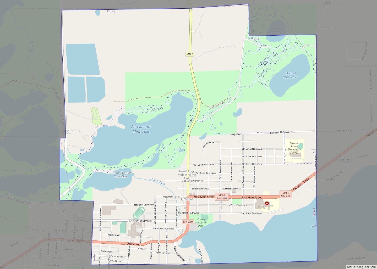
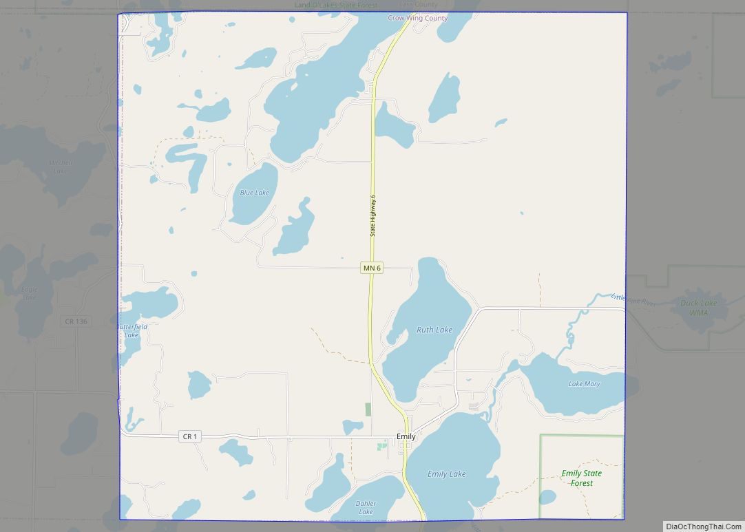
Online Interactive Map
Click on ![]() to view map in "full screen" mode.
to view map in "full screen" mode.
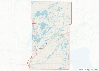
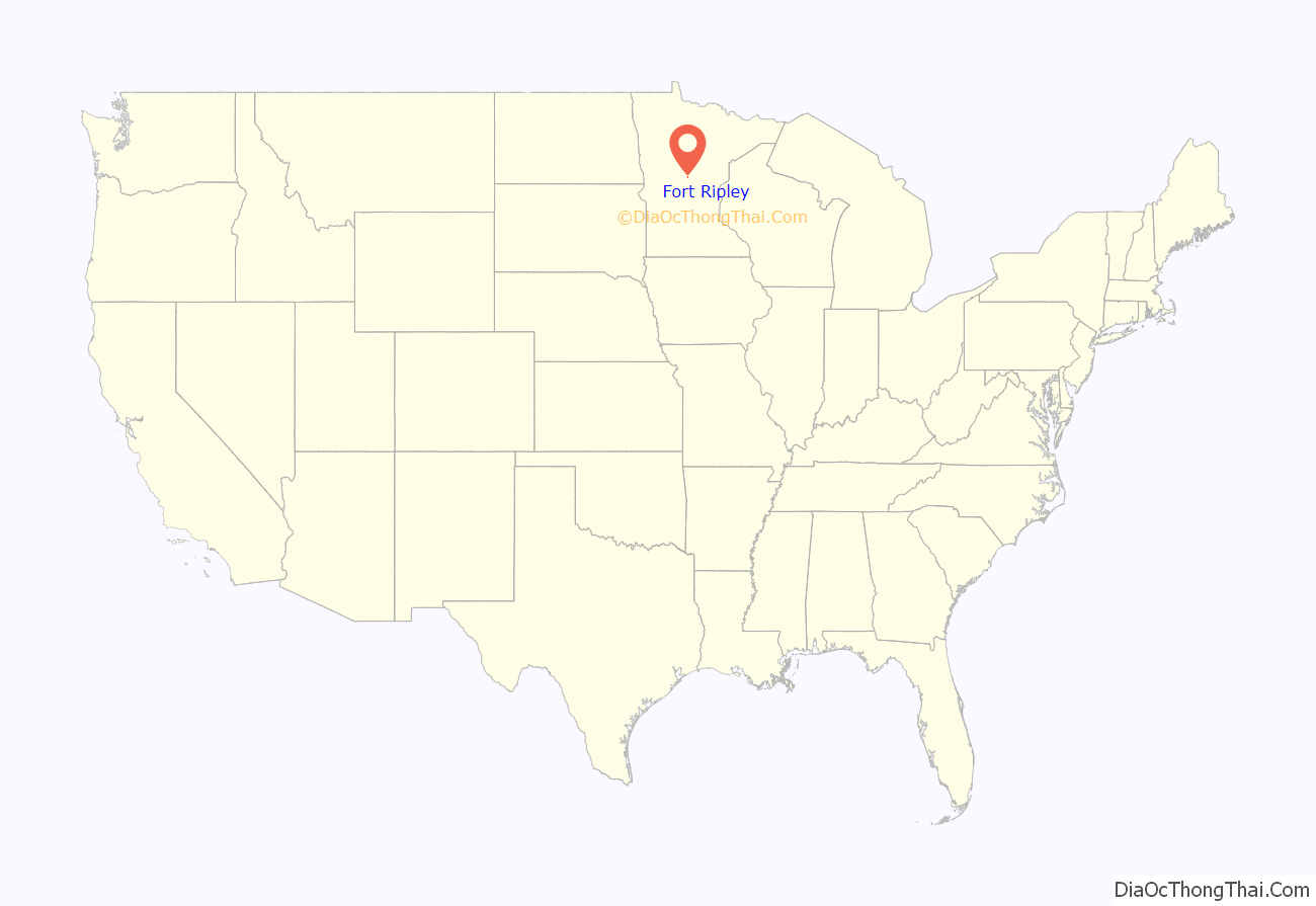
Fort Ripley location map. Where is Fort Ripley city?

History
Fort Ripley was a United States military installation beginning in 1849 and lasting until 1877. The fort, now Camp Ripley, was on the opposite side of the Mississippi River from Morrison County as the current city in Crow Wing County.
The city of Fort Ripley was incorporated in 1927. It took its name from the fort, which was named for Eleazer Wheelock Ripley, an American soldier and politician.
Fort Ripley Road Map

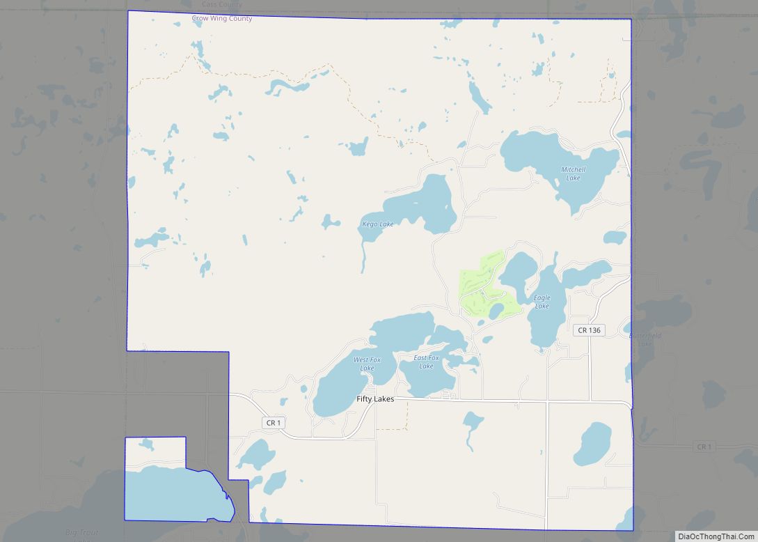
Fort Ripley city Satellite Map

Geography
According to the United States Census Bureau, the city has a total area of 1.44 square miles (3.73 km), of which 1.32 square miles (3.42 km) is land and 0.12 square miles (0.31 km) is water.
The city of Fort Ripley is geographically in Fort Ripley Township but is a separate entity.
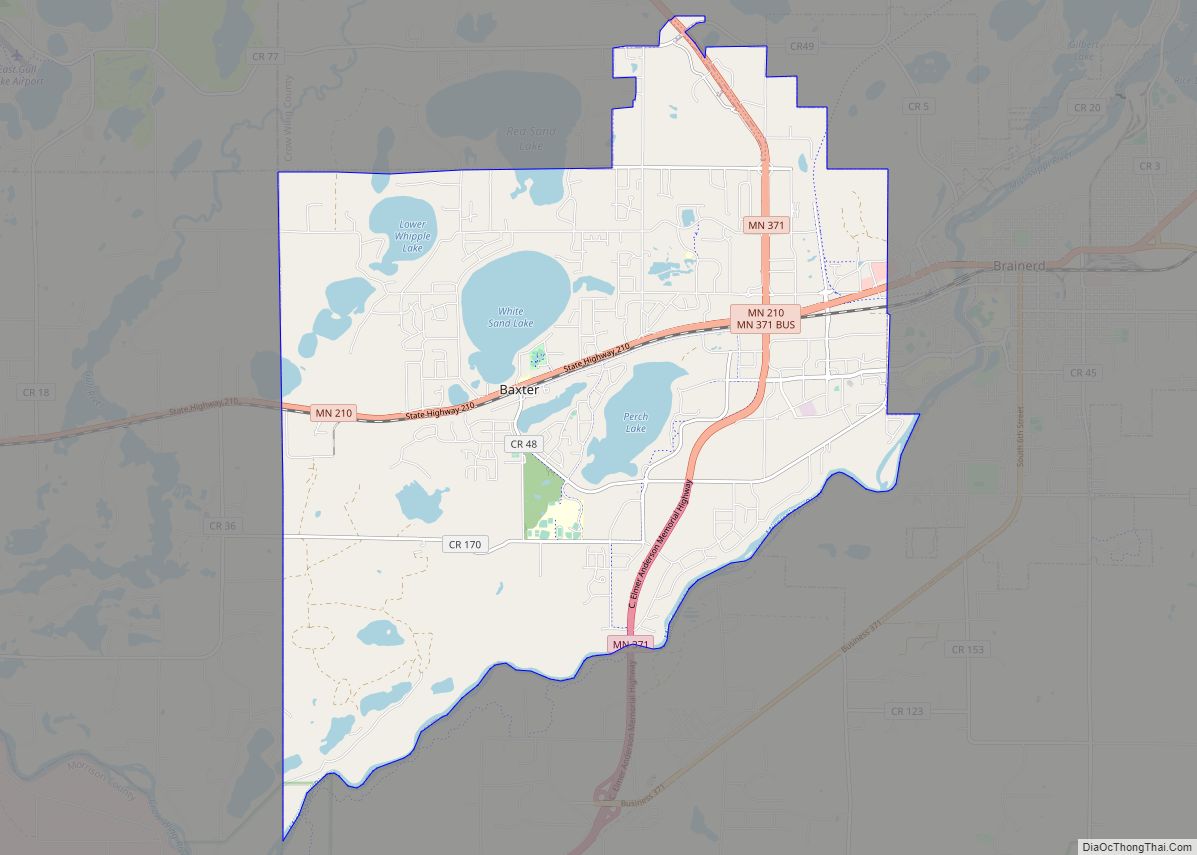
Fort Ripley is between Little Falls and Brainerd along Minnesota State Highway 371 near Over the Hill Road and Crow Wing County Road 2. The Mississippi River, the Nokasippi River, and the Little Nokasippi River are all in the vicinity.
The boundary line between Crow Wing and Morrison counties is nearby.
See also
Map of Minnesota State and its subdivision:- Aitkin
- Anoka
- Becker
- Beltrami
- Benton
- Big Stone
- Blue Earth
- Brown
- Carlton
- Carver
- Cass
- Chippewa
- Chisago
- Clay
- Clearwater
- Cook
- Cottonwood
- Crow Wing
- Dakota
- Dodge
- Douglas
- Faribault
- Fillmore
- Freeborn
- Goodhue
- Grant
- Hennepin
- Houston
- Hubbard
- Isanti
- Itasca
- Jackson
- Kanabec
- Kandiyohi
- Kittson
- Koochiching
- Lac qui Parle
- Lake
- Lake of the Woods
- Lake Superior
- Le Sueur
- Lincoln
- Lyon
- Mahnomen
- Marshall
- Martin
- McLeod
- Meeker
- Mille Lacs
- Morrison
- Mower
- Murray
- Nicollet
- Nobles
- Norman
- Olmsted
- Otter Tail
- Pennington
- Pine
- Pipestone
- Polk
- Pope
- Ramsey
- Red Lake
- Redwood
- Renville
- Rice
- Rock
- Roseau
- Saint Louis
- Scott
- Sherburne
- Sibley
- Stearns
- Steele
- Stevens
- Swift
- Todd
- Traverse
- Wabasha
- Wadena
- Waseca
- Washington
- Watonwan
- Wilkin
- Winona
- Wright
- Yellow Medicine
- Alabama
- Alaska
- Arizona
- Arkansas
- California
- Colorado
- Connecticut
- Delaware
- District of Columbia
- Florida
- Georgia
- Hawaii
- Idaho
- Illinois
- Indiana
- Iowa
- Kansas
- Kentucky
- Louisiana
- Maine
- Maryland
- Massachusetts
- Michigan
- Minnesota
- Mississippi
- Missouri
- Montana
- Nebraska
- Nevada
- New Hampshire
- New Jersey
- New Mexico
- New York
- North Carolina
- North Dakota
- Ohio
- Oklahoma
- Oregon
- Pennsylvania
- Rhode Island
- South Carolina
- South Dakota
- Tennessee
- Texas
- Utah
- Vermont
- Virginia
- Washington
- West Virginia
- Wisconsin
- Wyoming