Montgomery is a city in Le Sueur County, Minnesota, United States, 45 miles south of Minneapolis. It was named after Richard Montgomery, an Irish-American soldier who served as a major general in the Continental Army during the Revolutionary War. The population was 2,956 at the 2010 census.
| Name: | Montgomery city |
|---|---|
| LSAD Code: | 25 |
| LSAD Description: | city (suffix) |
| State: | Minnesota |
| County: | Le Sueur County |
| Elevation: | 1,070 ft (326 m) |
| Total Area: | 2.51 sq mi (6.50 km²) |
| Land Area: | 2.51 sq mi (6.50 km²) |
| Water Area: | 0.00 sq mi (0.00 km²) |
| Total Population: | 3,249 |
| Population Density: | 1,293.91/sq mi (499.55/km²) |
| ZIP code: | 56069 |
| Area code: | 507 |
| FIPS code: | 2743738 |
| GNISfeature ID: | 0648047 |
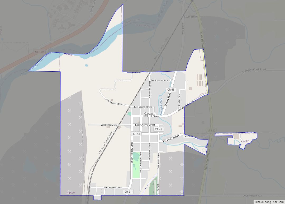
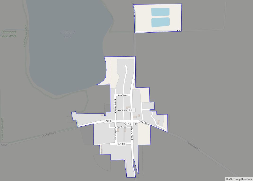
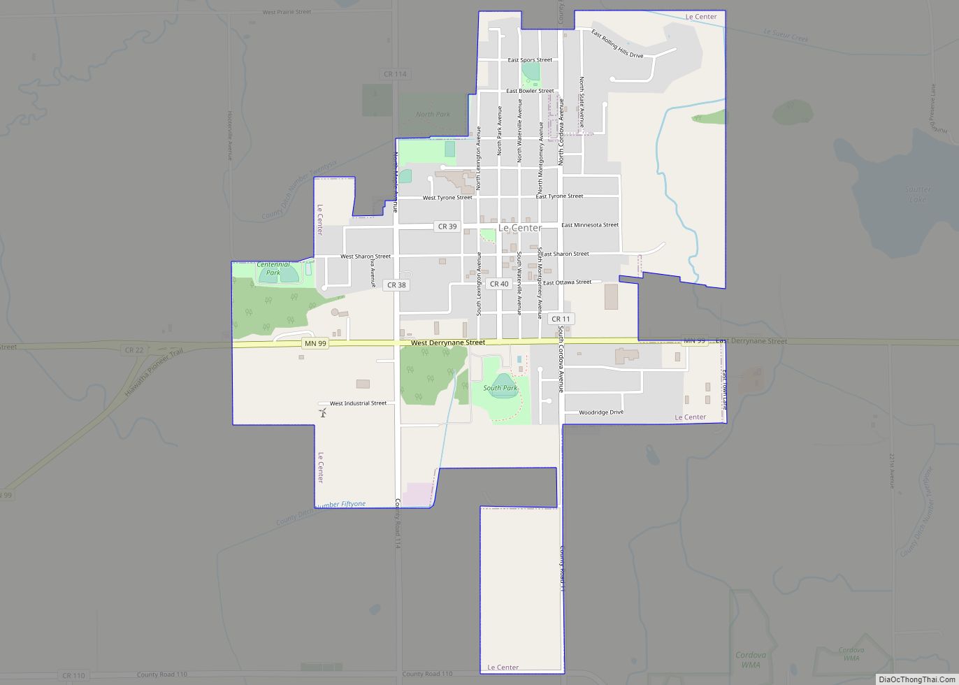
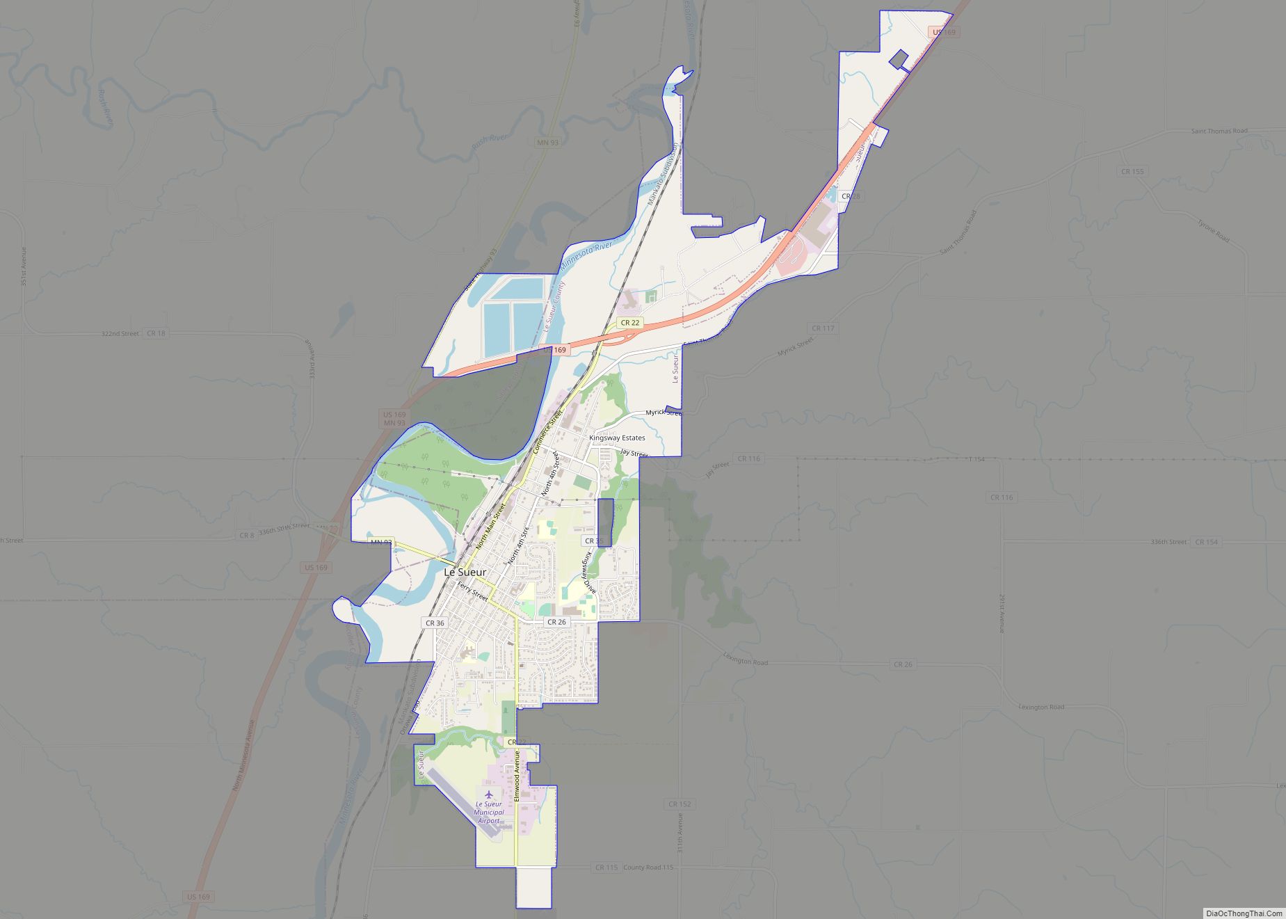
Online Interactive Map
Click on ![]() to view map in "full screen" mode.
to view map in "full screen" mode.
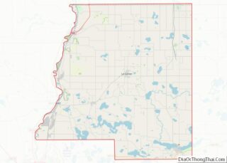
Montgomery location map. Where is Montgomery city?


History
Montgomery as platted in 1877 when the railroad was extended to that point. Martin M. Malone (1888-1962), politician and businessman, was born in Montgomery.
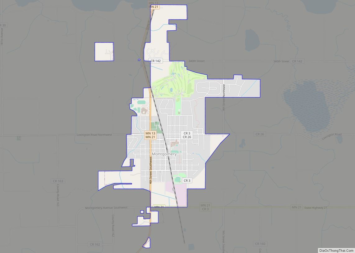
Montgomery Road Map

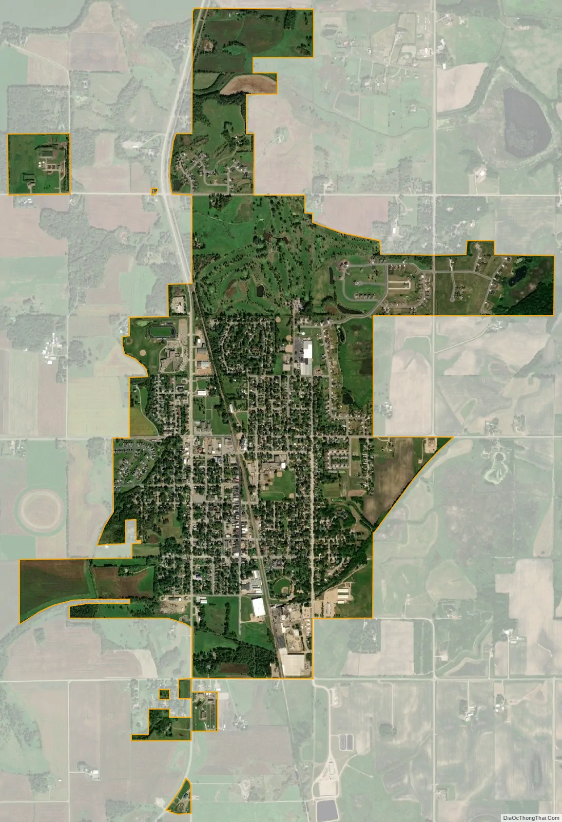
Montgomery city Satellite Map
Geography
According to the United States Census Bureau, the city has a total area of 2.62 square miles (6.79 km), all land.
Minnesota State Highways 13 and 21 are two of the main routes in the city.
Minnesota State Highway 99 is located directly to the south.
Montgomery is 15 miles from Interstate 35.
The closest towns to Montgomery are:
- North – New Prague
- South – Kilkenny
- East – Lonsdale
- West – Le Center
The closest major city is Faribault to the Southeast.
See also
Map of Minnesota State and its subdivision:- Aitkin
- Anoka
- Becker
- Beltrami
- Benton
- Big Stone
- Blue Earth
- Brown
- Carlton
- Carver
- Cass
- Chippewa
- Chisago
- Clay
- Clearwater
- Cook
- Cottonwood
- Crow Wing
- Dakota
- Dodge
- Douglas
- Faribault
- Fillmore
- Freeborn
- Goodhue
- Grant
- Hennepin
- Houston
- Hubbard
- Isanti
- Itasca
- Jackson
- Kanabec
- Kandiyohi
- Kittson
- Koochiching
- Lac qui Parle
- Lake
- Lake of the Woods
- Lake Superior
- Le Sueur
- Lincoln
- Lyon
- Mahnomen
- Marshall
- Martin
- McLeod
- Meeker
- Mille Lacs
- Morrison
- Mower
- Murray
- Nicollet
- Nobles
- Norman
- Olmsted
- Otter Tail
- Pennington
- Pine
- Pipestone
- Polk
- Pope
- Ramsey
- Red Lake
- Redwood
- Renville
- Rice
- Rock
- Roseau
- Saint Louis
- Scott
- Sherburne
- Sibley
- Stearns
- Steele
- Stevens
- Swift
- Todd
- Traverse
- Wabasha
- Wadena
- Waseca
- Washington
- Watonwan
- Wilkin
- Winona
- Wright
- Yellow Medicine
- Alabama
- Alaska
- Arizona
- Arkansas
- California
- Colorado
- Connecticut
- Delaware
- District of Columbia
- Florida
- Georgia
- Hawaii
- Idaho
- Illinois
- Indiana
- Iowa
- Kansas
- Kentucky
- Louisiana
- Maine
- Maryland
- Massachusetts
- Michigan
- Minnesota
- Mississippi
- Missouri
- Montana
- Nebraska
- Nevada
- New Hampshire
- New Jersey
- New Mexico
- New York
- North Carolina
- North Dakota
- Ohio
- Oklahoma
- Oregon
- Pennsylvania
- Rhode Island
- South Carolina
- South Dakota
- Tennessee
- Texas
- Utah
- Vermont
- Virginia
- Washington
- West Virginia
- Wisconsin
- Wyoming