Rice is a city in Benton County, Minnesota, United States. The population was 1,275 at the 2010 census. Its zip code also encompasses Graham, Langola, and Watab townships.
Rice is part of the St. Cloud Metropolitan Statistical Area.
| Name: | Rice city |
|---|---|
| LSAD Code: | 25 |
| LSAD Description: | city (suffix) |
| State: | Minnesota |
| County: | Benton County |
| Incorporated: | July 18, 1890 |
| Elevation: | 1,063 ft (324 m) |
| Total Area: | 5.74 sq mi (14.86 km²) |
| Land Area: | 5.70 sq mi (14.77 km²) |
| Water Area: | 0.04 sq mi (0.10 km²) |
| Total Population: | 1,975 |
| Population Density: | 346.37/sq mi (133.74/km²) |
| ZIP code: | 56367 |
| Area code: | 320 |
| FIPS code: | 2753998 |
| GNISfeature ID: | 0649962 |
| Website: | www.cityofrice.com |
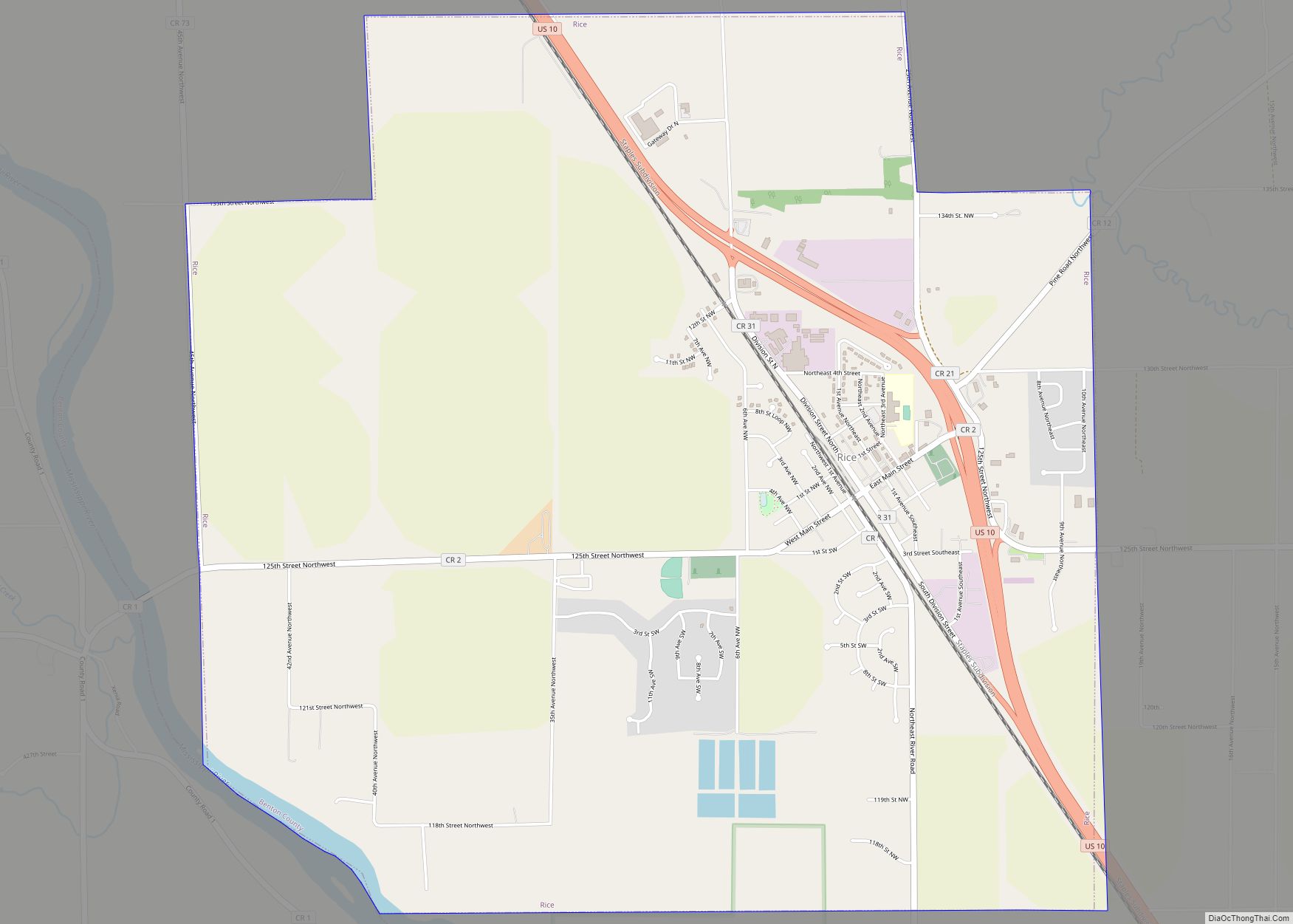
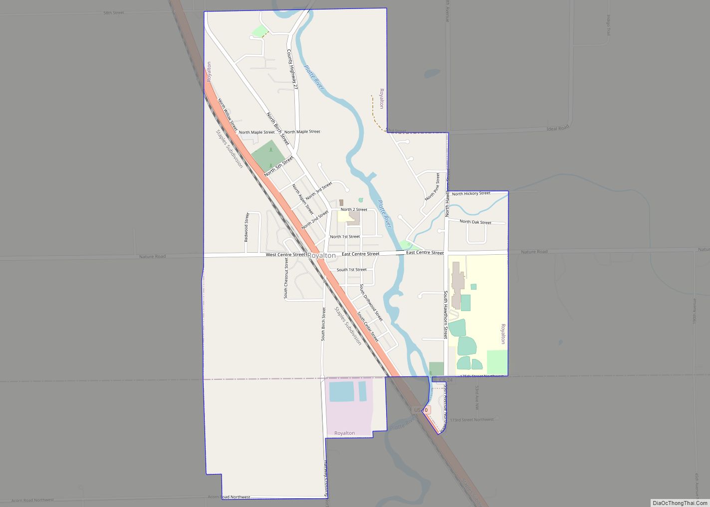
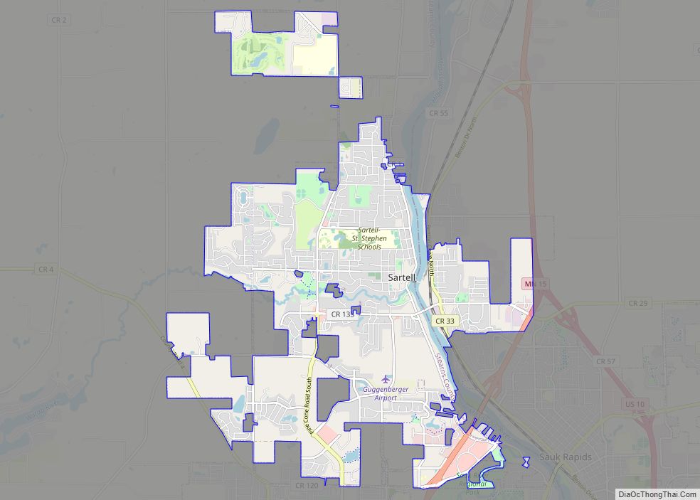
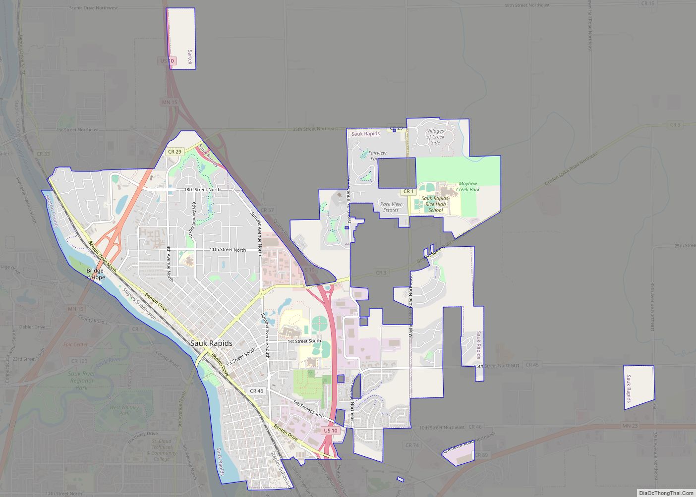
Online Interactive Map
Click on ![]() to view map in "full screen" mode.
to view map in "full screen" mode.
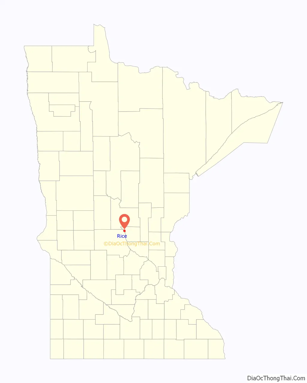
Rice location map. Where is Rice city?

History
Originally an Ojibway territory, Sand Prairie, saw its first settlers of European origin in the autumn of 1844. Under a mandate of the United States government and after the Ojibway ceded their land in the Treaty of 1837, the Territory of Minnesota was established in 1849. Benton County became one of nine organized counties. The village of Rice was named after Massachusetts born hotelier and mill owner, George T. Rice. Rice migrated to the village of Langola in 1864 to develop the area. In 1877, the Northern Pacific Railroad came through, and George T. Rice hired F.W. Earl to build the Luther hotel. The village of Rice became officially incorporated within Benton County, on July 18, 1890, as a farming community.
In 1993, Rice was named a Tree City USA by The National Arbor Day Foundation.
Rice has been awarded the “Minnesota Star City” designation for economic development.
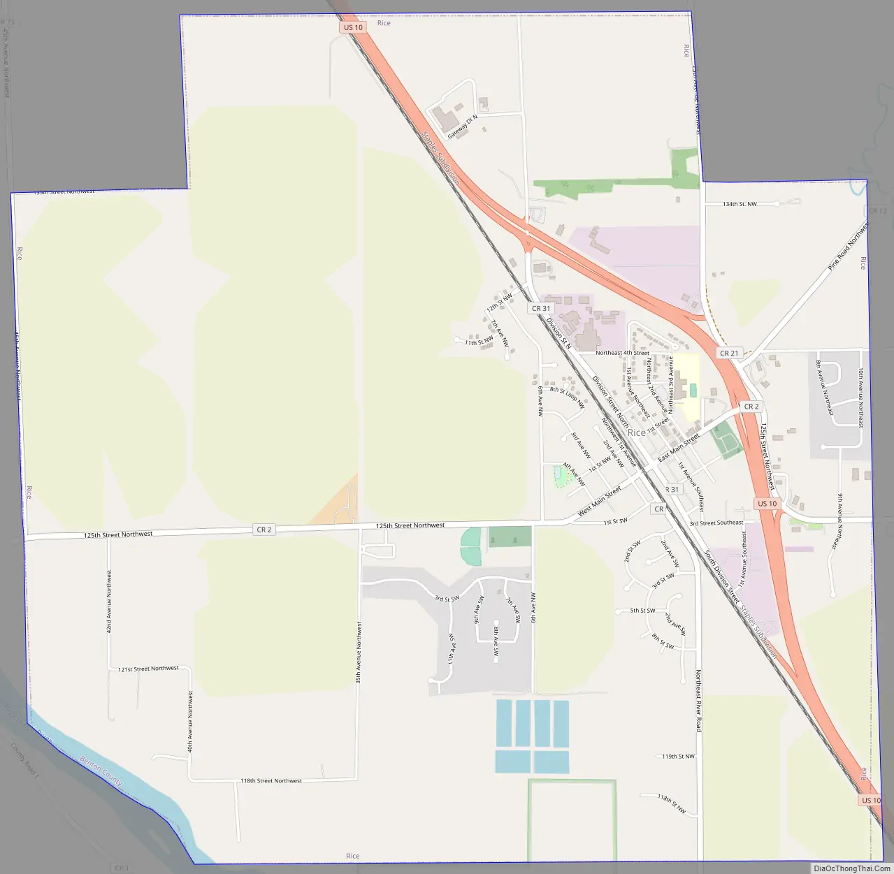
Rice Road Map
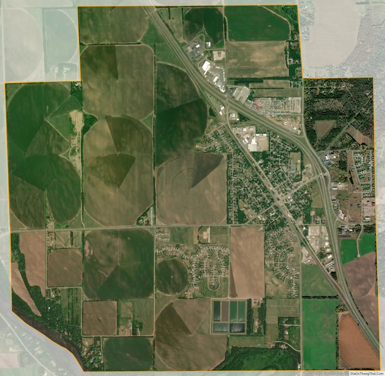
Rice city Satellite Map
Geography
According to the United States Census Bureau, the city has a total area of 5.71 square miles (14.79 km), of which 5.67 square miles (14.69 km) is land and 0.04 square miles (0.10 km) is water.
U.S. Highway 10 serves as a main route in the community.
The Mississippi River is located west of Rice, and Little Rock Lake is located east.
The terrain is largely sandy and flat and was historically prairie grassland and oak savannah. Today, numerous pine and poplar intersperse irrigated farm fields with small areas of prairie terrain.
Climate
See also
Map of Minnesota State and its subdivision:- Aitkin
- Anoka
- Becker
- Beltrami
- Benton
- Big Stone
- Blue Earth
- Brown
- Carlton
- Carver
- Cass
- Chippewa
- Chisago
- Clay
- Clearwater
- Cook
- Cottonwood
- Crow Wing
- Dakota
- Dodge
- Douglas
- Faribault
- Fillmore
- Freeborn
- Goodhue
- Grant
- Hennepin
- Houston
- Hubbard
- Isanti
- Itasca
- Jackson
- Kanabec
- Kandiyohi
- Kittson
- Koochiching
- Lac qui Parle
- Lake
- Lake of the Woods
- Lake Superior
- Le Sueur
- Lincoln
- Lyon
- Mahnomen
- Marshall
- Martin
- McLeod
- Meeker
- Mille Lacs
- Morrison
- Mower
- Murray
- Nicollet
- Nobles
- Norman
- Olmsted
- Otter Tail
- Pennington
- Pine
- Pipestone
- Polk
- Pope
- Ramsey
- Red Lake
- Redwood
- Renville
- Rice
- Rock
- Roseau
- Saint Louis
- Scott
- Sherburne
- Sibley
- Stearns
- Steele
- Stevens
- Swift
- Todd
- Traverse
- Wabasha
- Wadena
- Waseca
- Washington
- Watonwan
- Wilkin
- Winona
- Wright
- Yellow Medicine
- Alabama
- Alaska
- Arizona
- Arkansas
- California
- Colorado
- Connecticut
- Delaware
- District of Columbia
- Florida
- Georgia
- Hawaii
- Idaho
- Illinois
- Indiana
- Iowa
- Kansas
- Kentucky
- Louisiana
- Maine
- Maryland
- Massachusetts
- Michigan
- Minnesota
- Mississippi
- Missouri
- Montana
- Nebraska
- Nevada
- New Hampshire
- New Jersey
- New Mexico
- New York
- North Carolina
- North Dakota
- Ohio
- Oklahoma
- Oregon
- Pennsylvania
- Rhode Island
- South Carolina
- South Dakota
- Tennessee
- Texas
- Utah
- Vermont
- Virginia
- Washington
- West Virginia
- Wisconsin
- Wyoming