Sauk Rapids is a city in Benton County, Minnesota, United States. The population was 13,862 at the 2020 census and is 13,896 according to 2021 census estimates, about a third of Benton County’s population. It is on a set of rapids on the Mississippi River near its confluence with the Sauk River.
Sauk Rapids is part of the St. Cloud metropolitan area.
| Name: | Sauk Rapids city |
|---|---|
| LSAD Code: | 25 |
| LSAD Description: | city (suffix) |
| State: | Minnesota |
| County: | Benton County |
| Elevation: | 1,033 ft (315 m) |
| Total Area: | 6.52 sq mi (16.89 km²) |
| Land Area: | 6.29 sq mi (16.28 km²) |
| Water Area: | 0.23 sq mi (0.61 km²) |
| Total Population: | 13,862 |
| Population Density: | 2,204.52/sq mi (851.22/km²) |
| ZIP code: | 56379 |
| Area code: | 320 |
| FIPS code: | 2758684 |
| GNISfeature ID: | 0651235 |
| Website: | ci.sauk-rapids.mn.us |
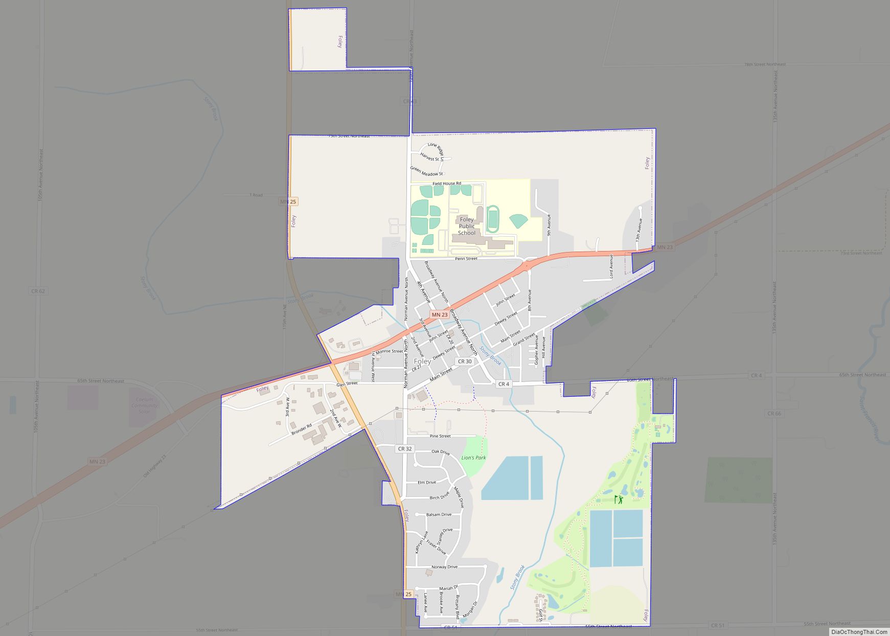
Online Interactive Map
Click on ![]() to view map in "full screen" mode.
to view map in "full screen" mode.
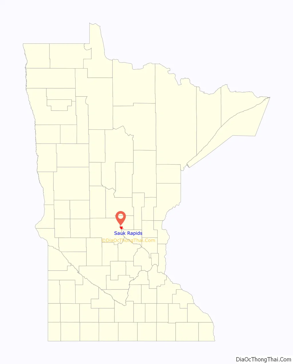
Sauk Rapids location map. Where is Sauk Rapids city?

History
Sauk Rapids was originally little more than a forest of oak, maple and basswood trees along the Mississippi River until the first home was constructed there in 1851, a large mansion named Lynden Terrace erected by W.H. Wood. Soon other settlers followed and the town was named Sauk Rapids after the rapids just below the Sauk River’s mouth on the Mississippi. The new settlement was along the Red River Trails.
Soon a general store was built, then a hotel, and a large jail. The first settlers organized a church that was soon followed by a Methodist, an Episcopalian and a Lutheran church. The first paper outside of St. Paul was the Sauk Rapids Frontiersman, founded in 1854.
A flour mill was erected in 1875, but was destroyed in 1886. The first bridge was built in 1876, was destroyed later in 1876, and was rebuilt in 1879. The first school was built in 1886.
In 1874, Sauk Rapids was the end of the line for the new railroad. Settlers from as far away as the Red River Valley brought their produce there to ship it. A six-horse stage coach made biweekly trips between St. Cloud and Crow Wing.
In 1856, the county seat moved to Watab, then returned to Sauk Rapids in 1859. A new courthouse was built, but in 1897 the seat moved to Foley, where it remains. In 1917 the courthouse burned down.
Sauk Rapids was one of Minnesota’s most important cities until 1886, when, on April 14 at approximately 4:00 p.m., a tornado struck the town. It swept through the center of the city, destroying all the stores. In Sauk Rapids, 44 people were killed and several hundred were injured.
The Sauk Rapids Regional Bridge was completed in 2007. The new bridge links to 2nd Street rather than 1st Street, as the original Sauk Rapids Bridge did. Several buildings had to be demolished during the construction process, and some were rebuilt. Some sidewalks were repaved with cobblestone and the medians were filled with granite blocks.
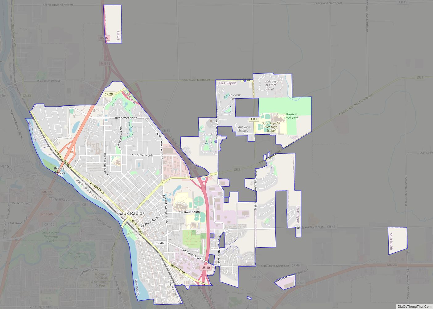
Sauk Rapids Road Map

Sauk Rapids city Satellite Map

Geography
According to the United States Census Bureau, the city has an area of 6.35 square miles (16.45 km), of which 6.10 square miles (15.80 km) is land and 0.25 square miles (0.65 km) is water.
U.S. Highway 10 and Minnesota State Highway 15 are two of the main routes in Sauk Rapids. Other nearby routes include Interstate 94/U.S. Highway 52, Minnesota State Highway 23, and County Road 75. Sauk Rapids is immediately northeast of the city of St. Cloud, on the east bank of the Mississippi River.
See also
Map of Minnesota State and its subdivision:- Aitkin
- Anoka
- Becker
- Beltrami
- Benton
- Big Stone
- Blue Earth
- Brown
- Carlton
- Carver
- Cass
- Chippewa
- Chisago
- Clay
- Clearwater
- Cook
- Cottonwood
- Crow Wing
- Dakota
- Dodge
- Douglas
- Faribault
- Fillmore
- Freeborn
- Goodhue
- Grant
- Hennepin
- Houston
- Hubbard
- Isanti
- Itasca
- Jackson
- Kanabec
- Kandiyohi
- Kittson
- Koochiching
- Lac qui Parle
- Lake
- Lake of the Woods
- Lake Superior
- Le Sueur
- Lincoln
- Lyon
- Mahnomen
- Marshall
- Martin
- McLeod
- Meeker
- Mille Lacs
- Morrison
- Mower
- Murray
- Nicollet
- Nobles
- Norman
- Olmsted
- Otter Tail
- Pennington
- Pine
- Pipestone
- Polk
- Pope
- Ramsey
- Red Lake
- Redwood
- Renville
- Rice
- Rock
- Roseau
- Saint Louis
- Scott
- Sherburne
- Sibley
- Stearns
- Steele
- Stevens
- Swift
- Todd
- Traverse
- Wabasha
- Wadena
- Waseca
- Washington
- Watonwan
- Wilkin
- Winona
- Wright
- Yellow Medicine
- Alabama
- Alaska
- Arizona
- Arkansas
- California
- Colorado
- Connecticut
- Delaware
- District of Columbia
- Florida
- Georgia
- Hawaii
- Idaho
- Illinois
- Indiana
- Iowa
- Kansas
- Kentucky
- Louisiana
- Maine
- Maryland
- Massachusetts
- Michigan
- Minnesota
- Mississippi
- Missouri
- Montana
- Nebraska
- Nevada
- New Hampshire
- New Jersey
- New Mexico
- New York
- North Carolina
- North Dakota
- Ohio
- Oklahoma
- Oregon
- Pennsylvania
- Rhode Island
- South Carolina
- South Dakota
- Tennessee
- Texas
- Utah
- Vermont
- Virginia
- Washington
- West Virginia
- Wisconsin
- Wyoming